• Home
  • About Geogypsy
    • Herstory
    • Parks where I’ve worked
  • Places I’ve been
    • United States
      • Arizona
        • Antelope Slot Canyon
        • Casa Grande Ruins National Monument
        • Colossal Cave Mountain Park
        • Flagstaff
        • Glen Canyon National Recreation Area
        • Grand Canyon National Park
          • Grand Canyon National Park North Rim
          • Grand Canyon National Park South Rim
          • Toroweap
        • Havasu Canyon
        • Horseshoe Bend
        • Jerome
        • Kaibab National Forest
        • Lee’s Ferry
        • Meteor Crater
        • Navajo Bridge
        • Oak Creek Canyon
        • Painted Desert
        • Pipe Springs National Monument
        • Prescott
        • Quartzsite
        • Saguaro National Park
        • Sedona
        • Sunset Crater Volcano National Monument
        • Vermilion Cliffs
        • Walnut Canyon National Monument
        • Wupatki National Monument
        • Yarnell
      • California
        • Anzaberrego
        • Bakersfield
        • Death Valley National Park
        • Joshua Tree National Park
        • Redwoods NP
        • Salton Sea
        • Yucca Valley
      • Colorado
        • Mesa Verde National Park
      • Florida
      • Illinois
        • IL River
        • Morton Arboretum
        • Starved Rock State Park
      • Michigan
      • Nevada
      • New Mexico
      • Oregon
        • Crater Lake NP
        • Mt Hood
        • Oregon Caves National Monument
      • Texas
        • Alpine Texas
        • Padre Island
        • Port Isabel
        • Rio Grande Valley
      • Utah
        • Brian’s Head
        • Bryce Canyon National Park
        • Buckskin Gulch
        • Cedar Breaks National Monument
        • Cedar City
        • Coral Pink Sand Dunes State Park
        • Dixie National Forest
        • Grand Staircase Escalante National Monument
        • Johnson Canyon
        • Kanab
    • World Travels
      • Germany
      • Mexico
      • South Africa
  • Tours
  • Photography
  • Work with Me
    • Sponsors
  • Contact
Geogypsy
Menu
  • Home
  • About Geogypsy
    • Herstory
    • Parks where I’ve worked
  • Places I’ve been
    • United States
      • Arizona
        • Antelope Slot Canyon
        • Casa Grande Ruins National Monument
        • Colossal Cave Mountain Park
        • Flagstaff
        • Glen Canyon National Recreation Area
        • Grand Canyon National Park
          • Grand Canyon National Park North Rim
          • Grand Canyon National Park South Rim
          • Toroweap
        • Havasu Canyon
        • Horseshoe Bend
        • Jerome
        • Kaibab National Forest
        • Lee’s Ferry
        • Meteor Crater
        • Navajo Bridge
        • Oak Creek Canyon
        • Painted Desert
        • Pipe Springs National Monument
        • Prescott
        • Quartzsite
        • Saguaro National Park
        • Sedona
        • Sunset Crater Volcano National Monument
        • Vermilion Cliffs
        • Walnut Canyon National Monument
        • Wupatki National Monument
        • Yarnell
      • California
        • Anzaberrego
        • Bakersfield
        • Death Valley National Park
        • Joshua Tree National Park
        • Redwoods NP
        • Salton Sea
        • Yucca Valley
      • Colorado
        • Mesa Verde National Park
      • Florida
      • Illinois
        • IL River
        • Morton Arboretum
        • Starved Rock State Park
      • Michigan
      • Nevada
      • New Mexico
      • Oregon
        • Crater Lake NP
        • Mt Hood
        • Oregon Caves National Monument
      • Texas
        • Alpine Texas
        • Padre Island
        • Port Isabel
        • Rio Grande Valley
      • Utah
        • Brian’s Head
        • Bryce Canyon National Park
        • Buckskin Gulch
        • Cedar Breaks National Monument
        • Cedar City
        • Coral Pink Sand Dunes State Park
        • Dixie National Forest
        • Grand Staircase Escalante National Monument
        • Johnson Canyon
        • Kanab
    • World Travels
      • Germany
      • Mexico
      • South Africa
  • Tours
  • Photography
  • Work with Me
    • Sponsors
  • Contact

Tag: stormy sky

22 July 2020

Exploring with the new camera Nikon D5600

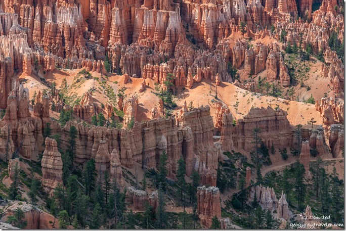
Peak-a-boo trail hoodoos trees Bryce Point Bryce Canyon National Park UtahThe new camera, a D5600 refurbished by Nikon, arrived last Wednesday late in the afternoon so I planned to go out exploring the next day, first of two days off work.  So far, I am happy with it.
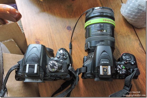
old D5100 & new D5600 Nikon camerasOld D5100 left and new D5600 right

First I had to charge the two batteries for the new camera.  Of course they are subtly different than the previous batteries even though the charger itself is the same.  The D5600 is slightly smaller and lighter, until I put the big 18-200mm lens on and then barely noticeable difference.  Took a little while and reading the manual to get the new camera settings where I want them.
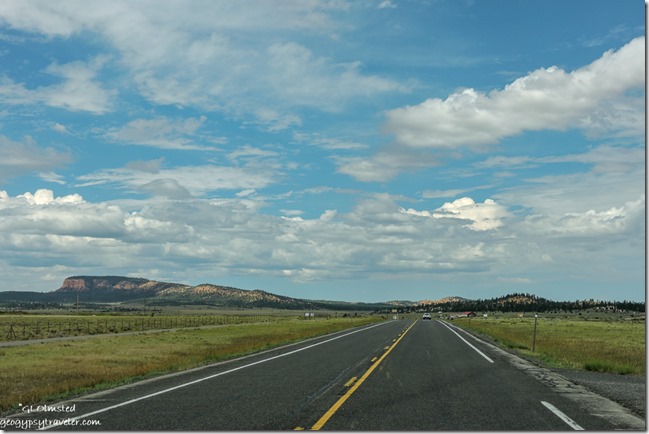
Wilson Peak SR12 West UtahWilson Peak from SR12 west of Bryce

The new camera is still too big to use while driving so I shoot Auto with the small and slow Nikon P600 for that.
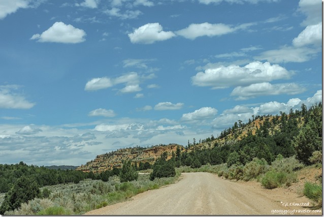
trees Pink Cliffs FR118 North Dixie National Forest UtahThursday, I drove just west of Red Canyon on the Dixie National Forest.  After a quick stop at their visitor center for maps and information I turned off SR12 north a few miles towards Losee and Casto Canyons, plus hoped to find nearby Agate Hill.

I was initially worried this would be a dust storm area as I saw many OHV near the turn off but thankfully didn’t see more after that.  Also discovered a few nice places to disperse camp not far from the trailheads.
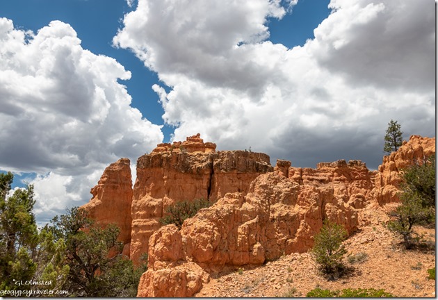
trees Arch Trail Losee Canyon Dixie National Forest Utah

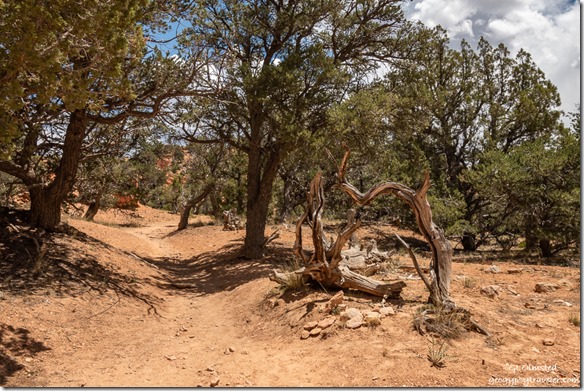
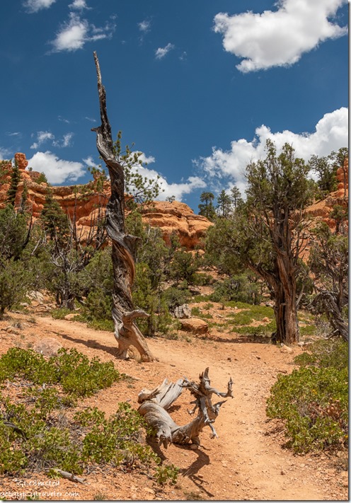
trees hoodoos clouds Arch Trail Losee Canyon Dixie National Forest UtahStopped at the Losee trailhead and walked part of the short Arches Trail.  I enjoyed the dead and twisted trees every bit as much as the redrock hoodoos.
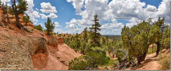
trees hoodoos Arch Trail Losee Canyon Dixie National Forest Utah

red rock trees clouds Arch Trail Losee Canyon Dixie National Forest UtahAs it was a warm day I didn’t feel like a long hot hike so slowly sauntered a bit until the trail took a steep climb where I turned around.  Landscape always looks different when facing the opposite direction.
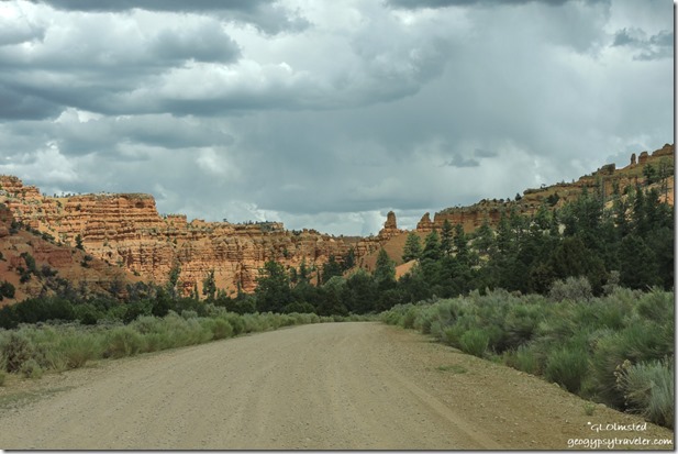
trees Pink Cliffs Casto Canyon FR118 North Dixie National Forest UtahContinued a short drive to the Casto Canyon trailhead and didn’t hike there at all.  Yet I will return to both these quiet canyons.
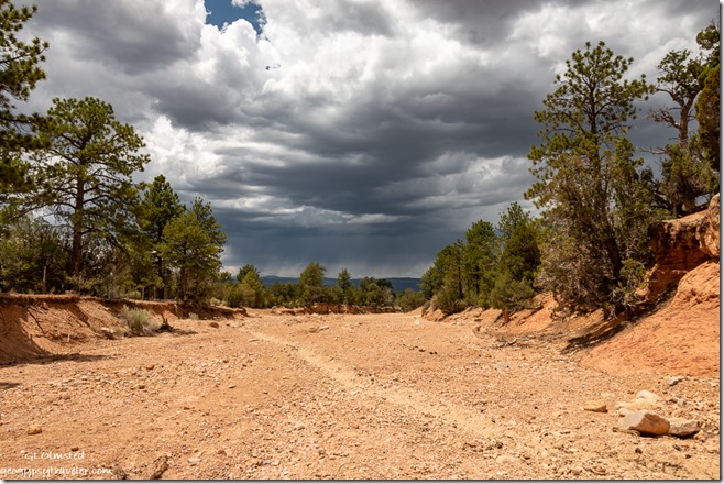
wash trees storm clouds Dixie National Forest UtahSomehow I missed Agate Hill which should have been at a junction to another road west that would take me to SR89 and ultimately to Panguitch.  Guess I’ll have to go back.
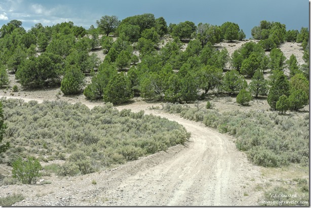
trees FR1700 West Dixie National Forest UtahI honestly wasn’t sure I was on the right road but was headed in the right direction.  Pretty drive descending through the Juniper and Pinyon Pines with more possible camping.
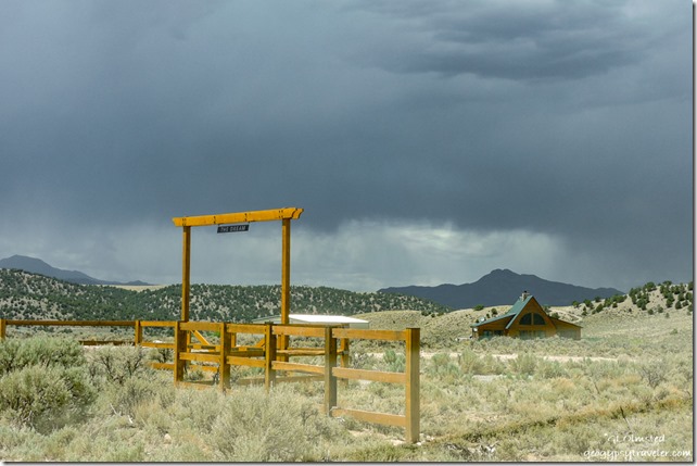
The Dream ranch gate & house UtahAs I approached the Sevier River valley the landscape changed to private agricultural ranches. (Sign reads “The Dream”)
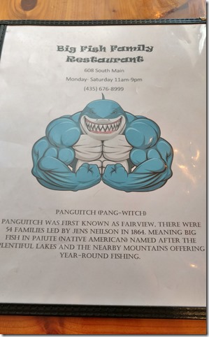
menu cover & story Big Fish resturant Panguit UtahHad a good lunch with lousy service at Big Fish in Panguitch then bought a few groceries at Joe’s Market, which I am not impressed with.
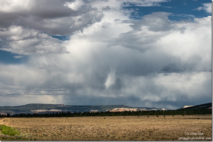
2-track Table Cliffs storm clouds SR22 Utah

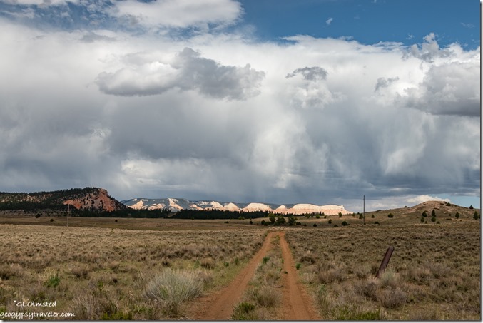
meadow Pink Cliffs storm clouds SR22 UtahBefore heading back into the park I drove a short ways on SR22 north towards Antimony because the stormy clouds above the Table Cliffs called my name.  It had threatened rain all day but none fell.
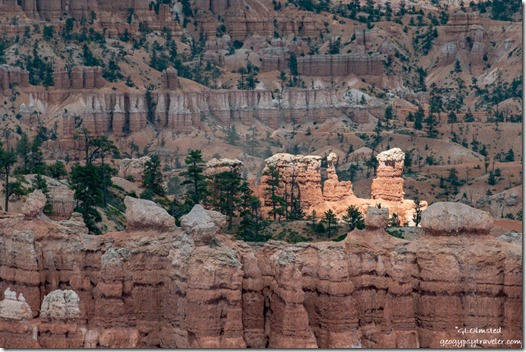
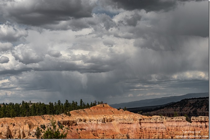
Sunrise Point storm clouds Bryce Canyon National Park UtahSunrise Point Bryce Canyon NP

highlighted hoodoos Bryce Canyon National Park UtahStorm clouds continued to hang out for days yet very little rain fell.  However, the wind brutally blew gritty dust enough to cancel the 4pm Rim Walk on Friday when I returned to work.  Also been cloudy enough to make viewing the comet difficult so I still haven’t even seen it.
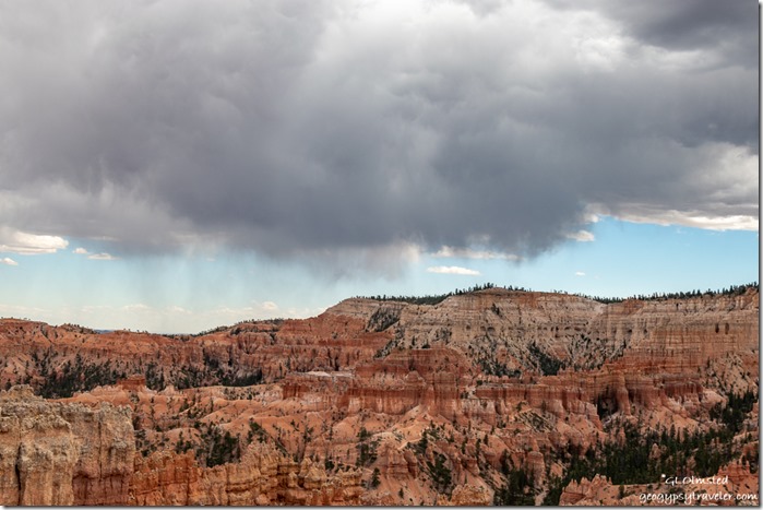
hoodoos amphitheater Bryce Point storm clouds Sunset Point Bryce Canyon National Park Utah50 million year-old limestone lake deposits weathered and eroded beginning about 16-5 million years ago

The next day, a man showed up at my hoodoo geology talk and wanted to argue about the million year-old ages of rock in the Grand Staircase.  I said to him, “I respect your right to believe what you want, but I believe in the science.  These sedimentary rocks are dated by the fossils.  I am not a geologist.”  Rather diffused his need to argue and he went away but returned for another similar talk by another Ranger a few hours later.  Why would someone do that?
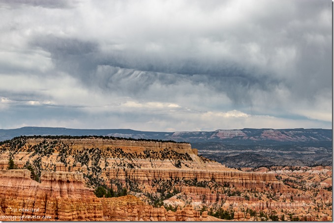
hoodoos valley plateau storm clouds Bryce Canyon National Park UtahBoat Mesa, valley, and Aquarius Plateau from Sunset Point

Monday was an early day opening then later a co-worker and I went to Rainbow Point to present Grand Staircase geology talks.  Sadly, after only one talk a huge storm blew in with lightning nearby, 10 miles down to four miles away.  So we packed up our props and spent the next hour telling people to get off the rim so they didn’t get struck by lightning.  One guy, who claimed to make a living on his cell phone photography, would not leave and got obnoxious.  Although I had my camera in the truck I did not pause to risk my life for the amazing sky.
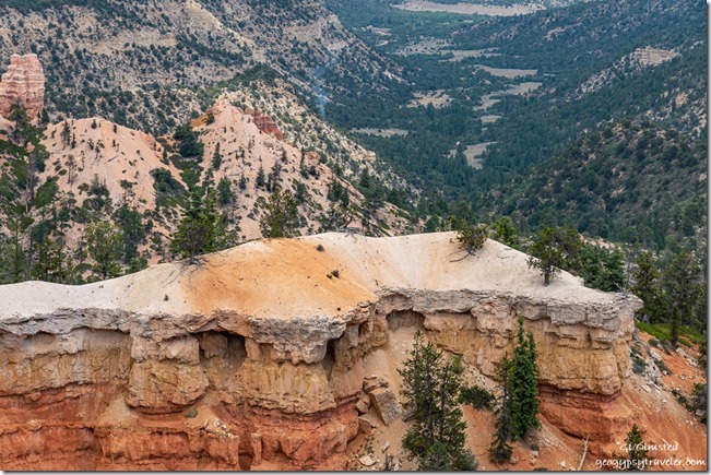
Pink Cliffs trees valley smoke Fatrview Bryce Canyon National Park UtahOn the return drive to the office we stopped at Fairview Point as we’d heard on the radio about a lightning strike below the overlook where smoke could be seen.  Fire folks were going to check it out and I haven’t heard any more.
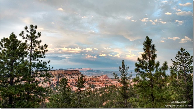
trees Boat Mesa Sinking Ship Table Cliffs pre-sunset clouds Bryce Canyon National Park UtahRangers get paid in sunsets (phone shot)

We are seeing an increase in visitation, and general stupidity.  With all the available information in this age why are people so ignorant.  All these new RVers who don’t have a clue. People visiting parks with no knowledge about the place or even why they are there.   I know this COVID19 year is difficult, but really folks.  Best thing is to stay home.  I so much want to travel myself, even a long weekend on the North Kaibab would be awesome.  But instead, I’ll stick closer to home.
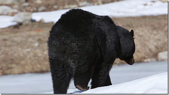
videoblocks-black-bear-walks-away-with-snow-on-butt_spl6gsj31w_thumbnail-full01Yesterday, my Friday, was a late start and ended with my evening program on the wildlife at Bryce.  A visitor asked about how many bears in the park.  Only one documented, so we’re calling it Covid Bear because it’s in isolation and honors social distancing.  (Not my photo)

I’m back to enjoying carrying the new camera around and making photos.  Though I’m still using the small Nikon and phone sometimes.  The best camera to use, is the one you have with you.

Push my buttons!

  • Click to share on Facebook (Opens in new window) Facebook
  • Click to share on X (Opens in new window) X
  • Click to share on LinkedIn (Opens in new window) LinkedIn

Like this:

Like Loading...
new camera, Places I've been, United States, Utah hoodoos, new camera, photography, Pink Cliffs, road trip, stormy sky, travel 19 Comments
16 July 2019

Bryce Canyon sunsets, storms, rainbows – waiting for monsoon

hoodoos amphitheater trees sunset clouds from Bryce Point Bryce Canyon National Park UtahI really have to make an extra effort to go out for Bryce Canyon sunsets because when I do, it’s always more than worth it.

last light hoodoos cliffs valley trees clouds from Bryce Point Bryce Canyon National Park UtahSeems like I don’t get out of my RV home much after a full 9+ hour day of work.  Or sometimes my schedule has me working through sunset and I’m not at the rim.  I’ve been working quite a few late shifts.

hoodoos amphitheater sunset clouds from Bryce Point Bryce Point Bryce Canyon National Park UtahBack in June I took a chance on Bryce Point for sunset.  Considering the entire amphitheater basically faces east it hardly makes sense to have Sunrise and Sunset overlooks a half-mile walk apart and both facing east.  (Who names these vistas anyway?)  Yet Bryce Point hooks around enough to provide a northwest to east view.

hoodoos valley plateaus reverse sunset clouds from Bryce Point Bryce Point Bryce Canyon National Park UtahI’d been sending visitors there for over a month and it proved to be right on.  Yet it’s always a luck of the cloud draw.

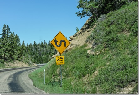
curve sign SR14 Dixie National Forest UtahShopping last week took me to Cedar City via a pretty drive on SR14, more on that later.

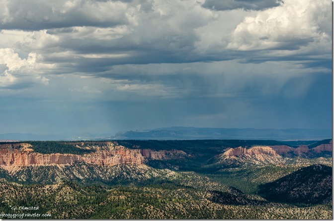
stormy sky east of Rainbow Point Bryce Point Bryce Canyon National Park UtahOne day last week under cloudy and possibly stormy skies my work schedule took me to the end of Bryce’s scenic drive to Rainbow Point.  Presented two almost back-to-back 20-minute programs about the Grand Staircase geology.

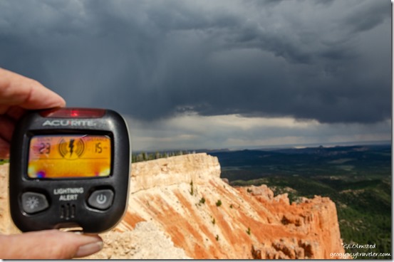
lightning detector stormy view Southeast from Yovimpa Point Bryce Point Bryce Canyon National Park UtahYovimpa Point

Carried a small lightning detector that made noise and varied from 15 miles (no worries) to six miles which is a concern.  I do love the energy of a good storm.  However, I don’t want to be too close so also warned visitors.

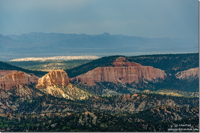
light & shadow amphitheater from Rainbow Point Bryce Point Bryce Canyon National Park UtahOnly dropped a few sprinkles.  So not sure if it counts as beginning of monsoon season.  I’d be delighted if a good rain would wipe out the obnoxious biting gnats.   I seem to be having an allergic reaction with much itching, swelling, some blisters and bruises.  Just can’t bring myself to use bug spray.  Not sure which is worse.

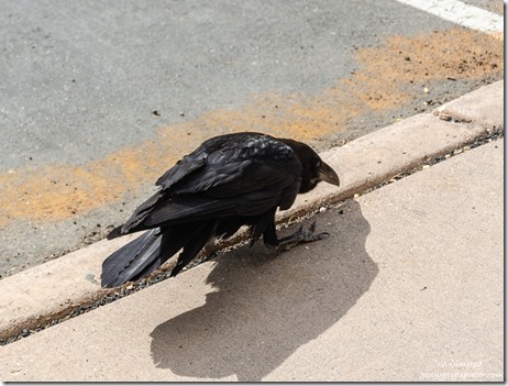
Raven Rainbow Point Bryce Point Bryce Canyon National Park UtahAn exceedingly pesky Raven in the parking lot allowed visitors within only a few feet in the obvious hope of food.  Of course not a good thing, so I used the teaching moment before hazing it away.

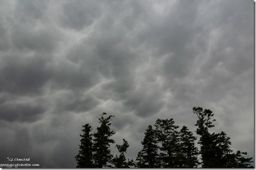
trees mammatus clouds Rainbow Point Bryce Point Bryce Canyon National Park UtahBecause of the cloud cover scopes didn’t go that night so I went home early.

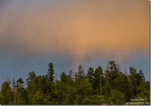
trees rainbow sunset clouds from RV Bryce Point Bryce Canyon National Park UtahI should have gone to the rim for sunset with a rainbow thrown in.  Instead I watched from my windows.

Sinking Ship valley light & shadow Aquarius Plateau clouds Bryce Point Bryce Canyon National Park Utah

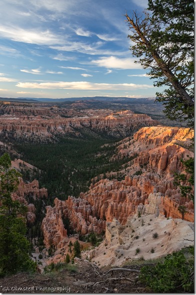
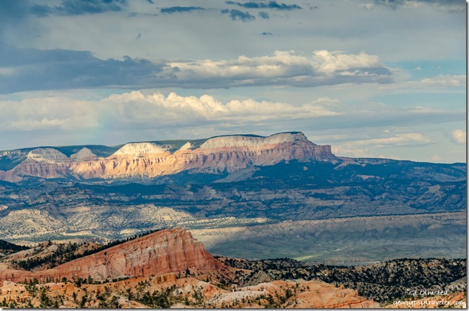
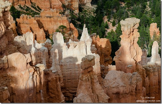
Light & shadow hoodoos Bryce Point Bryce Canyon National Park UtahThe next night, before my evening program at the lodge, I roved briefly on the rim and caught some of the westering light on the Aquarius Plateau and the hoodoos down below.  Clouds continued to tease with dramatic skies and little rain.

After a full day of programs and closing the visitor center I came home, quickly changed, and went back out to Bryce Point for sunset.

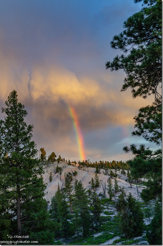
trees rainbow sunset clouds Bryce Point Bryce Point Bryce Canyon National Park UtahOn the drive I saw a rainbow and hurried to park and shoot it without breaking the speed limit too much.  Under the late evening light the white limestone hills almost look like snow.

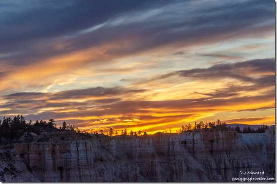
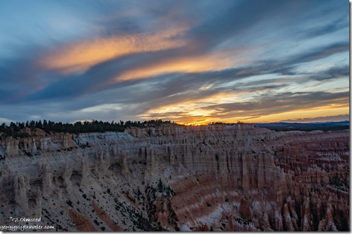
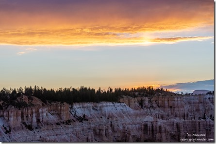
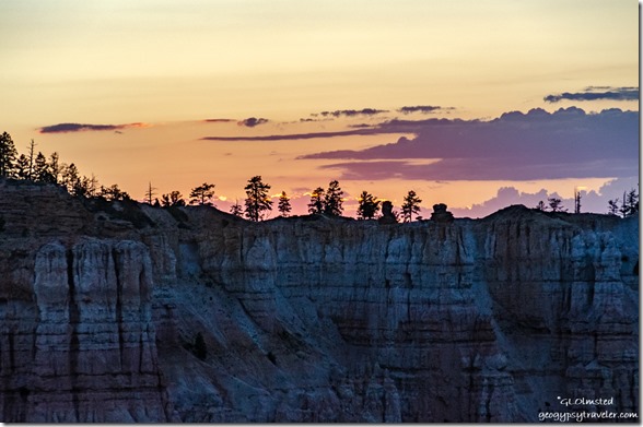
sunset over rim from Bryce Point Bryce Point Bryce Canyon National Park UtahAt first the actual sunset didn’t look like much.

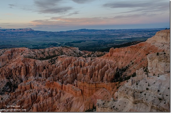
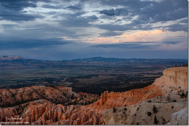
reverse sunset from Bryce Point Bryce Point Bryce Canyon National Park UtahI preferred the reverse colors and light.

trees sunset clouds over rim from Bryce Point Bryce Point Bryce Canyon National Park UtahBut I remind myself to turn around again and again so as not to miss an opportunity.  It’s not every night I see colorful Bryce Canyon sunsets.

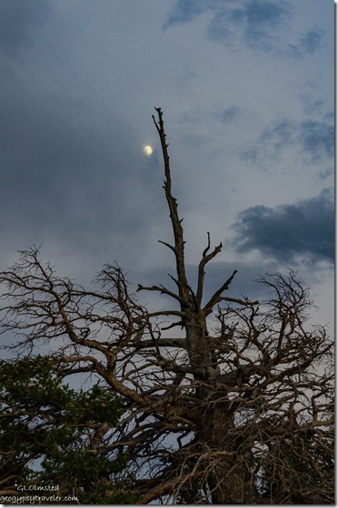
snag moon clouds Bryce Point Bryce Point Bryce Canyon National Park UtahOn the walk back to my truck, an almost full moon tries to shine through clouds.  Ah, next up, full moon.

Linking to Skywatch Friday.

Push my buttons!

  • Click to share on Facebook (Opens in new window) Facebook
  • Click to share on X (Opens in new window) X
  • Click to share on LinkedIn (Opens in new window) LinkedIn

Like this:

Like Loading...
Bryce Canyon National Park, Utah hoodoos, rainbows, stormy sky, sunsets 42 Comments
20 February 2018

Sky watching from the Arizona desert

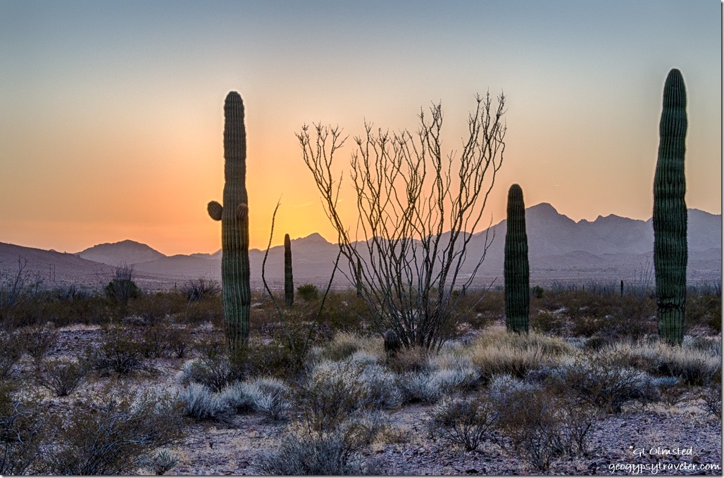
Saguaro Ocotillo Sonoran Desert Chocolate Mountains West view clouds reverse sunrise King Valley Kofa National Wildlife Refuge ArizonaBeen enjoying a lot of sky watching lately what with the recent lunar eclipse and glorious sunrises and sets over the Sonoran Desert of southern Arizona.  Yet fluffy clouds turned to skies of gray and there is also the chores of life.

last light Shea Road camp Parker ArizonaAfter 13 of the allowed 14 days camping on the BLM (Bureau of Land Management) just outside the Kofa NWR (National Wildlife Refuge) I needed to move on.  Where did the time go?  Besides, it was time to dump and fill tanks and get groceries.  I drove north through an almost quiet Quartzsite then continued 35 miles to Parker for a Safeway and Wally fix.  I looked at and passed on both the LaPaz County Park and Blue Water Casino dry camp with too many others for my personal taste.  Instead I drove a roughly paved six miles east of SR95 on Shea Road to a BLM boondock which was unimpressive and obviously a well used OHV area.  So glad I was prepared to leave in the morning as the crowds of noisy rigs pulled in to go tearing around in the desert.  Sure hope that’s not why there is less vegetation here.

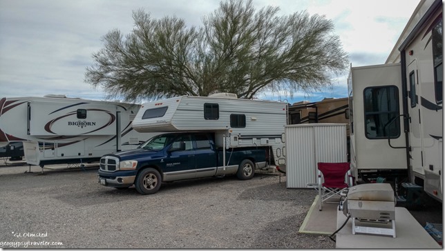
truck campter The Scenic Rd RV Park Quartzsite ArizonaIn the morning I checked the weather and big wind was predicted for Saturday night.  So being I still had to dump tanks and fill water ($12-15) plus take a shower ($8) I figured it was time to ‘treat’ myself to a RV Park.  I checked online and found The Scenic Road with rates from 2015/16 at $30.  Called ahead and they had space.  Level and close sites located along Hwy95 as are many other parks if not on Central in downtown Quartzsite.  With tax I figure that’s a $13/night site.  I refused the first parking option with my kitchen window three feet from the Women’s bathroom door.  Got a little better but definitely sandwiched in.  Figured that might turn out to be a good thing with overnight wind gusts predicted up to 25 mph.  Certainly not my cup of tea but I can sleep almost anywhere for one night.  And I had electricity too.

I heard the wind pick up just before going to bed at 11pm.  Guess it blew more but I never felt a thing so was good to be tucked in.  Sunday morning, after filling a propane tank and topping off the truck’s diesel I headed back out to the desert south of Quartzsite, this time the King Valley Road into the Kofa NWR.

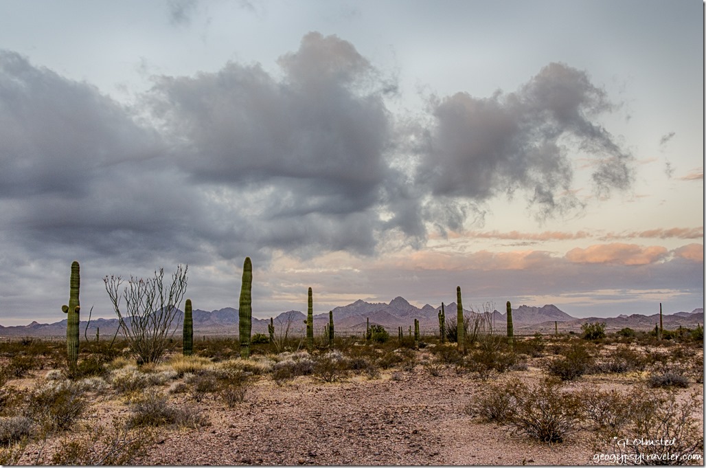
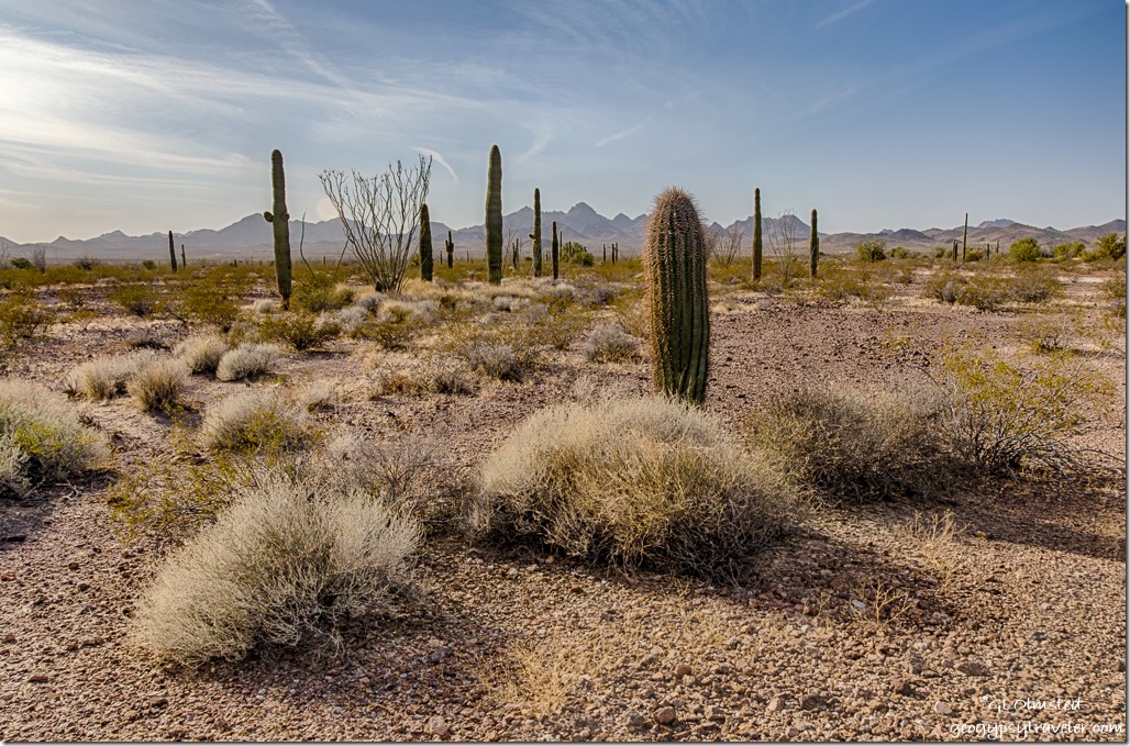
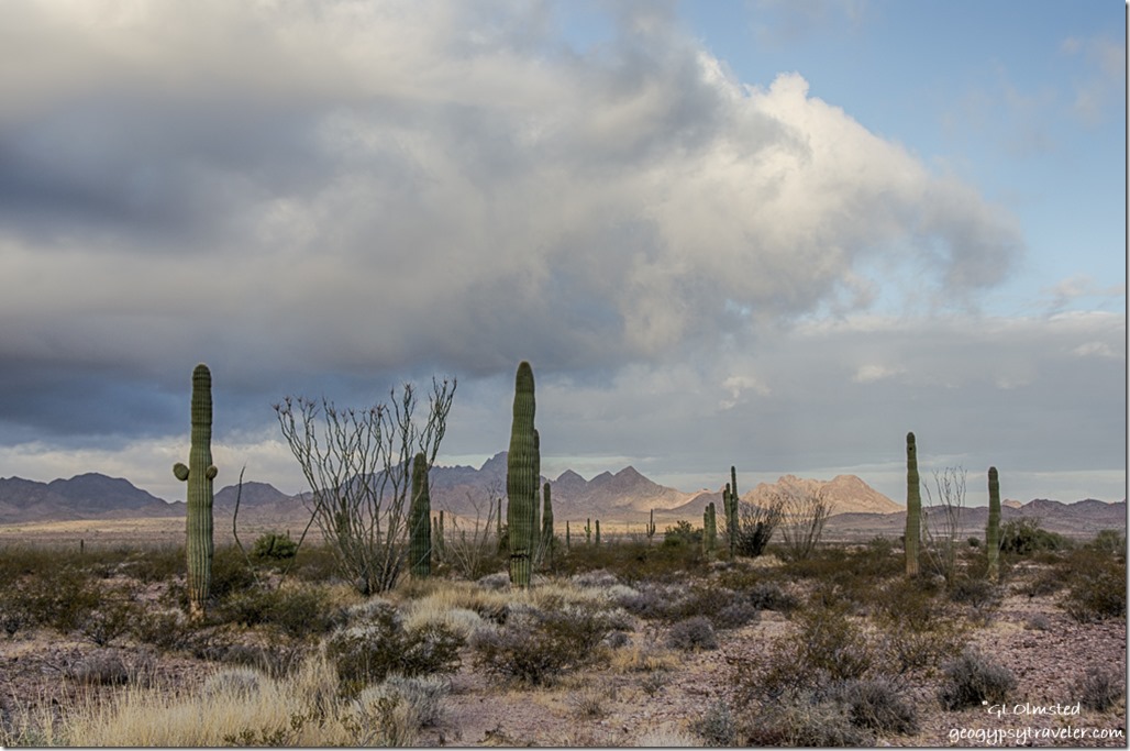
saguaros ocotillos Chocolate Mountains King Valley Road Kofa National Wildlife Refuge Arizona

Pencil Cholla King Valley Road Kofa National Wildlife Refuge ArizonaFound a side road from Kings Valley Road and although I could see a few RVs in the distance still felt like I had the place to myself.  Camp was surrounded by a goodly amount of saguaros and ocotillos, some palo verdes, lots of creosote bush, a few varieties of cholla, and some other scrubby stuff I don’t know.


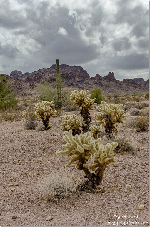
Pencil Cholla


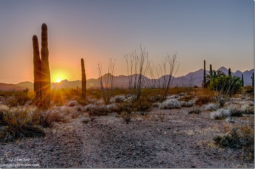
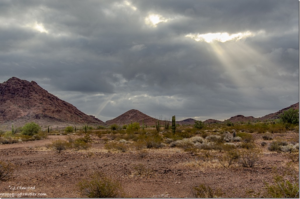
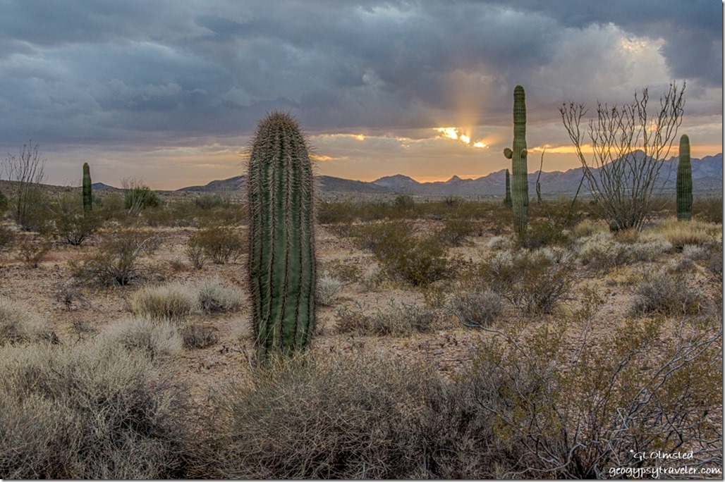
saguaros ocotillos Chocolate Mountains sunset sunrays King Valley Road Kofa National Wildlife Refuge ArizonaNice view of sunset over the Chocolate Mountains.

saguaros ocotillos Chocolate Mountains suset King Valley Road Kofa National Wildlife Refuge ArizonaWhile baking pizza for dinner I noticed a chirping noise when propane was used.  I Googled this new to me phenomenon and discovered the noise could mean time to replace hoses or regulator which I did about four years ago when I first got the camper.  Hmmmmm……

Sonoran Desert Kofa Mountains East view cloudy sunrise King Valley Kofa National Wildlife Refuge Arizona

Sonoran Desert Kofa Mountains East view cloudy sunrise sunrays King Valley Kofa National Wildlife Refuge ArizonaMonday morning a layer of dark clouds hung over the eastern horizon.  Only a 20% chance of rain predicted.  I was parked on good hard rocky ground but the road I drove in on was soft dust and gravel.  Did make me wonder if I could drive it if it got very wet.  But I didn’t really plan to go anywhere for a few days anyway other than  maybe a walk towards the mountains.

Saguaro Ocotillo first light Choclate Mountains West view clouds King Valley Kofa National Wildlife Refuge ArizonaWind picked up during the day keeping it cooler than it had been.  These spring like temperatures are way too early making me wonder what this low desert will be like during summer.  Even the desert will change with extended 100°+ and drought.

Sonoran Desert Kofa Mountains East view cloudy sunrise sunrays King Valley Kofa National Wildlife Refuge Arizona

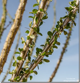
Ocotillo leaves King Valley Road Kofa National Wildlife Refuge ArizonaThe day remained gray as rows of clouds hung over the valley.  A we bit of soft female rain fell bringing a smile to my face.  Rain is a gift to the desert dwellers especially when soft and not an extended downpour.  Considering the lack of recent rain I was surprised how green leafed the ocotillo were dressed.


Ocotillo


Ocotillo Saguaro Sonoran Desert Tank Mountains South view cloudy sunrise King Valley Kofa National Wildlife Refuge ArizonaAlthough chilly outside, I wore a jacket and scarf and opened the door to breath deep the petrichor of the desert.  I could feel it crying for more moisture.  What doesn’t kill us, makes us strong.

Border Patrol truck drove by and didn’t stop so guess I’m legal.

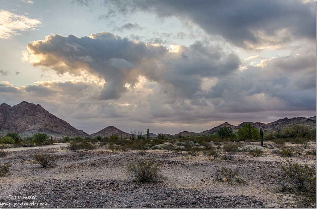
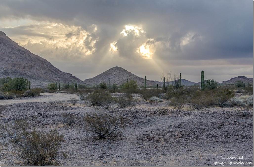
Sonoran Desert Kofa Mountains storm clouds Kofa National Wildlife Refuge ArizonaSun poking through holes in the clouds sent patches of light dancing across the land.  I grabbed the camera, stepped outside, and it was gone.  Just a tease.  In and out, taking ever more photos of the light on the desert while still processing the morning shots.

Sonoran Desert Chocolate Mountains storm clouds sunset sunrays King Valley Kofa National Wildlife Refuge Arizona

Sonoran Desert Chocolate Mountains storm clouds sunset sunrays King Valley Kofa National Wildlife Refuge ArizonaGorgeous sunrays before sunset and after dark it seriously rained.

Sonoran Desert Kofa Mountains storm clouds sunrays King Valley Kofa National Wildlife Refuge ArizonaI awoke to a fresh desert Tuesday morning.  The ground not really wet but with a scent of moisture and more low clouds indicating another day of perhaps life giving rain.  Was enough to settle the dust on the road without making a mess.

Cholla Saguaro Tank Mountains clouds King Valley Kofa National Wildlife Refuge ArizonaJumping Cholla Tank Mountains

Yet it did not rain so I went for a walk and heard only the wind and nothing else.  Where are the birds.

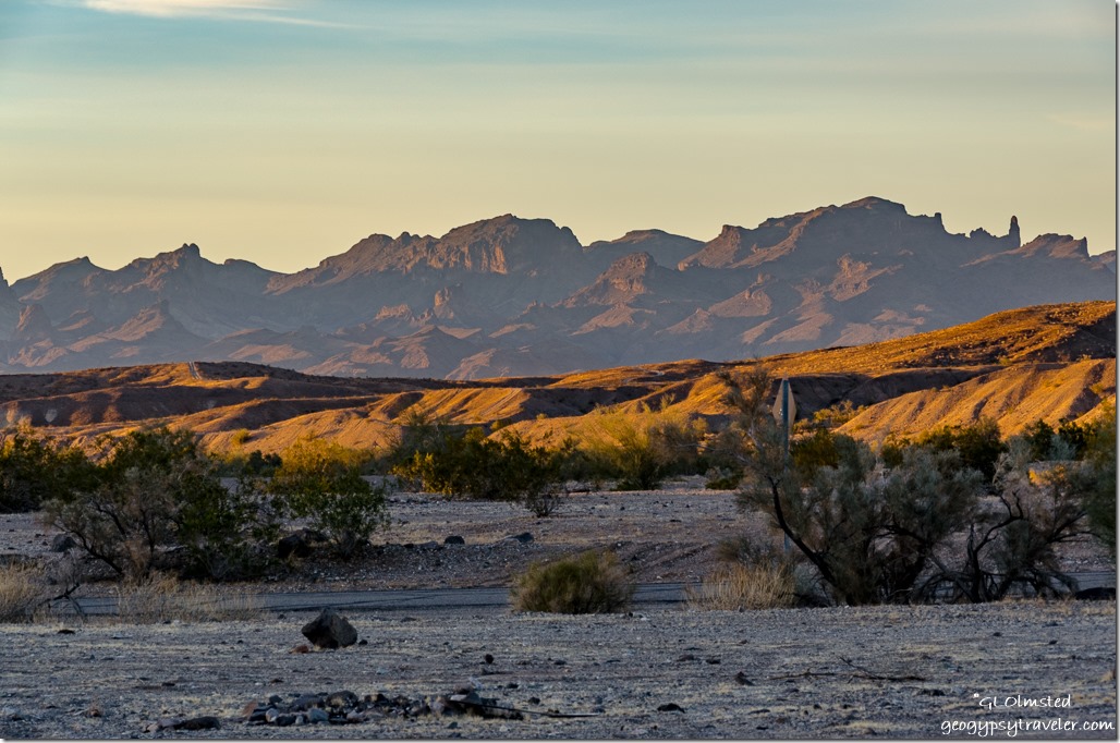
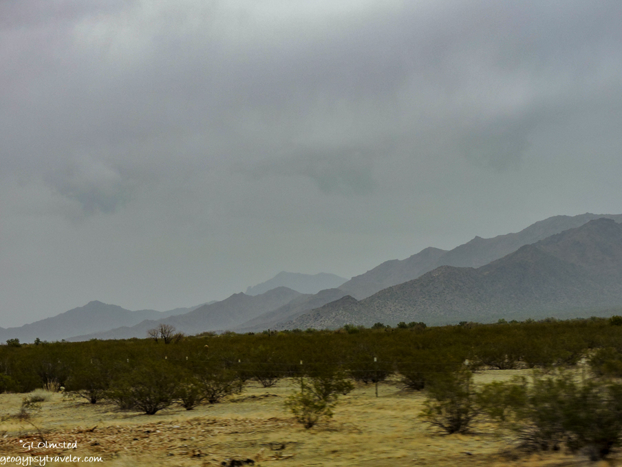
mountains approaching Agila Arizona

Enough gray.  Third day and I’m done with it.  I wanted my sunshine back.  And so, seemingly, did my solar system.  The control panel gave a fault message saying “the batteries are discharged below the minimum acceptable level”.  With another two days of cloud cover coming I would be in trouble.  No lights and eventually the fridge won’t ignite.  Called Solar Bill in Quartzsite and was told “gray skies don’t make much power” to keep my one battery charged.  I could live without lights but don’t want the ice cream to melt.  For some reason running the truck doesn’t charge the house battery.  Something that needs to be fixed.  At least the propane tank quit singing.

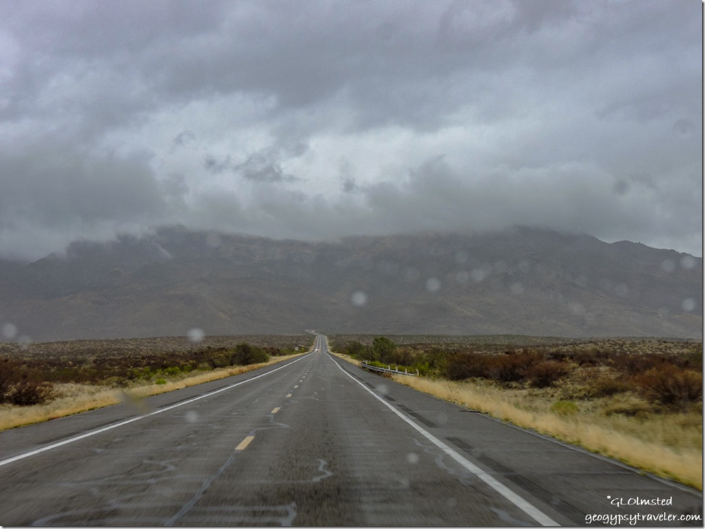
rain low clouds Weaver Mountains SR89 North to Yarnell ArizonaSo, I could pay $20-30 to camp in Quartzsite to charge the battery, or, drive two hours to home, plug in, and take care of some business plus pick up mail including new slippers and a book.  And here I am in Yarnell, at the top of the foggy mountain.

Push my buttons!

  • Click to share on Facebook (Opens in new window) Facebook
  • Click to share on X (Opens in new window) X
  • Click to share on LinkedIn (Opens in new window) LinkedIn

Like this:

Like Loading...
Arizona, Kofa NWR, Parker, Places I've been, Quartzsite, United States cholla, ocotillo, rain, saguaro, Sonoran Desert, stormy sky, sunrays, sunrise, sunset 16 Comments

Hi, I’m Gaelyn, the Geogypsy

I retired after 29 summer seasons as a Park Ranger, traveling solo for 40+ years. My passions include travel, connecting to nature, photography, and sharing stories.

I started exploring US National Parks in 1977 and 20 years later became a seasonal Park Ranger.  I’ve lived full-time in a RV for 30 years working summers and playing winters.  I’m still trying to figure out what I want to be when I grow old, other than grow up.

Let’s share our stories.  Here’s more of mine…

My wheeleastate

I am currently…

…boondocking somewhere in southern Arizona.  In the area, give a shout.

Geogypsytraveler on YouTube

Follow my journey on YouTube. Just click the pic. Hope you’ll like, share, and subscribe.

Click image for 7 minute documentary (Password “geogypsy” lowercase)

Making the Gypsy documentary is a story of its own.  Click below for the rest of the story.

Living nomadically & connecting to nature documentary

Subscribe to Blog via Email

Enter your email address to subscribe to this blog and receive notifications of new posts by email.

Photos available for sale include prints, greeting cards, coffee mugs, tote bags, phone cases and more

Reflected Wave 24X16 metal print under $100

Custom Coffee Mugs

Many items to choose from including prints

The Last Blast 24 x 16″ metal print under $100

Need a signal boost? When I boondock on public lands sometimes signal is weak or intermittent and a booster helps. Click the pic to visit WeBoost.

Connecting to nature and the rest of the world too.

Please contact me for photo purchases not seen at GLOlmsted Photography

Order fulfillment is by Fine Art America. If you’re not happy with your purchase, for any reason, simply return it within 30 days, and you’ll receive a full refund of the purchase price.

Why read Geogypsy?

The gypsy life spring-summer 1998 - "You were a real pioneer. RV'ing before it was cool." ...Yogi

How do you process photos? - “Your photographs create an Emotional feeling in the viewer...that they become One with You.” …Cindy

Life’s transitions between travel and work play - "I know you love your job as much as you love travel -- it shines through all your posts." ...Sallie

Lions at Kruger National Park - “Wonderful post, thank you. I was hooked start to finish!” … Peter B
11 lessons looking back 2013 - “A great post -- made me think, made me smile, made me want to cry." ...Sallie

Wildlife video Kruger National Park - “Gorgeous, this makes me want to go straight to South Africa now.” … Ayngelina

Living nomadically & connecting to nature documentary - “What an experience you had and gave to the "crew." Sometimes I think you don't realize how unique and inspiring you are.” …Alan

Search

Popular Posts

1. Prioritize the well-being of nature over photography. 2. Educate yourself about the places you photograph. 3. Reflect on the possible impact of your actions. 4. Use discretion if sharing locations. 5. Know and follow rules and regulations. 6. Always follow Leave No Trace principles and strive to leave places better than you found them. 7. Actively promote and educate others about these principles
Categories

Archives

Sites I follow, read & recommend

  • A Full-time Life
  • A Yankee in Belgrade
  • Bob's Eyes
  • Box Canyon Blog
  • Camels and Chocolate
  • Dawns bloggy blog
  • In the Direction of Our Dreams
  • Jane in her infinite wisdom
  • Janie and Steve, Utah Trails
  • Kathie's Birds
  • Las Adventuras
  • Memorable Meanders
  • Oh, The Places They Go
  • On the Road Abode
  • Port Elizabeth Daily Photo
  • Stillhowlyntravels
  • Take to the Highway
  • Technomadia
  • the good luck Duck
  • Travel with the Bayfield Bunch
  • Wandering Earl
  • Wheeling It
  • Yogi's Den

Caught in a Slot 9×12 canvas print under $50

If you don’t like what’s going on in your government, contact your Congress

Directory of Senators

Directory of Representatives

Lijit

© Copyright 2008-2024. Geogypsytraveler.com
%d