• Home
  • About Geogypsy
    • Herstory
    • Parks where I’ve worked
  • Places I’ve been
    • United States
      • Arizona
        • Antelope Slot Canyon
        • Casa Grande Ruins National Monument
        • Colossal Cave Mountain Park
        • Flagstaff
        • Glen Canyon National Recreation Area
        • Grand Canyon National Park
          • Grand Canyon National Park North Rim
          • Grand Canyon National Park South Rim
          • Toroweap
        • Havasu Canyon
        • Horseshoe Bend
        • Jerome
        • Kaibab National Forest
        • Lee’s Ferry
        • Meteor Crater
        • Navajo Bridge
        • Oak Creek Canyon
        • Painted Desert
        • Pipe Springs National Monument
        • Prescott
        • Quartzsite
        • Saguaro National Park
        • Sedona
        • Sunset Crater Volcano National Monument
        • Vermilion Cliffs
        • Walnut Canyon National Monument
        • Wupatki National Monument
        • Yarnell
      • California
        • Anzaberrego
        • Bakersfield
        • Death Valley National Park
        • Joshua Tree National Park
        • Redwoods NP
        • Salton Sea
        • Yucca Valley
      • Colorado
        • Mesa Verde National Park
      • Florida
      • Illinois
        • IL River
        • Morton Arboretum
        • Starved Rock State Park
      • Michigan
      • Nevada
      • New Mexico
      • Oregon
        • Crater Lake NP
        • Mt Hood
        • Oregon Caves National Monument
      • Texas
        • Alpine Texas
        • Padre Island
        • Port Isabel
        • Rio Grande Valley
      • Utah
        • Brian’s Head
        • Bryce Canyon National Park
        • Buckskin Gulch
        • Cedar Breaks National Monument
        • Cedar City
        • Coral Pink Sand Dunes State Park
        • Dixie National Forest
        • Grand Staircase Escalante National Monument
        • Johnson Canyon
        • Kanab
    • World Travels
      • Germany
      • Mexico
      • South Africa
  • Tours
  • Photography
  • Work with Me
    • Sponsors
  • Contact
Geogypsy
Menu
  • Home
  • About Geogypsy
    • Herstory
    • Parks where I’ve worked
  • Places I’ve been
    • United States
      • Arizona
        • Antelope Slot Canyon
        • Casa Grande Ruins National Monument
        • Colossal Cave Mountain Park
        • Flagstaff
        • Glen Canyon National Recreation Area
        • Grand Canyon National Park
          • Grand Canyon National Park North Rim
          • Grand Canyon National Park South Rim
          • Toroweap
        • Havasu Canyon
        • Horseshoe Bend
        • Jerome
        • Kaibab National Forest
        • Lee’s Ferry
        • Meteor Crater
        • Navajo Bridge
        • Oak Creek Canyon
        • Painted Desert
        • Pipe Springs National Monument
        • Prescott
        • Quartzsite
        • Saguaro National Park
        • Sedona
        • Sunset Crater Volcano National Monument
        • Vermilion Cliffs
        • Walnut Canyon National Monument
        • Wupatki National Monument
        • Yarnell
      • California
        • Anzaberrego
        • Bakersfield
        • Death Valley National Park
        • Joshua Tree National Park
        • Redwoods NP
        • Salton Sea
        • Yucca Valley
      • Colorado
        • Mesa Verde National Park
      • Florida
      • Illinois
        • IL River
        • Morton Arboretum
        • Starved Rock State Park
      • Michigan
      • Nevada
      • New Mexico
      • Oregon
        • Crater Lake NP
        • Mt Hood
        • Oregon Caves National Monument
      • Texas
        • Alpine Texas
        • Padre Island
        • Port Isabel
        • Rio Grande Valley
      • Utah
        • Brian’s Head
        • Bryce Canyon National Park
        • Buckskin Gulch
        • Cedar Breaks National Monument
        • Cedar City
        • Coral Pink Sand Dunes State Park
        • Dixie National Forest
        • Grand Staircase Escalante National Monument
        • Johnson Canyon
        • Kanab
    • World Travels
      • Germany
      • Mexico
      • South Africa
  • Tours
  • Photography
  • Work with Me
    • Sponsors
  • Contact

Tag: rockhound

02 February 2022

Rockin’ in the wind, and looking for rocks at Saddle Mt

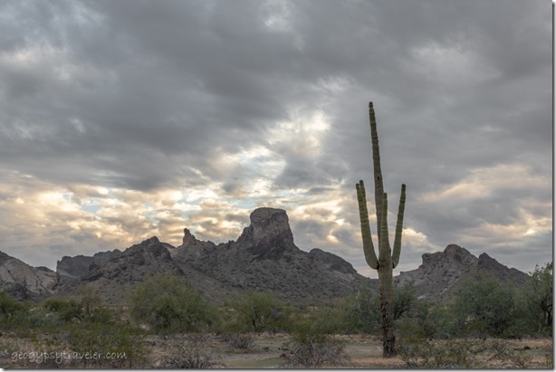
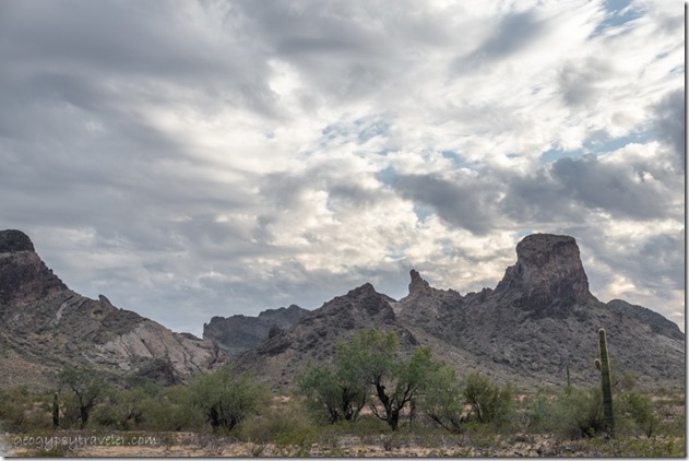
desert mts clouds Saddle Mt BLM Tonopah ArizonaAfter rockin’ in the wind a few nights in Congress it felt like time to move further south to Saddle Mountain, where there’s good rockin’ with boondock options and views.

solar controller reads FULWas really nice to have the battery and solar controller issues taken care of and I even mounted the controller on the wall.  Nice easy to read LED screen and when the sun goes down the controller turns off so no blinking lights overnight wasting energy.  With everything charged I was back to keeping the phone and laptop batteries topped up.

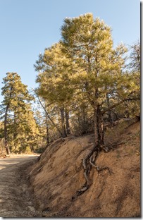
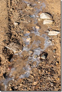
boulders valley trees mts moon Copper Basin Rd Prescott National Forest Arizonard Ponderosa Pine tree root Copper Basin Rd Prescott National Forest Arizonaice puddle Copper Basin Rd Prescott National Forest Arizona

Rode to Prescott with Joann one day so she could pick up some ordered plugs for her charging system.  Seemed to be a week of dealing with energy.  We came back over the Bradshaw Mountains on the gravel Copper Basin Road where there are trees, tiny patches of snow—as much as I want to see—and even a little ice on the puddles.
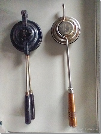
pie-makers old & newStopped at the Skull Valley post office for my mail, thanks for the Christmas cards including a “Secret Santa”.  Also made a quick dash into my 5th-wheel for mom’s pie-maker.  A blast from the past when Joann brought out her pie-maker, a wonderful way to make desert while camping.  My mom would put canned pie filling between two slices of buttered bread, then with a kitchen mitt or glove on, hold the maker over the campfire.  Joann and I did it on the stove instead.  I’ve also made cheese sandwiches and even leftovers though it’s only a little blob of filling.
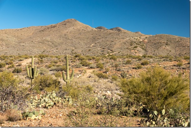
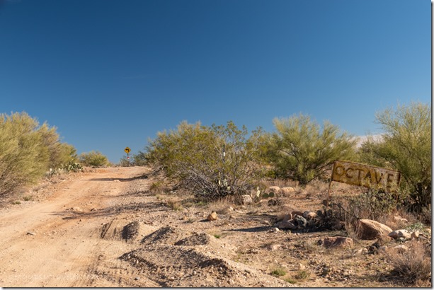
desert mts rd Octave ArizonaAnother day we took a drive further along the nearby gravel road to the mining town of Stanton and Octave.  There’s a few renovated buildings and lots of RV parking with and without hookups for modern miners.  Plus there’s private land around with mining equipment of various sorts I know little about.  It’s a different kind of rockin’ than I ever got into.
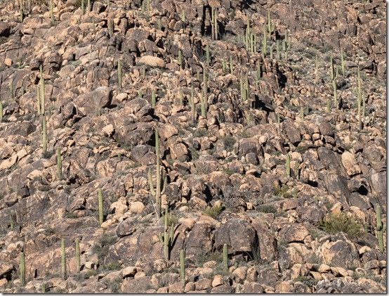
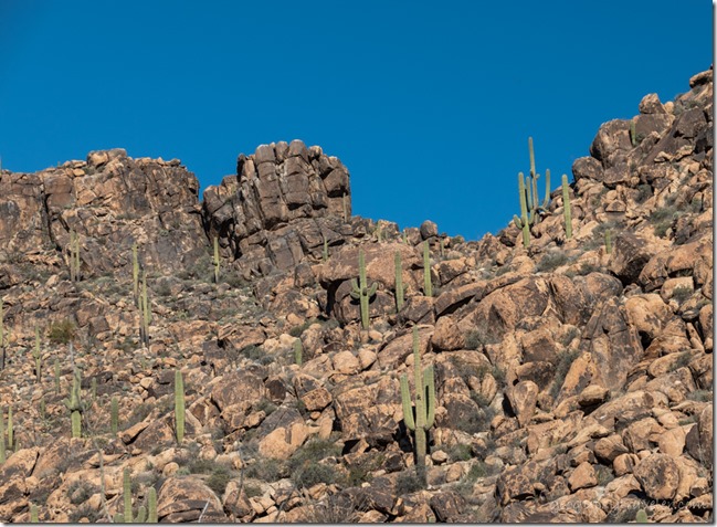
Saguaro cactus boulders mt Stanton Arizona

Saguaro cactus boulders mt Stanton ArizonaMore gorgeous rockin’ hillsides of Saguaro cactus.
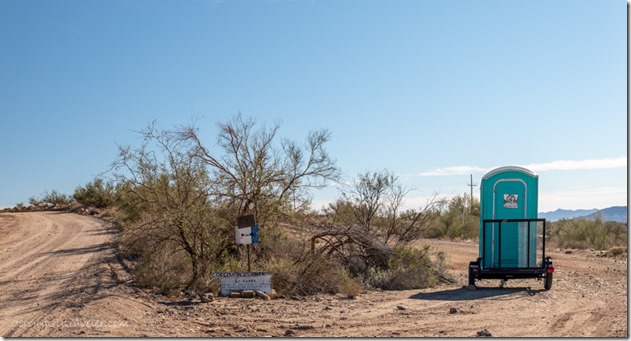
desert rd Octave Arizona

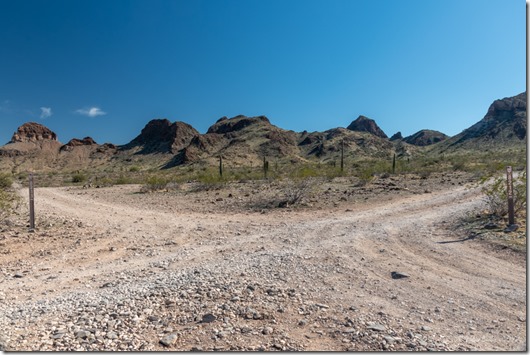
decision corner Octave ArizonaAt Octave, we had to make a decision. Or so read the sign.

bumper rocks Stanton Rd Congress ArizonaCongress bumper rocks

For several days and nights the wind blew hard enough to rock the camper.  I spent much time indoors writing, reading, and labeling photos from November 2020.  Yes I am that far behind, and just keep taking more.

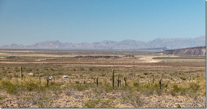
Yet with the wind coming from the northeast it seemed a good time to roll to the south with a tail-wind most of the way.  Left Congress about 10:30am headed to Wickenburg with a stop at North Ranch on the way to dump and fill tanks.  After a grocery stop continued south on Vulture Mine Road across some pretty and desolate desert highway.  Did see some side roads that might hold promise for future camps.
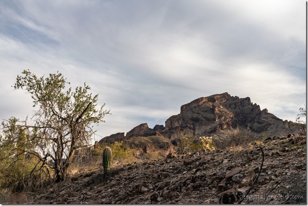
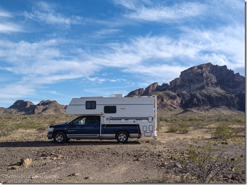
desert clouds Saddle Mt BLM Tonopah ArizonaAs we approached the dispersed camping north of Saddle Mt, parked Joann’s rig on the shoulder and explored in my truck to check out the road conditions.  It’s gravel and at first smooth but as the road rises slowly towards the feet of the mountains becomes rockier, yet still doable.
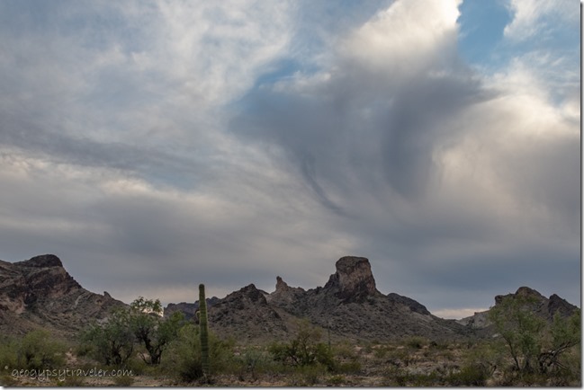
truckcamper Saddle Mt BLM Tonopah Arizona

desert clouds Saddle Mt BLM Tonopah ArizonaFound a nice camp far enough from neighbors, big enough for two and settled in with a marvelous view.
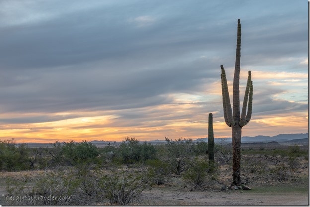
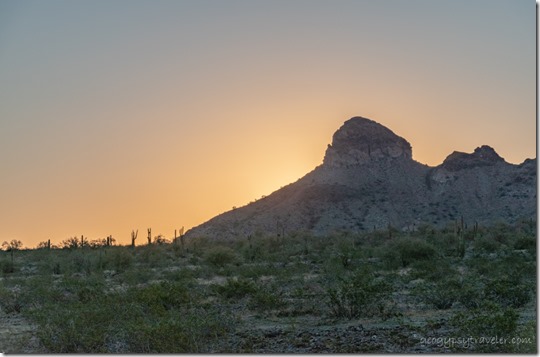
Saguaro cactus desert sunset clouds Saddle Mt BLM Tonopah ArizonaThe wind that pushed us there calmed enough to do a little rockin’ and we were treated to a colorful sunset.
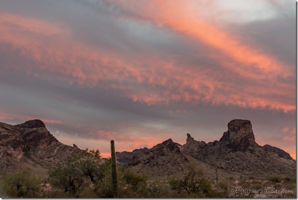
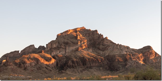
desert mts sunset clouds Saddle Mt BLM Tonopah ArizonaSaddle Mountain rises up to 3037 feet in elevation, about 1500 feet above the desert floor.  The rugged shapes formed about 24-36 million years ago during massive volcanic activity with basalt lava flows and cinders capped with ash flow and fall. Erosion created cliffs, spires, and buttes tinted by andesite (grayish), rhyolite (pinks), and basalt of dark gray to black.  I’ll bet that caused some “rockin’” time around here.
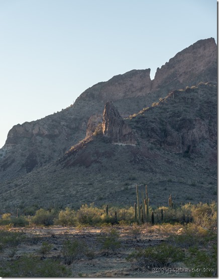
mt sunrise Saddle Mt BLM Tonopah Arizona

Saguaro cactus desert first light mt Saddle Mt BLM Tonopah ArizonaThe next day dawned clear with clouds increasing throughout the day.
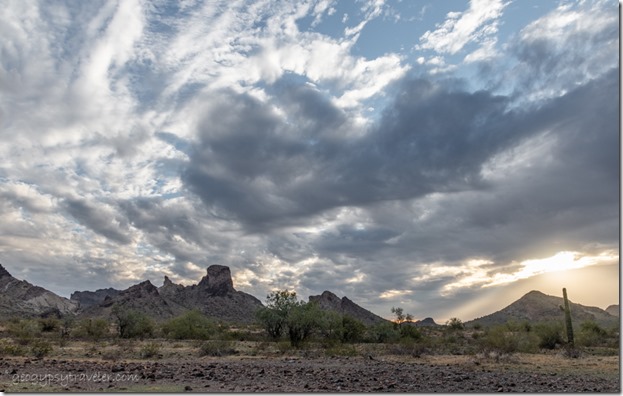
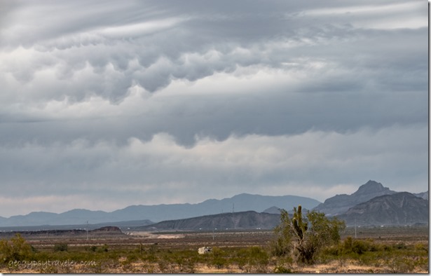
desert Belmont Mts mammatus clouds Saddle Mt BLM Tonopah Arizona

Saguaro cactus desert mts sunset clouds Saddle Mt BLM Tonopah Arizona

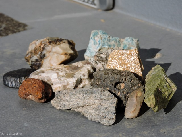
desert mts last light clouds Saddle Mt BLM Tonopah ArizonaShort walks from camp produced lots of rocks in our pockets.

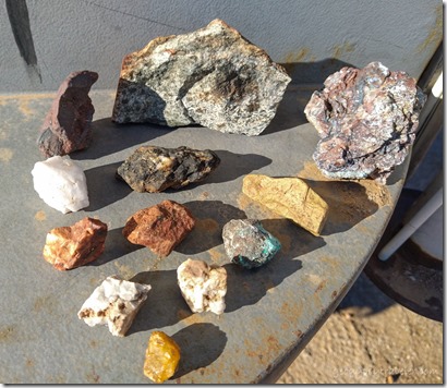
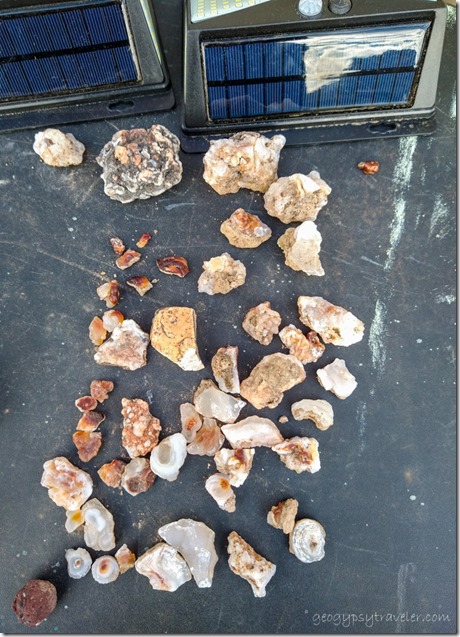
Along with this period of volcanism, hot water saturated with silica and iron oxide repeatedly filled cracks and bubbles in the surrounding rock.  Once lithified (turned into rock) the resulting quartz specimens produced crystals and chalcedony (sometimes called desert roses) that occasionally show an iridescent rainbow of colors called fire agates.  The adularescence, or Schiller effect, is caused by alternating silica and iron oxide layers diffracting light.
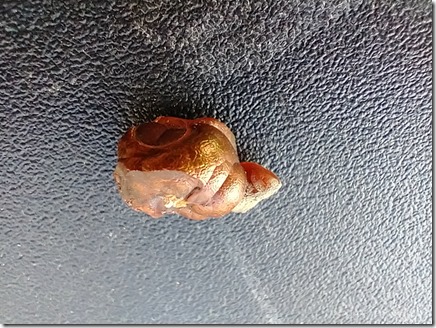
rocks Saddle Mt BLM Tonopah ArizonaUpper right shows colors

fire agate rock Saddle Mt BLM Tonopah ArizonaWe sat oohing and aahing over the rocks with a hand lens. I actually got one tiny pinky-fingernail sized piece that shows fire.
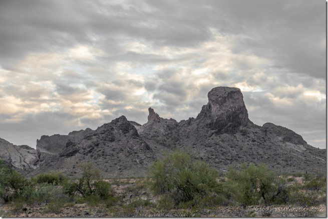
desert mts sunset clouds Saddle Mt BLM Tonopah ArizonaI vaguely remember my first visit to Saddle Mt during the winter of 1996 and think the area hadn’t been picked over so much then and the rockin’ was better as I filled five-gallon buckets.

Gaelyn rd desert mt Saddle Mt BLM Tonopah Arizona

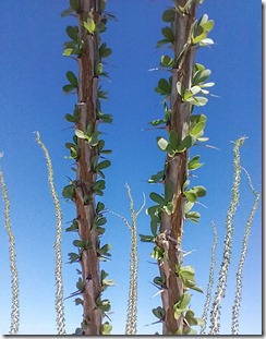
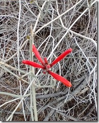
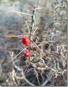
leaves Ocotillo Saddle Mt BLM Tonopah Arizonared Chuparosa flower Saddle Mt BLM Tonopah Arizonared cactus fruit Saddle Mt BLM Tonopah Arizona

                           Ocotillo                                                   Chuparosa                                       Christmas Cholla cactus

The following day held clear blue skies, light southern wind, and 72° that beckoned outdoors.  A walk up the road closer to the mountains revealed several campsites with only a few occupied.  I told myself no rockin’ until the walk back to camp.  Of course impossible.  Yet I was also distracted by the landscape, plants, and view.  The most prevalent plant is the creosote bush sending out roots to clone itself into a big family and lending good locations for the burrows of small mammals.  The three converging washes in the area, known as the Palo Verde foothills, create lush stands of mesquite, ironwood, and Palo Verde trees.
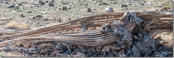
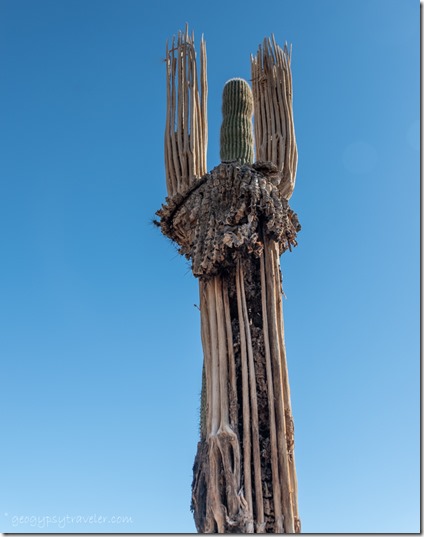
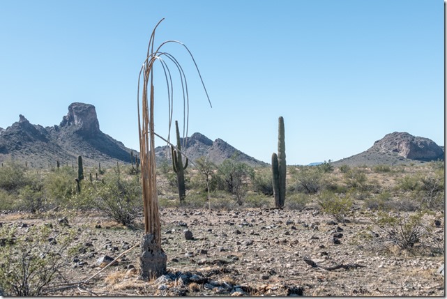
dead & live Saguaro cactus Saddle Mt BLM Tonopah Arizona

dead & live Saguaro cactus desert mts Saddle Mt BLM Tonopah Arizona

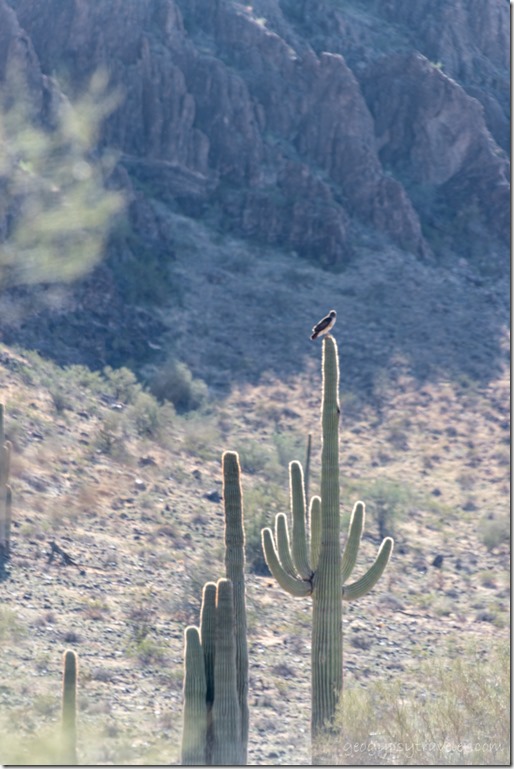
down & dead Saguaro cactus Saddle Mt BLM Tonopah ArizonaThe Saguaro cactus can grow at least 30 feet over time and are seen in various states of life and death.
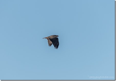
hawk on Saguaro desert Saddle Mt BLM Tonopah Arizona

hawk in flight Saddle Mt BLM Tonopah ArizonaThey provide a nice roost for local birds of prey like copper and sharp-shinned hawks, prairie falcons, and golden eagles.  Not sure what we saw as the images are out of focus.
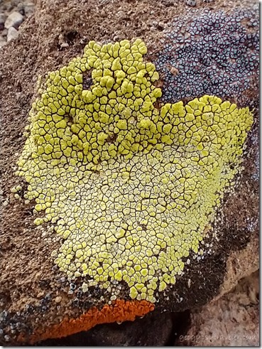
lime-green, ashy-gray, & orange map lichen Saddle Mt BLM Tonopah ArizonaYet all desert life isn’t tall or obvious.  The lime-green (no bigger around than an egg), ashy-gray, and orange lichen forms a symbiotic relationship with the dark rock varnish formed by manganese oxidation.
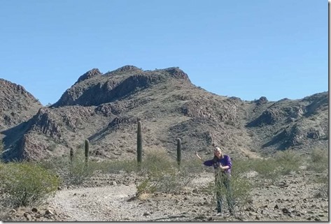
camp desert mts Saddle Mt BLM Tonopah ArizonaCamp left & down from center

jct BLM 8211 & 8212 desert mts Saddle Mt BLM Tonopah Arizona

Gaelyn desert mts Saddle Mt BLM Tonopah AZ by JoannJoann returned to camp before me and I continued sauntering to a four-way then turned around and about half way back saw her driving toward me.  We returned to the four-way and explored the right turn that quickly ended in a place for day-use folks to park while out rockin’.
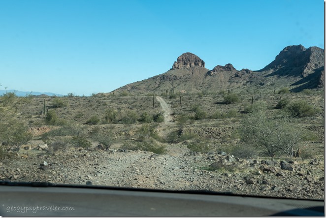
rd not taken desert mts Saddle Mt BLM Tonopah ArizonaAnother right turn stopped us quick as the “road not taken” so we turned around.  I am glad Joann likes to explore the backroads.

We took a round about drive to the town of Tonopah (population 59) where google indicated no services except the post office.  We looped the parking lot at El Dorado Hot Springs that didn’t look any more appealing than the lousy TripAdvisor reviews.  There are three fuel station options at the Tonopah freeway exit, one with a Subway where we had a late lunch.  Drove past the chicken farm that draws the abundance of flies when there’s no wind.
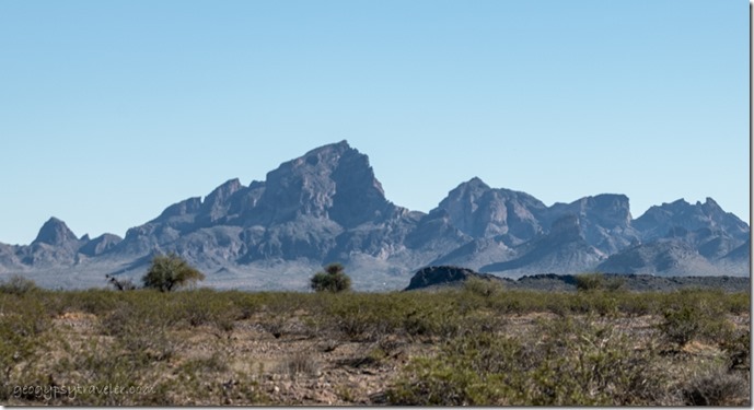
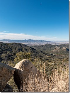
the saddle desert mts Salome Rd Tonopah ArizonaAnd saw a different perspective of Saddle Mt with a most obvious “saddle”.
late light mt Saddle Mt BLM Tonopah Arizona

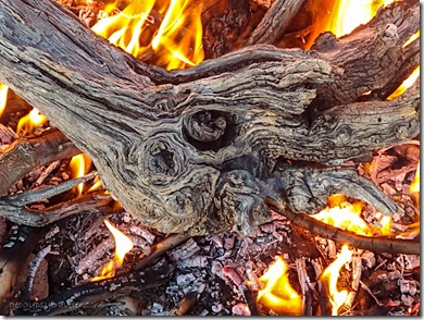
log in fire Saddle Mt BLM Tonopah ArizonaWind slowed enough for a campfire that night.  Later we used our pie-makers, with cherry filling, on my stove top, cleaner than sticking them in the flames.  And we talked about another outing for the next day to look for petroglyphs, kind of another form of rockin’.

Push my buttons!

  • Click to share on Facebook (Opens in new window) Facebook
  • Click to share on X (Opens in new window) X
  • Click to share on LinkedIn (Opens in new window) LinkedIn

Like this:

Like Loading...
Arizona, Congress, Places I've been, RV life, Saddle Mt, United States BLM camp, boondocking, desert, rockhound 26 Comments
06 August 2020

Living in the NOW

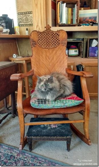
Sierra cat on rocking chair in RV Bryce Canyon National Park UtahI really try living in the NOW even though I enjoy memories and planning for the future.  With the recent state of COVID affairs, the future is so unreadable.  So I’m working on one day at a time which includes work and limited play.

Last week on a day off I was home working on the computer.  Everything seemed slow, barely a signal to get online, every program opened “not responding” for way too long.  I was frustrated with waiting.  During mid-day many visitors are online.  Living in the NOW was not so nice.

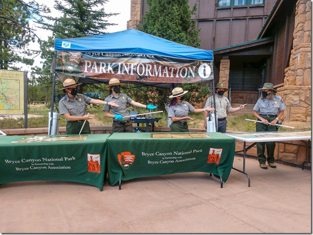
Rangers pointing at me VC plaza Bryce Canyon National Park UtahCelebrated World Ranger Day July 31st.  All Rangers deserve recognition for taking care of visitors everyday through a pandemic.  My supervisor has worked his bum off making Bryce Canyon National Park Rangers available to the public.  Thank goodness we don’t only staff the information tables outside the visitor center.

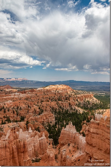
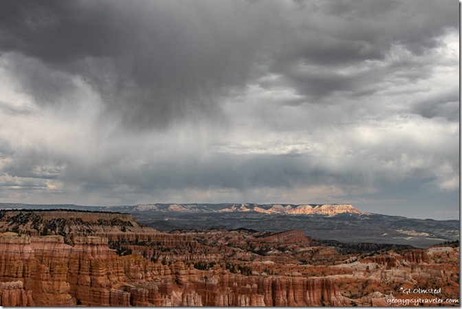
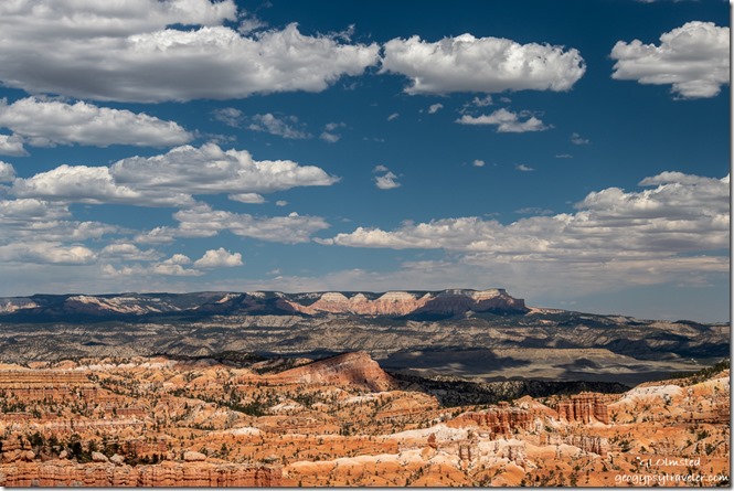
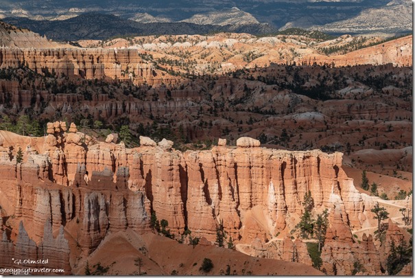
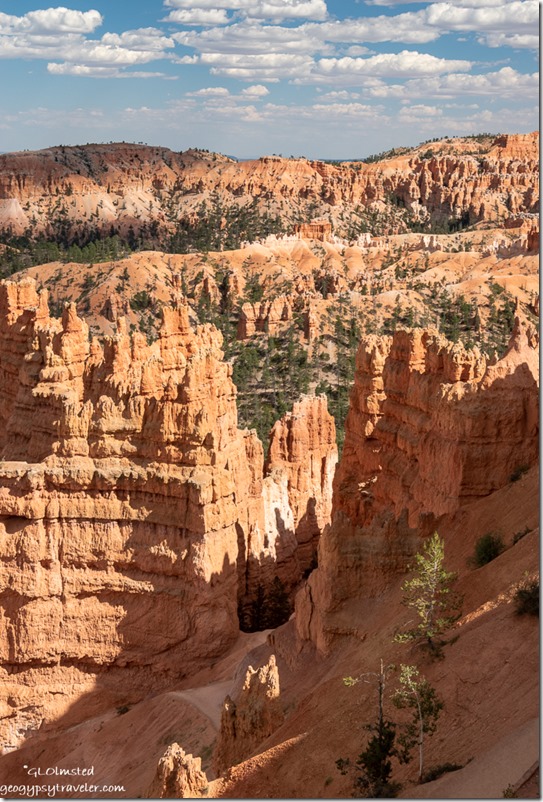
hoodoos valley Table Cliffs storm clouds Bryce Canyon National Park UtahAfter a hoodoo geology program I hung out near Sunset Point.  That day, dramatic clouds provided intermittent shade for perfect hiking and taking photographs from the rim of the main amphitheater.

hoodoos valley Table Cliffs storm clouds Bryce Canyon National Park UtahNo rain hit the ground.

hoodoos valley Table Cliff shadows clouds Bryce Canyon National Park UtahThe next day the clouds thinned out and the temperature rose.  I was a little cooked after four hours roving along the 8000 foot rim at 88°F.

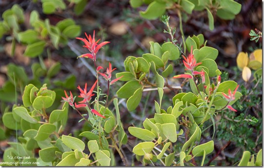
red Paintbrush flowers in Manzanita bush Bryce Canyon National Park UtahA good time to stop in shade and take a photo.

light shadow hoodoos Bryce Canyon National Park UtahAt one point, a visitor asked where is my favorite special place and when I told him, wherever I am, he couldn’t believe it.  “Like I would love the dump”, where I never go.  I told him “I try living in the now, as much as possible.”  He just couldn’t understand.

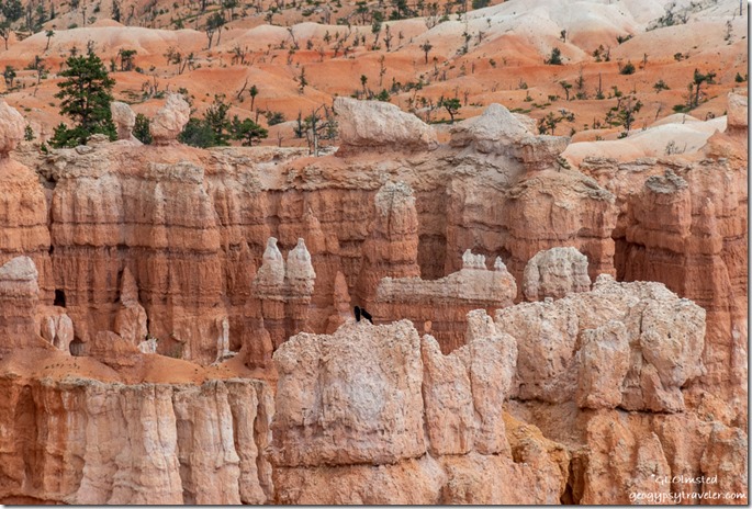
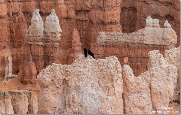
Ravens on hoodoos Bryce Canyon National Park Utah

Ravens on hoodoos Bryce Canyon National Park UtahMy now is frequently in the comfort of my own home—either RV—or outside in a lovely natural environment.  I kind of plan it that way.

Yovimpa Point from Bristlecone Trail Bryce Canyon National Park UtahLooking at Yovimpa Point from the Bristlecone Trail

Sunday, Ranger Julie and I went to Rainbow Point at the end of the scenic road, another hot day of 90°F at 9100 feet in elevation.  After setting up some tables with props and “Please do not touch” signs I left Julie to present the first Grand Staircase geology talks of the afternoon.

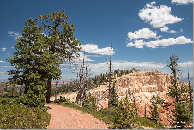
trees Pink Cliffs clouds Bristlecone Loop Trail Bryce Canyon National Park UtahI sauntered 1 1/2 hours roving almost one mile of the Bristlecone Loop Trail.

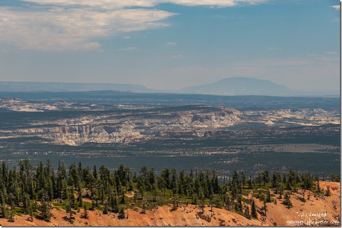
Southeast view Paria River canyon Rock Springs bench Hackberry canyon 50 Mile & Navajo Mt Bristlecone Point Bryce Canyon National Park UtahFrom Bristlecone point I enjoyed a long distance view southeast putting more of the surrounding geography in perspective while trying to figure out what I saw.  Navajo Mountain bulges almost 10,000 feet on the horizon about 90 miles away.  Later with good NatGeo maps and some online help I determined to the left of Navajo Mt lies the Kaiparowits Plateau and the right Echo Cliffs.  Mid-ground starts with the upper Paria Canyon, with Rock Springs Bench next, followed by the Hackberry Canyon, and a rather unrecognizable flatland beyond which is actually multiple benches and canyons.

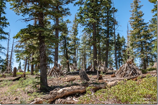
trees burn piles Bristlecone Loop Trail Bryce Canyon National Park UtahI chatted with folks about fire ecology.  A section of the trail borders a backburn from 2018 when lightning strikes started the Lonely Fire in late August and early September the Riggs Fire.  They burned together outside the park and started to approach Rainbow Point in the park.  Suppressing fires for over 100 years didn’t do forests any favors.  Now people try to clean up the unnatural amount of dead fuels and even thin some trees in an effort to restore forest health.

Bryce Canyon Junior Ranger book coverAt a forest gazebo along the trail, I met a family and was interviewed by their soon to be Bryce Canyon Junior Ranger.  The Questions from their Junior Ranger Book and my answers follow:
“Which was the first national park you ever visited? When did you visit?”  1974, Rocky Mountain National Park.

“What do you remember about that experience?”   I thought I’d live there someday.  It just hasn’t happened, yet.

“What do national parks mean to you?”  Special places for special people, that’s everyone.

“Of all the national parks you’ve visited, which was the most special to you? Why?”  Whichever one I’m at, as a Ranger or visitor.  Because I try living in the NOW.

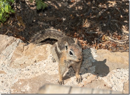
Ground squirrel begging Bryce Canyon National Park UtahAfter returning to Yovimpa Point it was my turn to talk geology while Julie roved.  After several hot hours with multiple small groups I briefly had the overlook to myself.  I sat down in the shade with a dark chocolate fig brownie and water.  Before long, a family arrived, walked to the safety fence, and a kid tells me a squirrel is eating my food.  No, I’m eating my food.  Except I forgot about the Oreos in my fanny pack, that I also forgot to zip shut.  My newest friend.

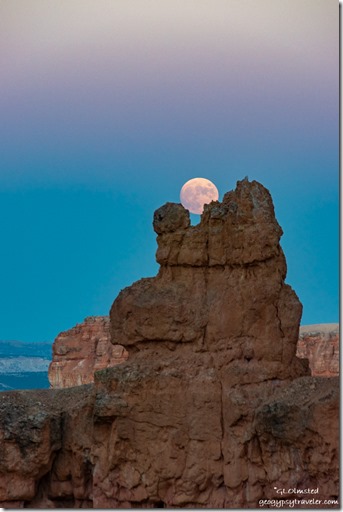
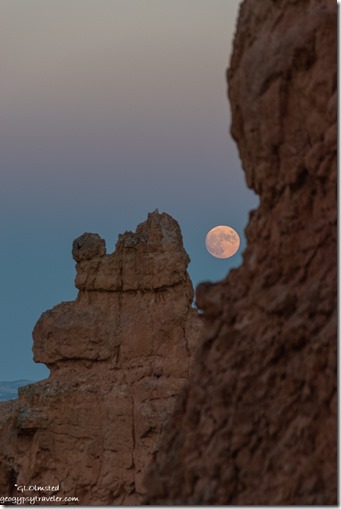
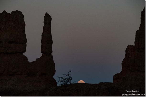
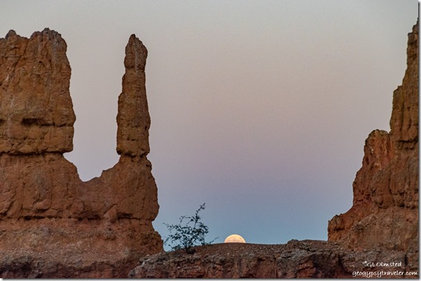
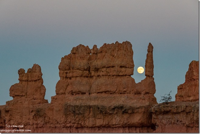
Navajo Trail trees hoodoos clouds Sunset Point Bryce Canyon National Park UtahEven though I was tired from the long afternoon, I went out for the full moon rise as it was only ten minutes before sunset making it easier to photograph without using a tripod.  Walked down the Two Bridges side of the Navajo Loop Trail about five switchbacks, just below what I call the Mask.  (For its shape and nothing to do with COVID.)

hoodoo moon Navajo Trail Bryce Canyon National Park Utahhoodoos moon Navajo Trail Bryce Canyon National Park Utah

Took some shots of the last light before the moon rose a little further south than expected through a smoky haze so not visible until about 15° above the horizon.  I moved up and down trail 30-40 feet catching it between several different hoodoos.

hoodoos moon Navajo Trail Bryce Canyon National Park Utah

hoodoos moon Navajo Trail Bryce Canyon National Park UtahThe camera kept going auto on the ISO and I couldn’t figure out why.  After every shot I’d have to try to put the ISO back where I wanted it, on manual.

hoodoos moon Navajo Trail Bryce Canyon National Park UtahThe next day I figured out the problem is the touch screen, that is now turned off.  I look through the eye viewfinder with my left (and better) eye and my nose touched the screen.  The camera’s choice was up like 25,000 and exceedingly grainy.

I woke the next morning feeling exhausted after almost seven hours of sleep.  Even after coffee and breakfast I couldn’t do another day at Rainbow Point so called in sick and went back to bed for another four hours of blissful sleep.  Don’t think I messed up the schedule too bad as Paula had help opening then went to Rainbow alone.  I might have overdone the day before getting over heated and dehydrated.

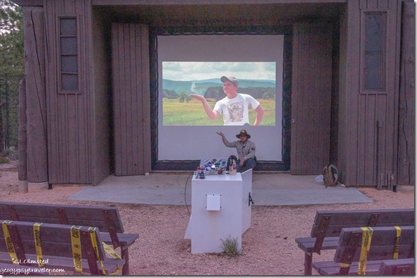
Intern Ben at evening program Bryce Canyon National Park UtahBy afternoon I felt recovered and the next day shared a late schedule with our intern Ben.  It’s his last week here so I gave up my evening program for his presentation about the science of life in the universe.  Really glad I had to open locks for setting up the slide projector and be there for this excellent program, not about aliens.  Afterwards, most of the staff, all wearing masks, joined together in the employee parking lot to look at the sky with our Vogon telescopes.  (Not open to the public.)  The only time we’ve had them out all season.  We are all going to miss the two astronomy interns who soon return to online school.

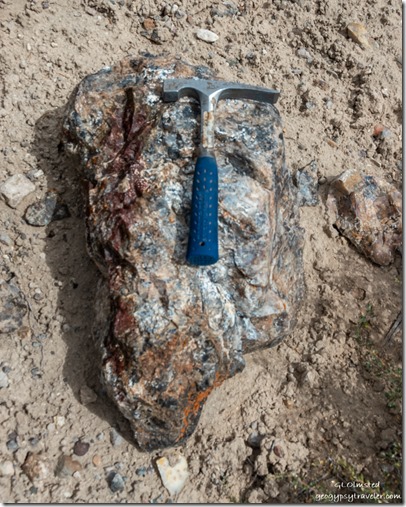
rock hammer agate rock Agate Hill Dixie National Forest UtahSo, although I was up late on my Friday, the next day I went rock-hounding with April.  Being both our days off, my first her last, we didn’t start our adventure until 10am.  Besides we weren’t going too far away either.  And unlike my last drive-by, we had no problem finding Agate Hill.  Good idea to go rock-hounding with a geologist.

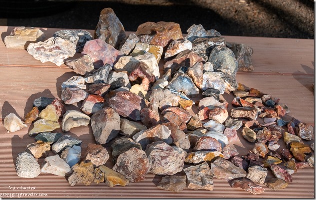
collection various agates from Agate HillOf course we gathered way too much rock even though under the allowed 25 pounds plus one for each person.  So many gorgeous colors: yellows, oranges, reds, black, root beer brown, and white.

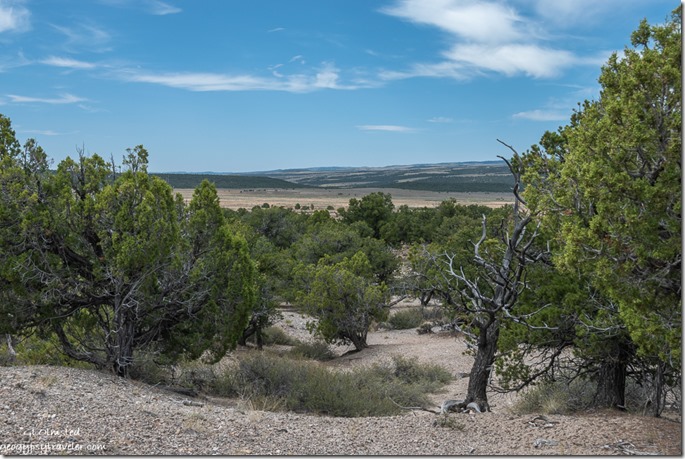
Southwest view trees valley Agate Hill Dixie National Forest UtahI was so busy looking down at the rock that I failed to take many photos of the lovely landscape which included the eastern cliffs of Red Canyon as well as the Sevier River valley to the west.  After a couple hours we went to The Big Fish in Panguitch for lunch and quick stop at the market, plus a long wait for April’s ice cream cone at the tourist trap in Bryce Canyon City.  A wonderful day living in the NOW.

I respect that 2020’s NOW certainly isn’t always the best for many reasons.  But for my own sanity, I have to try living in the NOW at least some of each day to find the good and beauty.  What NOW are you happiest in?

Push my buttons!

  • Click to share on Facebook (Opens in new window) Facebook
  • Click to share on X (Opens in new window) X
  • Click to share on LinkedIn (Opens in new window) LinkedIn

Like this:

Like Loading...
Bryce Canyon National Park, COVID-19, Park Ranger, Utah hiking, Park Ranger, play, ranger programs, rockhound, work 18 Comments
04 February 2015

A short long walk to the black mountain

I walk slowly, easily distracted, inspecting little things along the way and thus this was a short long walk to the black mountain within sight of my Ogilby camp.

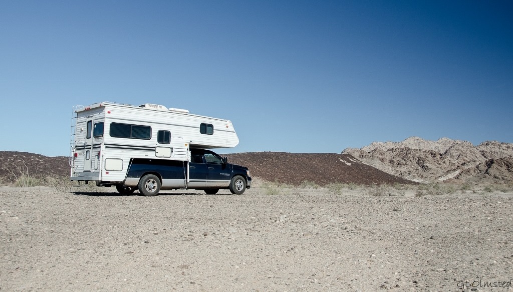
Truck camper Ogilby Road BLM CaliforniaOn the drive between Anza-Borrego and Quartzsite I stayed a few days on open and mostly empty desert managed by BLM just west of Yuma, Arizona.  One morning—OK it was 11:30 because I’m a slow morning person—I took a walk to the little ridge that looked like black rock.

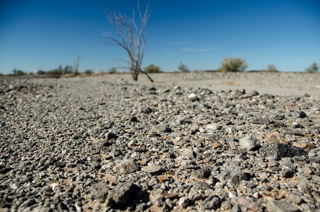
Rocky desert & ocotillo Ogilby Road BLM CaliforniaThe semi-sandy soil is littered with small rock and I am easily sidetracked looking closely at the many colors.  Lots of quartz, granite and many unidentifiable being disguised under layers of dark manganese varnish.  Some rocks glitter and shine.  One piece, a dark shiny charcoal color that is heavy could be hematite.  When rockhounding I look for the unusual, a color, shape or texture that stands out from the crowd.  I am rewarded with blue kyanite with its flat shiny planes.  I was absorbed with the rocks until distracted by the long whistle of a train in the distance that somehow seemed to belong to the desert.

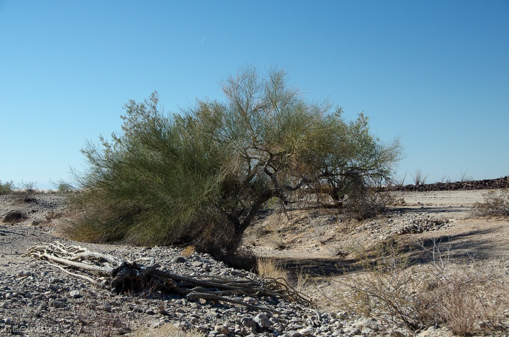
Palo Verde in wash Ogilby Road BLM CaliforniaThe vegetation is sparse and spread far apart, each trying to survive and absorb what little water comes to this arid land.  The Palo Verde are often found along a dry wash that will occasionally run with water.

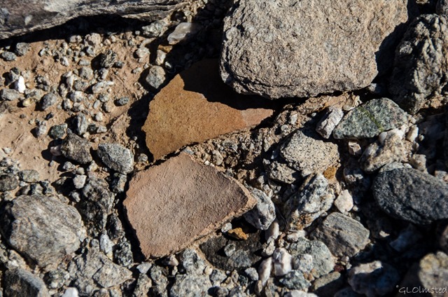
Pottery sherds Ogilby Road BLM CaliforniaI moved on towards the black mountain but soon my eye was attracted to another unusual color and shape.  Could it be?  OMG, two pottery sherds lying side by side.  I stoop to touch them and visions of people of the past living in this harsh desert environment come to me.  I can’t help myself, I pick them up and they fit together like pieces in a puzzle.  I can see where fingers have smoothed the clay.  Then I put them back.  A special gift, I only take photos and memories with me.

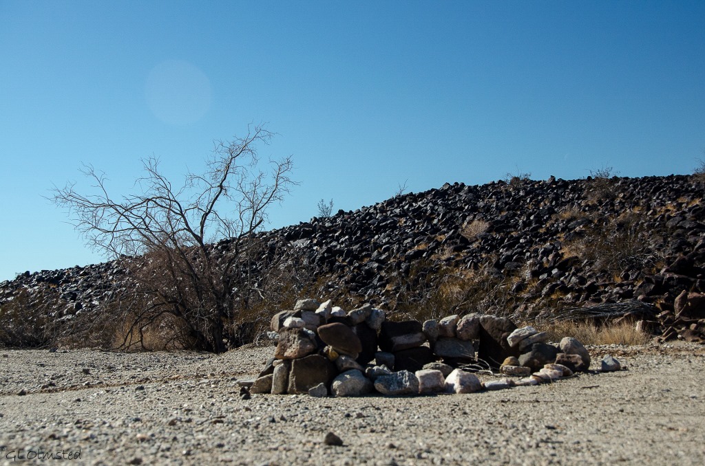
Fire pit Ogilby Road BLM CaliforniaOther evidence of people from a not so distant past are also found in the desert.  Rock stacked fire rings tell where more recent campers have passed the time.  Wonder when those will be considered “artifacts” and if future generations will ponder why people came to this quiet land.

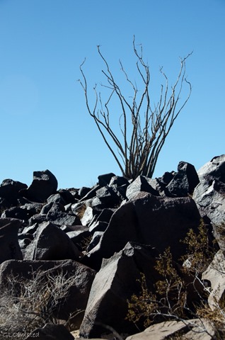
Ocotillo & rocks Ogilby Road BLM CaliforniaAfter 30 minutes of lollygagging maybe 1/4 mile I reached the base of the black mountain.  Here the rocks look pitted, worn and basaltic.  Life struggles to survive amongst this boulder pile.

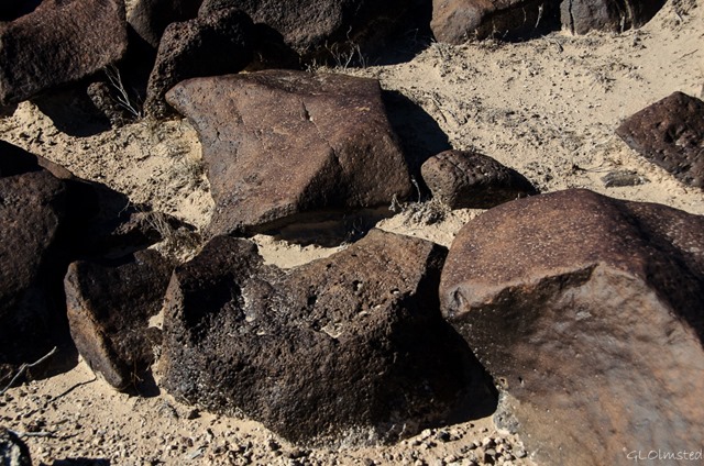
Dark rocks Ogilby Road BLM CaliforniaI found a semi-comfortable rock to sit on and just enjoy the peace and quiet.  A rabbit hoped under a tree.  A lizard scurried under a rock.  One bee and two flies were attracted to my skin and camera.

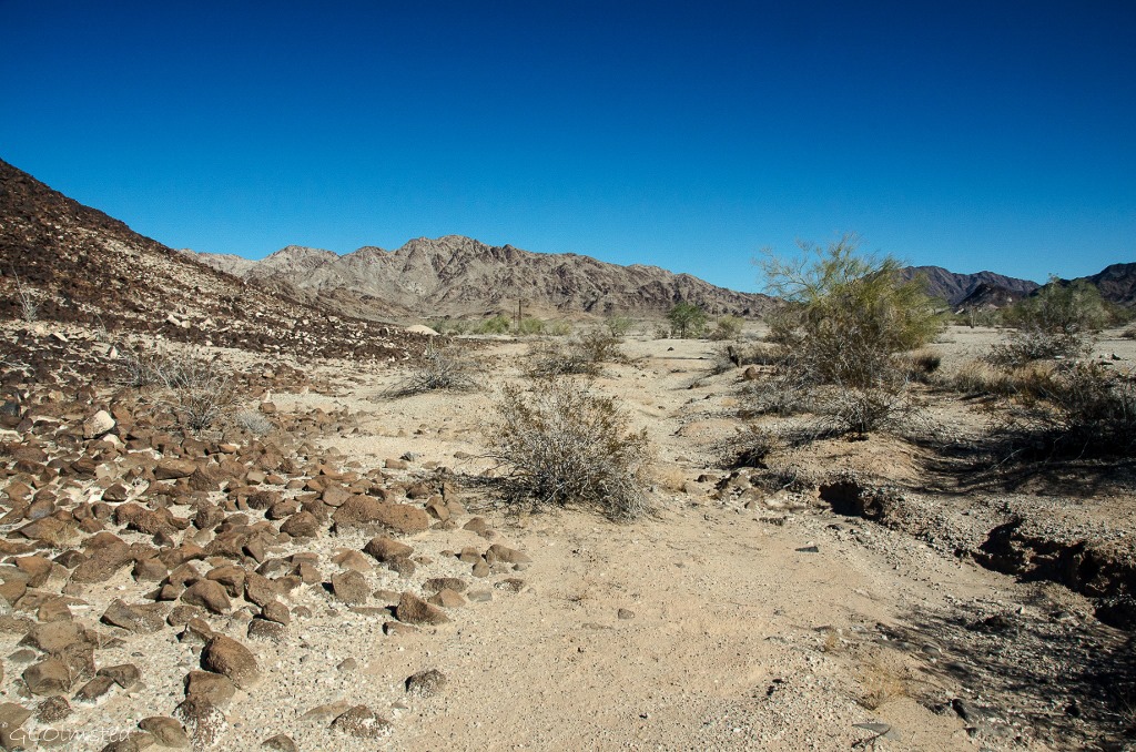
Mountains Ogilby Road BLM CaliforniaAn hour later, with stomach grumbling, I begin a circuitous route back to camp.  I saw a bowl in a wash and thought to pick it up as litter but then noticed water collected in the bottom so left it for the animals and birds that I’m sure have found it.  And with eyes still on the rocks I found a quartz crystal.

Rocks collected Ogilby Road BLM CaliforniaOk, I’ll admit it, I sometimes gather rocks off public lands.  I’m a rockhound and like to decorate my Yarnell yard with rocks from my travels.  I don’t haul big rocks and I don’t take artifacts.  Shhh, don’t tell anybody, OK?

Push my buttons!

  • Click to share on Facebook (Opens in new window) Facebook
  • Click to share on X (Opens in new window) X
  • Click to share on LinkedIn (Opens in new window) LinkedIn

Like this:

Like Loading...
California BLM, rockhound 28 Comments
Newer posts →

Hi, I’m Gaelyn, the Geogypsy

I retired after 29 summer seasons as a Park Ranger, traveling solo for 40+ years. My passions include travel, connecting to nature, photography, and sharing stories.

I started exploring US National Parks in 1977 and 20 years later became a seasonal Park Ranger.  I’ve lived full-time in a RV for 30 years working summers and playing winters.  I’m still trying to figure out what I want to be when I grow old, other than grow up.

Let’s share our stories.  Here’s more of mine…

My wheeleastate

I am currently…

…boondocking somewhere in southern Arizona.  In the area, give a shout.

Geogypsytraveler on YouTube

Follow my journey on YouTube. Just click the pic. Hope you’ll like, share, and subscribe.

Click image for 7 minute documentary (Password “geogypsy” lowercase)

Making the Gypsy documentary is a story of its own.  Click below for the rest of the story.

Living nomadically & connecting to nature documentary

Subscribe to Blog via Email

Enter your email address to subscribe to this blog and receive notifications of new posts by email.

Photos available for sale include prints, greeting cards, coffee mugs, tote bags, phone cases and more

Reflected Wave 24X16 metal print under $100

Custom Coffee Mugs

Many items to choose from including prints

The Last Blast 24 x 16″ metal print under $100

Need a signal boost? When I boondock on public lands sometimes signal is weak or intermittent and a booster helps. Click the pic to visit WeBoost.

Connecting to nature and the rest of the world too.

Please contact me for photo purchases not seen at GLOlmsted Photography

Order fulfillment is by Fine Art America. If you’re not happy with your purchase, for any reason, simply return it within 30 days, and you’ll receive a full refund of the purchase price.

Why read Geogypsy?

The gypsy life spring-summer 1998 - "You were a real pioneer. RV'ing before it was cool." ...Yogi

How do you process photos? - “Your photographs create an Emotional feeling in the viewer...that they become One with You.” …Cindy

Life’s transitions between travel and work play - "I know you love your job as much as you love travel -- it shines through all your posts." ...Sallie

Lions at Kruger National Park - “Wonderful post, thank you. I was hooked start to finish!” … Peter B

11 lessons looking back 2013 - “A great post -- made me think, made me smile, made me want to cry." ...Sallie

Wildlife video Kruger National Park - “Gorgeous, this makes me want to go straight to South Africa now.” … Ayngelina

Living nomadically & connecting to nature documentary - “What an experience you had and gave to the "crew." Sometimes I think you don't realize how unique and inspiring you are.” …Alan

Search

Popular Posts

1. Prioritize the well-being of nature over photography. 2. Educate yourself about the places you photograph. 3. Reflect on the possible impact of your actions. 4. Use discretion if sharing locations. 5. Know and follow rules and regulations. 6. Always follow Leave No Trace principles and strive to leave places better than you found them. 7. Actively promote and educate others about these principles

Categories

Archives

Sites I follow, read & recommend

  • A Full-time Life
  • A Yankee in Belgrade
  • Bob's Eyes
  • Box Canyon Blog
  • Camels and Chocolate
  • Dawns bloggy blog
  • In the Direction of Our Dreams
  • Jane in her infinite wisdom
  • Janie and Steve, Utah Trails
  • Kathie's Birds
  • Las Adventuras
  • Memorable Meanders
  • Oh, The Places They Go
  • On the Road Abode
  • Port Elizabeth Daily Photo
  • Stillhowlyntravels
  • Take to the Highway
  • Technomadia
  • the good luck Duck
  • Travel with the Bayfield Bunch
  • Wandering Earl
  • Wheeling It
  • Yogi's Den

Caught in a Slot 9×12 canvas print under $50

If you don’t like what’s going on in your government, contact your Congress

Directory of Senators

Directory of Representatives

Lijit

© Copyright 2008-2024. Geogypsytraveler.com
%d