• Home
  • About Geogypsy
    • Herstory
    • Parks where I’ve worked
  • Places I’ve been
    • United States
      • Arizona
        • Antelope Slot Canyon
        • Casa Grande Ruins National Monument
        • Colossal Cave Mountain Park
        • Flagstaff
        • Glen Canyon National Recreation Area
        • Grand Canyon National Park
          • Grand Canyon National Park North Rim
          • Grand Canyon National Park South Rim
          • Toroweap
        • Havasu Canyon
        • Horseshoe Bend
        • Jerome
        • Kaibab National Forest
        • Lee’s Ferry
        • Meteor Crater
        • Navajo Bridge
        • Oak Creek Canyon
        • Painted Desert
        • Pipe Springs National Monument
        • Prescott
        • Quartzsite
        • Saguaro National Park
        • Sedona
        • Sunset Crater Volcano National Monument
        • Vermilion Cliffs
        • Walnut Canyon National Monument
        • Wupatki National Monument
        • Yarnell
      • California
        • Anzaberrego
        • Bakersfield
        • Death Valley National Park
        • Joshua Tree National Park
        • Redwoods NP
        • Salton Sea
        • Yucca Valley
      • Colorado
        • Mesa Verde National Park
      • Florida
      • Illinois
        • IL River
        • Morton Arboretum
        • Starved Rock State Park
      • Michigan
      • Nevada
      • New Mexico
      • Oregon
        • Crater Lake NP
        • Mt Hood
        • Oregon Caves National Monument
      • Texas
        • Alpine Texas
        • Padre Island
        • Port Isabel
        • Rio Grande Valley
      • Utah
        • Brian’s Head
        • Bryce Canyon National Park
        • Buckskin Gulch
        • Cedar Breaks National Monument
        • Cedar City
        • Coral Pink Sand Dunes State Park
        • Dixie National Forest
        • Grand Staircase Escalante National Monument
        • Johnson Canyon
        • Kanab
    • World Travels
      • Germany
      • Mexico
      • South Africa
  • Tours
  • Photography
  • Work with Me
    • Sponsors
  • Contact
Geogypsy
Menu
  • Home
  • About Geogypsy
    • Herstory
    • Parks where I’ve worked
  • Places I’ve been
    • United States
      • Arizona
        • Antelope Slot Canyon
        • Casa Grande Ruins National Monument
        • Colossal Cave Mountain Park
        • Flagstaff
        • Glen Canyon National Recreation Area
        • Grand Canyon National Park
          • Grand Canyon National Park North Rim
          • Grand Canyon National Park South Rim
          • Toroweap
        • Havasu Canyon
        • Horseshoe Bend
        • Jerome
        • Kaibab National Forest
        • Lee’s Ferry
        • Meteor Crater
        • Navajo Bridge
        • Oak Creek Canyon
        • Painted Desert
        • Pipe Springs National Monument
        • Prescott
        • Quartzsite
        • Saguaro National Park
        • Sedona
        • Sunset Crater Volcano National Monument
        • Vermilion Cliffs
        • Walnut Canyon National Monument
        • Wupatki National Monument
        • Yarnell
      • California
        • Anzaberrego
        • Bakersfield
        • Death Valley National Park
        • Joshua Tree National Park
        • Redwoods NP
        • Salton Sea
        • Yucca Valley
      • Colorado
        • Mesa Verde National Park
      • Florida
      • Illinois
        • IL River
        • Morton Arboretum
        • Starved Rock State Park
      • Michigan
      • Nevada
      • New Mexico
      • Oregon
        • Crater Lake NP
        • Mt Hood
        • Oregon Caves National Monument
      • Texas
        • Alpine Texas
        • Padre Island
        • Port Isabel
        • Rio Grande Valley
      • Utah
        • Brian’s Head
        • Bryce Canyon National Park
        • Buckskin Gulch
        • Cedar Breaks National Monument
        • Cedar City
        • Coral Pink Sand Dunes State Park
        • Dixie National Forest
        • Grand Staircase Escalante National Monument
        • Johnson Canyon
        • Kanab
    • World Travels
      • Germany
      • Mexico
      • South Africa
  • Tours
  • Photography
  • Work with Me
    • Sponsors
  • Contact

Tag: road trip

02 November 2021

Window wildlife and a couple day trips

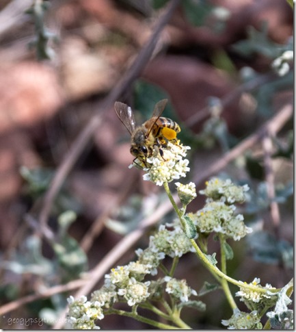
bee on flowers Sedona ArizonaI’m still not anxious to leave this amazing setting in Skull Valley where I watch wildlife right outside my windows, but I did get out a couple times and enjoyed a sweet day-trip with a friend.
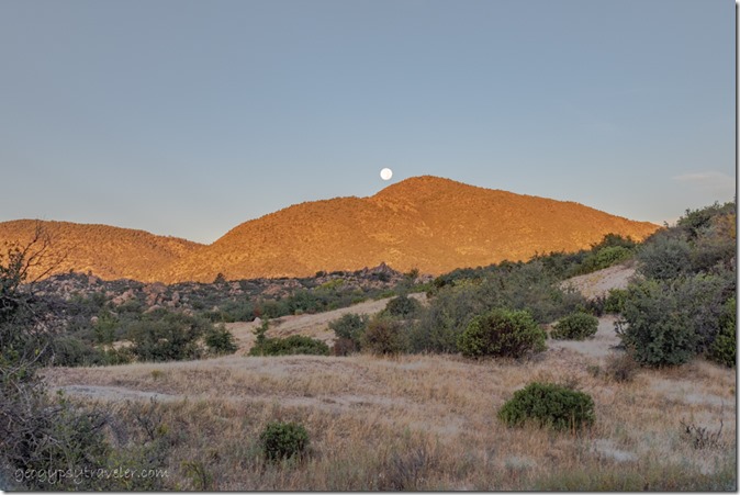
first light Brushy Mt full moon set Skull Valley ArizonaMy window view frames a remarkable landscape with a spectacular pallet changing from brilliant to drab.  Grassy weeds gone to gold surround shrubby bushes showing warm colors in shades of yellow, orange, and red.  Oak trees mostly holding green all year with patches of brown about to go down.
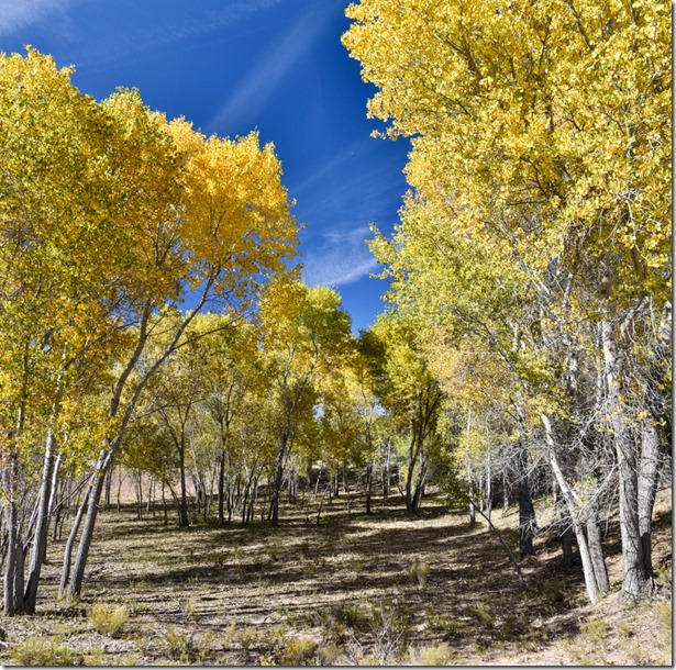
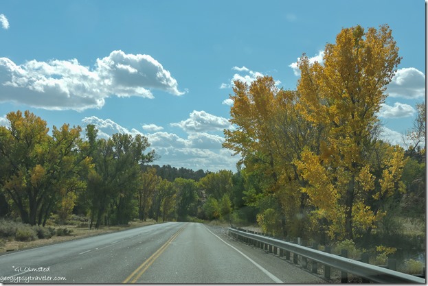
yellow Autumn Cottonwood trees Skull Valley ArizonaCottonwoods, the tallest trees in the topography found near any evidence of water past or present, show the most brilliant yellow fall leaves across the land.  All this mixed in with many shades of green bushes like Manzanita, creosote, and several others I haven’t identified yet.
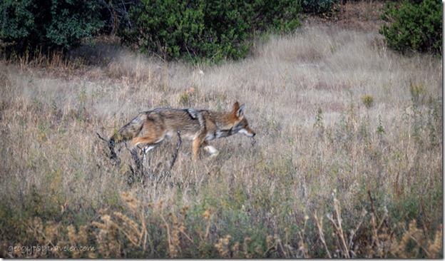
Coyote Skull Valley ArizonaStepping outside in the morning may have startled a bobcat yet the view was brief.  After sundown the coyotes often serenade.  Wildlife abounds.  Motion outside the window of something not usually seen catches my eye, even wind blowing a branch or a bird flying by.  Cottontail hopped across the top of the berm.  Coyote moved quickly through the grasses and I took a few photos before it disappeared into the brush moving east behind me where I briefly saw it once more between bushes and then no more.  Really want to put out water just the other side of the berm, out of my sight but animals insight.  Looking for the right container.
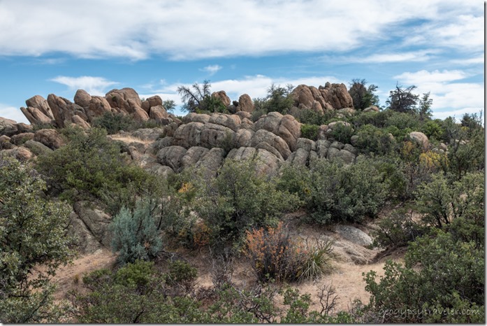
trees boulders clouds Skull Valley ArizonaTaking walks long or short around the ranch provide a chance to better connect to the landscape.  Every animal trail leads to another secret including boulders and homes for wildlife to hide.  Less than ½ mile in an hour and hundreds more photos.
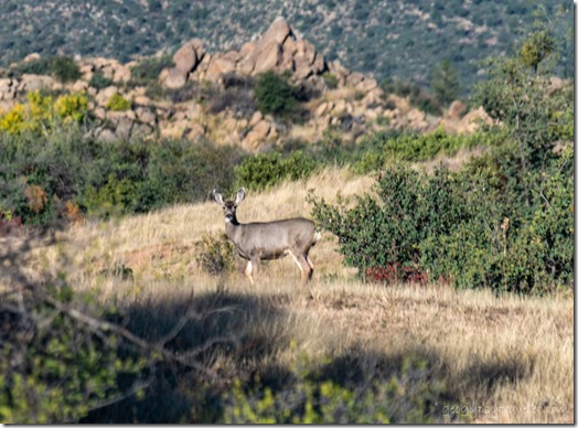
Mule Deer thru RV window Skull Valley ArizonaIn the morning as I prepared to head into town a Mule deer strolls through.
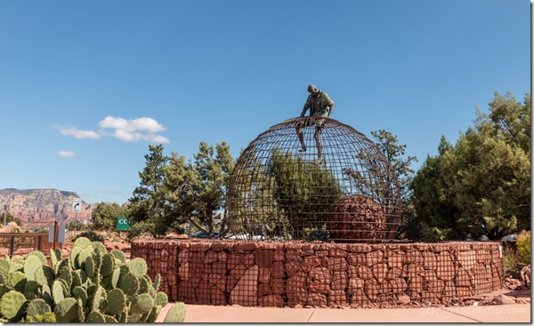
Escape metal sculpture Marriots Sedona Arizona“Escape” metal sculpture Sedona

Because I needed to do laundry pretty desperately I figured to also do some shopping in Prescott, about a 25 minute drive from home.  Got an early start so I’d also have time to first meet Joann and go with her to visit a mutual friend in Sedona.  However, on the way I decided to blow off the chores—they could wait—so we’d have more time to play.  Good idea.  I like retirement.
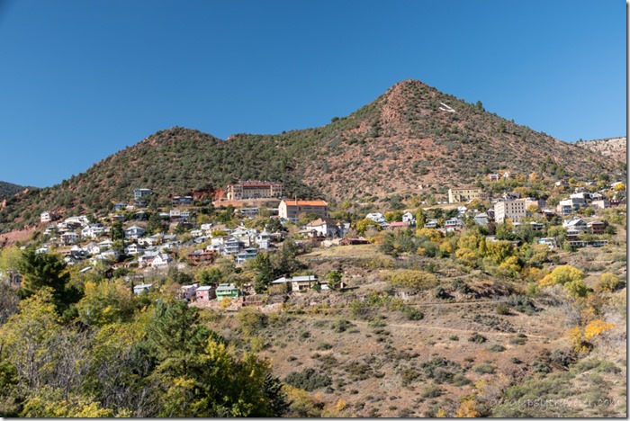
Jerome AZShe drove us through Prescott National Forest over Mingus Mountain through Jerome, an interesting old mining town turned tourist.
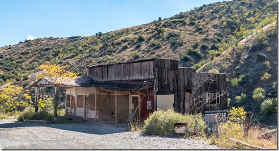
old closed building Jerome ArizonaWhen I first accidentally drove through Jerome during a 1974 road trip it was a tight curvy road cut into a mountain, and still is.  But then the dilapidated buildings perched on the side of Cleopatra Hill, many supported by pylons and looking to fall off the mountainside, provided a skyward view looking up through collapsed floors and through holes in the roof from every switchback of highway.  Most have been renovated and visitors stroll the sidewalks past emporiums, antique shops, and saloons.
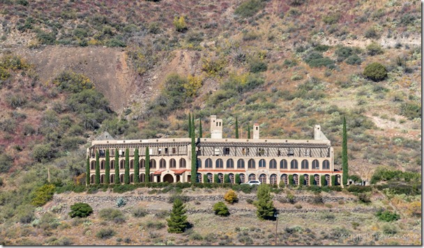
The Little Daisy Hotel Jerome ArizonaThere is reportedly a haunted hotel but it’s not the one pictured, I’ve just always admired the Little Daisy Hotel.  Just last year it was sold at auction for $1.9 million.  Check it out.
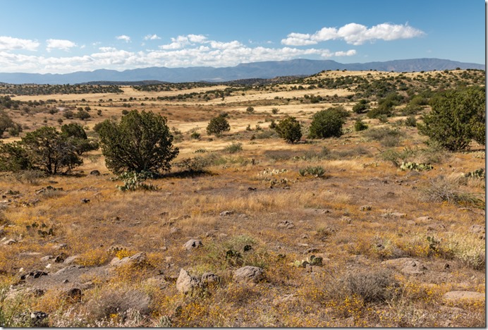
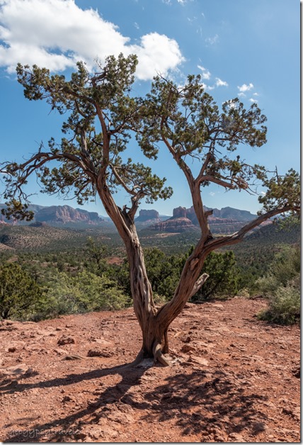
grassland & Juniper trees Public land South of Sedona ArizonaFollowing AZ260 down into the Verde River Valley we scoped out some possible future boondocking options south of Sedona.  Pretty open views with dried grasses and Juniper trees.  Some of the gravel roads were better than others.  Joann’s camp trailer sits low to the ground so it’s important to look at conditions before going there.
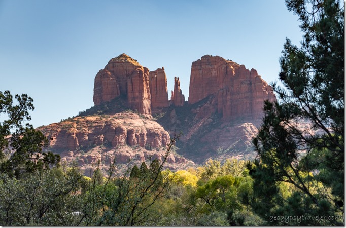
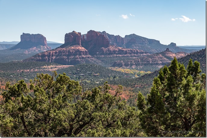
trees red rock cliffs Sedona ArizonaI actually preferred the vibe of Jerome over Sedona even though the surrounding landscape is breathtakingly beautiful towering sand stone formations.
trees houses red rock cliffs Sedona Arizona

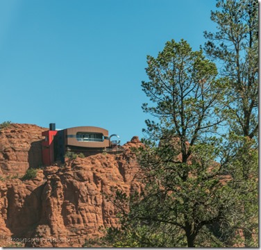
building on cliff face Sedona ArizonaJust too hoity-toity for me with the monstrous size multi-million dollar homes painted to kind of blend into the cliffs.
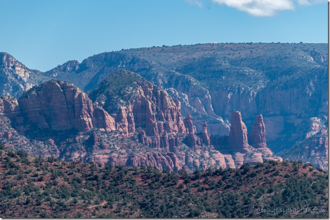
tree framed red rocks Sedona Arizona

red rocks Sedona ArizonaWe drove around and stopped at a few overlooks but didn’t have time to hike as we wanted to visit our friend Marty who is trying to adapt to living in a locked down facility as she deals with aging medical issues.  Her stories from the past are fascinating and she shared her visit to Giza as a young woman.
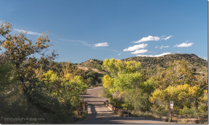
fall trees single lane bridge over Beaver Creek ArizonaEven though we visited a little longer than planned we took a side-trip to explore more backroads with possible boondocking sites and ended up crossing Beaver Creek.
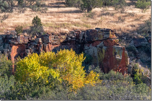
Fall trees rock grass Beaver Creek ArizonaBecause Joann thought she saw the ruins of an old building wall high above the creek we took a short walk and had to laugh when it turned out to be natural rocky wall along the creek.  Created an illusion we fell for because we’re both pareidolias.  Can you see what I mean?
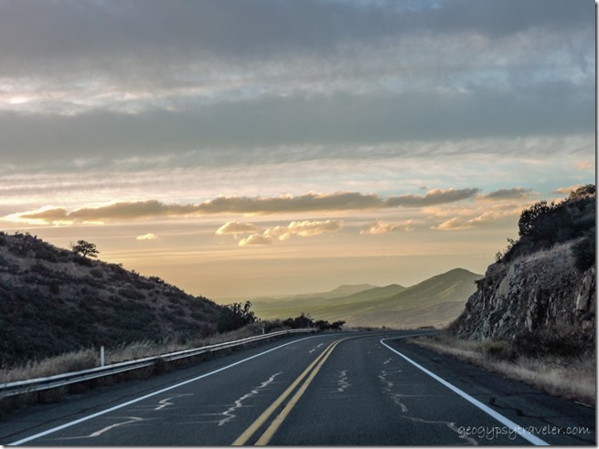
mountains sunset clouds Iron Springs Road ArizonaShe dropped me off at the truck and I drove over the Bradshaw Mountains to home just at sunset.  A magical day connecting with friends and new landscapes.  Yet I knew another trip to town would happen, after a day off, to actually take care of the chores and shopping.
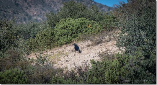
window view bushes Raven Skull Valley ArizonaThe next morning’s window wildlife was Raven who found something to eat.  Sadly, window photos are not usually very clear and focused.  But I am keeping the windows cleaner than they’ve been in a while.  LOL!

I drug myself back to town and managed to spend seven hours shopping at a thrift store, lunch at a new Greek joint, laundry, and groceries/stuff.  Turns out some of the later stuff will be returned when I next go to Prescott.  I noticed prices have gone up, on everything, including the thrift store.  Guess I expected to see that as wages rise, which they should but it needs to be done across the board so to speak.  I hadn’t had more than a few pennies’ raise in many years working for the National Park Service and now that I’m retired don’t expect to see a raise again.
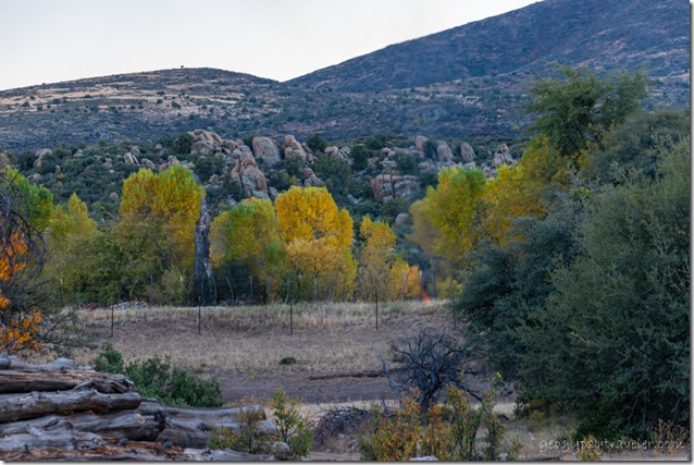
fall trees fire boulders mountain Skull Valley ArizonaIt’s not like I get a lot of snail mail but still need a mailing address.  My paid mail service in Wickenburg ends mid-November and I have some businesses that need to be notified about a change of address.  In fact, some things are on hold as I’ve been struggling to get a post office box in Skull Valley.  Even with a note from my landlord which I was told anybody could have written, they want an ID with local address.  Well that’s a catch-22 if I can’t get an address.  Hope when landlord Larry who’s lived here over 40 years goes into the post office with me and my IDs the problem will be solved.
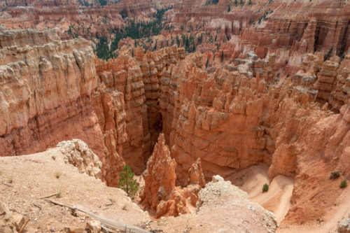
hoodoos Wall St Navajo trail Bryce Canyon National Park Utah

Many days it seems I do a whole lot of nothing, or at least not much to talk about.  I mean like I don’t even take any pictures, though that’s rare.  But probably just as well because I’m still labeling photos from just over a year ago from the end of my 2020 season at Bryce Canyon.  That’s OK, keeps me out of trouble.  But also gets me thinking about traveling.
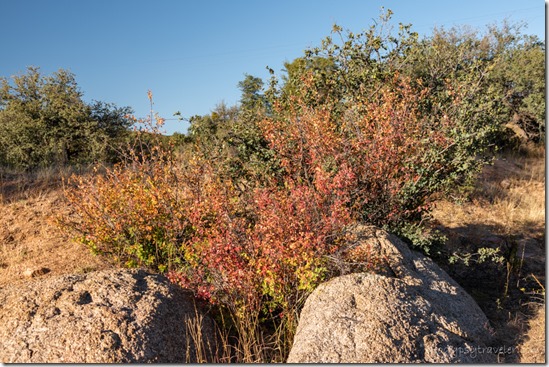
fall leaves boulders Skull Valley ArizonaHey, I’m almost caught up.  Sure that won’t last long as I’m working on a plan to travel in the truckcamper while waiting for the calendar order to be delivered.  Wonder what wildlife I’ll see out those windows, and where.
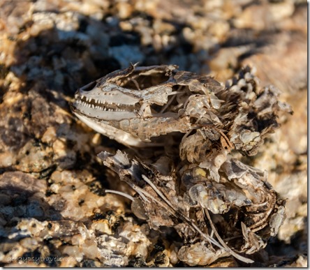
.01in critter skull Skull Valley ArizonaSaw this unusual evidence of wildlife on a boulder in my “yard”.  The skull of something including teeth measures about one inch long.  My spooky Halloween discovery.

Push my buttons!

  • Click to share on Facebook (Opens in new window) Facebook
  • Click to share on X (Opens in new window) X
  • Click to share on LinkedIn (Opens in new window) LinkedIn

Like this:

Like Loading...
Arizona, Jerome, Places I've been, Sedona, Skull Valley, United States, wildlife road trip, wildlife 15 Comments
10 November 2020

On the road to November

trees hoodoos Red Canyon Dixie National Forest SR12 UtahLeft Bryce Canyon on October 25th, before it snowed, and am on the road again in the truck-camper.  The more than 150 mile circle around Bryce was headed into a cold front.  With nights everywhere predicted below freezing, or close, I could only think south.

fall trees SR89 South UtahAnd I only got 1 1/2 hours south to Fredonia, just across the border into Arizona.  A familiar drive along SR89 to Kanab where I didn’t even stop.  I felt tired, exhausted, and drained from the last week at work and closing up the 5th-wheel to move into the camper.

5th-wheel stored in Henrieville UtahShortly after arriving at the Wheel Inn RV Park I received a text that the 5er is winterized and in storage.  That’s a relief.

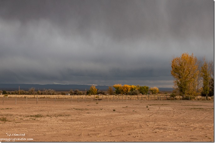
fall cottonwood trees field storm clouds Wheel Inn RV Park Fredonia ArizonaView from end of RV Park

Turned out a friend from the North Rim was already in this park so I pulled in next door.  Sure was good to catch up and talk to someone who understands an intense COVID summer season in a busy national park.  She usually waits tables in the Lodge but due to take-out dinning only her job ended up being the door counter, limiting ten people into the Lodge building for cabin and mule-ride check-in, and enforcing mask wearing.  Sounds like she was verbally abused way too many times.

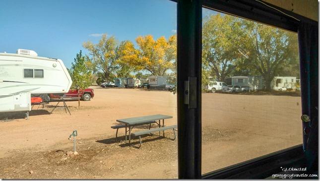
window view Wheel Inn RV Park Fredonia Arizona

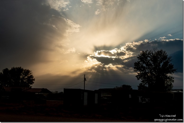
sunset clouds Wheel Inn RV Park Fredonia ArizonaKind of a noisy RV park, or maybe I’m just spoiled.  Also not used to paying $25/night even though I know that’s pretty cheap these days.  But really, basically a level gravel parking lot with utilities and a picnic table.  I initially paid for two nights and added a third to have electricity for heat as the lows dropped below freezing.

truck camper Lynda's house St George Utah

Red Cliffs Desert Reserve by Lynda's St George UtahI was ready to be on the road by Wednesday and drove another 1 1/2 hours west to St. George, Utah with a shopping stop along the way.  A friend invited me to park in her driveway.  I figured one night there but stayed two nights and we even got in a little walk at the nearby Red Cliffs Desert Reserve.  We plan to meet up in the southern desert somewhere this winter.

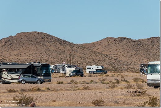
RVs on Snowbird Mesa Lake Road Overton NevadaFriday, I was on the road again continuing yet another 1 1/2 hours just south of Overton, Nevada to dispersed camping known as Snowbird Mesa or Poverty Flats.

RVs Snowbird Mesa Overton Nevada

RVs Snowbird Mesa Overton NevadaLots of snowbirds, more than I’m used to seeing the end of October, but by the look of the RVs and ‘toys’ mostly not suffering impoverishment.  Everybody works at keeping some distance.  Though my nearest neighbor living in a small pickup truck with a topper has rather loud conversations seemingly with himself, or maybe his dog.

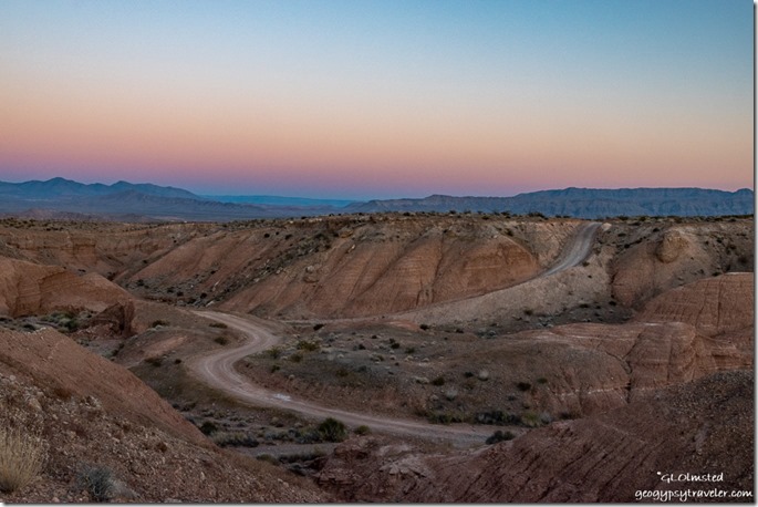
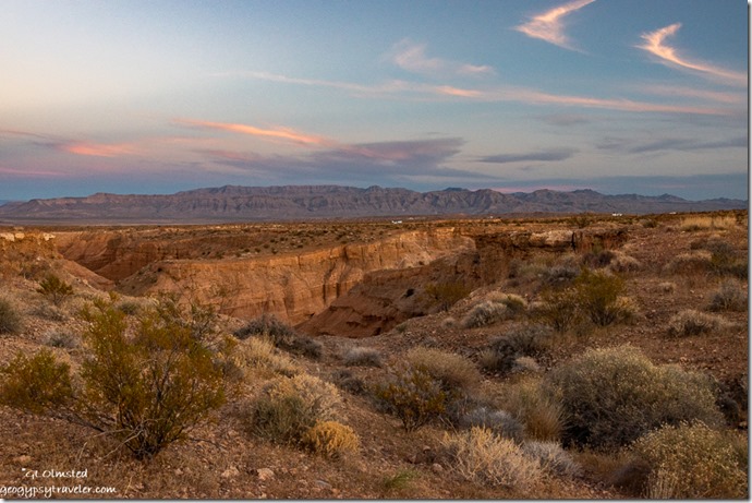
canyon road mountains reverse sunset Earth Shadow Snowbird Mesa Nevada

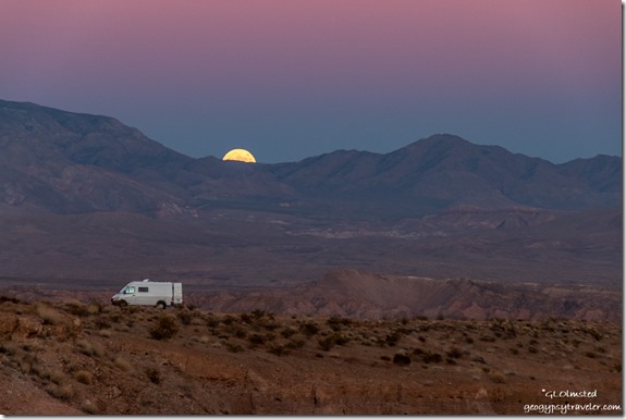
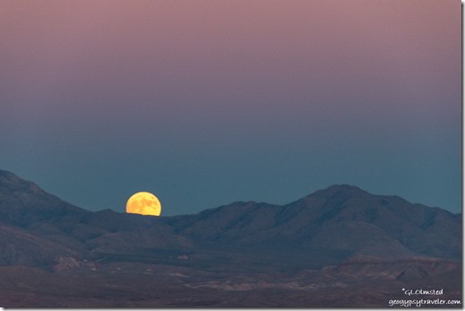
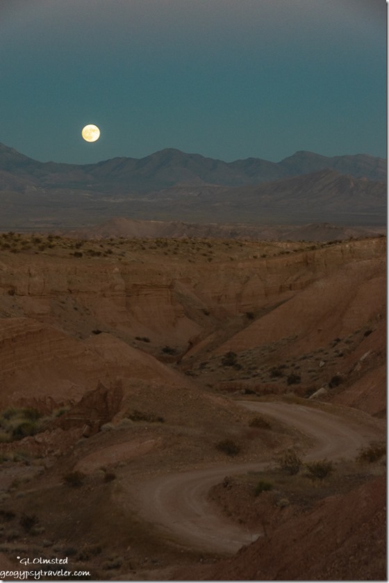
camper van mountains moon rise Snowbird Mesa NevadaI planned to photograph the almost full moon that night and didn’t have to walk far from camp for an interesting foreground and composition.  Had I driven further off the popular path I might have eliminated other RVs.

mountains moon rise Snowbird Mesa Nevada

canyon road mountains moon rise Snowbird Mesa NevadaBut when I walked the next day realized I’d have to drive farther than I wanted to on rough gravel to really isolate and for just one more night in that location decided it wasn’t worth it.  Definitely isolated enough for no trick-or-treaters.  Good thing, as I didn’t buy any candy.

canyon mountains sunset clouds Snowbird Mesa Overton NevadaPretty sunset, but for full moon it was too late thus too dark for this too lazy photographer to drag out the tripod.

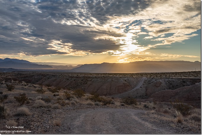
mountains sunrise clouds Snowbird Mesa NevadaI left Sunday morning relatively early for me with the intent of at least a four hour drive to Wickenburg, Arizona for my mail-in ballot.

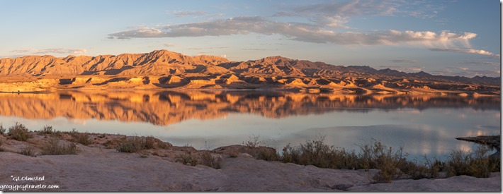
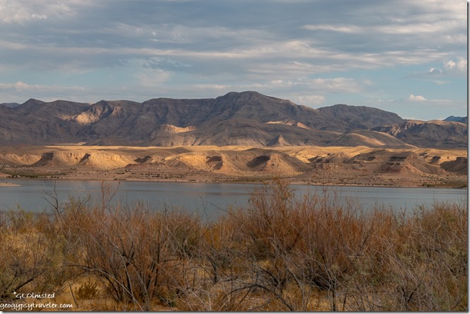
road lake mountains clouds late light Stewarts Point Overton Arm Lake Mead National Recreation Area NevadaInstead, in only 30 minutes, I saw a sign along the windy Lake Road drive for Stewarts Point and decided to check it out.  The two-mile drive to the lake goes past a bunch of older and many dilapidated small houses that make up the unincorporated community of Stewarts Point, inside the Lake Mead National Recreation Area.  These remaining not quite lakeshore properties are from the 1950s when the National Park Service issued long-term leases inside the recreation area yet quit renewing with a change in philosophy and policy during the 1970s.  According to this article, only 48 cabins remained as of 2013.  Most of what I saw didn’t look very used.

lake mountains clouds late light Stewarts Point Overton Arm Lake Mead National Recreation Area NevadaI’d say less RVs than Snowbird Mesa or maybe just spread out more.  There are many options for sites with some more difficult to get to than others.  I’d recommend scouting before driving with a big rig.  My spot was mostly level and good enough for a night or two but I saw many others I’d prefer for next time.

sunset clouds Stewarts Point Overton Arm Lake Mead National Recreation Area Nevada

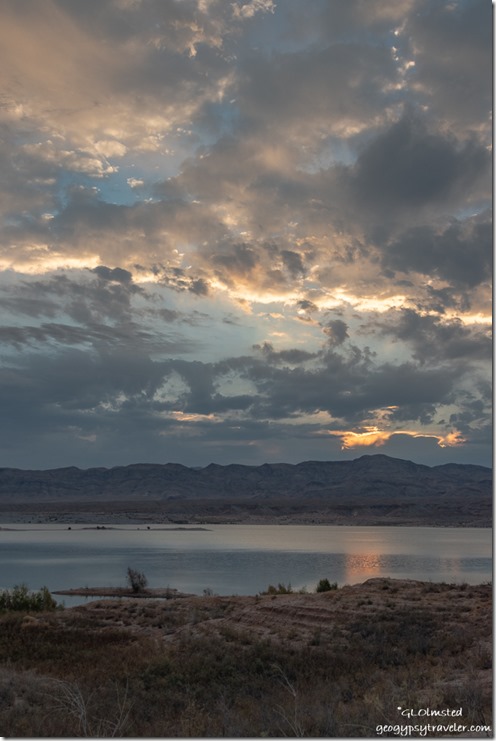
sunset clouds Stewarts Point Overton Arm Lake Mead National Recreation Area NevadaI spent a delightful day taking short walks and reading in the shade.  Just enough clouds to put on a show for sunset.

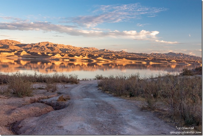
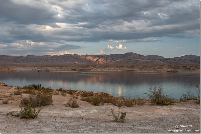
desert lake mountains sunrise clouds reflection Stewarts Point Overton Arm Lake Mead National Recreation Area NevadaI had every intention of leaving the next morning and was greeted with a worthy sunrise with clouds.

brush lake mountains clouds Stewarts Point Overton Arm Lake Mead National Recreation Area NevadaAnd the clouds beckoned me to stay yet another day.  I am a nepholographer.

shore lake mountains clouds Stewarts Point Overton Arm Lake Mead National Recreation Area Nevada

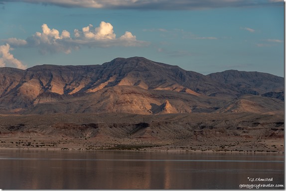
lake mountains Stewarts Point Overton Arm Lake Mead National Recreation Area NevadaLight and shadow danced across the land.  I finished reading another book.  Took short walks.  I tried to relax and be lazy.

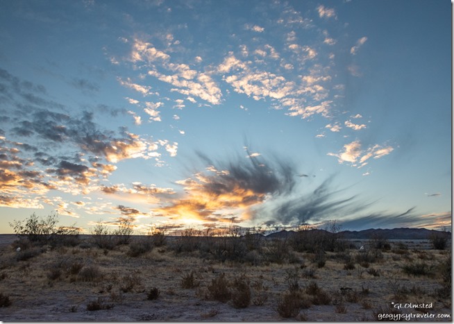
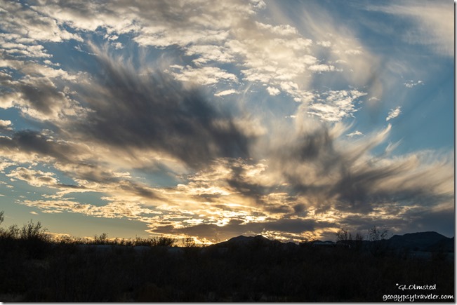
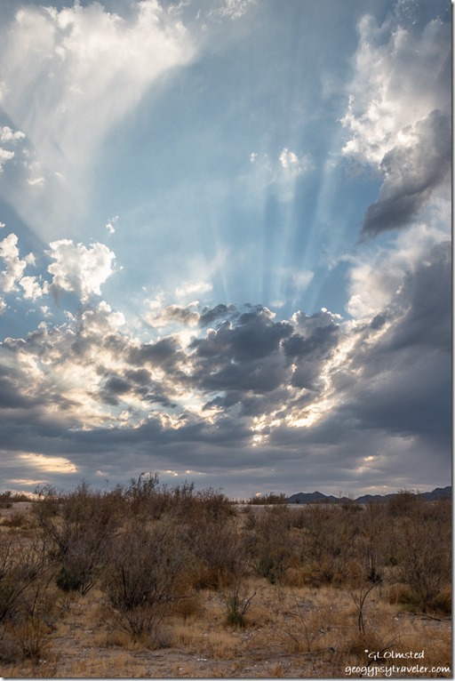
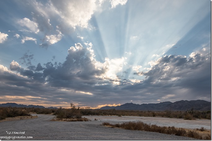
desert sunset clouds crepuscular rays Stewarts Point Overton Arm Lake Mead National Recreation Area NevadaMy mind just wouldn’t stop trying to figure out what and where to be this winter.  I need to figure out how to keep my phone and laptop charged by solar so I don’t NEED to stay in RV parks.  I don’t really understand all the solar stuff so want to talk to someone who does.  I’m willing to add another battery or panel, or both if that’s what it takes.  Probably go back to Solar Bill’s in Quartzsite, eventually.

desert mountains sunset clouds crepuscular rays Stewarts Point Overton Arm Lake Mead National Recreation Area NevadaI stayed for two nights within sight of the ever shrinking Lake Mead along the Overton Arm.  But I had no choice on Tuesday to get on the road to November 3rd so I could vote in Wickenburg, Maricopa county, where I’m registered.

Push my buttons!

  • Click to share on Facebook (Opens in new window) Facebook
  • Click to share on X (Opens in new window) X
  • Click to share on LinkedIn (Opens in new window) LinkedIn

Like this:

Like Loading...
Arizona, Nevada, Places I've been, road trip, RV living, travel, United States, Utah road trip, travel, truckcamper 19 Comments
22 July 2020

Exploring with the new camera Nikon D5600

Peak-a-boo trail hoodoos trees Bryce Point Bryce Canyon National Park UtahThe new camera, a D5600 refurbished by Nikon, arrived last Wednesday late in the afternoon so I planned to go out exploring the next day, first of two days off work.  So far, I am happy with it.

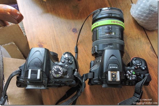
old D5100 & new D5600 Nikon camerasOld D5100 left and new D5600 right

First I had to charge the two batteries for the new camera.  Of course they are subtly different than the previous batteries even though the charger itself is the same.  The D5600 is slightly smaller and lighter, until I put the big 18-200mm lens on and then barely noticeable difference.  Took a little while and reading the manual to get the new camera settings where I want them.

Wilson Peak SR12 West UtahWilson Peak from SR12 west of Bryce

The new camera is still too big to use while driving so I shoot Auto with the small and slow Nikon P600 for that.

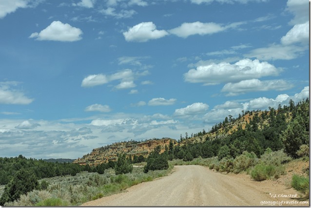
trees Pink Cliffs FR118 North Dixie National Forest UtahThursday, I drove just west of Red Canyon on the Dixie National Forest.  After a quick stop at their visitor center for maps and information I turned off SR12 north a few miles towards Losee and Casto Canyons, plus hoped to find nearby Agate Hill.

I was initially worried this would be a dust storm area as I saw many OHV near the turn off but thankfully didn’t see more after that.  Also discovered a few nice places to disperse camp not far from the trailheads.

trees Arch Trail Losee Canyon Dixie National Forest Utah

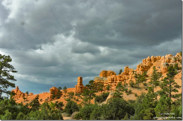
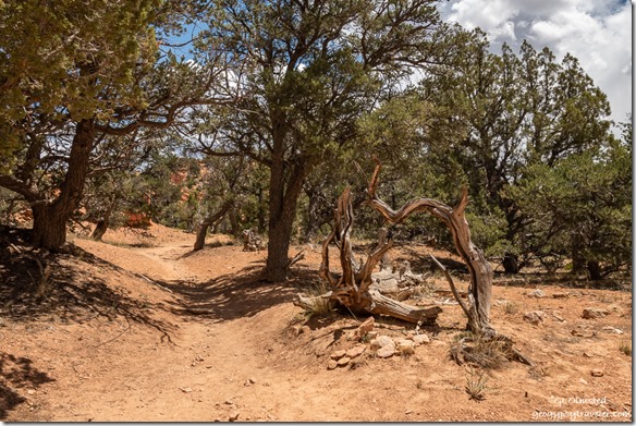
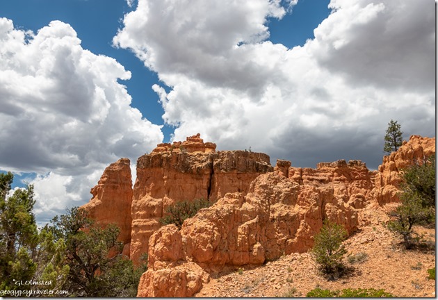
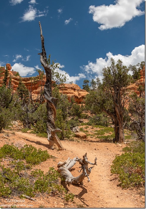
trees hoodoos clouds Arch Trail Losee Canyon Dixie National Forest UtahStopped at the Losee trailhead and walked part of the short Arches Trail.  I enjoyed the dead and twisted trees every bit as much as the redrock hoodoos.

trees hoodoos Arch Trail Losee Canyon Dixie National Forest Utah

red rock trees clouds Arch Trail Losee Canyon Dixie National Forest UtahAs it was a warm day I didn’t feel like a long hot hike so slowly sauntered a bit until the trail took a steep climb where I turned around.  Landscape always looks different when facing the opposite direction.

trees Pink Cliffs Casto Canyon FR118 North Dixie National Forest UtahContinued a short drive to the Casto Canyon trailhead and didn’t hike there at all.  Yet I will return to both these quiet canyons.

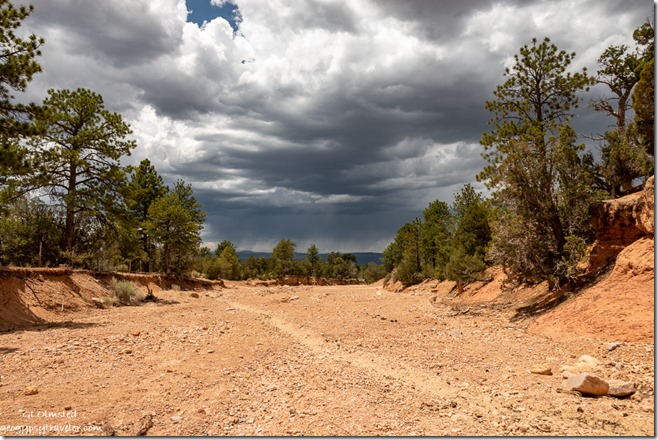
wash trees storm clouds Dixie National Forest UtahSomehow I missed Agate Hill which should have been at a junction to another road west that would take me to SR89 and ultimately to Panguitch.  Guess I’ll have to go back.

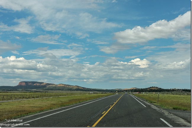
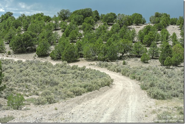
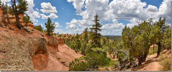
trees FR1700 West Dixie National Forest UtahI honestly wasn’t sure I was on the right road but was headed in the right direction.  Pretty drive descending through the Juniper and Pinyon Pines with more possible camping.

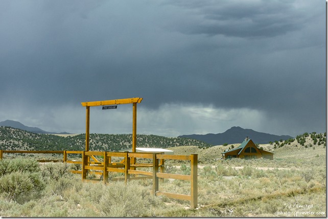
The Dream ranch gate & house UtahAs I approached the Sevier River valley the landscape changed to private agricultural ranches. (Sign reads “The Dream”)

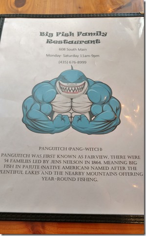
menu cover & story Big Fish resturant Panguit UtahHad a good lunch with lousy service at Big Fish in Panguitch then bought a few groceries at Joe’s Market, which I am not impressed with.

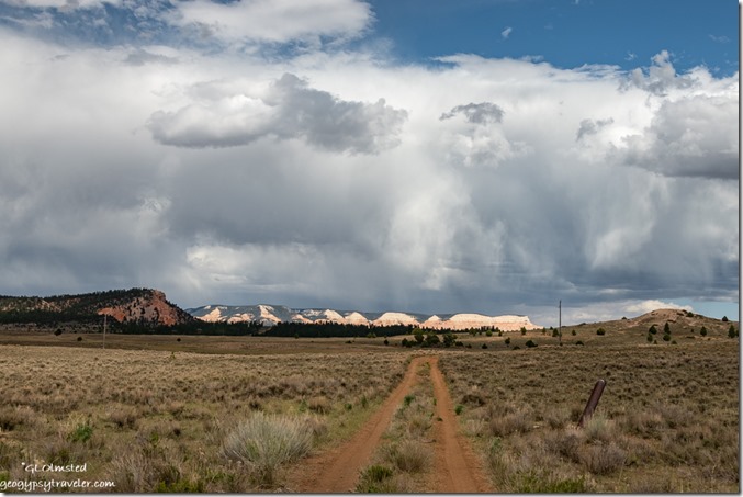
2-track Table Cliffs storm clouds SR22 Utah

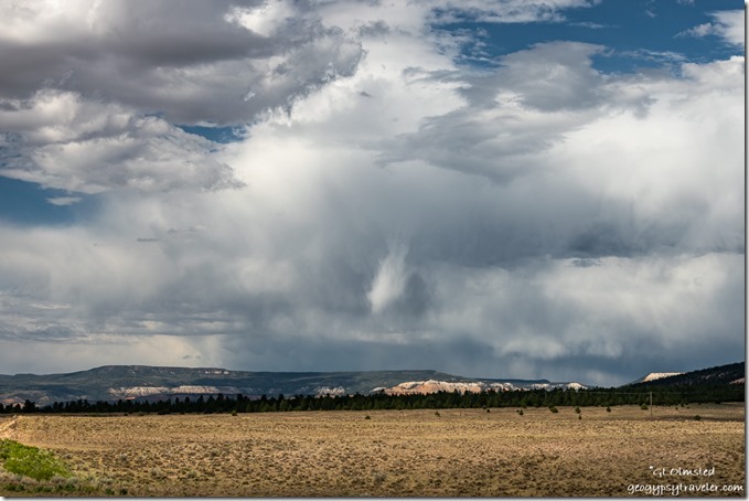
meadow Pink Cliffs storm clouds SR22 UtahBefore heading back into the park I drove a short ways on SR22 north towards Antimony because the stormy clouds above the Table Cliffs called my name.  It had threatened rain all day but none fell.

Sunrise Point storm clouds Bryce Canyon National Park UtahSunrise Point Bryce Canyon NP

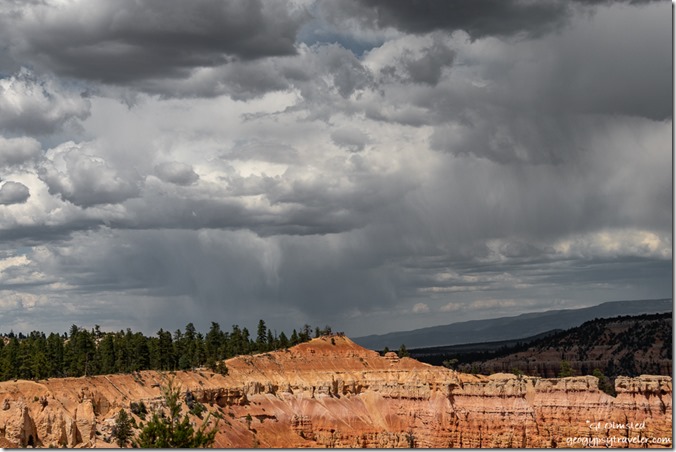
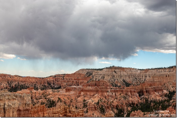
highlighted hoodoos Bryce Canyon National Park UtahStorm clouds continued to hang out for days yet very little rain fell.  However, the wind brutally blew gritty dust enough to cancel the 4pm Rim Walk on Friday when I returned to work.  Also been cloudy enough to make viewing the comet difficult so I still haven’t even seen it.

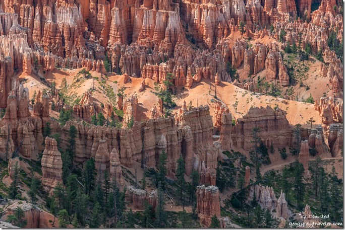
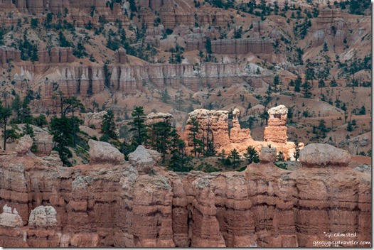
hoodoos amphitheater Bryce Point storm clouds Sunset Point Bryce Canyon National Park Utah50 million year-old limestone lake deposits weathered and eroded beginning about 16-5 million years ago

The next day, a man showed up at my hoodoo geology talk and wanted to argue about the million year-old ages of rock in the Grand Staircase.  I said to him, “I respect your right to believe what you want, but I believe in the science.  These sedimentary rocks are dated by the fossils.  I am not a geologist.”  Rather diffused his need to argue and he went away but returned for another similar talk by another Ranger a few hours later.  Why would someone do that?

hoodoos valley plateau storm clouds Bryce Canyon National Park UtahBoat Mesa, valley, and Aquarius Plateau from Sunset Point

Monday was an early day opening then later a co-worker and I went to Rainbow Point to present Grand Staircase geology talks.  Sadly, after only one talk a huge storm blew in with lightning nearby, 10 miles down to four miles away.  So we packed up our props and spent the next hour telling people to get off the rim so they didn’t get struck by lightning.  One guy, who claimed to make a living on his cell phone photography, would not leave and got obnoxious.  Although I had my camera in the truck I did not pause to risk my life for the amazing sky.

Pink Cliffs trees valley smoke Fatrview Bryce Canyon National Park UtahOn the return drive to the office we stopped at Fairview Point as we’d heard on the radio about a lightning strike below the overlook where smoke could be seen.  Fire folks were going to check it out and I haven’t heard any more.

trees Boat Mesa Sinking Ship Table Cliffs pre-sunset clouds Bryce Canyon National Park UtahRangers get paid in sunsets (phone shot)

We are seeing an increase in visitation, and general stupidity.  With all the available information in this age why are people so ignorant.  All these new RVers who don’t have a clue. People visiting parks with no knowledge about the place or even why they are there.   I know this COVID19 year is difficult, but really folks.  Best thing is to stay home.  I so much want to travel myself, even a long weekend on the North Kaibab would be awesome.  But instead, I’ll stick closer to home.

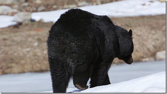
videoblocks-black-bear-walks-away-with-snow-on-butt_spl6gsj31w_thumbnail-full01Yesterday, my Friday, was a late start and ended with my evening program on the wildlife at Bryce.  A visitor asked about how many bears in the park.  Only one documented, so we’re calling it Covid Bear because it’s in isolation and honors social distancing.  (Not my photo)

I’m back to enjoying carrying the new camera around and making photos.  Though I’m still using the small Nikon and phone sometimes.  The best camera to use, is the one you have with you.

Push my buttons!

  • Click to share on Facebook (Opens in new window) Facebook
  • Click to share on X (Opens in new window) X
  • Click to share on LinkedIn (Opens in new window) LinkedIn

Like this:

Like Loading...
new camera, Places I've been, United States, Utah hoodoos, new camera, photography, Pink Cliffs, road trip, stormy sky, travel 19 Comments
← Older posts
Newer posts →

Hi, I’m Gaelyn, the Geogypsy

I retired after 29 summer seasons as a Park Ranger, traveling solo for 40+ years. My passions include travel, connecting to nature, photography, and sharing stories.

I started exploring US National Parks in 1977 and 20 years later became a seasonal Park Ranger.  I’ve lived full-time in a RV for 30 years working summers and playing winters.  I’m still trying to figure out what I want to be when I grow old, other than grow up.

Let’s share our stories.  Here’s more of mine…

My wheeleastate

I am currently…

…boondocking somewhere in southern Arizona.  In the area, give a shout.

Geogypsytraveler on YouTube

Follow my journey on YouTube. Just click the pic. Hope you’ll like, share, and subscribe.

Click image for 7 minute documentary (Password “geogypsy” lowercase)

Making the Gypsy documentary is a story of its own.  Click below for the rest of the story.
Living nomadically & connecting to nature documentary

Subscribe to Blog via Email

Enter your email address to subscribe to this blog and receive notifications of new posts by email.

Photos available for sale include prints, greeting cards, coffee mugs, tote bags, phone cases and more

Reflected Wave 24X16 metal print under $100

Custom Coffee Mugs

Many items to choose from including prints

The Last Blast 24 x 16″ metal print under $100

Need a signal boost? When I boondock on public lands sometimes signal is weak or intermittent and a booster helps. Click the pic to visit WeBoost.

Connecting to nature and the rest of the world too.

Please contact me for photo purchases not seen at GLOlmsted Photography

Order fulfillment is by Fine Art America. If you’re not happy with your purchase, for any reason, simply return it within 30 days, and you’ll receive a full refund of the purchase price.

Why read Geogypsy?

The gypsy life spring-summer 1998 - "You were a real pioneer. RV'ing before it was cool." ...Yogi

How do you process photos? - “Your photographs create an Emotional feeling in the viewer...that they become One with You.” …Cindy

Life’s transitions between travel and work play - "I know you love your job as much as you love travel -- it shines through all your posts." ...Sallie

Lions at Kruger National Park - “Wonderful post, thank you. I was hooked start to finish!” … Peter B

11 lessons looking back 2013 - “A great post -- made me think, made me smile, made me want to cry." ...Sallie

Wildlife video Kruger National Park - “Gorgeous, this makes me want to go straight to South Africa now.” … Ayngelina

Living nomadically & connecting to nature documentary - “What an experience you had and gave to the "crew." Sometimes I think you don't realize how unique and inspiring you are.” …Alan

Search

Popular Posts

1. Prioritize the well-being of nature over photography. 2. Educate yourself about the places you photograph. 3. Reflect on the possible impact of your actions. 4. Use discretion if sharing locations. 5. Know and follow rules and regulations. 6. Always follow Leave No Trace principles and strive to leave places better than you found them. 7. Actively promote and educate others about these principles
Categories

Archives

Sites I follow, read & recommend

  • A Full-time Life
  • A Yankee in Belgrade
  • Bob's Eyes
  • Box Canyon Blog
  • Camels and Chocolate
  • Dawns bloggy blog
  • In the Direction of Our Dreams
  • Jane in her infinite wisdom
  • Janie and Steve, Utah Trails
  • Kathie's Birds
  • Las Adventuras
  • Memorable Meanders
  • Oh, The Places They Go
  • On the Road Abode
  • Port Elizabeth Daily Photo
  • Stillhowlyntravels
  • Take to the Highway
  • Technomadia
  • the good luck Duck
  • Travel with the Bayfield Bunch
  • Wandering Earl
  • Wheeling It
  • Yogi's Den

Caught in a Slot 9×12 canvas print under $50

If you don’t like what’s going on in your government, contact your Congress

Directory of Senators

Directory of Representatives

Lijit

© Copyright 2008-2024. Geogypsytraveler.com
%d