• Home
  • About Geogypsy
    • Herstory
    • Parks where I’ve worked
  • Places I’ve been
    • United States
      • Arizona
        • Antelope Slot Canyon
        • Casa Grande Ruins National Monument
        • Colossal Cave Mountain Park
        • Flagstaff
        • Glen Canyon National Recreation Area
        • Grand Canyon National Park
          • Grand Canyon National Park North Rim
          • Grand Canyon National Park South Rim
          • Toroweap
        • Havasu Canyon
        • Horseshoe Bend
        • Jerome
        • Kaibab National Forest
        • Lee’s Ferry
        • Meteor Crater
        • Navajo Bridge
        • Oak Creek Canyon
        • Painted Desert
        • Pipe Springs National Monument
        • Prescott
        • Quartzsite
        • Saguaro National Park
        • Sedona
        • Sunset Crater Volcano National Monument
        • Vermilion Cliffs
        • Walnut Canyon National Monument
        • Wupatki National Monument
        • Yarnell
      • California
        • Anzaberrego
        • Bakersfield
        • Death Valley National Park
        • Joshua Tree National Park
        • Redwoods NP
        • Salton Sea
        • Yucca Valley
      • Colorado
        • Mesa Verde National Park
      • Florida
      • Illinois
        • IL River
        • Morton Arboretum
        • Starved Rock State Park
      • Michigan
      • Nevada
      • New Mexico
      • Oregon
        • Crater Lake NP
        • Mt Hood
        • Oregon Caves National Monument
      • Texas
        • Alpine Texas
        • Padre Island
        • Port Isabel
        • Rio Grande Valley
      • Utah
        • Brian’s Head
        • Bryce Canyon National Park
        • Buckskin Gulch
        • Cedar Breaks National Monument
        • Cedar City
        • Coral Pink Sand Dunes State Park
        • Dixie National Forest
        • Grand Staircase Escalante National Monument
        • Johnson Canyon
        • Kanab
    • World Travels
      • Germany
      • Mexico
      • South Africa
  • Tours
  • Photography
  • Work with Me
    • Sponsors
  • Contact
Geogypsy
Menu
  • Home
  • About Geogypsy
    • Herstory
    • Parks where I’ve worked
  • Places I’ve been
    • United States
      • Arizona
        • Antelope Slot Canyon
        • Casa Grande Ruins National Monument
        • Colossal Cave Mountain Park
        • Flagstaff
        • Glen Canyon National Recreation Area
        • Grand Canyon National Park
          • Grand Canyon National Park North Rim
          • Grand Canyon National Park South Rim
          • Toroweap
        • Havasu Canyon
        • Horseshoe Bend
        • Jerome
        • Kaibab National Forest
        • Lee’s Ferry
        • Meteor Crater
        • Navajo Bridge
        • Oak Creek Canyon
        • Painted Desert
        • Pipe Springs National Monument
        • Prescott
        • Quartzsite
        • Saguaro National Park
        • Sedona
        • Sunset Crater Volcano National Monument
        • Vermilion Cliffs
        • Walnut Canyon National Monument
        • Wupatki National Monument
        • Yarnell
      • California
        • Anzaberrego
        • Bakersfield
        • Death Valley National Park
        • Joshua Tree National Park
        • Redwoods NP
        • Salton Sea
        • Yucca Valley
      • Colorado
        • Mesa Verde National Park
      • Florida
      • Illinois
        • IL River
        • Morton Arboretum
        • Starved Rock State Park
      • Michigan
      • Nevada
      • New Mexico
      • Oregon
        • Crater Lake NP
        • Mt Hood
        • Oregon Caves National Monument
      • Texas
        • Alpine Texas
        • Padre Island
        • Port Isabel
        • Rio Grande Valley
      • Utah
        • Brian’s Head
        • Bryce Canyon National Park
        • Buckskin Gulch
        • Cedar Breaks National Monument
        • Cedar City
        • Coral Pink Sand Dunes State Park
        • Dixie National Forest
        • Grand Staircase Escalante National Monument
        • Johnson Canyon
        • Kanab
    • World Travels
      • Germany
      • Mexico
      • South Africa
  • Tours
  • Photography
  • Work with Me
    • Sponsors
  • Contact

Tag: hiking

29 May 2013

Hiking Cathedral Wash with friends

Cathedral Wash GRCA NP AZ

Hiking Cathedral Wash with friends and co-workers proved to be a great way to get out of the office.

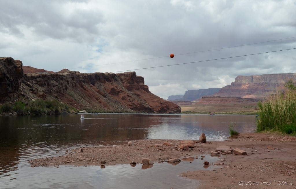
Lee's Ferry boat launch area along Colorado River Marble Canyon AZ

Downstream on the Colorado River from Lee’s Ferry boat launch

We usually hike rim-to-rim, from north to south, across Grand Canyon during training but this year we struck out into the surrounding area for a day.  Always good to know what there is to see outside the park to better help our North Rim visitors.  After touring Lees Ferry and the Lonely Dell Ranch we hit Cathedral Wash, the shortest of the Marble Canyon tributaries to the Colorado River at only 1.25 miles (2 km) one way.

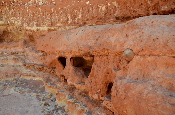
Erosion Kaibab limestone Cathedral Wash GRCA NP AZ

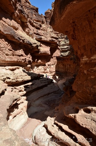
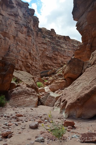
This canyon is a great way to see and get close to erosion in motion.  Of course you don’t want to enter it if there’s any chance of rain within 50 miles because of the possibility of flash flood.  Blue sky overhead doesn’t mean it’s not raining up stream.

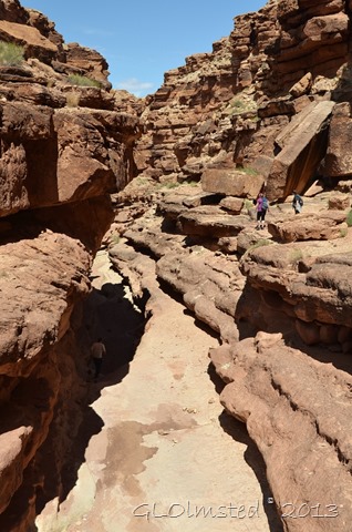
Cathedral Wash GRCA NP AZ

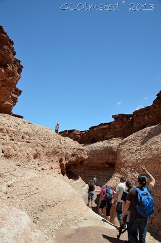
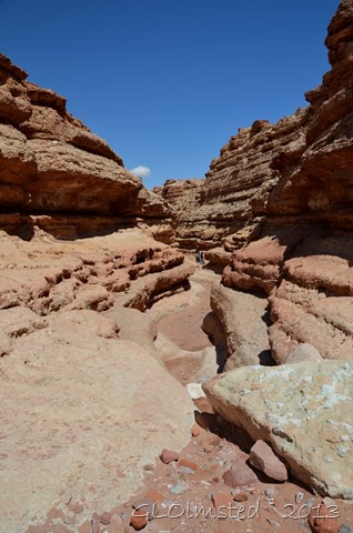
The stair step walls and dry falls created by eons of water and erosion have to be climbed with caution and I’m glad we watched out for and helped each other along the way.  Well at least a hand for me once in a while.  Previous hikers placed rock cairns to mark their preferred route which we didn’t always agree with or follow.

Cathedral Wash GRCA NP AZ

I’d rate this moderately difficult but no ropes were needed over the 200 foot change in elevation.  Still, I don’t recommend doing this solo.

Cathedral Wash GRCA NP AZ

The canyon descends through the Kaibab Limestone and Toroweap Formations of the Grand Canyon Group which are loaded with fossils left from ancient seas.  But honestly, I was watching my step so much I didn’t look for any.  I frequently see the usual brachiopod, sponge and crinoid fossils on the Kaibab Plateau.

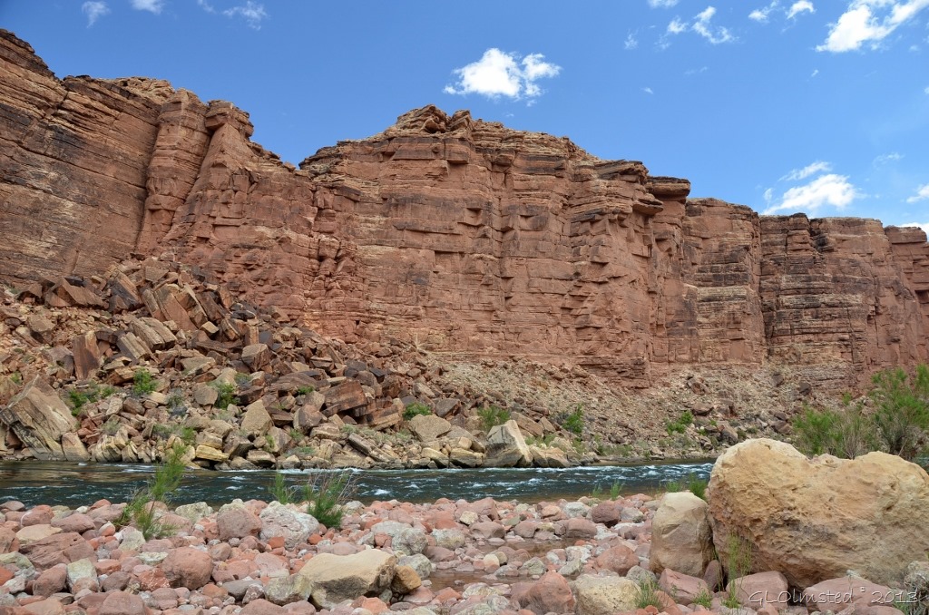
Colorado River at mouth of Cathedral Wash GRCA NP AZ

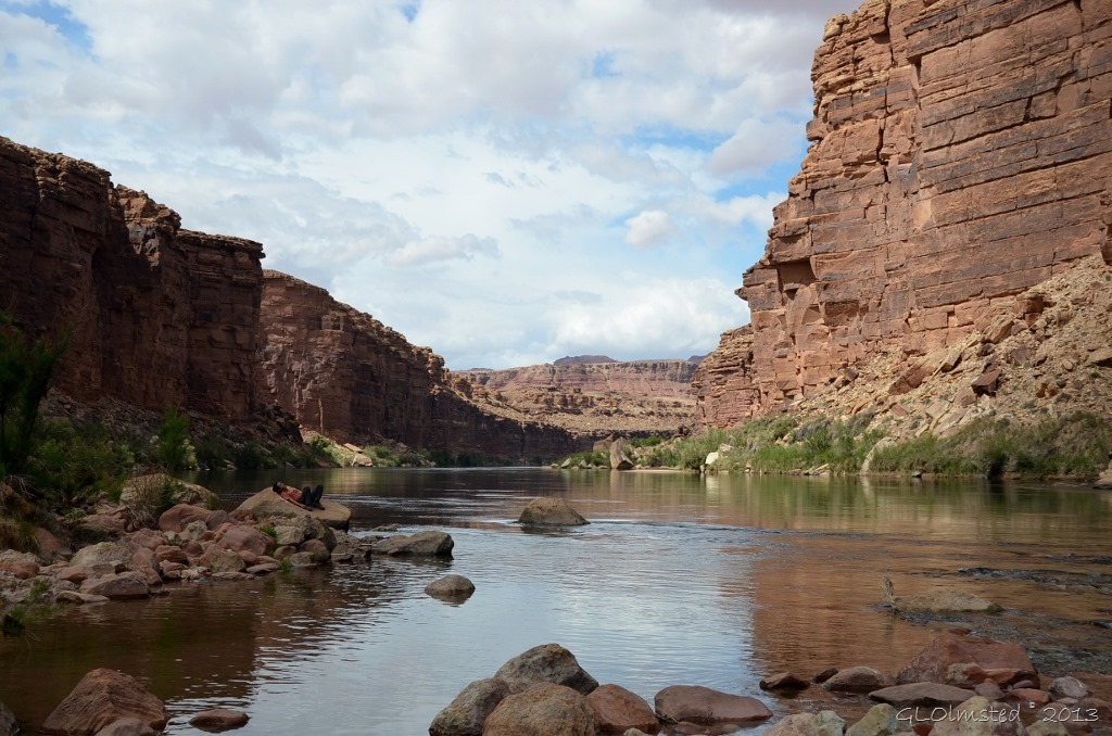
The reward at the end included marvelous views along the Colorado River.

08 Upstream Colorado River from mouth of Cathedral Wash GRCA NP AZ (1024x678)

We hung out for a bit to absorb the grandeur and could have stayed longer except our tummies were growling for lunch instead of just trail snacks.

Cathedral Wash GRCA NP AZ

So before long we headed back up canyon.

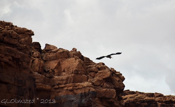
Blue heron Cathedral Wash GRCA NP AZ

My advice

The parking area is not easy to spot.  Might be best to go to the end of the road and explore Lee’s Ferry first then drive back 4 miles (6.4 km) and look for a wide gravel shoulder on the right with an interpretive sign.

Although a short trail with little change in elevation that can be completed in 3 hours round trip, why hurry.  Hike slowly and carefully, take lunch and plenty of water.  During the heat of summer go early to avoid possible 120 degree days.  Watch for rattlesnakes.

No camping is allowed in this area of Grand Canyon National Park.  However a campground is located at Lee’s Ferry and free camping abounds on BLM (Bureau of Land Management) land a little further to the west.  Also no pets are allowed.

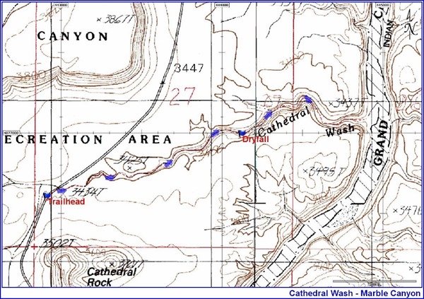
Map Cathedral Wash trail

Please remember, collecting specimens of any kind (fossils, plants, reptiles, flowers, rocks, etc.) is prohibited in a National Park.  Instead collect memories and photos.

This post is part of a blog carnival hosted by More Time to Travel along with a group of travel friends.  I hope you’ll check out more of their group travel stories.  You just might get some travel ideas and find new blogs to follow.

Push my buttons!

  • Facebook
  • Twitter
  • LinkedIn

Like this:

Like Loading...
Arizona, Grand Canyon National Park Arizona, Cathedral Wash trail, Grand Canyon National Park, hiking, Marble Canyon 34 Comments
03 January 2013

Granite Basin Lake Recreation Area

01 Granite Basin Lake & Mt Prescott AZ (1024x392)

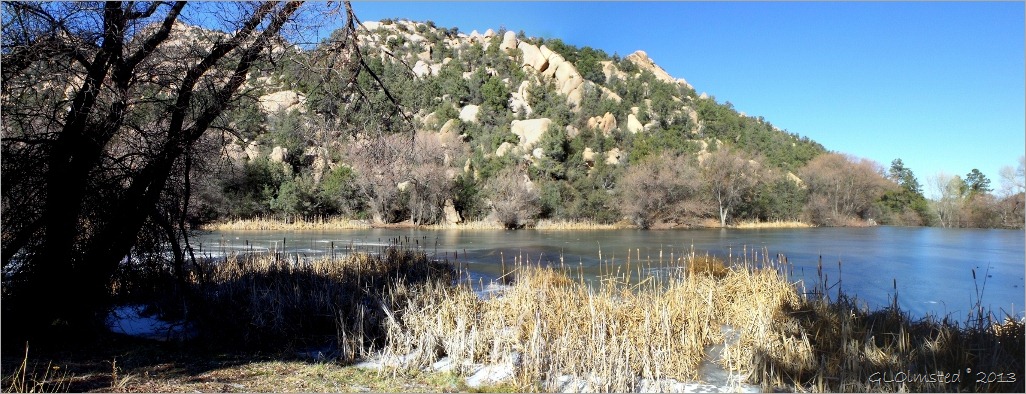
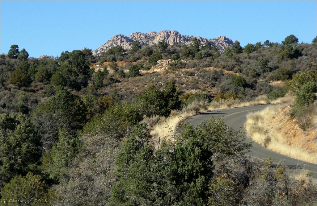
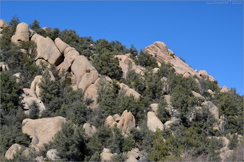
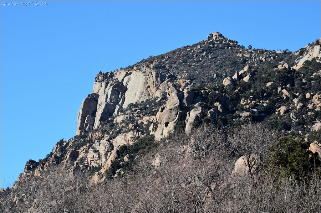
Not all of Arizona is desert.  In fact several lakes are located around Prescott with Granite Basin Lake only 15 minutes away nestled in a Ponderosa Pine forest at the base of Granite Mountain, a towering pile of boulders.  My first visit on a crisp January day didn’t entice me into much recreation yet I braved the cold briefly wearing many layers.

02 Granite Mountain Granite Basin Drive Prescott NF AZ (1024x666)

Just a three-mile drive off Iron Springs Road in the Prescott National Forest Granite Basin Recreation Area offers fishing, non-motorized boating, camping, hiking, horse riding, rock climbing and picnicking.  I pass this turn off all the time on my drive back and forth to Prescott and didn’t even know it was there.

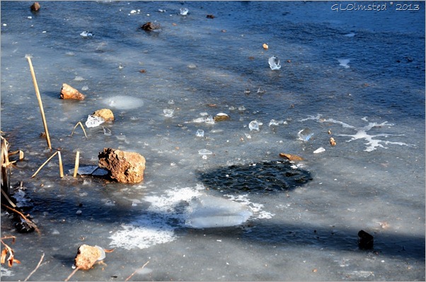
03 Icey Granite Basin Lake Prescott NF AZ (1024x678)

The man-made lake built by the Civilian Conservation Corp was completed in 1939.  It is not stocked but allows fishing with a license.  I don’t fish but the word is that patience may bring anglers bluegill, largemouth bass and catfish.  Of course right now you’d have to bring tools just to break through the ice.

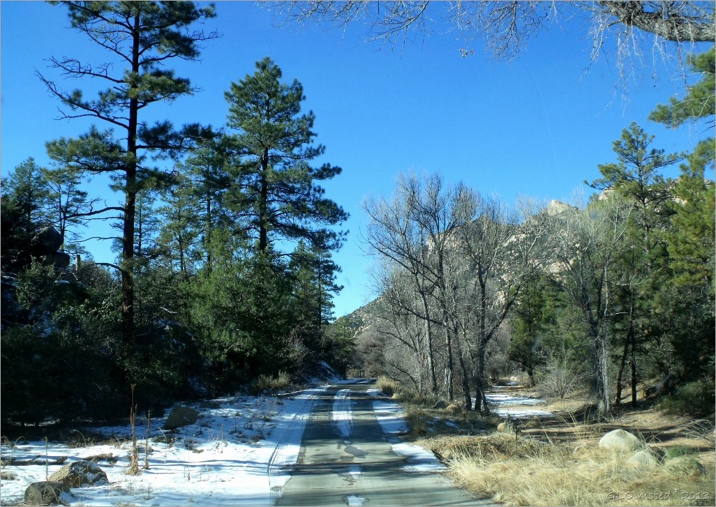
04 Snowy Granite Basin Drive Prescott NF AZ (1024x725)

Yavapai Campground accommodates tents, and trailers up to 40 feet in length at a small fee.  There are no hookups but water and toilets are available.  I didn’t notice anybody camping but then it’s a little chilly in the mountains right now.

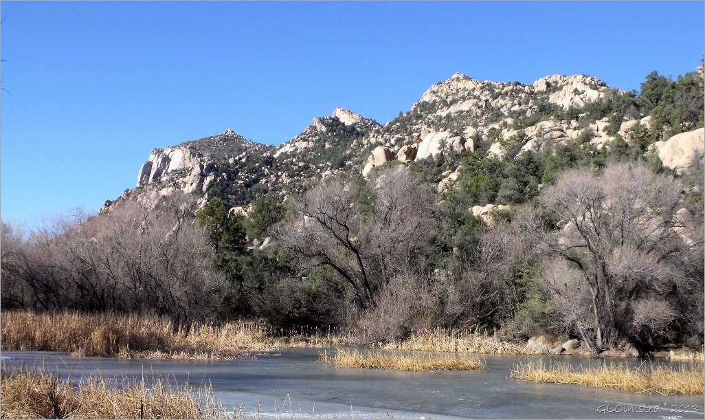
05 Granite Basin Lake & Mt Prescott NF AZ (1024x609)

Come warmer weather I look forward to hiking some of the eight trails of 1.3 to 3.2 miles each way, or connect a few to lengthen the hike.  The trails wind through Ponderosa and Pinyon Pine forest studded with granite boulders along seasonal creeks.  During summer months wildflowers should add color to the landscape.  The Forest Service rates these trails from easy to difficult.  I’ll let you know.

06 Giant boulders on Granite Mt Prescott NF AZ (1024x678)

Mountain biking and hiking are allowed on all the same trails and horses on some of them too.  I’m not too keen on the multi-use trails under heavy traffic, bikes sneak up on you and I don’t like stepping around horse poop.  No offense to anyone who enjoys these modes of transportation, I just like to see separate trails.

07 Cliff face on Granite Mt Prescott NF AZ (1024x678)

For the more adventurous than I, rock climbers tackle the steep cliff faces.  But only from August to February as there’s a seasonal Peregrine Falcon closure from February 1 to July 15.  While researching the recreational opportunities I saw one route described as “the Guillotine Flake, that requires the leader to enter the depths of a large flake/chimney feature and emerge out its top.”  I know I won’t be tackling that.

And even if you’re not into this much exercise Granite Basin Recreation Area offers shade on a summer afternoon for a picnic and it’s not far from town.  Picnic tables are available at Cayuse, Wekuvde, Boat Launch, Playa, and Metate day-use areas.

08 Map of Prescott & Granite Basin Lake area (1024x471)

All recreational use areas on the Prescott National Forest requires a pass.  Day use fee is $5 payable on site.  Or use an Interagency Pass like the annual, senior or access passes.  If you live nearby, like I do, think about purchasing the Prescott National Forest Pass annually for $40 or four months for $20.

Oh, I forgot to mention, if you’re into movies this place may look familiar as a segment of the movie Creepshow 2 was filmed here.  If you watch this you might not want to visit.  Don’t say I didn’t warn you.

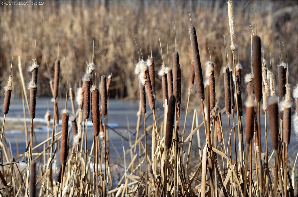
09 Cattails along Granite Basin Lake Prescott NF AZ (1024x678)

After about 30 minutes of wandering along the lake shore taking photos my glove covered hands started to tingle.  That’s my clue to get somewhere warm.  However I’m glad to have finally checked out this local destination and look forward to returning for some future hikes.  Sometimes it’s those places in our own backyards we visit last.

What local destinations offer you an escape into nature?


Capturing the present for future memories of the past.

Push my buttons!

  • Facebook
  • Twitter
  • LinkedIn

Like this:

Like Loading...
Arizona, Prescott Arizona, camping, fishing, Granite Basin Lake, hiking, horseback riding, mountain biking, outdoor recreation, Prescott, rock climbing 29 Comments
02 January 2012

New Year’s Day hike OR Life’s a balancing act

01 Gaelyn climbing fence to Weaver Mts (810x574)

Second year for a New Year’s Day hike might be the beginning of a new tradition. 

I love being able to hike right outside my door.  Well, actually we usually drive the 1.5 miles to park near the gate, then off we go, up into the Weaver Mountains.

02 View W Weaver Mts Yarnell AZ (1024x768)

I know I’ve posted before about hiking in the Weavers, in fact that’s where last year’s first hike was as well.

03 Property for sale sign Weaver Mts Yarnell AZ (1024x768)

I would love to live up here but the properties are just too expensive plus would have to bring in utilities from the access road.  Out of my budget even though I’m kind of looking for a place to call my own.  And, no I don’t have horses.

04 Mike looking for gold Weaver Mts Yarnell AZ (1024x768)

Mike thinks there’s gold and looks at every black sand opportunity.  Hope he finds a big nugget one of these days then could afford to buy the land, and keep golding.

05 Rock gateway Weaver Mts Yarnell AZ (1024x767)

Although there are no houses built up on these many acres obviously someone had a dream.

06 Balacing boulders Weaver Mts Yarnell AZ (1024x768)

It’s a real balancing act….

07 Balancing boulder Weaver Mts Yarnell AZ (1024x719)

I’m talking about life here.

08 Balancing boulder Weaver Mts Yarnell AZ (1024x768)

Maybe I should start off small.

Our World Tuesday meme badge

To tour more of the world go to Our World Tuesday by clicking here.

Push my buttons!

  • Facebook
  • Twitter
  • LinkedIn

Like this:

Like Loading...
Arizona, Our World Tuesday, Weaver Mountains Arizona, hiking, Our World Tuesday meme, Weaver Mountains 21 Comments
← Older posts
Newer posts →

Hi, I’m Gaelyn, the Geogypsy

I retired after 29 summer seasons as a Park Ranger, traveling solo for 40+ years. My passions include travel, connecting to nature, photography, and sharing stories.

I started exploring US National Parks in 1977 and 20 years later became a seasonal Park Ranger.  I’ve lived full-time in a RV for 30 years working summers and playing winters.  I’m still trying to figure out what I want to be when I grow old, other than grow up.

Let’s share our stories.  Here’s more of mine…

My wheeleastate

I am currently…

…boondocking somewhere in southern Arizona.  In the area, give a shout.

Geogypsytraveler on YouTube

Follow my journey on YouTube. Just click the pic. Hope you’ll like, share, and subscribe.

Click image for 7 minute documentary (Password “geogypsy” lowercase)

Making the Gypsy documentary is a story of its own.  Click below for the rest of the story.

Living nomadically & connecting to nature documentary

Subscribe to Blog via Email

Enter your email address to subscribe to this blog and receive notifications of new posts by email.

Photos available for sale include prints, greeting cards, coffee mugs, tote bags, phone cases and more

Reflected Wave 24X16 metal print under $100

Custom Coffee Mugs

Many items to choose from including prints

The Last Blast 24 x 16″ metal print under $100

Need a signal boost? When I boondock on public lands sometimes signal is weak or intermittent and a booster helps. Click the pic to visit WeBoost.

Connecting to nature and the rest of the world too.

Please contact me for photo purchases not seen at GLOlmsted Photography

Order fulfillment is by Fine Art America. If you’re not happy with your purchase, for any reason, simply return it within 30 days, and you’ll receive a full refund of the purchase price.

Why read Geogypsy?

The gypsy life spring-summer 1998 - "You were a real pioneer. RV'ing before it was cool." ...Yogi

How do you process photos? - “Your photographs create an Emotional feeling in the viewer...that they become One with You.” …Cindy

Life’s transitions between travel and work play - "I know you love your job as much as you love travel -- it shines through all your posts." ...Sallie

Lions at Kruger National Park - “Wonderful post, thank you. I was hooked start to finish!” … Peter B

11 lessons looking back 2013 - “A great post -- made me think, made me smile, made me want to cry." ...Sallie

Wildlife video Kruger National Park - “Gorgeous, this makes me want to go straight to South Africa now.” … Ayngelina

Living nomadically & connecting to nature documentary - “What an experience you had and gave to the "crew." Sometimes I think you don't realize how unique and inspiring you are.” …Alan

Search

Popular Posts

1. Prioritize the well-being of nature over photography. 2. Educate yourself about the places you photograph. 3. Reflect on the possible impact of your actions. 4. Use discretion if sharing locations. 5. Know and follow rules and regulations. 6. Always follow Leave No Trace principles and strive to leave places better than you found them. 7. Actively promote and educate others about these principles

Categories

Archives

Sites I follow, read & recommend

  • A Full-time Life
  • A Yankee in Belgrade
  • Bob's Eyes
  • Box Canyon Blog
  • Camels and Chocolate
  • Dawns bloggy blog
  • In the Direction of Our Dreams
  • Jane in her infinite wisdom
  • Janie and Steve, Utah Trails
  • Kathie's Birds
  • Las Adventuras
  • Memorable Meanders
  • Oh, The Places They Go
  • On the Road Abode
  • Port Elizabeth Daily Photo
  • Stillhowlyntravels
  • Take to the Highway
  • Technomadia
  • the good luck Duck
  • Travel with the Bayfield Bunch
  • Wandering Earl
  • Wheeling It
  • Yogi's Den

Caught in a Slot 9×12 canvas print under $50

If you don’t like what’s going on in your government, contact your Congress

Directory of Senators

Directory of Representatives

Lijit

© Copyright 2008-2024. Geogypsytraveler.com
%d