• Home
  • About Geogypsy
    • Herstory
    • Parks where I’ve worked
  • Places I’ve been
    • United States
      • Arizona
        • Antelope Slot Canyon
        • Casa Grande Ruins National Monument
        • Colossal Cave Mountain Park
        • Flagstaff
        • Glen Canyon National Recreation Area
        • Grand Canyon National Park
          • Grand Canyon National Park North Rim
          • Grand Canyon National Park South Rim
          • Toroweap
        • Havasu Canyon
        • Horseshoe Bend
        • Jerome
        • Kaibab National Forest
        • Lee’s Ferry
        • Meteor Crater
        • Navajo Bridge
        • Oak Creek Canyon
        • Painted Desert
        • Pipe Springs National Monument
        • Prescott
        • Quartzsite
        • Saguaro National Park
        • Sedona
        • Sunset Crater Volcano National Monument
        • Vermilion Cliffs
        • Walnut Canyon National Monument
        • Wupatki National Monument
        • Yarnell
      • California
        • Anzaberrego
        • Bakersfield
        • Death Valley National Park
        • Joshua Tree National Park
        • Redwoods NP
        • Salton Sea
        • Yucca Valley
      • Colorado
        • Mesa Verde National Park
      • Florida
      • Illinois
        • IL River
        • Morton Arboretum
        • Starved Rock State Park
      • Michigan
      • Nevada
      • New Mexico
      • Oregon
        • Crater Lake NP
        • Mt Hood
        • Oregon Caves National Monument
      • Texas
        • Alpine Texas
        • Padre Island
        • Port Isabel
        • Rio Grande Valley
      • Utah
        • Brian’s Head
        • Bryce Canyon National Park
        • Buckskin Gulch
        • Cedar Breaks National Monument
        • Cedar City
        • Coral Pink Sand Dunes State Park
        • Dixie National Forest
        • Grand Staircase Escalante National Monument
        • Johnson Canyon
        • Kanab
    • World Travels
      • Germany
      • Mexico
      • South Africa
  • Tours
  • Photography
  • Work with Me
    • Sponsors
  • Contact
Geogypsy
Menu
  • Home
  • About Geogypsy
    • Herstory
    • Parks where I’ve worked
  • Places I’ve been
    • United States
      • Arizona
        • Antelope Slot Canyon
        • Casa Grande Ruins National Monument
        • Colossal Cave Mountain Park
        • Flagstaff
        • Glen Canyon National Recreation Area
        • Grand Canyon National Park
          • Grand Canyon National Park North Rim
          • Grand Canyon National Park South Rim
          • Toroweap
        • Havasu Canyon
        • Horseshoe Bend
        • Jerome
        • Kaibab National Forest
        • Lee’s Ferry
        • Meteor Crater
        • Navajo Bridge
        • Oak Creek Canyon
        • Painted Desert
        • Pipe Springs National Monument
        • Prescott
        • Quartzsite
        • Saguaro National Park
        • Sedona
        • Sunset Crater Volcano National Monument
        • Vermilion Cliffs
        • Walnut Canyon National Monument
        • Wupatki National Monument
        • Yarnell
      • California
        • Anzaberrego
        • Bakersfield
        • Death Valley National Park
        • Joshua Tree National Park
        • Redwoods NP
        • Salton Sea
        • Yucca Valley
      • Colorado
        • Mesa Verde National Park
      • Florida
      • Illinois
        • IL River
        • Morton Arboretum
        • Starved Rock State Park
      • Michigan
      • Nevada
      • New Mexico
      • Oregon
        • Crater Lake NP
        • Mt Hood
        • Oregon Caves National Monument
      • Texas
        • Alpine Texas
        • Padre Island
        • Port Isabel
        • Rio Grande Valley
      • Utah
        • Brian’s Head
        • Bryce Canyon National Park
        • Buckskin Gulch
        • Cedar Breaks National Monument
        • Cedar City
        • Coral Pink Sand Dunes State Park
        • Dixie National Forest
        • Grand Staircase Escalante National Monument
        • Johnson Canyon
        • Kanab
    • World Travels
      • Germany
      • Mexico
      • South Africa
  • Tours
  • Photography
  • Work with Me
    • Sponsors
  • Contact

Tag: Grand Canyon National Park

10 June 2009

Rock Fall at Grand Canyon

Taken from Plateau Point
Rock fall at Grand Canyon happens regularly, whether anybody sees it or not.  Yet in the geologic story about how the canyon formed, erosion is the last chapter and explains why the rims are so much wider than the Colorado River at the bottom.
Middle Permian Paleogeography of North America about 275 million years ago – Ancient Landscapes of the Colorado Plateau by Ron Blakey and Wayne Ranney
Over 1,500 million years about one mile of limestone, sandstone and shale sediments were deposited in northern Arizona by oceans, swamps, deltas, beaches and sand dunes.

Ripple marks on limestone
Possibly another mile of deposits on top of that eroded away yet can be seen at Grand Staircase Escalante National Monument, Bryce and Zion National Parks.

Kaibab Plateau
Then about 65 million years ago the area now known as the Colorado Plateau uplifted 6,000-8,000 feet, almost like a cake rising, and left the deposited layers intact.

Taken from Desert View South Rim
Rocky Mountain snow melt forms the headwaters of the Colorado River which are joined by the Green River from Wyoming, San Juan River from Colorado, Little Colorado River and many tributaries to create a fast flowing river full of sediments and boulders capable of carving through the mile of deposits over the last 5-6 million years.

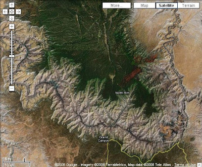
Erosion from the walls of the canyon continues. Because the North Rim is 1,200 feet higher than the South Rim and gets more precipitation, 25 versus 15 inches, water flowing over the rim causes headwater erosion which slowly moves the North Rim further away from the Colorado River.

Fresh rock fall discovered the first week in June
The expansion of freezing water and tree roots also contribute to erosion. Rocks fall regularly but rarely does anyone see it happen. One of my fellow Rangers noticed this fresh rock fall at Grand Canyon one morning from the North Rim Lodge. Damn, we missed it again.

Push my buttons!

  • Click to share on Facebook (Opens in new window) Facebook
  • Click to share on X (Opens in new window) X
  • Click to share on LinkedIn (Opens in new window) LinkedIn

Like this:

Like Loading...
Arizona, Grand Canyon NP erosion, geology, Grand Canyon National Park 9 Comments
13 April 2009

The Gypsy life of a seasonal Park Ranger at Grand Canyon National Park Summer 2008

Ranger Gaelyn North Rim Grand Canyon National Park ArizonaRanger Gaelyn
After hiking rim-to-rim across the Grand Canyon during training as a Park Ranger I could intelligently talk to visitors about the challenge involved. Down is optional, up is mandatory.
California Condor size comparison chart Vermilion Cliffs ArizonaCondor size comparisons posted below Vermillion Cliffs release site
Yet I also had a lot to learn about Grand Canyon National Park in preparation for presenting nine different Ranger programs. I spent the first month working every waking hour; reading, writing, researching, prepping, practicing and learning PowerPoint. All very interesting and well worth it.
Map of Grand Canyon and area ArizonaHowever, I didn’t limit myself to just the Grand Canyon, as there are so many amazing places in the area.
Fire tower Jacob Lake Kaibab National Forest ArizonaJacob Lake fire lookout tower
Jacob Lake Inn lies at the junction of highways 89A, and 67 into the North Rim. There is fuel, cabins, a restaurant with delectable home baked cookies, and a gift shop overflowing with a wide variety of excellently selected Native American arts and crafts.  But don’t expect to swim in Jacob Lake.
Vermlion Cliffs ArizonaVermillion Cliffs
Heading east you drop off the plateau onto House Rock Valley and follow the Vermillion Cliffs to Marble Canyon and Navajo Bridge, one of two Grand Canyon crossings located 277 miles apart.
Navajo Bridge over the Colorado River at Marble Canyon ArizonaNavajo Bridge over the Colorado River at Marble Canyon
There are actually two bridges and a small parking lot on one side with a visitor center. This is a worthwhile stop as you can walk onto the original bridge built in 1929 where you might see a California Condor.
Historic building Lee's Ferry Glen Canyon National Recreation Area ArizonaLee’s Ferry Glen Canyon National Recreation Area
A short side trip upriver takes you to Lee’s Ferry, the original way to cross the Colorado River. This is also where the river rafting trips start. I haven’t gotten to do this, yet. Maybe I need to befriend some river guides. Anybody out there?
Windsor Castle Pipe Springs National Monument ArizonaWindsor Castle at Pipe Spring NM
Heading north from Jacob Lake on Hwy 89A leads to Utah. But a side trip west on Hwy 389 from Fredonia, Arizona leads through the Kaibab (Ki’ bab) Indian Reservation and past Pipe Spring National Monument. Park Rangers lead tours of the main house that Mormons built over the spring in the 1870s. You can also wander around the visitor center, cowboy’s quarters, vegetable garden and often see a blacksmith demonstration.
The Cathedral Zion National Park UtahThe Cathedral at Zion NP
If you continue north on Hwy 89A into Utah past Kanab, Hwy 9 west drives right through Zion National Park. Be prepared to pay the entrance fee or show a Park’s Pass.
The Great White Throne Zion Nationa Park UtaThe Great White Throne at Zion NP
A park shuttle takes you to several amazing places in Zion Canyon where you can hike or just enjoy the views.
Mules on the North Kaibab trail North Rim Grand Canyon National Park ArizonaMules on the North Kaibab trail
One of the last tourist activities I did at Grand Canyon was take a mule ride to Roaring Springs, five miles down from the North Rim. Mules are huge! A cross between a female horse and a male donkey, they are often bigger than a horse. One of the main advantages for mules on this narrow precipitous trail is they can see all four feet at the same time whereas horses only see the two front feet.
Fall aspen Harvey Meadow North Rim Grand Canyon National Park ArizonaGolden fall Aspen Harvey Meadows Grand Canyon
As summer came to an end at the canyon so did my seasonal Park Ranger job. And so it was time to move back to Yarnell.

Push my buttons!

  • Click to share on Facebook (Opens in new window) Facebook
  • Click to share on X (Opens in new window) X
  • Click to share on LinkedIn (Opens in new window) LinkedIn

Like this:

Like Loading...
Arizona, Grand Canyon NP, My gypsy life Grand Canyon National Park, Jacob Lake, Lee's Ferry, Navajo Bridge, Park Ranger, Pipe Springs National Monument, travel, Zion National Park 21 Comments
06 April 2009

Hiking the Grand Canyon 2008 Part 2


After hiking down to the bottom of Grand Canyon to Phantom Ranch, reservations required, I didn’t see the river until I left the bunkhouse at 6am to hike out of the canyon and up to the South Rim.

Bright Angel Bridge
Two foot bridges cross the Colorado River. East of camp .5 mile the Kaibab Suspension Bridge leads to the South Kaibab Trail which climbs just under 5,000 feet along a ridge in about 7 miles to top out on the South Rim near Yaki Point. This route offers no water or shade.

Bright Angel Bridge
The Bright Angel Suspension Bridge carries hikers and the transcanyon water pipe across the Colorado River. Water from Roaring Springs is gravity fed to Indian Gardens then pumped to the South Rim supplying all water needs.

Colorado River
I opted for the slightly longer 9.3 mile Bright Angel Trail with three nicely spaced water sources. Then I didn’t have to carry the added weight of four large bottles full of water.

Devils Corkscrew
After crossing the bridge, the sandy River Trail winds above the Colorado for 1.5 miles before veering away from the river up the Pipe Creek drainage to a series of switchbacks called the Devils Corkscrew.

The trail tops out onto the Tonto Plateau to follow Garden Creek to Indian Garden, about a 1500 foot climb. This is a great stopping point to eat, fill water containers and rest for the final 4.6 mile climb up to the top.

Mules at Indian Garden
If you don’t feel up to hiking the canyon you might consider riding a mule. But no matter how you get there and back, something is going to hurt.

Gaelyn with North Rim on horizon
A side trip from Indian Garden 1.5 miles on the Plateau Point Trail leads to a dramatic view of the canyon and river below. Many day hikers make the 12.2 mile round trip from the South Rim.

Looking up to the South Rim
I didn’t add those extra miles.

Jacobs Ladder
After the first rather gentle half mile, there’s a series of tight switchbacks called Jacobs Ladder that continues a 2860 foot climb.

Three-mile house on upper right green ridge, green patch on the flat is Indian Garden
Three-mile House was a welcome sight to stop, rest, eat and fill water bottles. And it meant only 3 miles to go.

Almost to the top
There’s another rest shelter 1.5 miles further up the trail. From there I was so tired I basically walked 60 steps and stopped, 60 steps and stop. In fact being it was Cinco de Mayo I repeated a mantra, “salty crusty Margarita.”
I was on the trail for 12 hours, granted not hiking the entire time. I stopped a lot to eat, drink, rest and take photos. I certainly wasn’t the first of my fellow rangers to make the rim, but I wasn’t the last either.After a meal, long soak in a bathtub and a good night’s sleep, I could barely walk in the morning. Yet I attended three days of training before returning to the North Rim to prepare for the summer season.

“Though we travel the world over to find the beautiful, we must carry it with us or we find it not.” –Ralph Waldo Emerson


Save

Push my buttons!

  • Click to share on Facebook (Opens in new window) Facebook
  • Click to share on X (Opens in new window) X
  • Click to share on LinkedIn (Opens in new window) LinkedIn

Like this:

Like Loading...
Arizona, Grand Canyon National Park, National Parks and Monuments Arizona, Bright Angel trail, Grand Canyon National Park, hiking 27 Comments
Newer posts →

Hi, I’m Gaelyn, the Geogypsy

I retired after 29 summer seasons as a Park Ranger, traveling solo for 40+ years. My passions include travel, connecting to nature, photography, and sharing stories.

I started exploring US National Parks in 1977 and 20 years later became a seasonal Park Ranger.  I’ve lived full-time in a RV for 30 years working summers and playing winters.  I’m still trying to figure out what I want to be when I grow old, other than grow up.

Let’s share our stories.  Here’s more of mine…

My wheeleastate

I am currently…

…boondocking somewhere in southern Arizona.  In the area, give a shout.

Geogypsytraveler on YouTube

Follow my journey on YouTube. Just click the pic. Hope you’ll like, share, and subscribe.

Click image for 7 minute documentary (Password “geogypsy” lowercase)

Making the Gypsy documentary is a story of its own.  Click below for the rest of the story.

Living nomadically & connecting to nature documentary

Subscribe to Blog via Email

Enter your email address to subscribe to this blog and receive notifications of new posts by email.

Photos available for sale include prints, greeting cards, coffee mugs, tote bags, phone cases and more

Reflected Wave 24X16 metal print under $100

Custom Coffee Mugs

Many items to choose from including prints

The Last Blast 24 x 16″ metal print under $100

Need a signal boost? When I boondock on public lands sometimes signal is weak or intermittent and a booster helps. Click the pic to visit WeBoost.

Connecting to nature and the rest of the world too.

Please contact me for photo purchases not seen at GLOlmsted Photography

Order fulfillment is by Fine Art America. If you’re not happy with your purchase, for any reason, simply return it within 30 days, and you’ll receive a full refund of the purchase price.

Why read Geogypsy?

The gypsy life spring-summer 1998 - "You were a real pioneer. RV'ing before it was cool." ...Yogi

How do you process photos? - “Your photographs create an Emotional feeling in the viewer...that they become One with You.” …Cindy

Life’s transitions between travel and work play - "I know you love your job as much as you love travel -- it shines through all your posts." ...Sallie

Lions at Kruger National Park - “Wonderful post, thank you. I was hooked start to finish!” … Peter B

11 lessons looking back 2013 - “A great post -- made me think, made me smile, made me want to cry." ...Sallie

Wildlife video Kruger National Park - “Gorgeous, this makes me want to go straight to South Africa now.” … Ayngelina

Living nomadically & connecting to nature documentary - “What an experience you had and gave to the "crew." Sometimes I think you don't realize how unique and inspiring you are.” …Alan

Search

Popular Posts

1. Prioritize the well-being of nature over photography. 2. Educate yourself about the places you photograph. 3. Reflect on the possible impact of your actions. 4. Use discretion if sharing locations. 5. Know and follow rules and regulations. 6. Always follow Leave No Trace principles and strive to leave places better than you found them. 7. Actively promote and educate others about these principles

Categories

Archives

Sites I follow, read & recommend

  • A Full-time Life
  • A Yankee in Belgrade
  • Bob's Eyes
  • Box Canyon Blog
  • Camels and Chocolate
  • Dawns bloggy blog
  • In the Direction of Our Dreams
  • Jane in her infinite wisdom
  • Janie and Steve, Utah Trails
  • Kathie's Birds
  • Las Adventuras
  • Memorable Meanders
  • Oh, The Places They Go
  • On the Road Abode
  • Port Elizabeth Daily Photo
  • Stillhowlyntravels
  • Take to the Highway
  • Technomadia
  • the good luck Duck
  • Travel with the Bayfield Bunch
  • Wandering Earl
  • Wheeling It
  • Yogi's Den

Caught in a Slot 9×12 canvas print under $50

If you don’t like what’s going on in your government, contact your Congress

Directory of Senators

Directory of Representatives

Lijit

© Copyright 2008-2024. Geogypsytraveler.com
%d