
.jpg)
Taken from Plateau Point
Rock fall at Grand Canyon happens regularly, whether anybody sees it or not. Yet in the geologic story about how the canyon formed, erosion is the last chapter and explains why the rims are so much wider than the Colorado River at the bottom..jpg)
.jpg)
Middle Permian Paleogeography of North America about 275 million years ago – Ancient Landscapes of the Colorado Plateau by Ron Blakey and Wayne Ranney
Over 1,500 million years about one mile of limestone, sandstone and shale sediments were deposited in northern Arizona by oceans, swamps, deltas, beaches and sand dunes.
.jpg)
Ripple marks on limestone
Possibly another mile of deposits on top of that eroded away yet can be seen at Grand Staircase Escalante National Monument, Bryce and Zion National Parks.
.jpg)
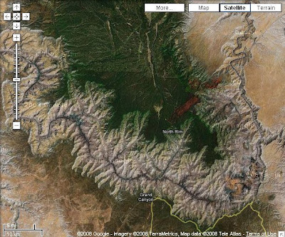
Kaibab Plateau
Then about 65 million years ago the area now known as the Colorado Plateau uplifted 6,000-8,000 feet, almost like a cake rising, and left the deposited layers intact.
.jpg)
Taken from Desert View South Rim
Rocky Mountain snow melt forms the headwaters of the Colorado River which are joined by the Green River from Wyoming, San Juan River from Colorado, Little Colorado River and many tributaries to create a fast flowing river full of sediments and boulders capable of carving through the mile of deposits over the last 5-6 million years.
Erosion from the walls of the canyon continues. Because the North Rim is 1,200 feet higher than the South Rim and gets more precipitation, 25 versus 15 inches, water flowing over the rim causes headwater erosion which slowly moves the North Rim further away from the Colorado River.
.jpg)
Fresh rock fall discovered the first week in June
The expansion of freezing water and tree roots also contribute to erosion. Rocks fall regularly but rarely does anyone see it happen. One of my fellow Rangers noticed this fresh rock fall at Grand Canyon one morning from the North Rim Lodge. Damn, we missed it again.
Over 1,500 million years about one mile of limestone, sandstone and shale sediments were deposited in northern Arizona by oceans, swamps, deltas, beaches and sand dunes.
.jpg)
Ripple marks on limestone
Possibly another mile of deposits on top of that eroded away yet can be seen at Grand Staircase Escalante National Monument, Bryce and Zion National Parks.
.jpg)
Kaibab Plateau
Then about 65 million years ago the area now known as the Colorado Plateau uplifted 6,000-8,000 feet, almost like a cake rising, and left the deposited layers intact.
.jpg)
Taken from Desert View South Rim
Rocky Mountain snow melt forms the headwaters of the Colorado River which are joined by the Green River from Wyoming, San Juan River from Colorado, Little Colorado River and many tributaries to create a fast flowing river full of sediments and boulders capable of carving through the mile of deposits over the last 5-6 million years.

Erosion from the walls of the canyon continues. Because the North Rim is 1,200 feet higher than the South Rim and gets more precipitation, 25 versus 15 inches, water flowing over the rim causes headwater erosion which slowly moves the North Rim further away from the Colorado River.
.jpg)
Fresh rock fall discovered the first week in June
The expansion of freezing water and tree roots also contribute to erosion. Rocks fall regularly but rarely does anyone see it happen. One of my fellow Rangers noticed this fresh rock fall at Grand Canyon one morning from the North Rim Lodge. Damn, we missed it again.
+(800x473).jpg "SR89 W Grand Staircase Escalante NM UT")
+(800x431).jpg "SR89 W Grand Staircase Escalante NM UT") Created in 1996 by departing President Bill Clinton and managed by the Bureau of Land Management this Grand Staircase represents 135 million years of Earth history.
Created in 1996 by departing President Bill Clinton and managed by the Bureau of Land Management this Grand Staircase represents 135 million years of Earth history. +(800x494).jpg "SR89 W Grand Staircase Escalante NM UT") The diverse geology includes many exposed sedimentary layers on top of the Page sandstone seen near Glen Canyon Dam. Tidal mud, windblown sand, lakes, streams and rivers followed by more sand until 94 million years ago when covered by a shallow sea.
The diverse geology includes many exposed sedimentary layers on top of the Page sandstone seen near Glen Canyon Dam. Tidal mud, windblown sand, lakes, streams and rivers followed by more sand until 94 million years ago when covered by a shallow sea. +(800x424).jpg)
.jpg)
.jpg)
.jpg "Old bridge over the LCR Cameron AZ")
.jpg "SR 89 N Painted Desert AZ")

.jpg "SR 89 N Painted Desert AZ")
.jpg "Painted Desert AZ")
.jpg "SR89 N Painted Desert AZ")

.jpg "Painted Desert AZ")
.jpg "Painted Desert AZ")
.jpg "SR89 N Painted Desert AZ")
.jpg "Native American vendors along SR89 Painted Desert AZ")
.jpg "Vermilion and Echo Cliffs SR89 N AZ")