• Home
  • About Geogypsy
    • Herstory
    • Parks where I’ve worked
  • Places I’ve been
    • United States
      • Arizona
        • Antelope Slot Canyon
        • Casa Grande Ruins National Monument
        • Colossal Cave Mountain Park
        • Flagstaff
        • Glen Canyon National Recreation Area
        • Grand Canyon National Park
          • Grand Canyon National Park North Rim
          • Grand Canyon National Park South Rim
          • Toroweap
        • Havasu Canyon
        • Horseshoe Bend
        • Jerome
        • Kaibab National Forest
        • Lee’s Ferry
        • Meteor Crater
        • Navajo Bridge
        • Oak Creek Canyon
        • Painted Desert
        • Pipe Springs National Monument
        • Prescott
        • Quartzsite
        • Saguaro National Park
        • Sedona
        • Sunset Crater Volcano National Monument
        • Vermilion Cliffs
        • Walnut Canyon National Monument
        • Wupatki National Monument
        • Yarnell
      • California
        • Anzaberrego
        • Bakersfield
        • Death Valley National Park
        • Joshua Tree National Park
        • Redwoods NP
        • Salton Sea
        • Yucca Valley
      • Colorado
        • Mesa Verde National Park
      • Florida
      • Illinois
        • IL River
        • Morton Arboretum
        • Starved Rock State Park
      • Michigan
      • Nevada
      • New Mexico
      • Oregon
        • Crater Lake NP
        • Mt Hood
        • Oregon Caves National Monument
      • Texas
        • Alpine Texas
        • Padre Island
        • Port Isabel
        • Rio Grande Valley
      • Utah
        • Brian’s Head
        • Bryce Canyon National Park
        • Buckskin Gulch
        • Cedar Breaks National Monument
        • Cedar City
        • Coral Pink Sand Dunes State Park
        • Dixie National Forest
        • Grand Staircase Escalante National Monument
        • Johnson Canyon
        • Kanab
    • World Travels
      • Germany
      • Mexico
      • South Africa
  • Tours
  • Photography
  • Work with Me
    • Sponsors
  • Contact
Geogypsy
Menu
  • Home
  • About Geogypsy
    • Herstory
    • Parks where I’ve worked
  • Places I’ve been
    • United States
      • Arizona
        • Antelope Slot Canyon
        • Casa Grande Ruins National Monument
        • Colossal Cave Mountain Park
        • Flagstaff
        • Glen Canyon National Recreation Area
        • Grand Canyon National Park
          • Grand Canyon National Park North Rim
          • Grand Canyon National Park South Rim
          • Toroweap
        • Havasu Canyon
        • Horseshoe Bend
        • Jerome
        • Kaibab National Forest
        • Lee’s Ferry
        • Meteor Crater
        • Navajo Bridge
        • Oak Creek Canyon
        • Painted Desert
        • Pipe Springs National Monument
        • Prescott
        • Quartzsite
        • Saguaro National Park
        • Sedona
        • Sunset Crater Volcano National Monument
        • Vermilion Cliffs
        • Walnut Canyon National Monument
        • Wupatki National Monument
        • Yarnell
      • California
        • Anzaberrego
        • Bakersfield
        • Death Valley National Park
        • Joshua Tree National Park
        • Redwoods NP
        • Salton Sea
        • Yucca Valley
      • Colorado
        • Mesa Verde National Park
      • Florida
      • Illinois
        • IL River
        • Morton Arboretum
        • Starved Rock State Park
      • Michigan
      • Nevada
      • New Mexico
      • Oregon
        • Crater Lake NP
        • Mt Hood
        • Oregon Caves National Monument
      • Texas
        • Alpine Texas
        • Padre Island
        • Port Isabel
        • Rio Grande Valley
      • Utah
        • Brian’s Head
        • Bryce Canyon National Park
        • Buckskin Gulch
        • Cedar Breaks National Monument
        • Cedar City
        • Coral Pink Sand Dunes State Park
        • Dixie National Forest
        • Grand Staircase Escalante National Monument
        • Johnson Canyon
        • Kanab
    • World Travels
      • Germany
      • Mexico
      • South Africa
  • Tours
  • Photography
  • Work with Me
    • Sponsors
  • Contact

Tag: camping

08 March 2017

Colorful hiking at Valley of Fire State Park

March 1-4, 2017 Valley of Fire
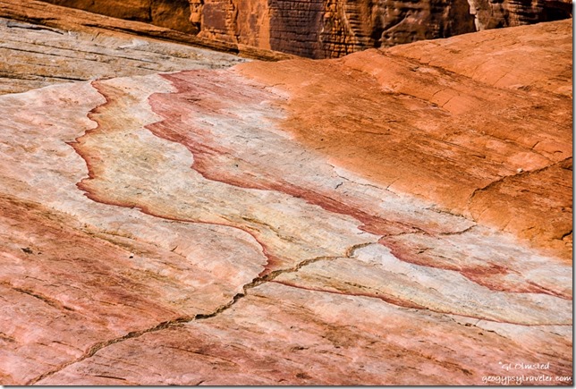
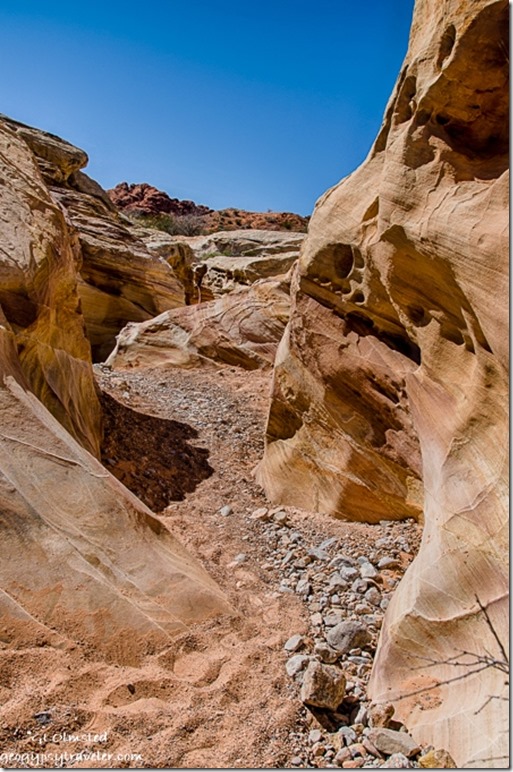
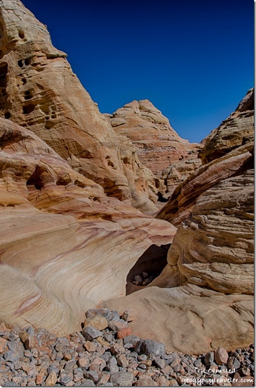
Colorful sandstone White Domes trail Valley of Fire State Park NevadaLike a watercolor left in the rain, the rocks make for colorful hiking at Valley of Fire State Park in Nevada.
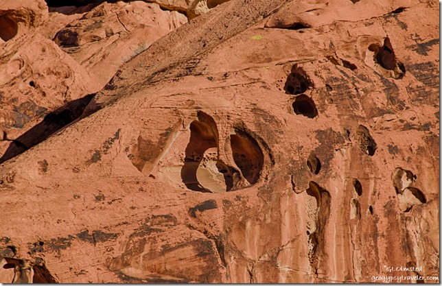
Carved sandstone Arch Rock campground Valley of Fire State Park NevadaSure am glad Sandee arrived early enough to get a campsite as I didn’t pull in until just after sunset and both campgrounds were full, every night we were there.  She tried to save three sites in Arch Rock campground for some friends but a Ranger came by and told her that was illegal.  So we both parked in the one site she’d paid for, my camper and her minivan.  As soon as the sun went down the temperatures followed and we got in the camper where I could make heat and dinner.  Experienced a very cold night, below 40°F so was glad for the extra wool blanket.

Thursday morning we were off early, for me, because of the gained hour in Pacific time.  Went to the visitor center first to get a map and ask if they would let me pay for campsites with credit card, no problem. Check out time 2:30pm also meant no rush.
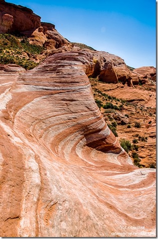
Fire Wave trail Valley of Fire State Park Nevada

Flowers Valley of Fire State Park Nevada

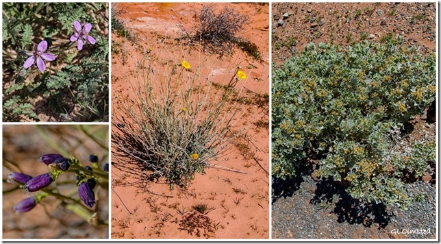
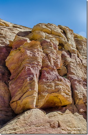
Fire Wave Valley of Fire State Park NevadaOff we went hiking to the Fire Wave and although it is a beautiful feature we spent way more time on our lollygag walk than at the actual Fire Wave.  Some plants are starting to bloom, Mormon tea, brittlebush, and several I don’t know.  Plus so much awesome rock, shades of red sandstone, limestone, green-gray shale, and conglomerates often with a coating of desert varnish.  Sandee says she enjoys our walks because she learns so much about the geology.  The 1.2 mile hike turned into about 3 miles as we wandered about 2-3 hours.


Big horned sheep Valley of Fire State Park Nevada

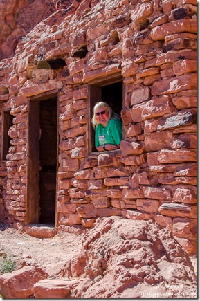
The Cabins Valley of Fire State Park Nevada

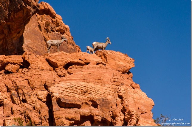
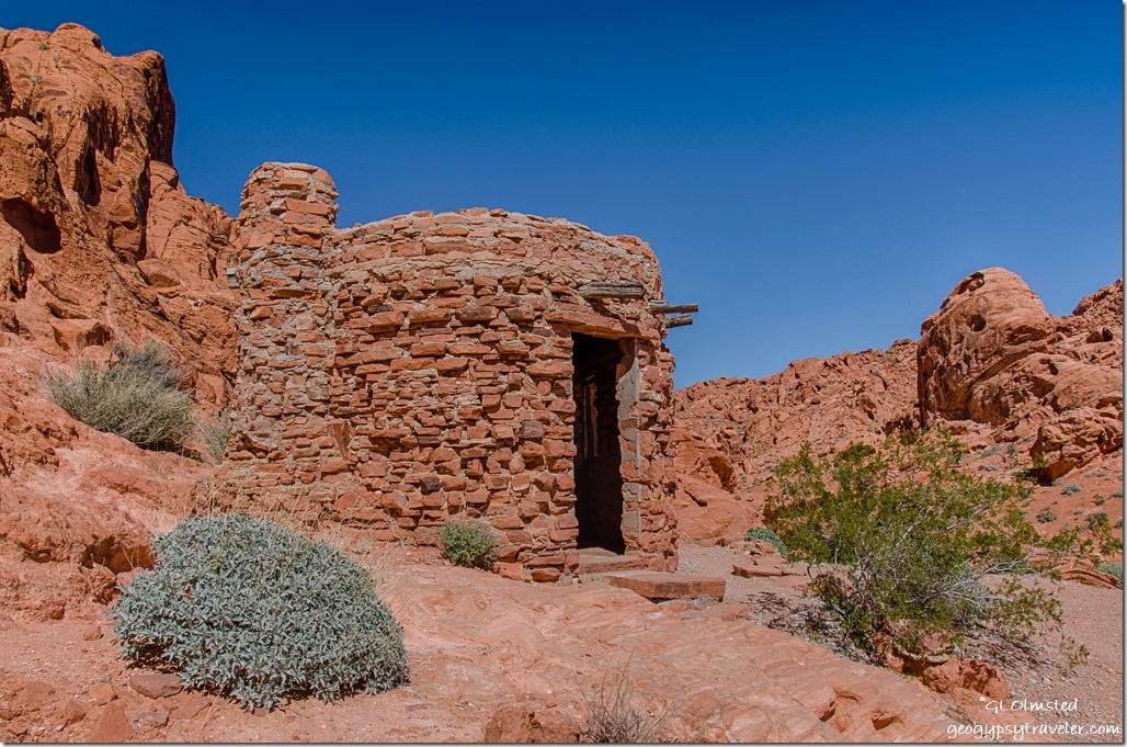
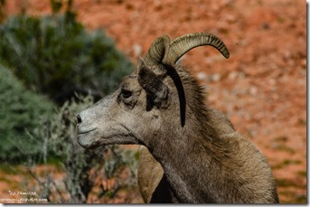
Sandee The Cabins Valley of Fire State Park NevadaSure sign of something good to see when several vehicles are parked both on and off the road.  Sure enough, we saw big horned sheep high up on the rocks just above the road on the way to see The Cabins.


Big horned sheep Valley of Fire State Park NevadaBig horned sheep Valley of Fire State Park Nevada

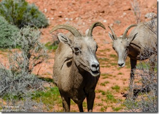
Then saw them much closer to the road on the way back to camp in the same area.

A fenced off chunk of petrified log.  Poor Sandee was not feeling well, coming down with a cold.  So after we had lunch back at camp, and said hello to Nina, we drove the 25 miles to Overton for some cold medications.
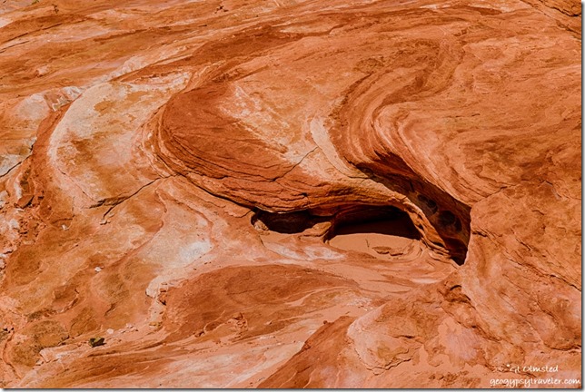
Fire Wave trail Valley of Fire State Park NevadaI’m bummed about the less than tack sharpness of most of the photos, and of course only sharing what I consider “the best” yet out of 130 photos the first day only 23 where rated with one star out of five.  So many seem totally out of focus.  That’s only about 6% success.  Is it me or the camera?  Valley of Fire sure would be a great place to take a photography workshop if I could afford it.
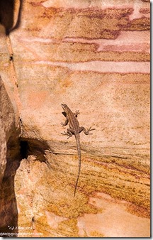
Lizard colorful sandstone Prospect trail Valley of Fire State Park NevadaFriday morning Sandee and I went looking for Arch Rock just down the road from camp.  We wandered into an alcove of rocks squinting into the morning sun searching for the arch with no luck.  Finally gave up and discovered it’s actually right along the road even though the park’s map clearly shows a trail.  And I didn’t even take a photo of it.


Petroglyphs by Atalatal Rock Valley of Fire State Park Nevada

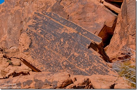
Then we went around the corner, of a huge rock formation, and wandered next to the cliff face finding many petroglyphs pecked into the varnish up to 2300 years ago.  I wandered a little farther than Sandee who still not feeling well returned to sit on a picnic table in the shade.  When she walked away she left her phone behind which she quickly discovered when we returned to camp.  Definitely a moment of panic as she was leaving the park to return to Mesa.  She drove back to the table, then to the visitor center.  When I got into the camper I saw she’d left her boots behind.  So I hurried to the visitor center hoping to catch her there.  Sure enough, someone had picked up her phone and given it to a Ranger who was bringing it to the visitor center.  So off she went with all her stuff, but still not feeling up to snuff.
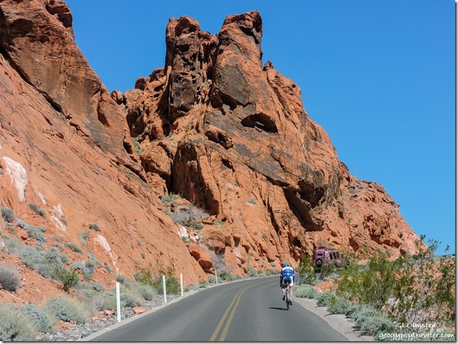
Bicycle Pink Jeep White Domes Road Valley of Fire State Park NevadaFrom there I drove to the end of the White Domes scenic road, delightfully narrow, twisty, and rolling through mounds, and past walls of sun warm colors, burnt oranges, dusty whites, soft pastel yellows, pinks, and lavenders.  I love twisty roads until I come around a blind curve and discover a staunchly peddling bicyclist.  No shoulder.  No way to pass.  No offense to those who bike but it seems especially dangerous on this type of road.

Colorful sandstone White Domes trail Valley of Fire State Park NevadaSlot canyon White Domes trail Valley of Fire State Park Nevada

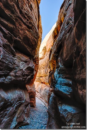
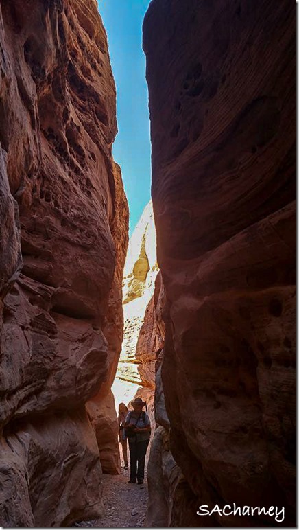
I started the White Dome loop trail counterclockwise, backwards of most hikers, to avoid slugging through the deep soft sand then only went a little ways to the Prospect trail.  Opposite that trail junction a short slot canyon offered a cool reprieve from the mid-day sun where I chatted with a photographer carrying a tripod and two cameras.  Roman is from the east coast but comes west often and we knew some of the same photographers.  I noticed someone had scratched a tic-tac-toe on the graceful canyon walls and took a hand-sized piece of sandstone to wipe it off.  I will never understand this mentality of desecrating the beauty one comes to see.
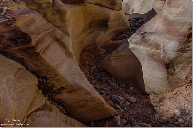
Colorful sandstone Prospect trail Valley of Fire State Park Nevada

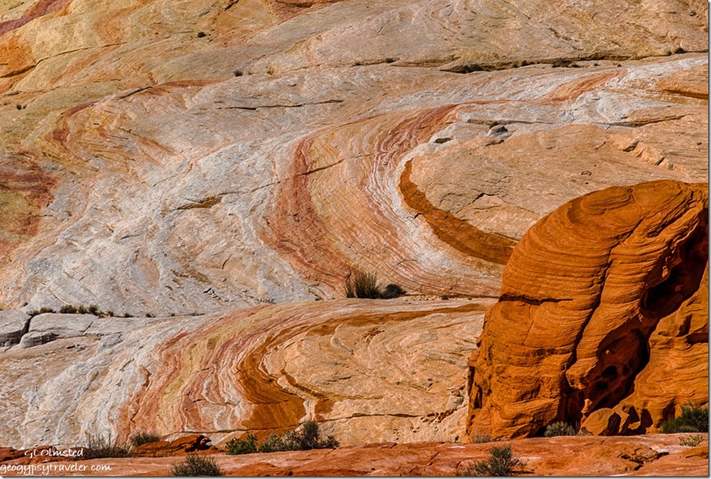
Colorful sandstone Prospect trail Valley of Fire State Park NevadaThen I wandered into the sinuous curves of the less traveled Prospect trail captivated by the swirling layers of colors.
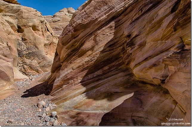
Colorful sandstone Prospect trail Valley of Fire State Park Nevada

Colorful sandstone Prospect trail Valley of Fire State Park NevadaI didn’t make it far or fast and after about an hour Nina’s group of hikers showed up and I walked back out with them.
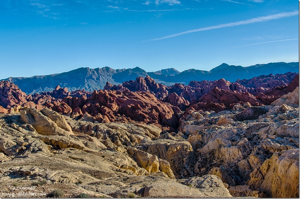
Fire Canyon Valley of Fire State Park NevadaNext I drove out the Fire Canyon Road and at the end discovered a signal so tried to catch up a little online.

Gaelyn & Nina slot canyon Valley of Fire State Park Nevada by Sacha Ann CharneyGaelyn & Nina

Then back to camp before sunset when the road is closed and Nina invited me over for taco dinner along with her friend Sacha who had worked with her at Yellowstone for a couple of seasons and is now at the South Rim Grand Canyon.  It’s a small National Park Service world.

Saturday was my last day in the park and not an early start.  I helped Nina with her first RV, a vintage 1972 trailer.  I showed her how to light the fridge and the oven pilot.  We chatted and soon it was after noon and I had decided not to pay for another night but instead head to Quartzsite for a solar repair.  That’s another story.  But instead I discovered a desperate need for propane so drove the 20 miles north to Overton where I couldn’t get propane then another 25 miles, north mind you, to Glendale.  On the way back south of Overton the winds increased from the southeast so I stopped at Snowbird Mesa to boondock for the night.  Thought I’d be blown further north with 30 mph gusts rocking the rig all night.

Camping in Valley of Fire – get there early as campgrounds fill quickly

Half the 44 camp sites in Atalatal Rock campground have water and electric the other half are semi-primitive.  This campground offers showers and modern restrooms.  Arch Rock campground offers 29 more primitive campsites and pit toilets.  Most of the sites are just big enough for two standard sized vehicles yet I saw some up to probably 35 foot RVs crammed in even there.  No cell signal at all in camp however a weak signal worked at the visitor center and better popped up while driving around.
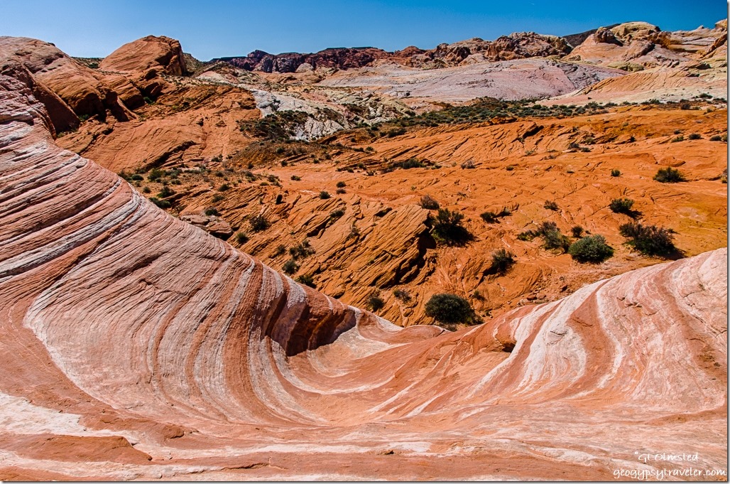
Fire Wave Valley of Fire State Park NevadaHiking in Valley of Fire – the easy trails

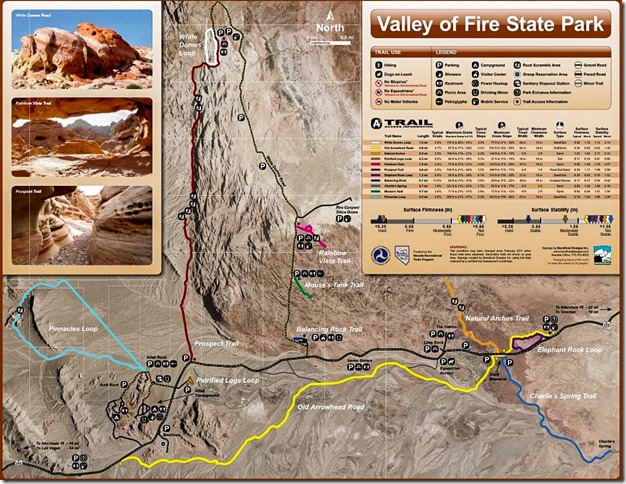
The petroglyphs at Atalatal Rock are almost within sight of the parking lot.  Several short easy trails lead through spectacular contoured sandstone canyons.  Mouse’s Tank .75 mile round trip trail passes canyon walls covered with petroglyphs.  Elephant Rock trail’s 1.2 mile loop speaks for itself.  White Domes 1.25 mile loop includes sand dunes and slot canyons.  The .6 mile trail to Fire Wave passes shale and conglomerates on the way to the sandstone swirls.

Valley of Fire State Park trail map

There is a $10 entrance fee for day use which is included in camp fees.  I highly recommend downloading the map from Valley of Fire’s website as the one handed out isn’t very good.

 

Save

Push my buttons!

  • Facebook
  • Twitter
  • LinkedIn

Like this:

Like Loading...
National Parks and Monuments, Nevada, Valley of Fire State Park arches, camping, flowers, hiking, sandstone 14 Comments
06 February 2017

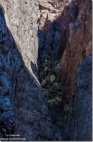
Palm Canyon trail Kofa NWR Arizona

Sunset Kofa National Wildlife Refuge ArizonaThe contrasts are striking between desert, palms, and canyon walls along the Palm Canyon trail.  Located in the Kofa Mountains named because the King of Arizona gold mine stamping its property “K of A” in the late 1800s.  The idea of protecting this Sonoran Desert landscape began during the 1960s when conservationist Major Frederick R. Burnham observed that populations of bighorn sheep were sharply declining and appealed to the Boy Scouts to take up the cause.  For two years, more than 10,000 boy Scouts and their leaders campaigned to protect bighorn sheep and finally in 1976 the 665,400 acre Kofa National Wildlife Refuge was established to be managed by the US Fish & Wildlife Service.

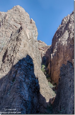
Looking up Palm Canyon trail Kofa National Wildlife Refuge ArizonaPalm Canyon

A half-mile National Recreation Trail leads into Palm Canyon so all four of us camping together on the Kofa climbed into Sharon’s jeep and drove the two miles to the end of the road to start our hike.  Turns out either of the truck campers could have made the drive on this well graded road, but we weren’t sure until we got there.  I’m sure there are times when after heavy rain the road would be rutted and rough.

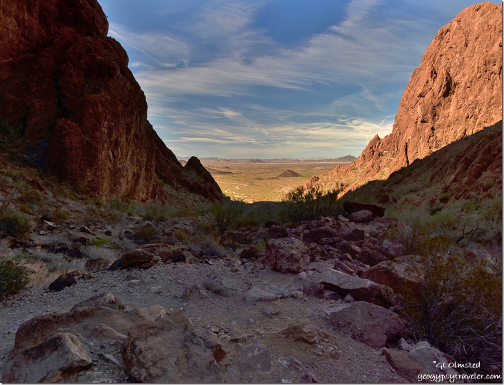
View West Dome Rock Mountains from mouth of Palm Canyon trail Kofa National Wildlife Refuge ArizonaView west from Palm Canyon trail

At 11am it was still chilly enough, especially in the shaded canyon, to wear a couple layers.  But we weren’t far along before the jacket went around the waist.  The website suggests to allow an hour round trip but us lollygag hikers took over an hour just to get one way.  There was just so much to see.  Plus the sometimes steep and rocky trail required us to watch our feet while walking so we stopped often to look around.

Palm Canyon trail Kofa National Wildlife Refuge ArizonaGeology

Millions of years ago the Southwestern United States resembled a broad plain with scattered marshes and streams studded with mountain ranges and erupting volcanoes that covered the marshes with 100s of feet of ash, rocks, cinders, and lava.  Then about 25,000,000 years ago, after a long quiet period, earthquakes and eruptions occurred cracking, splitting, tilting, and lifting the previous formed rock and created today’s Kofa mountains.  Water flowing through cracks in the volcanic rhyolite formed canyons through erosion.

Plants

The current desert ecosystem is characterized by hot summers, mild winters and low annual rainfall of 4-8 inches.  Yet even in this harsh environment plants have adapted.  Looking with binoculars up tiny side canyons to the north, opposite the wash we followed, rewarded us with an amazing variety of plants.

Cactus Palm Canyon trail Kofa National Wildlife Refuge ArizonaMost obvious are the tall and stately saguaros, yet these seem not terrible old and all of about the same age as is common with the species.  Closer to the ground, prickly pear, cholla, hedgehog, pincushion and barrel cacti thrive.  All wonderful to see but we were really excited about seeing the California fan palm, the only native species of palm tree in Arizona, and only 100 trees remain.

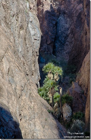
These could be relics of the ice age when the range of California fan palms was much larger than its isolated groves today gradually spreading into these canyons and other protected niches as the climate warmed to desert conditions.  California fan palms typically live for 80 to 90 years.  A fire burned through the grove in 1953, seriously damaging the trees.  Fortunately, most of the palms survived and young trees have become established.  The survival of these trees is directly dependent on the microclimate in this protected canyon.  The palm trees are only able to live in the narrow side canyons where direct sunshine is limited and moisture is available.

Nolina against sky Palm Canyon trail Kofa National Wildlife Refuge ArizonaAs we strained even with binoculars to find the palms we were often fooled by a palm-like plant growing out of cracks and on ledges but the nolinas are much smaller than palms and do not develop a trunk.

Palo Verde along Palm Canyon trail Kofa National Wildlife Refuge ArizonaI love the twisted and contorted shape of the palo verde.  Its almost neon green branches and twigs have enough chlorophyll to produce all the energy the tree requires and during drought often has no leaves.

California fan palms side canyon Palm Canyon trail Kofa National Wildlife Refuge ArizonaCalifornia fan palms side canyon Palm Canyon trail Kofa National Wildlife Refuge Arizona

As the sun rose higher interesting shadow shapes moved rapidly across the north canyon walls.

California fan palms side canyon Palm Canyon trail Kofa National Wildlife Refuge ArizonaCalifornia fan palms side canyon Palm Canyon trail Kofa National Wildlife Refuge Arizona

And the timing was perfect to see sunshine creep into a side canyon and light up the oasis of palms.

Didn’t see the endemic Kofa Mountain Barberry with its holly like leaves which may have been because I was looking for a low growing plant and this is a small bush.  Also don’t think I saw any Ironwood unless it was the thorny trees I called mesquite.

Animals

We also didn’t see the famed desert bighorn sheep.  The only animals we saw were a few birds and lizards flitting about way too fast to positively identify.  Maybe some peak-headed phainopeplas, some kind of hawks soaring in the far distance, turkey vultures, and mostly crows/ravens which seem to survive anywhere.  Saw the scat evidence of coyote and fox.

View West Palm Canyon trail Kofa National Wildlife Refuge ArizonaMany animals survive in the desert because they are mostly nocturnal.  But then after the sun went down and the temperature dropped we weren’t particularly nocturnal ourselves.  Quite frankly there are a few species I wouldn’t want to trip over, especially after dark, like the Gila Monster or Western Diamondback.

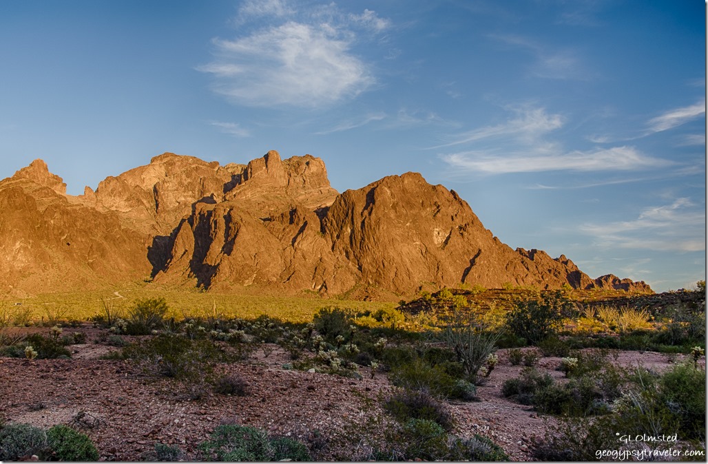
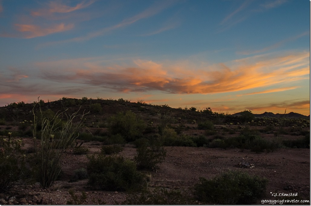
Late light Kofa Mountains Kofa National Wildlife Refuge ArizonaYet no worries while the sun was up about being cold and by the time we returned to camp it was a delightful 73°F.  But that quickly changed just as we finished dinner enjoying the setting sun light up the Kofa Mountains and the desert.

Sunset Kofa National Wildlife Refuge Arizona

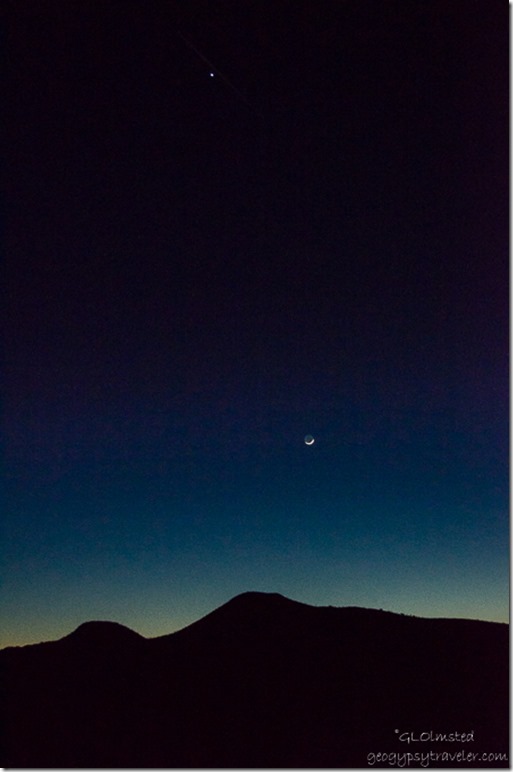
Venus & crescent moon Chocolate Mountains Kofa National Wildlife Refuge ArizonaFollowed by a gorgeous sunset and then a crescent moon with Venus, and Mars.

Of the 665,400 acres within Kofa National Wildlife Refuge, 547,700 acres are designated wilderness, making it the second largest wilderness area in Arizona.  While the Palm Canyon Trail is the only designated trail on Kofa, visitors are welcome to hike anywhere on the refuge so long as vehicles remain within 100 feet of the road, do not enter mines, or the area closed for the recovery of Sonoran pronghorn mostly seen in King Valley.  Camping on the refuge is limited to a maximum of 14 days in any 12-month period.  Campfires are permitted with a limited amount of only dead, down and detached wood that can be gathered and I didn’t see any of that so probably want to bring your own firewood.  Also remember that summer temperatures can exceed 120°F.  Seems winter is the time to visit and I would highly recommend that.  Had a great cell and internet signal in camp.
Push my buttons!

  • Facebook
  • Twitter
  • LinkedIn

Like this:

Like Loading...
Arizona, Kofa NWR adaptation, California fan palm, camping, desert, geology, hike, hiking, Kofa National Wildlife Refuge, Palm Canyon trail, plants, Sonoran Desert, wildlife, wildlife refuge 14 Comments
12 September 2016

A forest drive to Marble View

September 6 & 7 2016

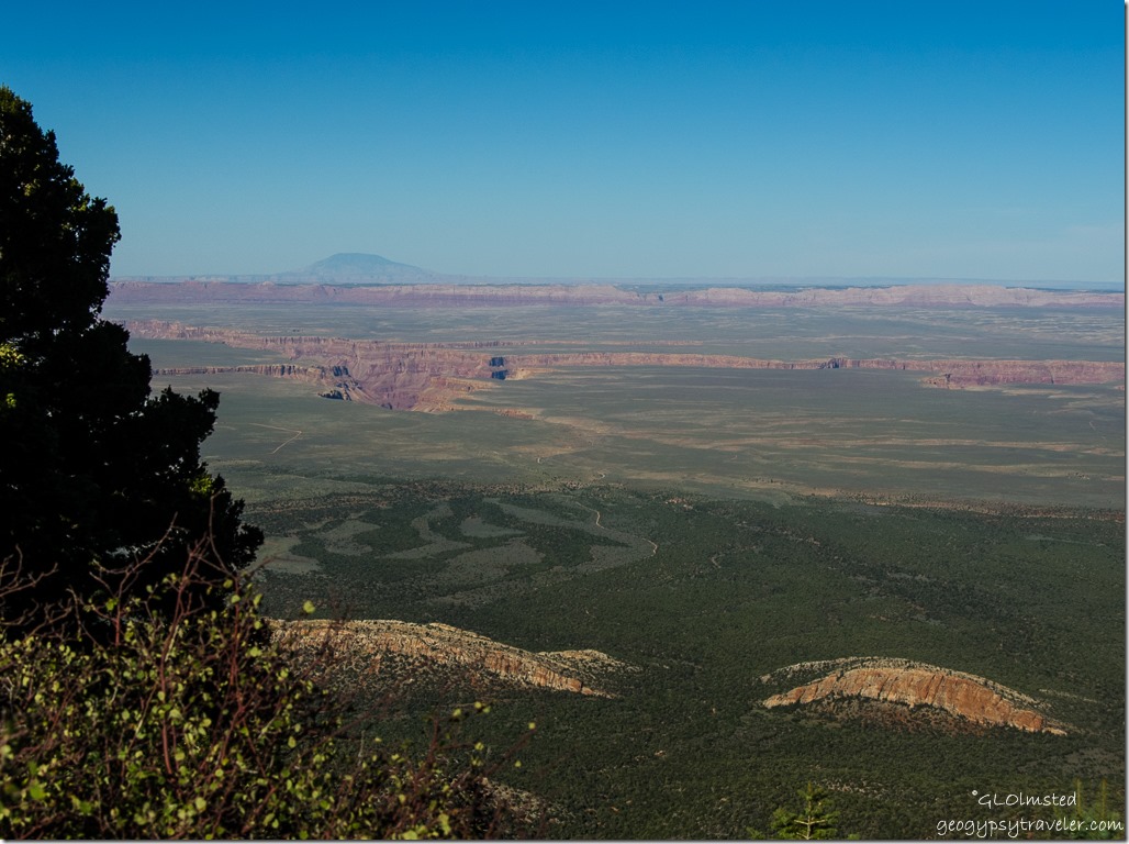
Marble Plateau & Canyon, Vermilion & Echo Cliffs, Navajo Mountain from Marble View Kaibab National Forest ArizonaThree days in a row off work so I chose to stay at home the first day, then Bill drove up and we took a forest drive to Marble View for an overnighter.  Even though I love my park, sometimes I just have to change the view.    Plus I wanted to see what effects, if any, the Fuller Fire had on this area of the Kaibab National Forest.  And I suspected some fall colors would be showing.

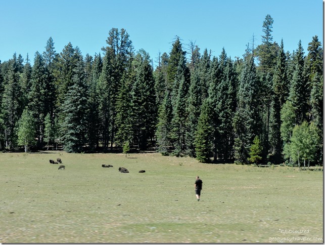
Bison & touron meadow SR67 North Rim Grand Canyon National Park ArizonaJust before the North Rim entrance station I saw about 30 bison mostly laying down in a meadow, plus one touron.  What don’t these people understand about “wild” life?

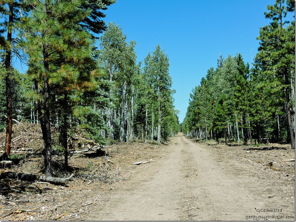
FR219 Kaibab Kaibab National Forest ArizonaBarely out of sight from State Route 67 and into the forest on FR611 I saw the strangest, what I believe to be, fire break along both sides of the road and some very large slash piles.

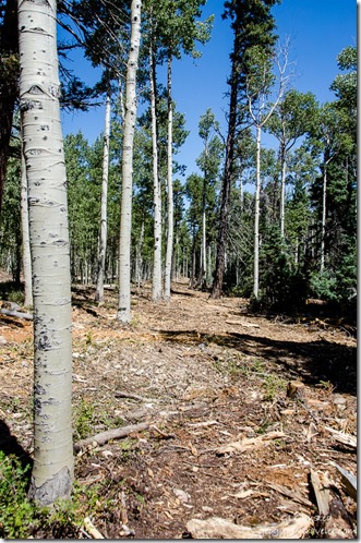
Chipped fire break FR219 Kaibab Kaibab National Forest ArizonaActually it’s about 30 feet from the road, a swath at least 100 feet wide with most of the trees cut down and chips left behind.  Looked like a thinning process leaving clusters of aspen and a few ponderosa pine.  Yet there were also many large and small stumps, some trees gashed and knocked over.  These clearings ran for about 12 miles in the national forest but not on national park land where a section of the road is a boundary between the two.  I saw no evidence of burn at all.
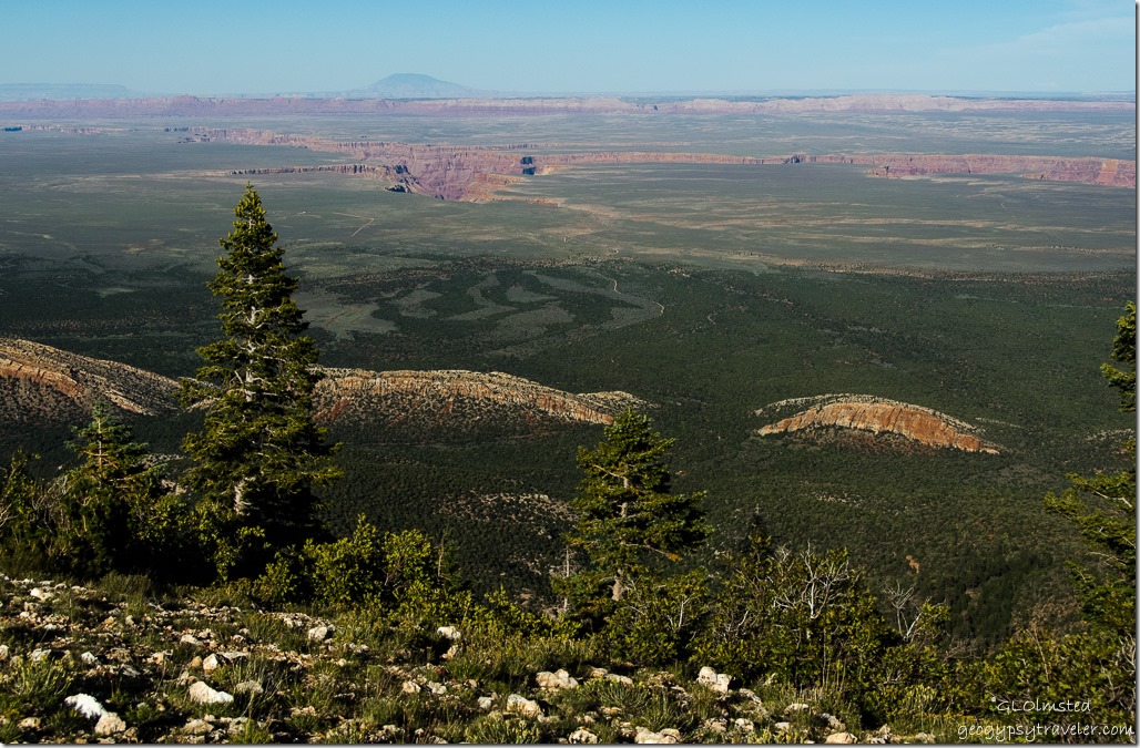
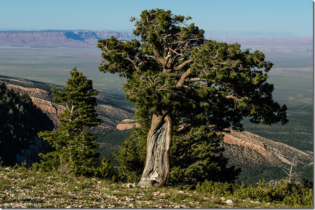


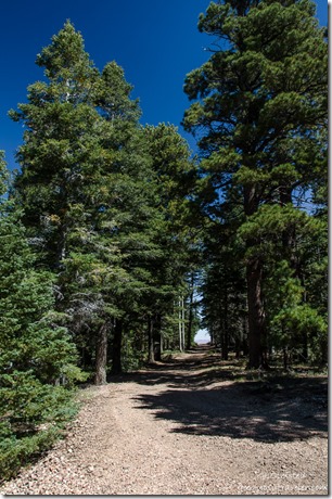
Marble View FR219 Kaibab Kaibab National Forest ArizonaI welcomed the familiar tunnel of trees at the end of FR219 leading to Marble View, yet the narrow road had been widened and trimmed.

Marble View Kaibab Kaibab National Forest Arizona

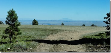
Two people with a tent occupied the first big site so we went around the trees a bit to allow for privacy and quickly leveled up with an excellent view.


View from camp Marble View Kaibab Kaibab National Forest ArizonaRosehips Marble View Kaibab Kaibab National Forest Arizona

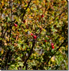
Wild rose bushes turning colors and covered with hips grew at the edge of camp.

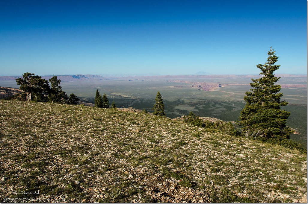
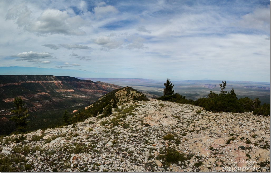
Marble Plateau & Canyon Echo Cliffs Navajo Mountain from Marble View Kaibab Kaibab National Forest ArizonaI absolutely love this view for it’s distances.  About 100 miles away Navajo Mountain stands alone at 10,416 feet.  Echo Cliffs to the east, Vermilion Cliffs to the northeast, and the Colorado River deep in Marble Canyon cutting through the Marble Plateau.

Wind blown pinyon pine from Marble View Kaibab Kaibab National Forest ArizonaAncient trees on the rim lean from the strong southwest winds of summer yet a dense forest blocked our camp.  That is until a walk out to the point threatened to blow us off the edge and the bite in the wind sent us back to camp.

Marble Plateau & Canyon Echo Cliffs Navajo Mountain from Marble View Kaibab Kaibab National Forest ArizonaSo many gravel roads visible below and leading to the rim that I haven’t explored yet.

Shadow creeping across Marble Plateau from Marble View Kaibab Kaibab National Forest Arizona

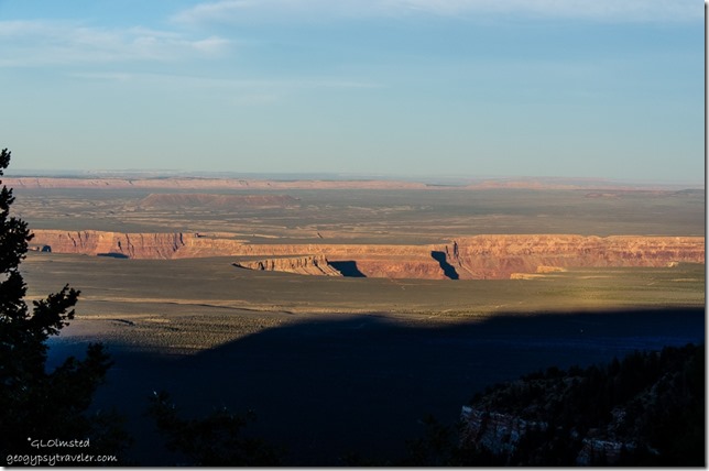
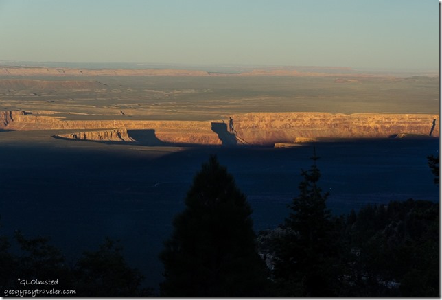
Shadow creeping across Marble Plateau from Marble View Kaibab Kaibab National Forest ArizonaAs the sun sank behind the forest shadows crept across the plateau below and seemed to flow into Marble Canyon.

Sunset Marble View Kaibab Kaibab National Forest Arizona

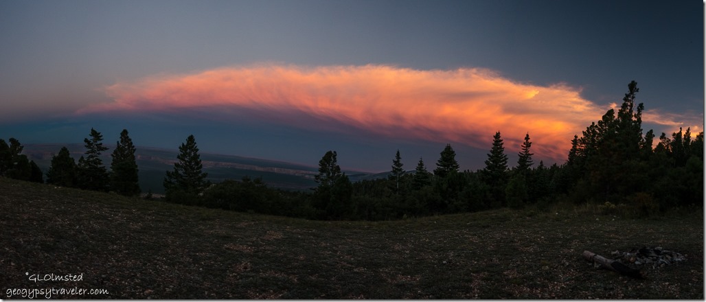
Sunset Marble View Kaibab Kaibab National Forest ArizonaHad there been less wind we might have sat outside around a campfire.  No shortage of fire wood nearby.  Instead we admired the sunset through the camper window and I stepped outside for a couple quick shots.

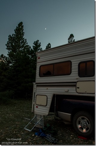
Moon above camper Marble View Kaibab Kaibab National Forest ArizonaIncluding a crescent moon.

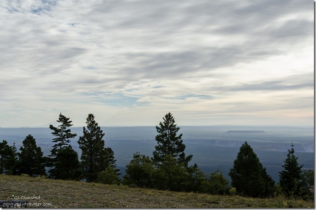
Clouds & hazy view Marble View Kaibab Kaibab National Forest ArizonaThe morning began with light colored clouds and haze.

Kaibab monocline, Vermilion & Echo Cliffs, Marble Plateau & Canyon Marble View Kaibab Kaibab National Forest ArizonaAfter coffee and conversation we walked to the point.  To the north the cliff face shows the marvelous curve of the Kaibab monocline dipping east into the valley below.

Paintbrush Marble View Kaibab Kaibab National Forest ArizonaThis area reminds me of tundra with stunted vegetation and lots of fossils.


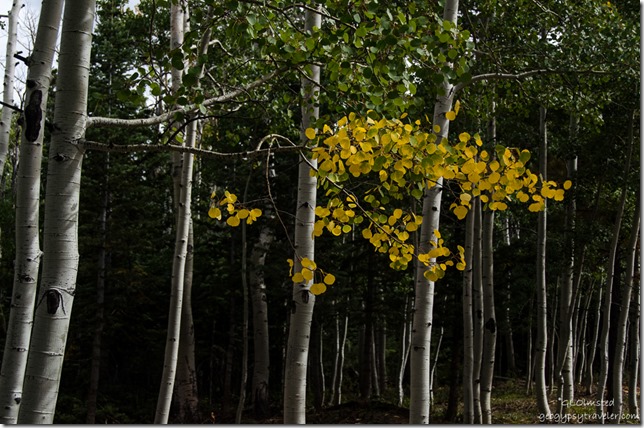
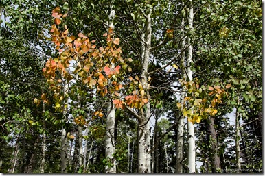
Golden Aspen Kaibab Kaibab National Forest Arizona

Bees on Fleabane Kaibab Kaibab National Forest Arizona


We left camp about 3pm.  Bill headed back to Kanab and I slowly, 2 hours, drove back to the North Rim.  I stopped often for the splashes of fall colors.

Fall Aspen Kaibab Kaibab National Forest Arizona

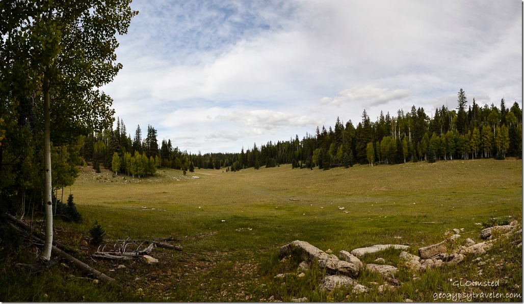
Arizona trail meadow Kaibab Kaibab National Forest Arizona

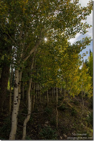
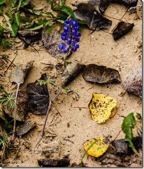
Sun through fall aspen Kaibab Kaibab National Forest ArizonaFall leaves & lupine Kaibab Kaibab National Forest ArizonaAnd along a meadow where the Arizona trail passes through.


Fall aspen Kaibab Kaibab National Forest Arizona


Fall aspen & fence Kaibab Kaibab National Forest ArizonaPlus a quick pit-stop where I usually find colors and love this old fence.

One yellow aspen leaf FR219 Kaibab Kaibab National Forest ArizonaI do understand the importance of fire for forest ecology, and fire breaks to keep fire from jumping the road.  But this is plum ugly and I’d rather have seen burn.

I could feel and hear the forest crying.

Push my buttons!

  • Facebook
  • Twitter
  • LinkedIn

Like this:

Like Loading...
Arizona, Kaibab National Forest camping, fire break, Marble View 19 Comments
← Older posts
Newer posts →

Hi, I’m Gaelyn, the Geogypsy

I retired after 29 summer seasons as a Park Ranger, traveling solo for 40+ years. My passions include travel, connecting to nature, photography, and sharing stories.

I started exploring US National Parks in 1977 and 20 years later became a seasonal Park Ranger.  I’ve lived full-time in a RV for 30 years working summers and playing winters.  I’m still trying to figure out what I want to be when I grow old, other than grow up.

Let’s share our stories.  Here’s more of mine…

My wheeleastate

I am currently…

…boondocking somewhere in southern Arizona.  In the area, give a shout.

Geogypsytraveler on YouTube

Follow my journey on YouTube. Just click the pic. Hope you’ll like, share, and subscribe.

Click image for 7 minute documentary (Password “geogypsy” lowercase)

Making the Gypsy documentary is a story of its own.  Click below for the rest of the story.

Living nomadically & connecting to nature documentary

Subscribe to Blog via Email

Enter your email address to subscribe to this blog and receive notifications of new posts by email.

Photos available for sale include prints, greeting cards, coffee mugs, tote bags, phone cases and more

Reflected Wave 24X16 metal print under $100

Custom Coffee Mugs

Many items to choose from including prints

The Last Blast 24 x 16″ metal print under $100

Need a signal boost? When I boondock on public lands sometimes signal is weak or intermittent and a booster helps. Click the pic to visit WeBoost.

Connecting to nature and the rest of the world too.

Please contact me for photo purchases not seen at GLOlmsted Photography

Order fulfillment is by Fine Art America. If you’re not happy with your purchase, for any reason, simply return it within 30 days, and you’ll receive a full refund of the purchase price.

Why read Geogypsy?

The gypsy life spring-summer 1998 - "You were a real pioneer. RV'ing before it was cool." ...Yogi

How do you process photos? - “Your photographs create an Emotional feeling in the viewer...that they become One with You.” …Cindy

Life’s transitions between travel and work play - "I know you love your job as much as you love travel -- it shines through all your posts." ...Sallie

Lions at Kruger National Park - “Wonderful post, thank you. I was hooked start to finish!” … Peter B

11 lessons looking back 2013 - “A great post -- made me think, made me smile, made me want to cry." ...Sallie

Wildlife video Kruger National Park - “Gorgeous, this makes me want to go straight to South Africa now.” … Ayngelina

Living nomadically & connecting to nature documentary - “What an experience you had and gave to the "crew." Sometimes I think you don't realize how unique and inspiring you are.” …Alan

Search

Popular Posts

1. Prioritize the well-being of nature over photography. 2. Educate yourself about the places you photograph. 3. Reflect on the possible impact of your actions. 4. Use discretion if sharing locations. 5. Know and follow rules and regulations. 6. Always follow Leave No Trace principles and strive to leave places better than you found them. 7. Actively promote and educate others about these principles

Categories

Archives

Sites I follow, read & recommend

  • A Full-time Life
  • A Yankee in Belgrade
  • Bob's Eyes
  • Box Canyon Blog
  • Camels and Chocolate
  • Dawns bloggy blog
  • In the Direction of Our Dreams
  • Jane in her infinite wisdom
  • Janie and Steve, Utah Trails
  • Kathie's Birds
  • Las Adventuras
  • Memorable Meanders
  • Oh, The Places They Go
  • On the Road Abode
  • Port Elizabeth Daily Photo
  • Stillhowlyntravels
  • Take to the Highway
  • Technomadia
  • the good luck Duck
  • Travel with the Bayfield Bunch
  • Wandering Earl
  • Wheeling It
  • Yogi's Den

Caught in a Slot 9×12 canvas print under $50

If you don’t like what’s going on in your government, contact your Congress

Directory of Senators

Directory of Representatives

Lijit

© Copyright 2008-2024. Geogypsytraveler.com
%d