• Home
  • About Geogypsy
    • Herstory
    • Parks where I’ve worked
  • Places I’ve been
    • United States
      • Arizona
        • Antelope Slot Canyon
        • Casa Grande Ruins National Monument
        • Colossal Cave Mountain Park
        • Flagstaff
        • Glen Canyon National Recreation Area
        • Grand Canyon National Park
          • Grand Canyon National Park North Rim
          • Grand Canyon National Park South Rim
          • Toroweap
        • Havasu Canyon
        • Horseshoe Bend
        • Jerome
        • Kaibab National Forest
        • Lee’s Ferry
        • Meteor Crater
        • Navajo Bridge
        • Oak Creek Canyon
        • Painted Desert
        • Pipe Springs National Monument
        • Prescott
        • Quartzsite
        • Saguaro National Park
        • Sedona
        • Sunset Crater Volcano National Monument
        • Vermilion Cliffs
        • Walnut Canyon National Monument
        • Wupatki National Monument
        • Yarnell
      • California
        • Anzaberrego
        • Bakersfield
        • Death Valley National Park
        • Joshua Tree National Park
        • Redwoods NP
        • Salton Sea
        • Yucca Valley
      • Colorado
        • Mesa Verde National Park
      • Florida
      • Illinois
        • IL River
        • Morton Arboretum
        • Starved Rock State Park
      • Michigan
      • Nevada
      • New Mexico
      • Oregon
        • Crater Lake NP
        • Mt Hood
        • Oregon Caves National Monument
      • Texas
        • Alpine Texas
        • Padre Island
        • Port Isabel
        • Rio Grande Valley
      • Utah
        • Brian’s Head
        • Bryce Canyon National Park
        • Buckskin Gulch
        • Cedar Breaks National Monument
        • Cedar City
        • Coral Pink Sand Dunes State Park
        • Dixie National Forest
        • Grand Staircase Escalante National Monument
        • Johnson Canyon
        • Kanab
    • World Travels
      • Germany
      • Mexico
      • South Africa
  • Tours
  • Photography
  • Work with Me
    • Sponsors
  • Contact
Geogypsy
Menu
  • Home
  • About Geogypsy
    • Herstory
    • Parks where I’ve worked
  • Places I’ve been
    • United States
      • Arizona
        • Antelope Slot Canyon
        • Casa Grande Ruins National Monument
        • Colossal Cave Mountain Park
        • Flagstaff
        • Glen Canyon National Recreation Area
        • Grand Canyon National Park
          • Grand Canyon National Park North Rim
          • Grand Canyon National Park South Rim
          • Toroweap
        • Havasu Canyon
        • Horseshoe Bend
        • Jerome
        • Kaibab National Forest
        • Lee’s Ferry
        • Meteor Crater
        • Navajo Bridge
        • Oak Creek Canyon
        • Painted Desert
        • Pipe Springs National Monument
        • Prescott
        • Quartzsite
        • Saguaro National Park
        • Sedona
        • Sunset Crater Volcano National Monument
        • Vermilion Cliffs
        • Walnut Canyon National Monument
        • Wupatki National Monument
        • Yarnell
      • California
        • Anzaberrego
        • Bakersfield
        • Death Valley National Park
        • Joshua Tree National Park
        • Redwoods NP
        • Salton Sea
        • Yucca Valley
      • Colorado
        • Mesa Verde National Park
      • Florida
      • Illinois
        • IL River
        • Morton Arboretum
        • Starved Rock State Park
      • Michigan
      • Nevada
      • New Mexico
      • Oregon
        • Crater Lake NP
        • Mt Hood
        • Oregon Caves National Monument
      • Texas
        • Alpine Texas
        • Padre Island
        • Port Isabel
        • Rio Grande Valley
      • Utah
        • Brian’s Head
        • Bryce Canyon National Park
        • Buckskin Gulch
        • Cedar Breaks National Monument
        • Cedar City
        • Coral Pink Sand Dunes State Park
        • Dixie National Forest
        • Grand Staircase Escalante National Monument
        • Johnson Canyon
        • Kanab
    • World Travels
      • Germany
      • Mexico
      • South Africa
  • Tours
  • Photography
  • Work with Me
    • Sponsors
  • Contact

Tag: BLM

17 April 2017

Lava and flowers at Mojave Trails National Monument Amboy Crater

March 28-29, 2017

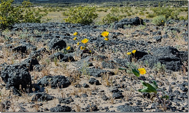
sunflowers Amboy Crater Mojave Trails National Monument BLM CaliforniaThe Southwest spring wind blew me from one lava flow at Fossil Falls to another at Amboy Crater in Mojave Trails National Monument.  Although I’d driven in the area before this was my first actual visit to one of our newest national monuments thanks to President Obama.  But there was no way I had time to visit the entire 2,500 square miles so I chose the easy to access Amboy Crater and hoped for flowers.

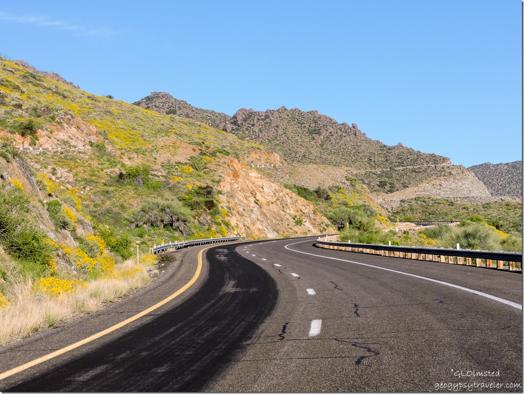
Started with a nice tail wind south on US395 but then the darn road turned eastward and the camper really caught it on the side.  Carpets of pepper-grass blanketing the ground between scrub reminded me of the 70s when I decorated my bedroom in harvest gold and avocado green.  BLM signs for places called Spangler Hills and Trona Pinnnacles beckoned for future explorations.

Towns—if you can call the crumbling remains of buildings that time forgot—barely slowed down for.  Red Canyon, Johannesburg, and Randsburg made me wonder if I’d switched countries to South Africa.  At one time mining occurred in these parts and this was a major route.  Now it is littered with living ghost towns and only a few hold outs.
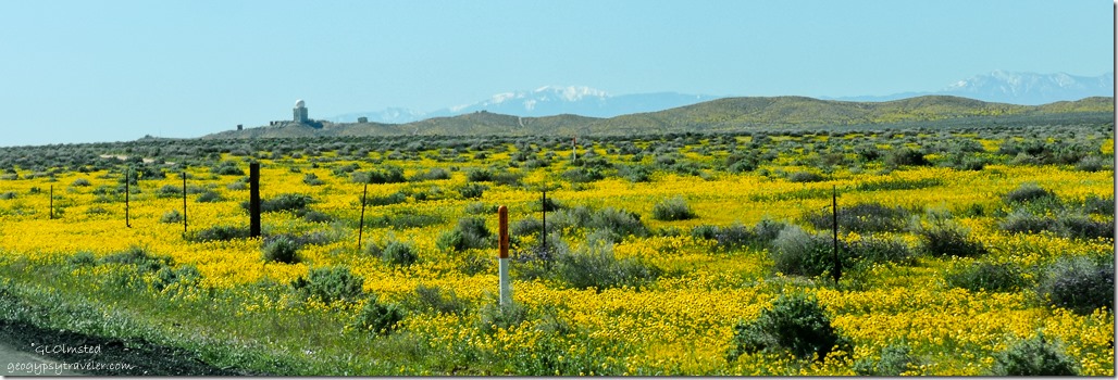
yellow flowers radar US395 South Boron CaliforniaAs I drove along a huge golf ball-shape stood out on a hillside and I whizzed past a stone entrance sign covered with wood.  Strange things occur in the remote desert so I did some homework later.  Not far from Kramer Junction (US395 & SR58) the ball-shape turns out to be a radar antennae operated by the Federal Aviation Administration (FAA) but originally built by the US Military as part of an air defense network that provided detection and early warning of non-friendly (enemy) aircraft.  The original Boron Air Force Station was converted to the Boron Federal Prison in 1978 as a minimum security prison meant for white collar non-violent offenders.  Closed in 2000, the facility sits abandoned and falling apart with the assistance of vandals.

Stopped in Barstow for supplies and when coming out of the store noticed something hanging down from under the back end of the camper.  Thank goodness it wasn’t a holding tank but a protective plastic cover with about half the 100 screws in it pulled out.  Now what did I bump?  Crawled underneath to assess the situation and decided to bungee it up rather than take it off and not have a place to put it.  I’m talking a slightly flexible, 4×8, molded chunk of plastic.  All I could do to hold it up with my head while stretching the bungees.  No photos.
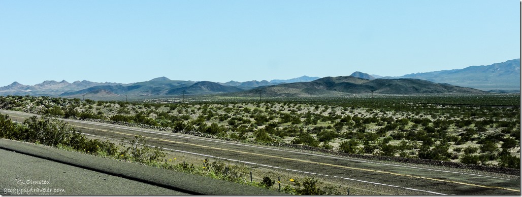
Route 66 parallel to I40 East CaliforniaFinally headed east on I40 and looked longingly at the Mother Road, Route 66, running parallel to the go-fast freeway.  I like to lollygag along the old “blue line” highways and saw several tempting exits yet continued to Ludlow before cruising the crumbling, deteriorating, and mega-patched pavement from the past called the National Trails Highway.

I could have pulled off on a dirt two-track anywhere on the BLM but I really didn’t want to do a whole lot of bouncing with this bungee thing going on.
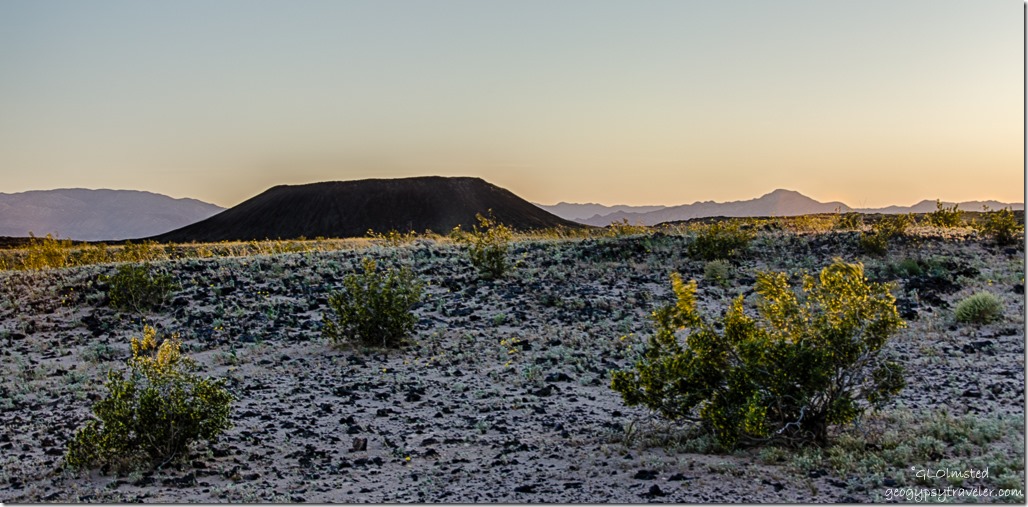
sunset Amboy Crater Mojave Trails National Monument BLM CaliforniaAnd finally, late afternoon, I drove to the end of the newly paved .5 mile road at Amboy Crater then turned back half way to an empty paved lot for the night.  There were a couple RVs in the end lot and I was joined by two others.  Sore and tired I watched the sunset.
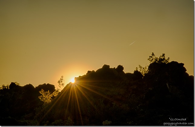
sunset Mojave Trails National Monument BLM CaliforniaExcept for the incessant wind and many trains, it was a quiet night.  Fridge wouldn’t light and I don’t get that because it was downside from the wind and plenty of propane.  The stove worked.  This has happened a few times before.  I ate the last of the ice cream.  A sure sign to head home soon.
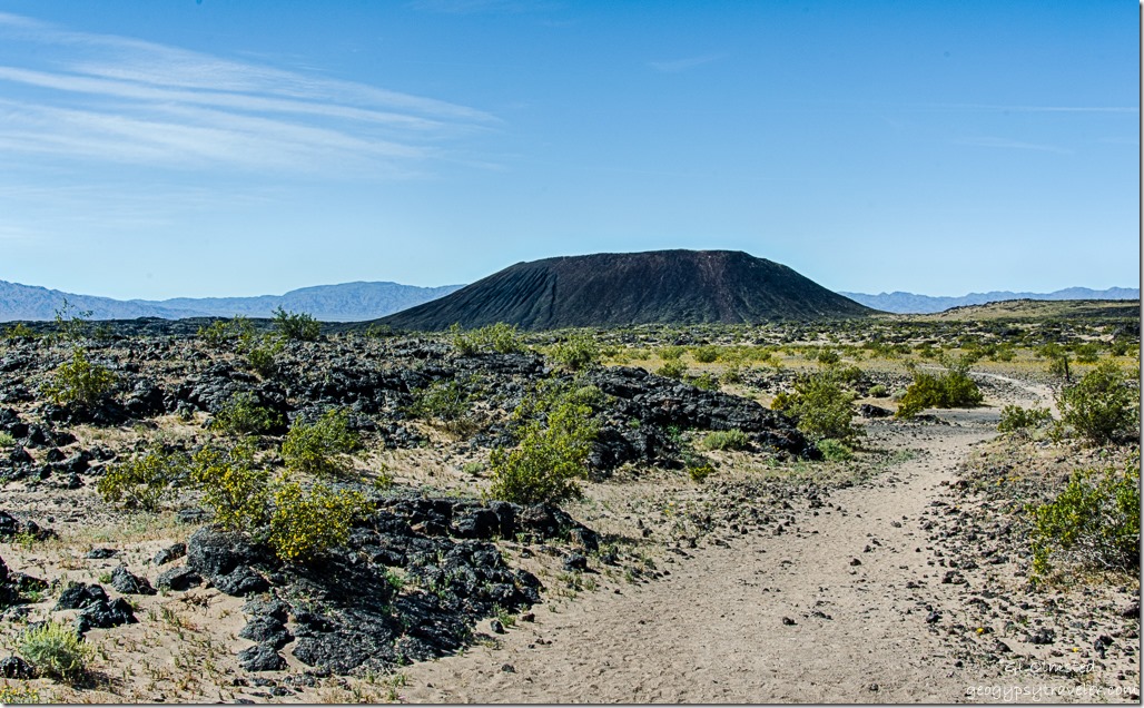
Amboy Crater trail Mojave Trails National Monument BLM CaliforniaWith barely any wind the fridge lit in the morning and I went back down to the trail head parking.  A 1.5 mile trail leads to the west and open side of the cinder cone, then an 80 foot incline and additional .5 mile rim walk.  Which I guess is not really at the top rim of the 250-foot high cinder cone.
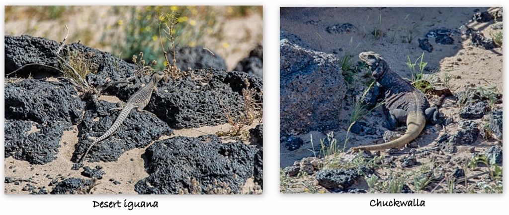
Desert iguana & chuckwalla Amboy Crater trail Mojave Trails National Monument BLM CaliforniaBeing I still had a long drive ahead of me to get back to Arizona that day I just wandered around the lava a bit looking at the pretty flowers and being startled by the skittering lizards.  These two measured over a foot long.
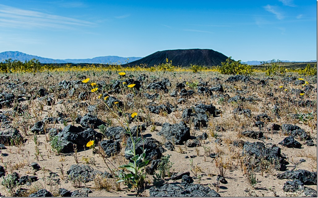
Sunflowers Amboy Crater Mojave Trails National Monument BLM CaliforniaAmboy Crater stands alone in the desert and is a dominant landmark seen for many miles.  A rather young cinder cone last erupting about 10,000 years ago.  It breached on one side and lava flowed for 24 square miles.
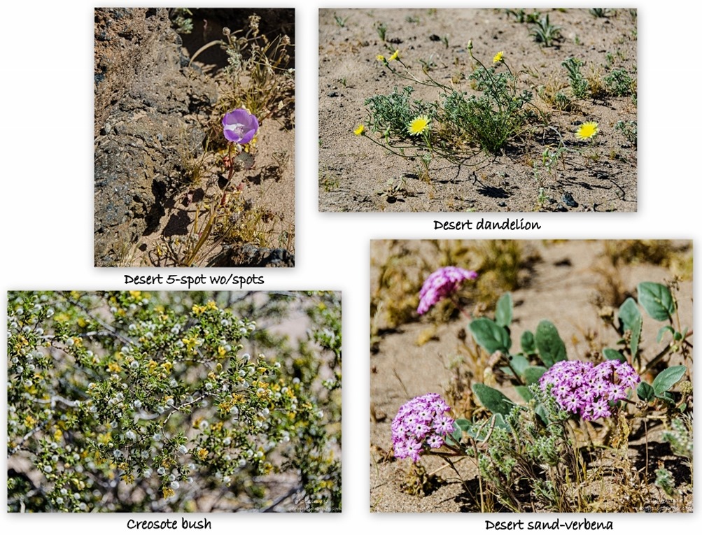
wildflower collage Amboy Crater trail National Monument BLM CaliforniaDue to the cone’s youth and lack of mature soil, plant life is limited.  Yet I still found flowers in some pockets of sand captured within the lava flow.

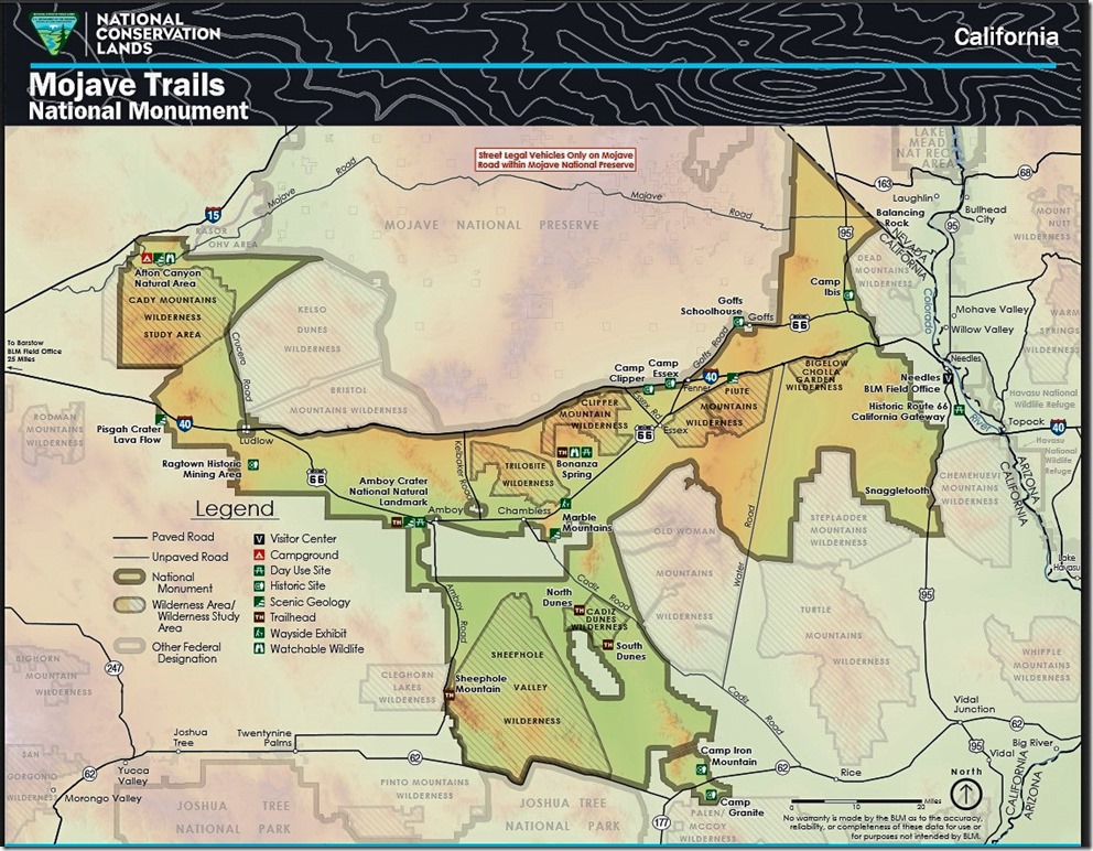
Mojave Trails National Monument at 1.6 million acres is the second largest desert preserve in the world—Namib-Naukluft National Park in Namibia is larger—and creates wildlife corridor link with Joshua Tree National Park, Mojave National Preserve and several wilderness areas.  The monument’s diverse features include lava fields and cinder cones at Amboy Crater, primitive 4×4 camping at a desert wetland at the Bonanza Spring Watchable Wildlife Area, rock-hounding at the Chambless and Trilobite Mountain sites, and sand dunes in the Cadiz Wilderness.
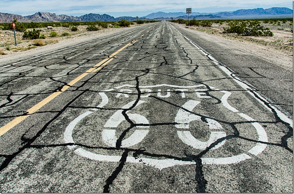
Route 66 on road Amboy CaliforniaPlus there’s a long stretch of Route 66 which I’d hoped to drive more of to the east when I left but knew the road was closed (and will be until mid-September) just beyond Amboy at the Kelbaker Road north back to I40.  So there I was standing on the side of the road along Route 66 just before the road block and two different vehicles stopped to ask me directions like I would know.  One how to get to Cadiz the other to I40.  And I did know, because I read a map and do my homework.
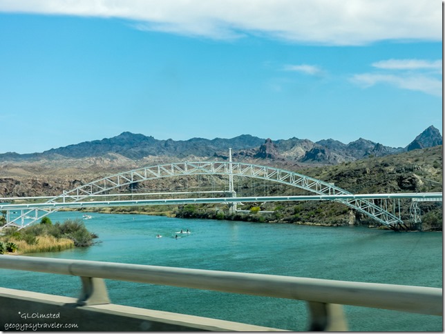
Colorado River I40 CA-AZ borderYet even planning isn’t often enough.  Google told me four hours to home.  What does Google know about my slow rate of pace.  Even though once I crossed the Colorado River into Arizona it felt like home I had miles yet to go.
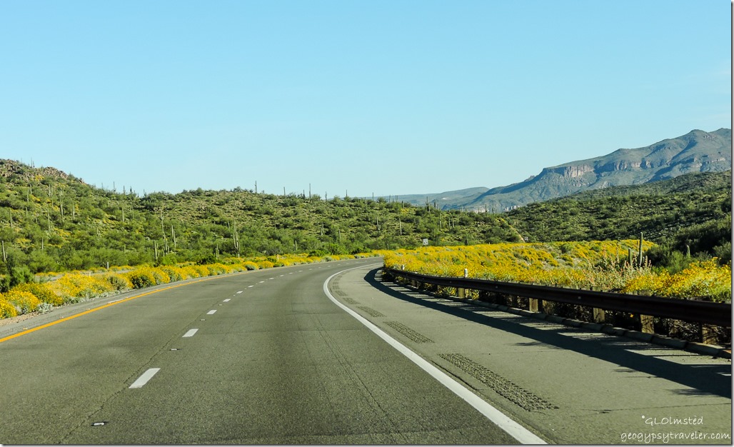
wildflowers US93 South ArizonaUS93 South

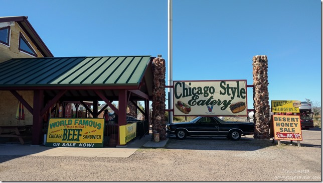
Dazzos Chicago Style Eatery US93 Wikeup ArizonaFour hours turned into seven because of all the stops I just had to make for flowers, fuel, and to pick up dinner for Berta and I at Dazzos Chicago Style Eatery in Wikeup, Arizona US93 for their world famous Italian Beef sandwich. (BTW there’s an RV Park there too.)

wildflowers SR89 North ArizonaSR89 North Yarnell Hill

Then because it was late I parked in Berta’s drive for the night after we enjoyed a couple hours of catching up.  Much easier than getting home late and wanting to unpack at least the necessities.  So I returned home four weeks and a day after leaving for Valley of Fire.  Been living with wind for almost two weeks and it seems to have followed me home.  Hello Spring in the Southwest.    Ah….chooooooo!

Know before you Go

Carry a paper map in case you have no signal.  Check the monument’s website and road conditions/closures.  Be aware of weather conditions as summer temperatures exceed 110°F and winter nights drop to 36°F.  Heavy rain during summer monsoon can make roads impassible.  Carry, and drink plenty of water.  Fuel up your vehicle because it’s a long ways between services.  Watch for snakes, spiders, and scorpions.  This is a leave no trace landscape so pack it in, pack it out.  Because the US Armed Forces has and still does use the desert for bombing ranges there may be unexploded devices.  Need I say leave them alone.  People have also reported feeling the ground vibrate during “war games” within the nearby military base.

Mojave Trails National Monument map g-2

Save

Save

Save

Push my buttons!

  • Click to share on Facebook (Opens in new window) Facebook
  • Click to share on X (Opens in new window) X
  • Click to share on LinkedIn (Opens in new window) LinkedIn

Like this:

Like Loading...
California, Mojave Trails National Monument, National Parks and Monuments, Places I've been, United States BLM, camping, hiking, lava flow, national monument, wildflowers 14 Comments
26 January 2017

Hanging out on the desert near Quartzsite Arizona

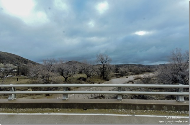
Water in Kirkland Creek Kirkland ArizonaKirkland Creek

Arrived Saturday afternoon after seeing all kinds of weather, snow on the mountains, water in the wash, and wind on the nose getting to Quartzsite Arizona.  I was the last to arrive, so far.  And the Grand Canyon Association group is smaller this year with only six people.

With not particularly nice weather everyone agreed communal dinners could wait until the next night, me making Hungarian goulash.  However after dinner we comfortably gathered in the largest RV, 32’ motor home, for John’s birthday cake.

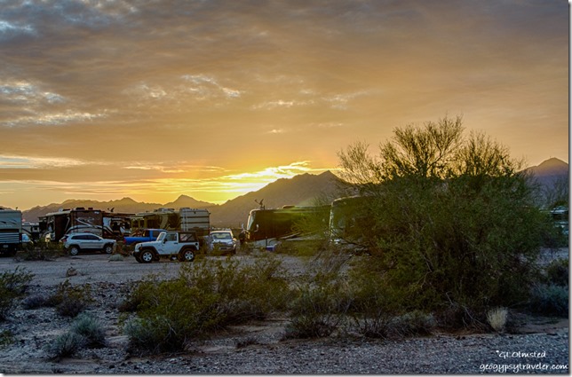
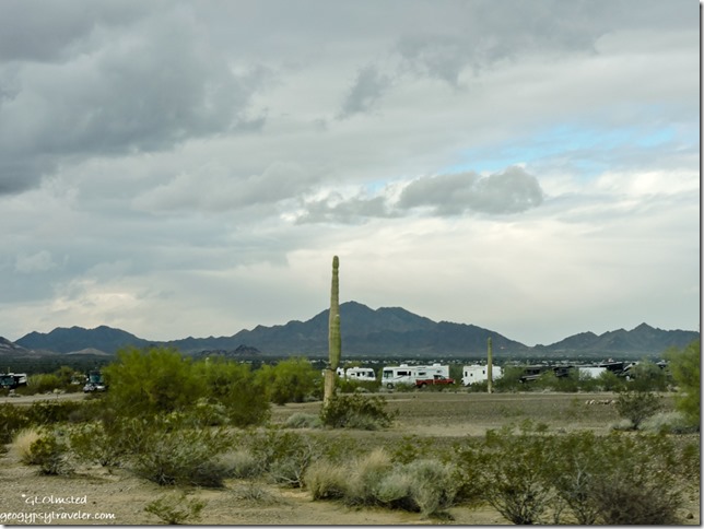
Sunset from camp La Paz Valley Road Quartzsite ArizonaFrom camp off La Paz Valley Road and Dome Rock Mountains Quartzsite

We got lucky Sunday when the wind died down in time for us to sit out for dinner and even enjoy a little campfire for a short while.  It never actually rained but the skies continued to look rather threatening.

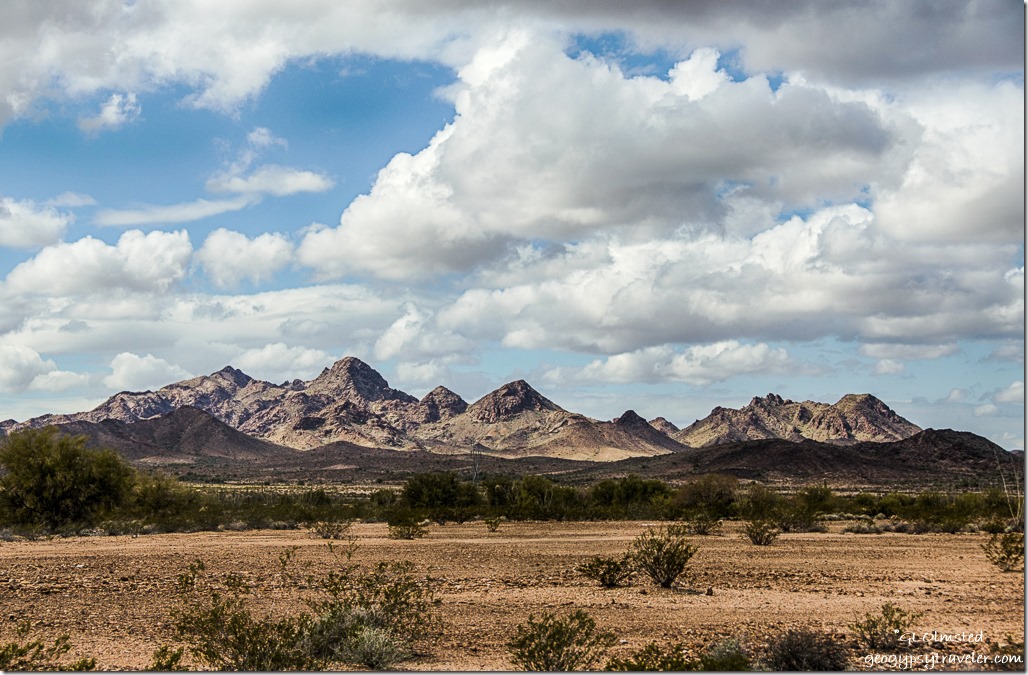
West view Trigo Mountainss BLM US95 Arizona

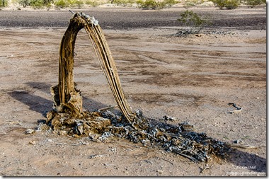
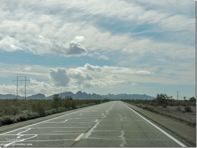
Dead saguaro BLM US95 South of Quartzsite ArizonaMonday I took a drive south on US95 to scope out the KOFA National Wildlife Refuge and made a few photo opp stops along the way.  The desert floor is hard packed and stony so easy to find a place to park on the BLM land adjacent to the road.  Plus there are numerous gravel side roads, just depending on how far you want to get off the beaten path.  But pay attention to signs that often alert to the possibility of undetonated ammunition from military operations.

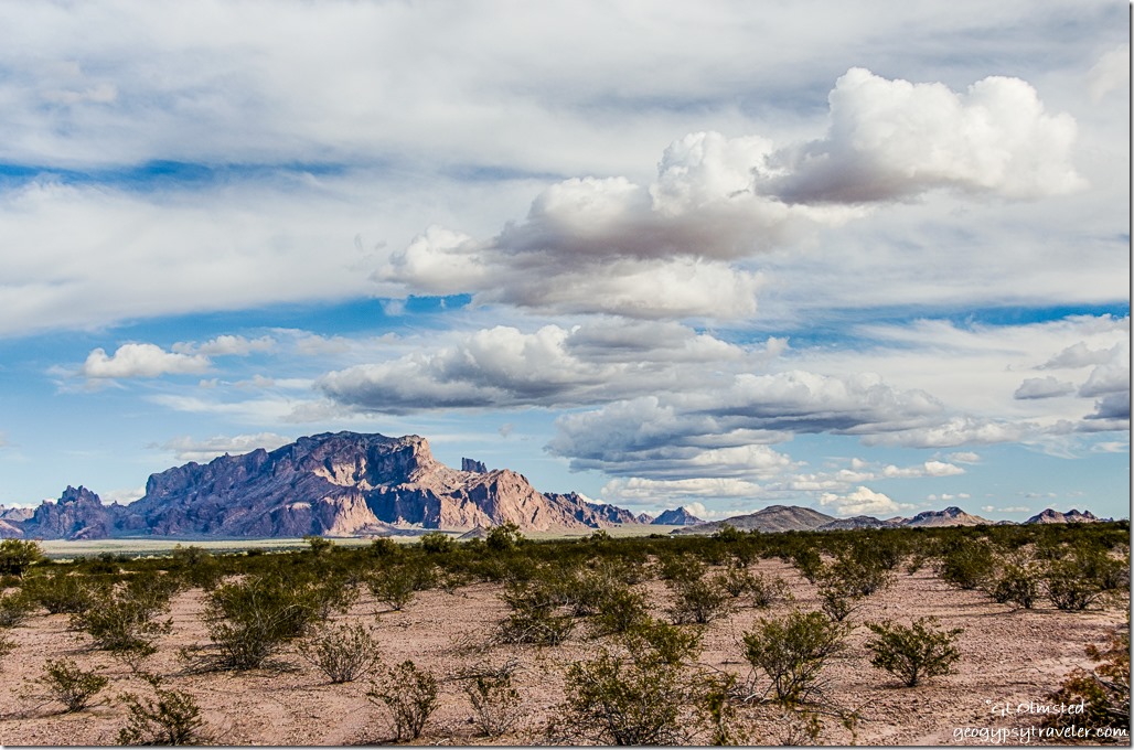
KOFA Mountains clouds BLM US95 South of Quartzsite Arizona

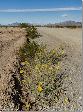
Wildflowers BLM US95 South of Quartzsite ArizonaI never walked very far from the road or my truck as the wind blew fiercely.  Yet I just had to get away from the power lines that run along both sides of the road.  A shame to put that in a photo of such gorgeous landscapes.


US95 South Castle Dome Mountains ArizonaUS95 South Castle Dome Mountains

I drove only about a mile from pavement to the east of the Stone Cabin towards King Valley.  There are other areas in the refuge like Crystal Hill, where I’ve gathered crystals but never camped, and Palm Canyon which I’ve heard in superb.  And I wasn’t even off BLM on to the refuge yet.

Northeast Ocotillos KOFA Mountains King Road BLM ArizonaNortheast KOFA Mountains from King Road

Southwest Chocolate Mountains King Road BLM ArizonaSouthwest Chocolate Mountains from King Road

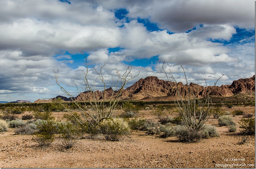
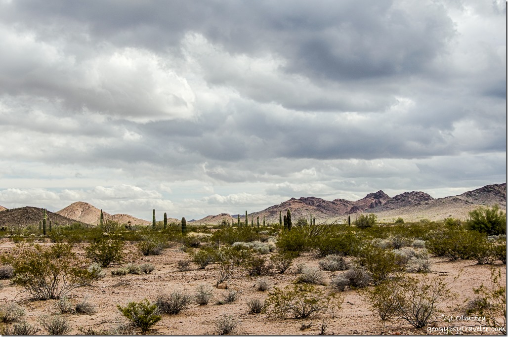
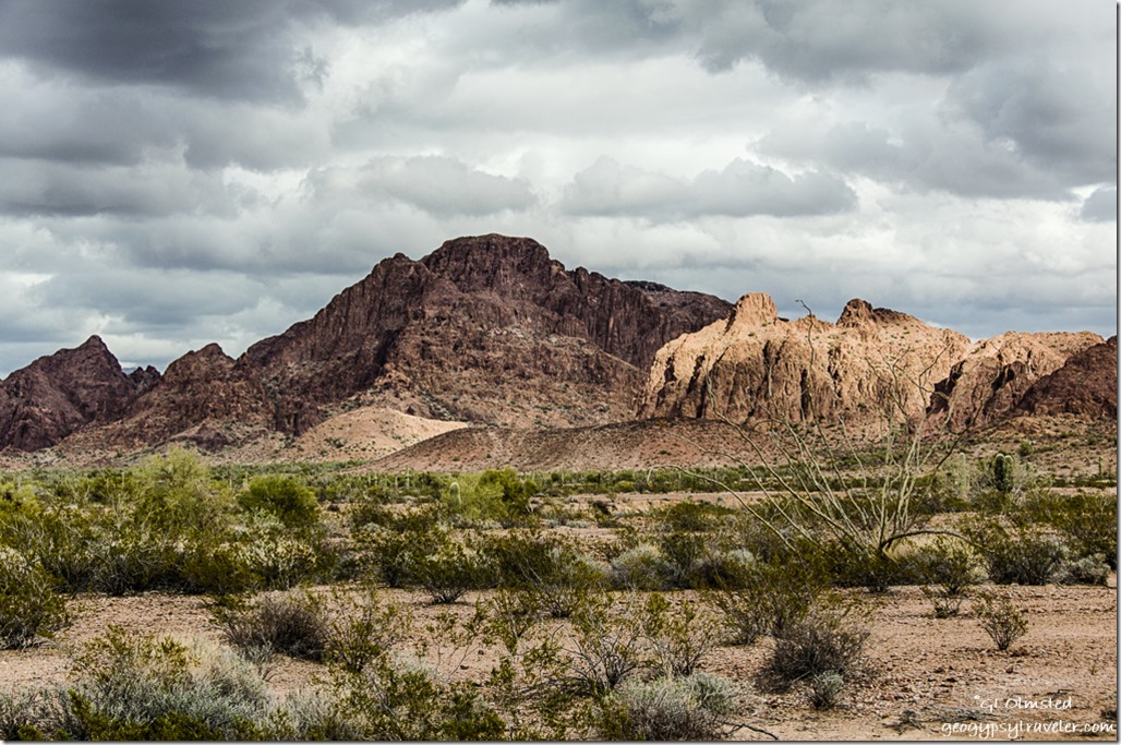
Oh my! Absolutely gorgeous!  Cloudy skies made light dance around on the land making for superb sights, and shooting.  Found a delightful place to park for lunch off the King Road not far from the plethora of saguaros, ocotillos and creosote bushes. Still windy so even at 60°F I was bundled up and hung out on the downwind side of the truck and camper soaking in the sights.  Mountains all around.

East Castle Dome Mountains King Road BLM ArizonaEast Castle Dome Mountains from King Road

Light & shadows KOFA Mountains King Road BLM ArizonaNortheast KOFA Mountains King Road

Ocotillo KOFA Mountains King Road BLM ArizonaI think the group should gather here next year where there are very few people, a much better signal, and exceedingly quite.  Only about 25 miles south of town.  I’m definitely going to stay there after Quartzsite, and believe at least two in the group will also.


Camp Dome Rock Mountains La Paz Valley Quartzsite ArizonaCamp between saguaros and Dome Rock Mountains Quartzsite

Reluctantly returned to camp for a superb dinner prepared by Greg and Karry.  All day long smoked pork roast which literally melted in my mouth, baked beans, Hawaiian sweet rolls, fruit salad, and for desert cherry cobbler backed in a Dutch oven.  We ate in their spacious and warm motorhome.

The camper was still having battery problems, or charging, or solar, or not sure so Tuesday I went to town in search of help.  Plus tanks needed dumping and water filled.  Rose’s RV Park charged $10 to dump and $1 for four gallon jugs of “filtered city water”.  Yea, I don’t use the fresh water tank or system in this old beast because of previous pipe breakage problems.  But I need 12v power for lights and to feed the brain on my fridge even running on propane.  Made an appointment for trouble shooting at Solar Bill’s for 9am the next day.

KOFA Mountains Palm Canyon Road BLM ArizonaNortheast KOFA Mountains from Palm Canyon Road

Got back to camp just in time for last night’s leftovers for lunch.  Then took another drive towards KOFA because I thought the truck would charge the house battery if the solar panel didn’t.  The meter for the panel glows red but doesn’t show it’s charging.  That night the 12v lights were so dim I gave up and read by headlamp.  And really weird is the LED lights didn’t work at all.  Internet signal is always uncertain.  Thus the quiet from me.

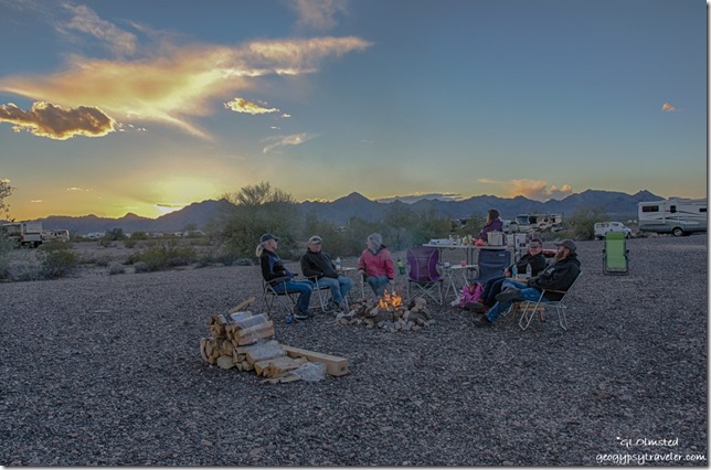
Campfire La Paz Valley BLM Quartzsite ArizonaThat night Paul made a dinner of black bean and ham soup with salad, bread, and cake for desert.  We do eat good in the desert.  And we sat outside around the fire for a while because the wind had dropped.  Although we still work several layers under the star studded sky.  Unfortunately, there were a few folks setting off fireworks and the candle lit bags?

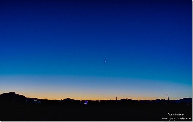
Sunrise crescent moon La Paz Valley Road Quartzsite ArizonaYes I actually saw a sunrise

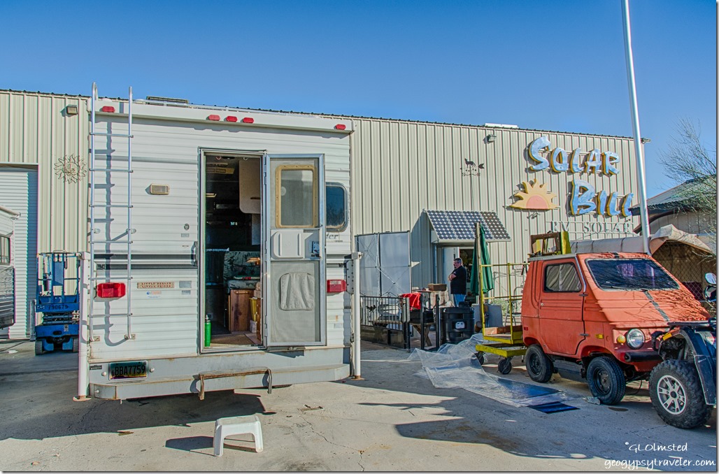
Truckcamper Solar Bill Quartzsite ArizonaUp early Wednesday for the Solar Bill’s appointment.  Got there a little before they opened and parked in front of a large bay door next to another rig, truck and trailer, also waiting.  Turns out that Johnny, the service man, and I have a mutual friend from Yarnell.  He tests.  The old battery bought two years ago is shot but here’s the real problem.  I had a 50 watt solar panel that puts out 1 amp/hour, the fridge that draws .6 amp/hr and there’s not enough sunlight hours to keep the battery full.  In other words, more power being used than being made.  The truck doesn’t charge the camper battery but will be rewired in the future to do that.  So I bought a 100 watt panel to replace the old one, and got $30 back on the old panel.  This panel puts out 5 amps/hr, plus I bought a bigger battery.  Wasn’t a planned expense but had to do it and spent less than expected under $400.  And I have power, lights, and a working fridge again.  Yipee!!!  That took about two hours although I was only charged for 50 minutes of labor.

Geocache La Paz Valley Quartzsite ArizonaNot in the log John

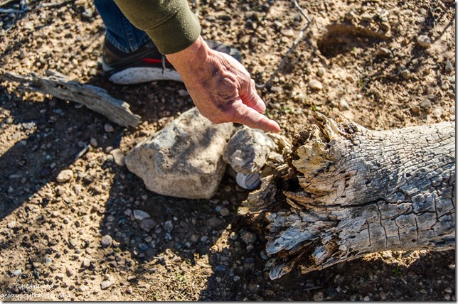
After lunch I went for a geocache walk with John, my first geocaching experience.  We may not have walked even two miles from camp.   I know some of you geocache but being totally new to this I didn’t know what to expect.  John told me the name of the cache and described it as “tiny” then kept looking at his phone for distance and direction.  When we got close I just started looking for something out of place.  We were by a barbed-wire fence line not far from the road and John said sometimes their magnetic.  So we looked at the nearby metal fence posts.  Nope.  But then I noticed that only one fence post in the line had rocks piled around the base and low and behold, under those rocks was a small plastic container with a roll of paper inside for geocachers to note date they found this.  I was amazed that some people have a custom, small, stamp to use with their “handle”.  John had me sign first as I found it then said something to his phone app about “Geogypsy” being the discoverer of her first cache.  And then we went on to discover three more nearby.  I need to learn more about this now.  I downloaded the app on my phone and am officially “geogypsy2u”.

Other than that, hung out with the folks in camp and had yet another delicious dinner made by John and Shirley of chicken alfredo, 4-bean salad, mac and cheese, and multiple choice deserts.  And I had lights in the camper to read by although not much signal to get online.

Clear, cold 31°F Thursday morning.  Only a light wind.  This morning I sit and work on the blog post, editing photos, and thinking I’ll have to drive somewhere else for a signal strong enough to actually post.  Maybe another ride to KOFA where there was four bars and a great signal.  Saturday is Blogger-Fest and then back out to the KOFA desert and mountains with solar power.  I am a happy camper.

Apologies for some not so great photos as post processing on the laptop with terrible reflections makes it difficult to see what I’m doing.  Trust me it’s gorgeous out here!

Push my buttons!

  • Click to share on Facebook (Opens in new window) Facebook
  • Click to share on X (Opens in new window) X
  • Click to share on LinkedIn (Opens in new window) LinkedIn

Like this:

Like Loading...
Arizona, Quartzsite, RV living BLM, desert, KOFA NWR, mountains, Quartzsite, solar panel, wildlife refuge 9 Comments
18 November 2015

Camping along the Colorado River at Big Bend Beach

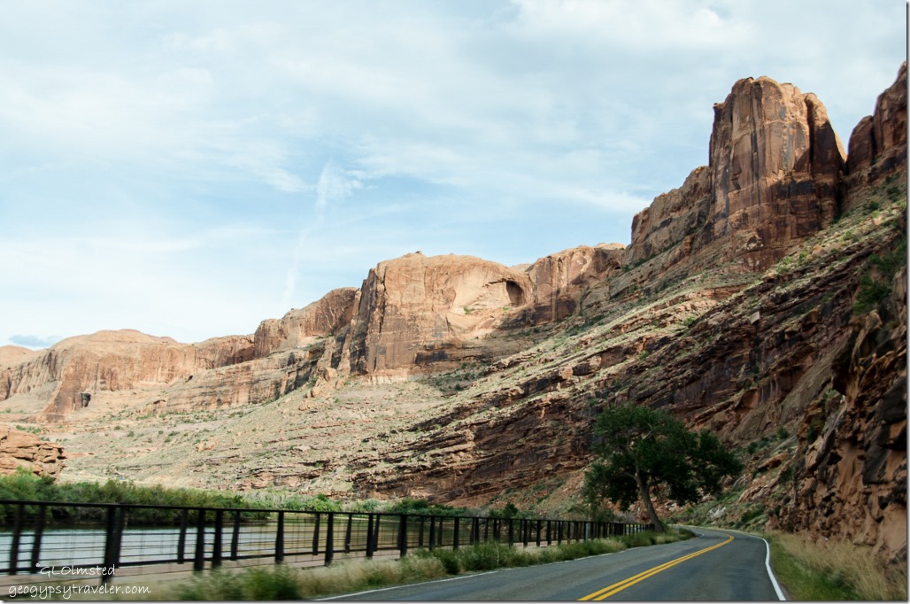
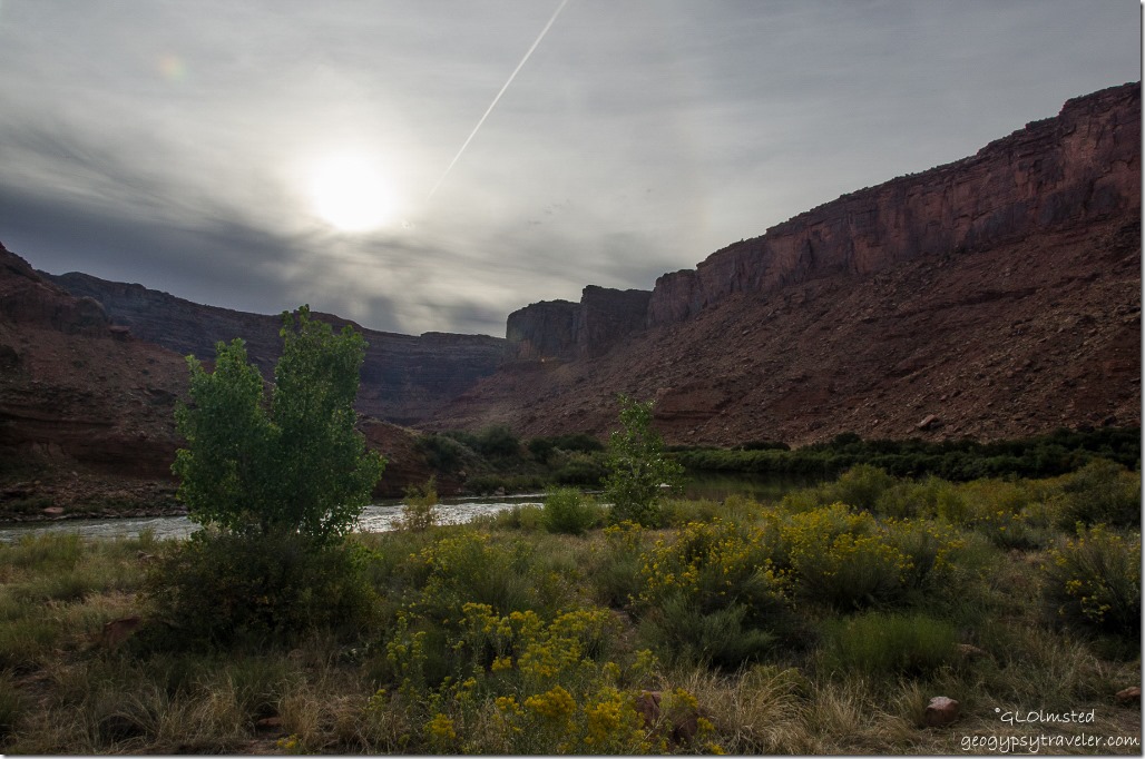
Colorado River UT128 Colorado Riverway Recreation Area UtahWe didn’t have much luck camping in national parks on this fall vacation and because Arches campground was full we went right outside the park to BLM (Bureau of Land Management) land and camped along the Colorado River at Big Bend Beach.

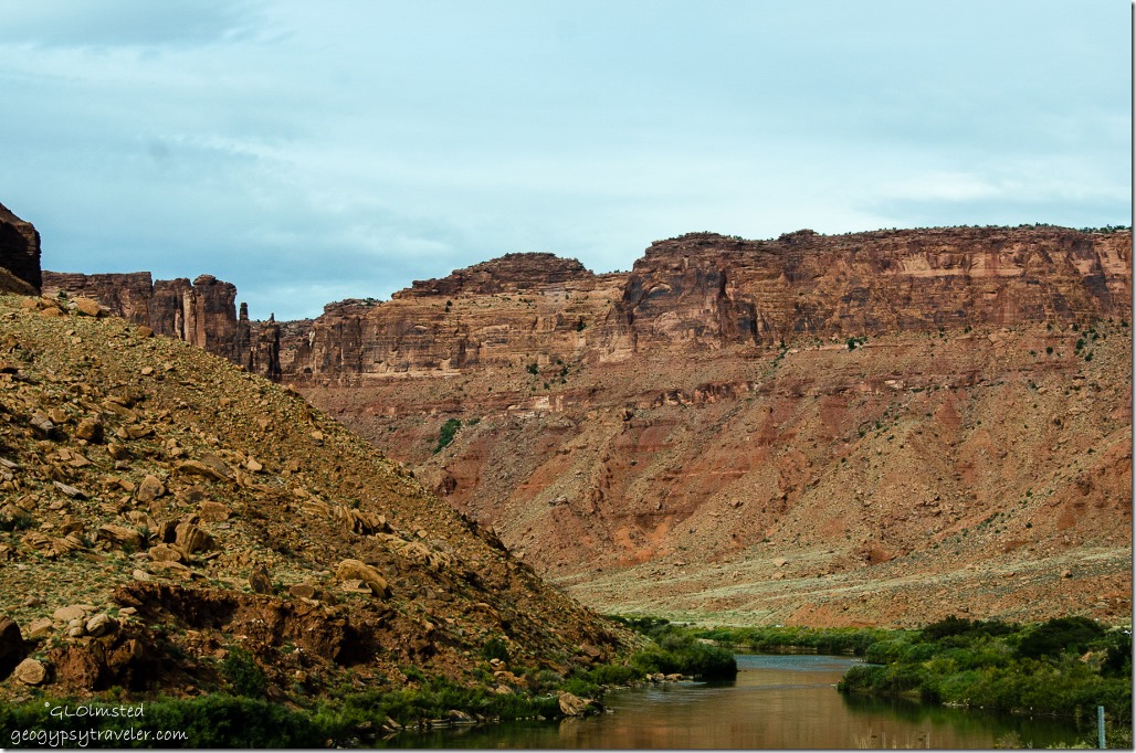
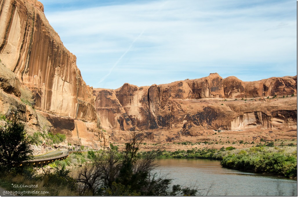
Colorado River UT128 Colorado Riverway Recreation Area UtahThere are seven campgrounds within 7.4 miles of US191.  Pulled into the first one and did the loop.  Full.  Second, third, fourth…you get the picture, all full.  Finally at the last one we got the last site.  And what a fantastic view of the Colorado River cutting through the towering sandstone bluffs.

Colorado River UT128 Colorado Riverway Recreation Area Big Bend Beach campground UtahSome of the sites look big enough for large RVs,  first come first serve, with picnic tables, drop-pit toilets and a few water spigots.  In fact BLM offers many “camps” along the Colorado Riverway further along UT128 30 miles to Dewey and on the southwest side of US191 on both sides of the river.  Paid half price with ‘Geezer’ card.

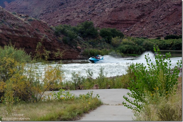
Boat on Colorado River Colorado Riverway Recreation Area Big Bend Beach campground UtahA loud noise caught my attention in this quiet landscape and a tour boat came whipping down stream full of smiling and screaming passengers.

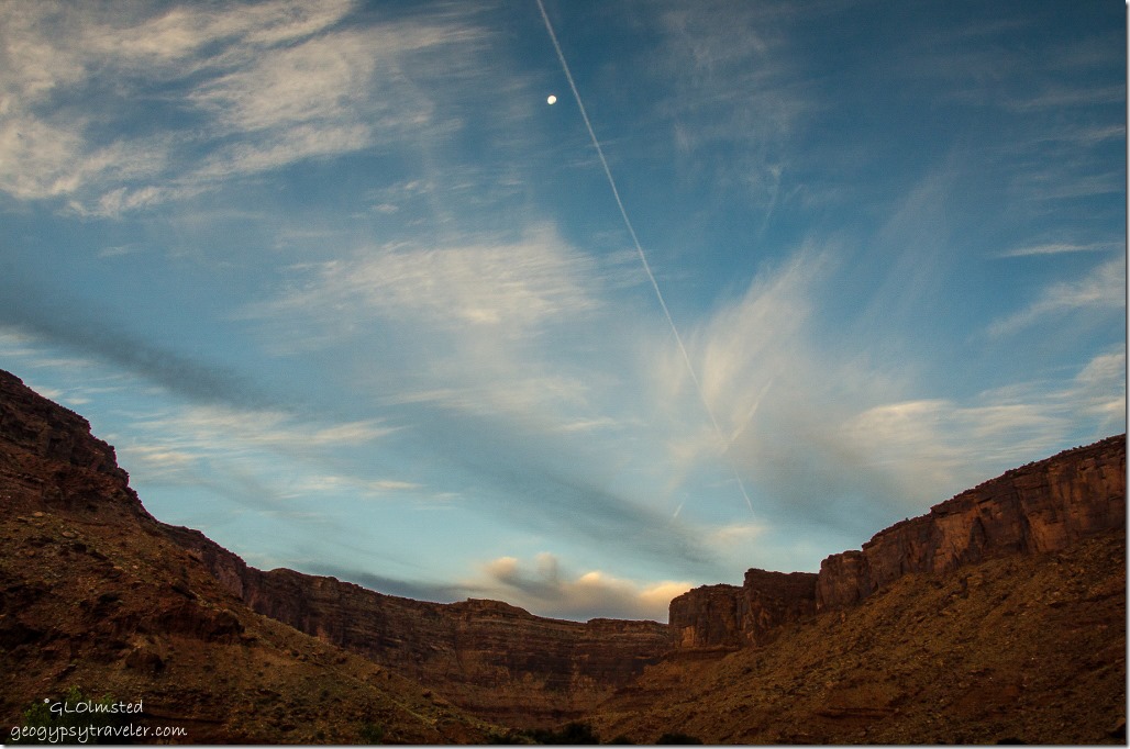
Morning light Colorado Riverway Recreation Area Big Bend Beach campground UtahWoke up to light slowly sliding down these steep canyon walls with the moon overhead.

Colorado River junction US191 and UT128 UtahPacked up camp, headed to US191 and turned north towards I70 where we’d go west to Green River on the way home to Kanab saying goodbye to the Colorado River.  We did take a long drive to Hanskville before crossing through Capitol Reef National Park on the way.  Our last day of vacation on the 1st of October.


Push my buttons!

  • Click to share on Facebook (Opens in new window) Facebook
  • Click to share on X (Opens in new window) X
  • Click to share on LinkedIn (Opens in new window) LinkedIn

Like this:

Like Loading...
Utah Big Bend Beach, BLM, camping, Colorado River 17 Comments
← Older posts
Newer posts →

Hi, I’m Gaelyn, the Geogypsy

I retired after 29 summer seasons as a Park Ranger, traveling solo for 40+ years. My passions include travel, connecting to nature, photography, and sharing stories.

I started exploring US National Parks in 1977 and 20 years later became a seasonal Park Ranger.  I’ve lived full-time in a RV for 30 years working summers and playing winters.  I’m still trying to figure out what I want to be when I grow old, other than grow up.

Let’s share our stories.  Here’s more of mine…

My wheeleastate

I am currently…

…boondocking somewhere in southern Arizona.  In the area, give a shout.

Geogypsytraveler on YouTube

Follow my journey on YouTube. Just click the pic. Hope you’ll like, share, and subscribe.

Click image for 7 minute documentary (Password “geogypsy” lowercase)

Making the Gypsy documentary is a story of its own.  Click below for the rest of the story.

Living nomadically & connecting to nature documentary

Subscribe to Blog via Email

Enter your email address to subscribe to this blog and receive notifications of new posts by email.

Photos available for sale include prints, greeting cards, coffee mugs, tote bags, phone cases and more

Reflected Wave 24X16 metal print under $100

Custom Coffee Mugs

Many items to choose from including prints

The Last Blast 24 x 16″ metal print under $100

Need a signal boost? When I boondock on public lands sometimes signal is weak or intermittent and a booster helps. Click the pic to visit WeBoost.

Connecting to nature and the rest of the world too.

Please contact me for photo purchases not seen at GLOlmsted Photography

Order fulfillment is by Fine Art America. If you’re not happy with your purchase, for any reason, simply return it within 30 days, and you’ll receive a full refund of the purchase price.

Why read Geogypsy?

The gypsy life spring-summer 1998 - "You were a real pioneer. RV'ing before it was cool." ...Yogi

How do you process photos? - “Your photographs create an Emotional feeling in the viewer...that they become One with You.” …Cindy

Life’s transitions between travel and work play - "I know you love your job as much as you love travel -- it shines through all your posts." ...Sallie

Lions at Kruger National Park - “Wonderful post, thank you. I was hooked start to finish!” … Peter B

11 lessons looking back 2013 - “A great post -- made me think, made me smile, made me want to cry." ...Sallie

Wildlife video Kruger National Park - “Gorgeous, this makes me want to go straight to South Africa now.” … Ayngelina

Living nomadically & connecting to nature documentary - “What an experience you had and gave to the "crew." Sometimes I think you don't realize how unique and inspiring you are.” …Alan

Search

Popular Posts

1. Prioritize the well-being of nature over photography. 2. Educate yourself about the places you photograph. 3. Reflect on the possible impact of your actions. 4. Use discretion if sharing locations. 5. Know and follow rules and regulations. 6. Always follow Leave No Trace principles and strive to leave places better than you found them. 7. Actively promote and educate others about these principles

Categories

Archives

Sites I follow, read & recommend

  • A Full-time Life
  • A Yankee in Belgrade
  • Bob's Eyes
  • Box Canyon Blog
  • Camels and Chocolate
  • Dawns bloggy blog
  • In the Direction of Our Dreams
  • Jane in her infinite wisdom
  • Janie and Steve, Utah Trails
  • Kathie's Birds
  • Las Adventuras
  • Memorable Meanders
  • Oh, The Places They Go
  • On the Road Abode
  • Port Elizabeth Daily Photo
  • Stillhowlyntravels
  • Take to the Highway
  • Technomadia
  • the good luck Duck
  • Travel with the Bayfield Bunch
  • Wandering Earl
  • Wheeling It
  • Yogi's Den

Caught in a Slot 9×12 canvas print under $50

If you don’t like what’s going on in your government, contact your Congress

Directory of Senators

Directory of Representatives

Lijit

© Copyright 2008-2024. Geogypsytraveler.com
%d