• Home
  • About Geogypsy
    • Herstory
    • Parks where I’ve worked
  • Places I’ve been
    • United States
      • Arizona
        • Antelope Slot Canyon
        • Casa Grande Ruins National Monument
        • Colossal Cave Mountain Park
        • Flagstaff
        • Glen Canyon National Recreation Area
        • Grand Canyon National Park
          • Grand Canyon National Park North Rim
          • Grand Canyon National Park South Rim
          • Toroweap
        • Havasu Canyon
        • Horseshoe Bend
        • Jerome
        • Kaibab National Forest
        • Lee’s Ferry
        • Meteor Crater
        • Navajo Bridge
        • Oak Creek Canyon
        • Painted Desert
        • Pipe Springs National Monument
        • Prescott
        • Quartzsite
        • Saguaro National Park
        • Sedona
        • Sunset Crater Volcano National Monument
        • Vermilion Cliffs
        • Walnut Canyon National Monument
        • Wupatki National Monument
        • Yarnell
      • California
        • Anzaberrego
        • Bakersfield
        • Death Valley National Park
        • Joshua Tree National Park
        • Redwoods NP
        • Salton Sea
        • Yucca Valley
      • Colorado
        • Mesa Verde National Park
      • Florida
      • Illinois
        • IL River
        • Morton Arboretum
        • Starved Rock State Park
      • Michigan
      • Nevada
      • New Mexico
      • Oregon
        • Crater Lake NP
        • Mt Hood
        • Oregon Caves National Monument
      • Texas
        • Alpine Texas
        • Padre Island
        • Port Isabel
        • Rio Grande Valley
      • Utah
        • Brian’s Head
        • Bryce Canyon National Park
        • Buckskin Gulch
        • Cedar Breaks National Monument
        • Cedar City
        • Coral Pink Sand Dunes State Park
        • Dixie National Forest
        • Grand Staircase Escalante National Monument
        • Johnson Canyon
        • Kanab
    • World Travels
      • Germany
      • Mexico
      • South Africa
  • Tours
  • Photography
  • Work with Me
    • Sponsors
  • Contact
Geogypsy
Menu
  • Home
  • About Geogypsy
    • Herstory
    • Parks where I’ve worked
  • Places I’ve been
    • United States
      • Arizona
        • Antelope Slot Canyon
        • Casa Grande Ruins National Monument
        • Colossal Cave Mountain Park
        • Flagstaff
        • Glen Canyon National Recreation Area
        • Grand Canyon National Park
          • Grand Canyon National Park North Rim
          • Grand Canyon National Park South Rim
          • Toroweap
        • Havasu Canyon
        • Horseshoe Bend
        • Jerome
        • Kaibab National Forest
        • Lee’s Ferry
        • Meteor Crater
        • Navajo Bridge
        • Oak Creek Canyon
        • Painted Desert
        • Pipe Springs National Monument
        • Prescott
        • Quartzsite
        • Saguaro National Park
        • Sedona
        • Sunset Crater Volcano National Monument
        • Vermilion Cliffs
        • Walnut Canyon National Monument
        • Wupatki National Monument
        • Yarnell
      • California
        • Anzaberrego
        • Bakersfield
        • Death Valley National Park
        • Joshua Tree National Park
        • Redwoods NP
        • Salton Sea
        • Yucca Valley
      • Colorado
        • Mesa Verde National Park
      • Florida
      • Illinois
        • IL River
        • Morton Arboretum
        • Starved Rock State Park
      • Michigan
      • Nevada
      • New Mexico
      • Oregon
        • Crater Lake NP
        • Mt Hood
        • Oregon Caves National Monument
      • Texas
        • Alpine Texas
        • Padre Island
        • Port Isabel
        • Rio Grande Valley
      • Utah
        • Brian’s Head
        • Bryce Canyon National Park
        • Buckskin Gulch
        • Cedar Breaks National Monument
        • Cedar City
        • Coral Pink Sand Dunes State Park
        • Dixie National Forest
        • Grand Staircase Escalante National Monument
        • Johnson Canyon
        • Kanab
    • World Travels
      • Germany
      • Mexico
      • South Africa
  • Tours
  • Photography
  • Work with Me
    • Sponsors
  • Contact

Category: Bryce Canyon National Park

13 August 2019

Bryce Canyon Hoodoo geology–the short version

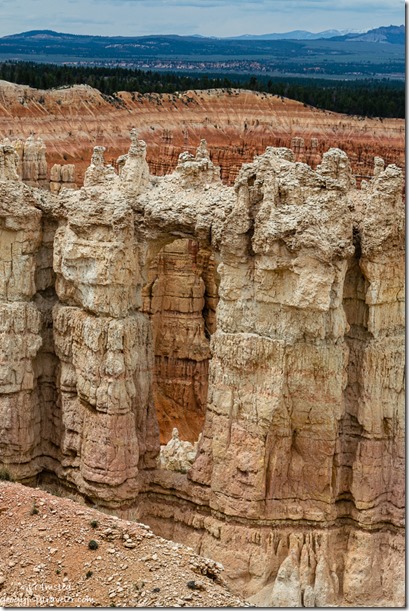
Wall of Windows hoodoos Rim Trail Bryce Canyon National Park UtahAs a Park Ranger at Bryce Canyon National Park I prepared and present a 20-minute Hoodoo geology talk several times a week.  Those crazy looking hoodoos is why people visit Bryce.

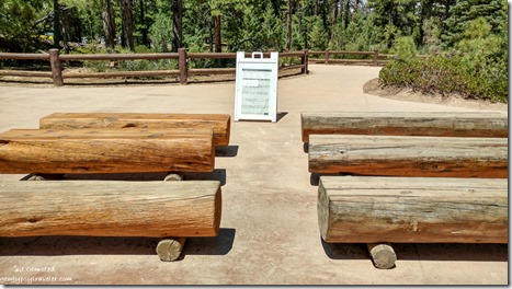
seating Sunset Point Bryce Canyon National Park UtahPhone shot

The audience area is located about 40 feet from Sunset Point and the Navajo Loop trailhead.  Seating is three double rows of wooden benches.  Depending on the time of day many visitors either hang out there to sit in shade, not attend a Ranger program, or hover nearby along a fence under a shade tree.  It’s awkward.
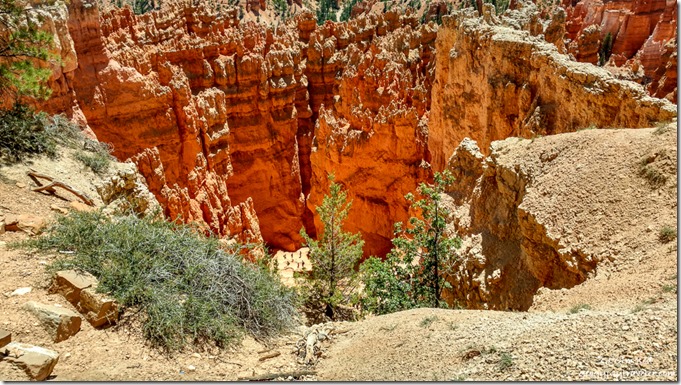
Wall Street Sunset Point Bryce Canyon National Park UtahLook closely for people on the Wall Street trail (phone shot)
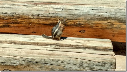
Ground squirrel on bench Sunset Point Bryce Canyon National Park UtahGolden Mantled Ground Squirrel attending program (phone shot)

Plus, the fenced area along the amphitheater’s rim looks down on the popular Wall Street side of the Navajo Loop trail.  In addition, the Sunset parking lot is where tour buses disgorge their hordes of mostly international visitors so the overlook fills quickly and frequently.  Have I mentioned that 65% of Bryce’s visitors are international.  Some people speak English better than others, some not at all.  Always interesting to explain things like not feeding, or putting your fingers near, wildlife like chipmunks and ground squirrels who having been fed are way too friendly with people.  Part of my job is to haze the critters away from people, basically stomp my feet and act intimidating.  Doesn’t work well or for long.  But I digress…
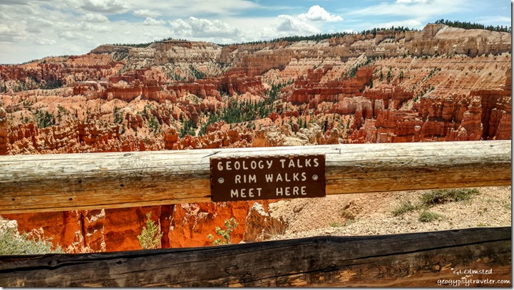
sign Sunset Point view South Bryce Canyon National Park UtahView above Wall Street (phone shot)

I get to my presentation area about 15 minutes before start time, right now advertised at 11am or 2pm.  Sometimes it’s difficult to tell if anybody is there for a Ranger program.  So I chat with folks asking where they are from, and take it from there.  Knowing where visitors live in regards to elevation usually tells me I need to make altitude sickness and dehydration my safety talk before getting down to hoodoo geology.

Depending on the season and weather I often add a reminder to stay away from the rim during a nearby lightning storm recommending a vehicle or building as the safest place to be.  When thunder roars, go indoors.  When you see the flash of a lightning bolt, you can start counting seconds, “One-Mississippi, two-Mississippi, three-Mississippi…”  Sound travels 1 mile in roughly 5 seconds and you should be at least 10 miles away from lightning.  Finally with small talk and safety message done, usually more people have joined because there’s a Ranger talking.
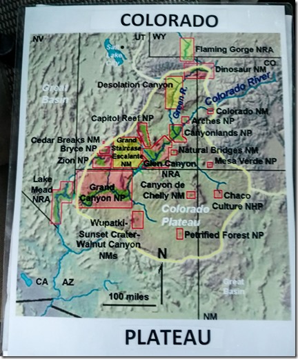
map Colorado Plateau Image shared with audience

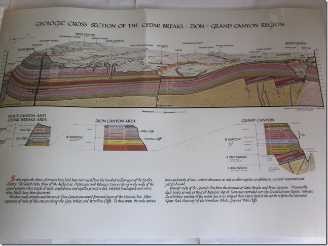
geologic cross section of the Cedar Breaks Zion Grand Canyon region(borrowed from the internet, although I own the poster and use it in another geology talk)  

I’m going to talk about how these crazy looking rocks called hoodoos were both created and destroyed by water.  But first let’s put Bryce Canyon National Park in perspective on the Colorado Plateau.  Going back about 85-60 mya (million years ago) the continent was smaller, no California, and closer to the equator.  The floor of the Pacific Ocean, on a separate tectonic plate than the continent, bumped into the continent and subducted below the continental crust.  It’s hot down there so that rock melted, became buoyant, and lifted a land mass of 240,000 square miles that straddles some of Utah, Arizona, New Mexico, and Colorado at The Four Corners.  The slow uplift went from sea level up 7,000 to 10,000 feet with almost a mile of sedimentary rock deposits from oceans, lakes, dunes, estuaries and rivers.
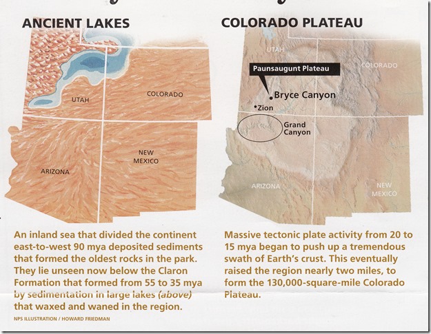
ancient lakes on Colorado Plateau(NPS illustration)

About 60 mya in this location, a dip in the land allowed for a lake to fill.  When the tiny creatures living in the lake died their bones and shells fell to the lake bottom, built up, and were compressed into limestone.  Rivers and streams flowed into the lake sometimes bringing mud, or sand which was also lithified, or turned into rock, mudstone or shale, sandstone, and then more limestone.  Over millions of years the deposits built up to at least 2000 feet thick.
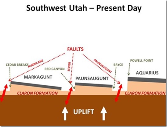
normal faults between Sevier and Paunsaugunt(borrowed from the internet, I use my fists to demonstrate normal faulting)

Then, about 16-6 mya, three blocks of land with faults between broke apart leaving the Aquarius Plateau in the east, a valley where the Paria River flows, the Paunsaungunt Plateau where Bryce is, the Sevier River Valley, and the Markagunt Plateau to the west.  The Paunsaungunt is about 1000 to 2000 feet lower than the other two plateaus.  Yet the lake deposits are the same so hoodoos can also be seen at Cedar Breaks National Monument, just in smaller concentration than Bryce.  Imagine all the shaking of the earth during this faulting.
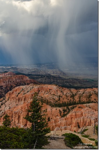
trees hoodoos valley sunset storm clouds from Bryce Point Bryce Canyon National Park Utah

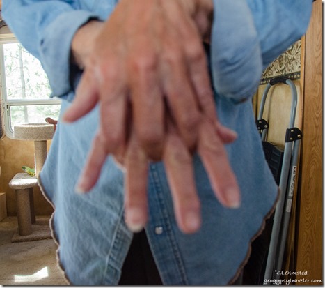
hand demo headward erosion I most often use my hands to demonstrate (lousy hand selfie)

OK, now on to the formation of hoodoos.  Bryce receives about 16 inches of precipitation a year.  Water flows off the plateau following the line of least resistance and finds cracks and fractures.  The water erodes the land backwards, called headward erosion, and leaves walls of rock.  The rate of erosion is about one foot every 50 years.  That’s fast.  In some areas of the park old rim trails are closed and new railings are parallel to the old because of that fast rate of erosion.  Think about it, 50 years compared to the 85 million years where I started this story.
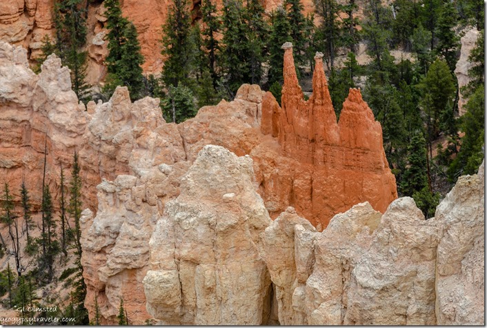
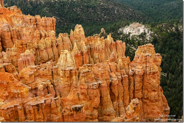
trees hoodoos from rim trail near Inspiration Point Bryce Point Bryce Canyon National Park UtahNote the skinny hoodoos still have some gray dolomite cap rock

hoodoo formationI use my hands for this demonstration also (borrowed from internet)

Now, there are walls of fractured, soft, sedimentary rock – mostly limestone with intermittent layers of sandstone and mudstone – and they are capped by dolomite, a harder layer of limestone which protects the softer layers below, for a while anyway.  Sort of like me wearing a hat that keeps my glasses dry in the rain.  The narrowest area is the softest mudstone.  At 8000 feet in elevation, Bryce receives about 200 nights below freezing.  When the water in the vertical cracks in the walls freezes it expands forcing the rocks apart, called frost wedging.  Over time the wall can become a window.  Eventually the cap rock falls and leaves pillars of rock standing side by side.  Then erosion from wind, rain and snow softens the shapes into hoodoos.  But they don’t stand forever, slowly shrinking into a rounded pile of dirt.  The average life of a hoodoo is 2000 years.
Hoodoos Ponderosa Point Bryce Canyon National Park Utah

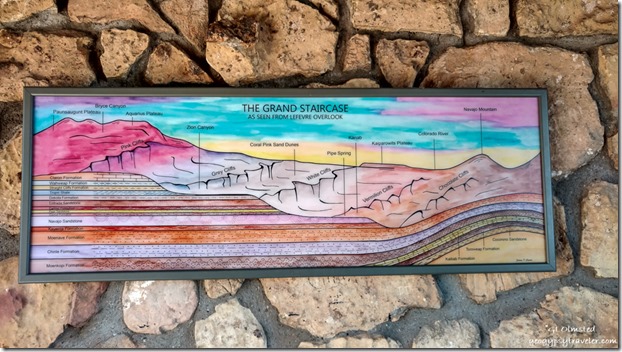
painting Grand Staircase Le Fevre overlook Kaibab National Forest ArizonaGrand Staircase painting at Le Fevre overlook Kaibab NF AZ

But what about the color?  In the early 1870s, geologist Clarence Dutton named these rocks at the top of the Grand Staircase the Pink Cliffs, also known as the Claron Formation.  I struggle with pink, seeing mostly shades of orange.  Maybe Clarence saw them in a different light, or maybe he was colorblind.  Iron is present in the sediments and oxidation makes for the colors.
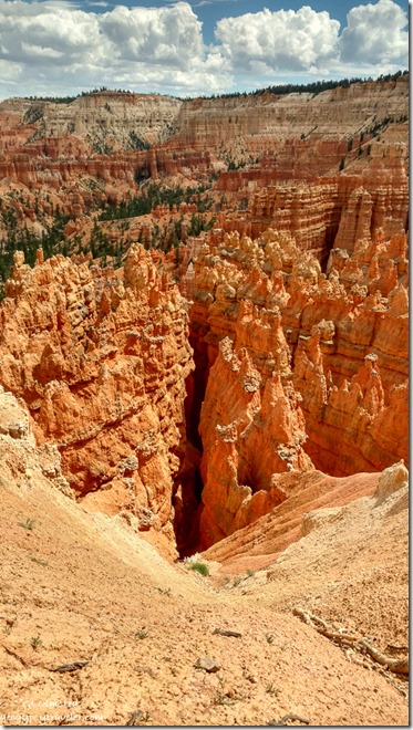
hoodoos Silent City clouds Bryce Canyon National Park UtahWalls of hoodoos in the Silent City (phone shot)

The word Hoodoos is fun to say, go ahead ‘who-do’.  I have discovered different origins for hoodoo.  Coming from the southeastern US where 1800s African slaves practiced a folk magic called hoodoo.  One band of native Paiute tell a story of the rocks being bad people turned to stone by the trickster coyote.  Yet when recently talking to a group of Paiute youth with elders I was told the word is ‘oodoo’ – no “h” – and means neither bad nor good.
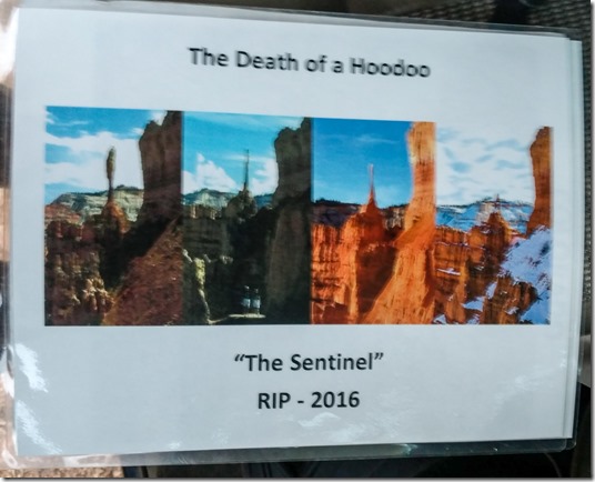
shrinking Sentinel hoodoo Bryce Canyon National Park UtahThe once famous Sentinel hoodoo over ten years time was struck by lightning

So, hoodoos come and hoodoos go, all created by and destroyed by water.  Headward erosion will continue to create walls until there is no plateau left.  Of course, not in our lifetimes.  Changing climate may also change the rate of frost wedging.  Will there be a Bryce Canyon National Park someday in the geologic future?
inside pocketThe above is one out 1100 photos of the inside of my back pocket from my phone the day I took many of the above photos and presented my talk about Hoodoo geology.  Oops.  Kind of a fun pattern though.

Push my buttons!

  • Click to share on Facebook (Opens in new window) Facebook
  • Click to share on X (Opens in new window) X
  • Click to share on LinkedIn (Opens in new window) LinkedIn

Like this:

Like Loading...
Bryce Canyon National Park, Utah geology, hoodoos 29 Comments
06 August 2019

Walk with me under the Bryce Canyon full moon hoodoos

I hadn’t photographed the full moon since May, too many clouds in June, July looked good so I started to make a plan to shoot Bryce Canyon full moon hoodoos, and it worked.  I took lots of photos.  Hope you’re ready.

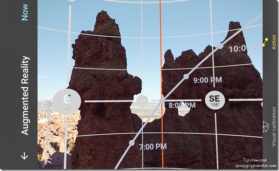
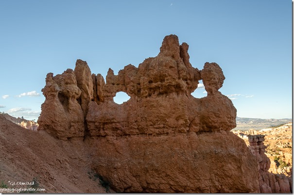
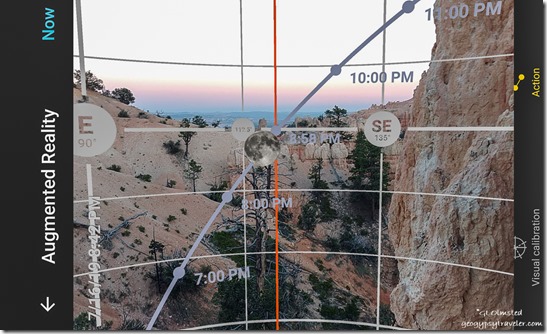
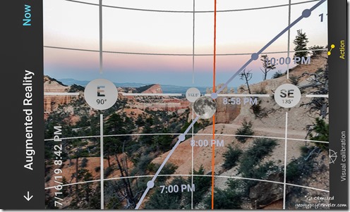
windows mask hoodoos Navajo Loop Trail Bryce Canyon National Park UtahI’m still learning to use the Photo Pills app ahead of time for some idea of time, degrees, and direction of rise (or set) from different locations.  Plus considering which trail to get down into the hoodoos without too much distance and drop.

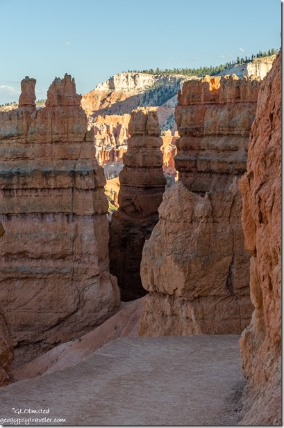
Hoodoos last light Navajo Loop Trail Bryce Canyon National Park UtahI started down the Navajo Loop Trail about 7:15 for the 8:10 moonrise and maybe the 8:50 sunset.

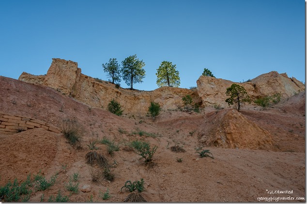
looking up Navajo Loop Trail Bryce Canyon National Park UtahLooking up from four switchbacks down

Couldn’t believe how many people clustered along the rim and top of the trailhead at the mostly eastern “Sunset Point” view.

hoodoos Wall Street Bryce Canyon National Park UtahWallstreet, the other side of the Navajo Loop Trail

A few folks passed me still huffing up the trail, many carrying no water.  They may have done the 1.3 mile loop, 357 feet up in .7miles.  Not for me tonight.

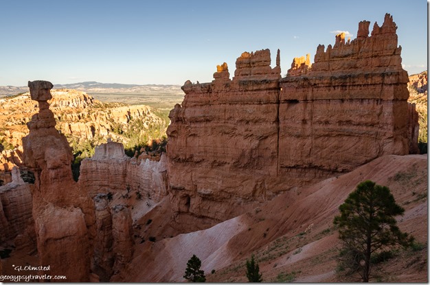
Thors Hammer hoodoos late light Navajo Loop Trail Bryce Canyon National Park UtahI kept checking Photo Pills against the real time landscape.

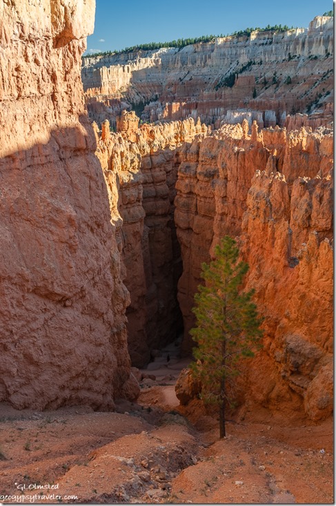
windows Navajo Loop Trail Bryce Canyon National Park Utah

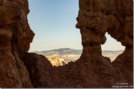
view through Hoodoo windows Navajo Loop Trail Bryce Canyon National Park UtahAt first I was sure I’d get the moon rise through one of the windows in a formation I call the mask.  But alas, the app was out of calibration.

Hoodoos full moon rise last light Navajo Loop Trail Bryce Canyon National Park UtahYet I knew it was close and went for a backup plan.  Wherever the moon would rise I’d surely find a good hoodoo foreground.

late light hoodoos Sunset Point Bryce Canyon National Park UtahHad to keep moving up and down the trail because the gnats/noseeums were driving me crazy, and ultimately ate me alive leaving terrible welts that got hard bumps and blisters.  Brutal.  A reaction I’d never experienced before, and hope not to again.

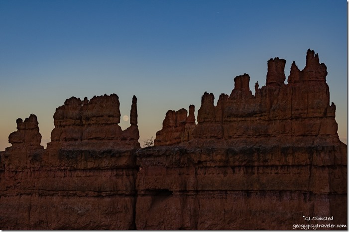
Hoodoos full moon rise last light Navajo Loop Trail Bryce Canyon National Park Utah

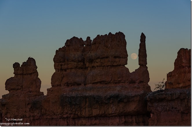
Hoodoos full moon rise last light Navajo Loop Trail Bryce Canyon National Park Utah

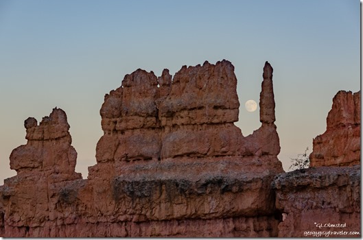
Hoodoos full moon rise last light Navajo Loop Trail Bryce Canyon National Park Utah

Hoodoos full moon rise last light Navajo Loop Trail Bryce Canyon National Park UtahHoodoos full moon rise last light Navajo Loop Trail Bryce Canyon National Park Utah

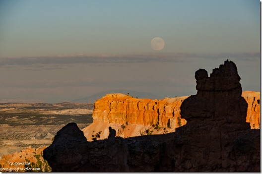
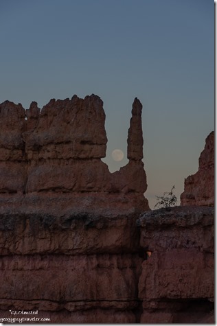
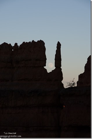
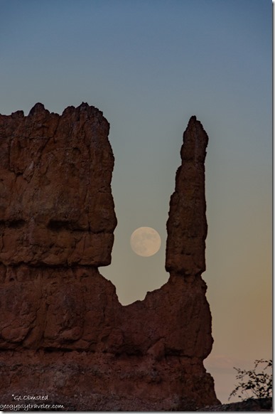
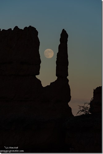
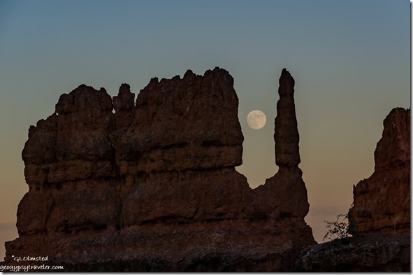
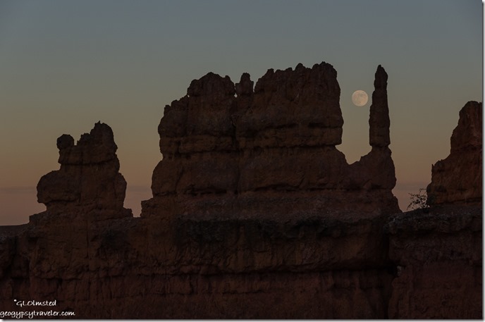
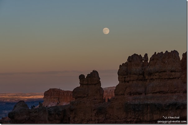
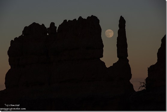
Hoodoos full moon rise sunset Navajo Loop Trail Bryce Canyon National Park UtahWith a bit of haze on the horizon I didn’t get the actual moon rise but I did get some fun shots of the full moon with the magical shapes of hoodoos.  I saw a person reading a book and someone else said a knight holding a staff or sword.  What do you see?

Hoodoos full moon rise sunset Navajo Loop Trail Bryce Canyon National Park Utah

Hoodoos full moon rise sunset Navajo Loop Trail Bryce Canyon National Park Utah

Hoodoos full moon rise sunset Navajo Loop Trail Bryce Canyon National Park UtahHoodoo is a word derived from late 1800 African Americans in the southeastern United States meaning “folk magic”.  I can’t find out who actually named these crazily carved and magical shaped rocks.  Zoomed in and zoomed out.

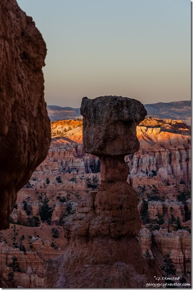
Thors Hammer last light Navajo Loop Trail Bryce Canyon National Park UtahA different view than from the top of the iconic Thor’s Hammer hoodoo.

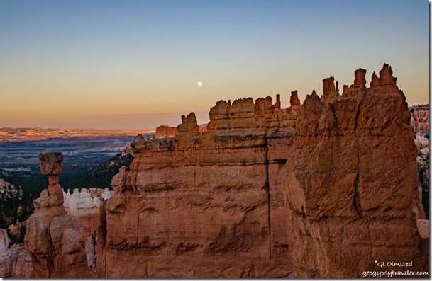
Thors Hammer Hoodoos valley last light full moon rise sunset Navajo Loop Trail Bryce Canyon National Park Utah

Hoodoos full moon rise sunset Navajo Loop Trail Bryce Canyon National Park UtahI had so much fun.

sunset distant view full moon Bryce Canyon National Park UtahAfter my shoot on the climb up to the rim I stopped a young boy, maybe tweenage, from driving his remote control 18-inch car down the trail.  No motorized vehicles allowed.  Even though I wasn’t in uniform, told him I was a Ranger, and he asked if he could drive it back up and I said “no, carry it.”  Which he did with no other response.  Where were his parents?

last light view East from Fairyland Point Bryce Canyon National Park Utah

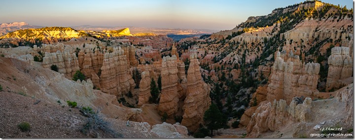
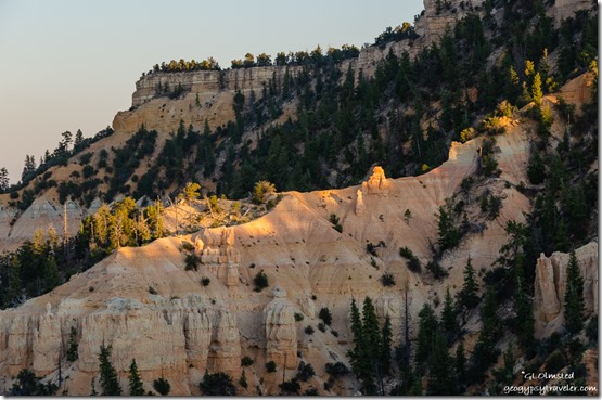
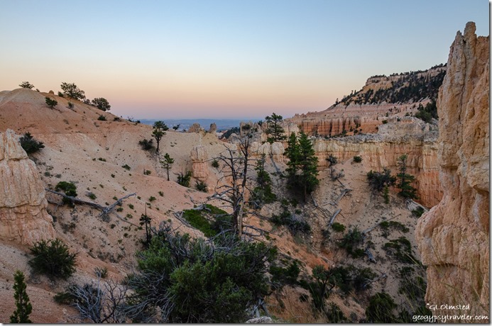
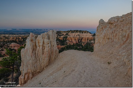
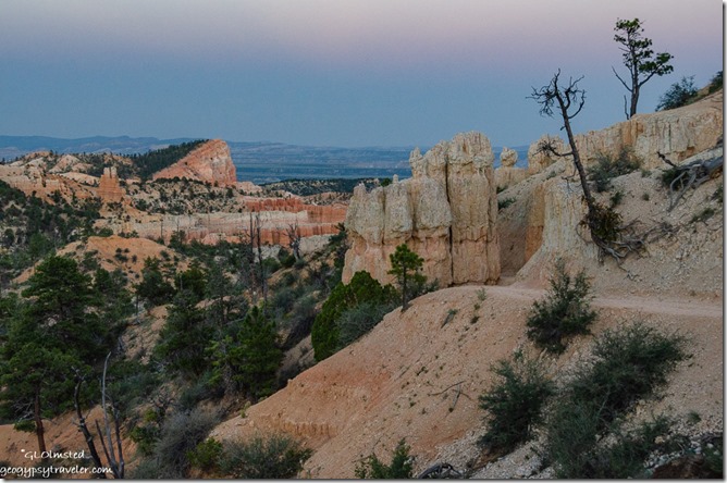
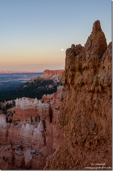
last light on hoodoos Boat Mesa from Fairland Point Bryce Canyon National Park UtahTo avoid crowds and for someplace different, the next night I went to Fairyland Point.  For the first time I found a place to park in the tiny lot.  Arrived at 8:25 for an 8:49 sunset and 8:58 moon rise.

last light Fairyland Loop Trail Bryce Canyon National Park Utah

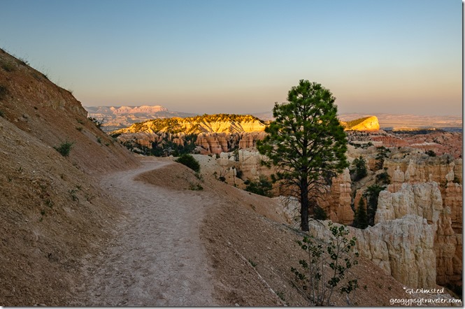
last light Sinking Ship from Fairyland Loop Trail Bryce Canyon National Park UtahThe trail had obviously been walked on when wet and was lumpy and uneven which made for unsteady slow walking.  I should have brought my tripod and used it as a walking stick.  Thank goodness a light breeze kept most of the bugs away.

trees hoodoos sunset Fairyland Loop Trail Bryce Canyon National Park Utah

trees hoodoos Earth Shadow from Fairyland Loop Trail Bryce Canyon National Park UtahScoped a couple places out with Photo Pills but didn’t feel like I could trust it 100% even with recalibrating the previous night.

reverse sunset Fairyland Loop Trail Bryce Canyon National Park Utah

hoodoos sunset Fairyland Loop Trail Bryce Canyon National Park Utah

trees hoodoos Sinking Ship sunset Fairyland Loop Trail Bryce Canyon National Park UtahI would have had to walk a little further than I wanted to get below the hoodoos for the shots I imagined.  But with the hazy horizon I didn’t catch the first rise anyway.

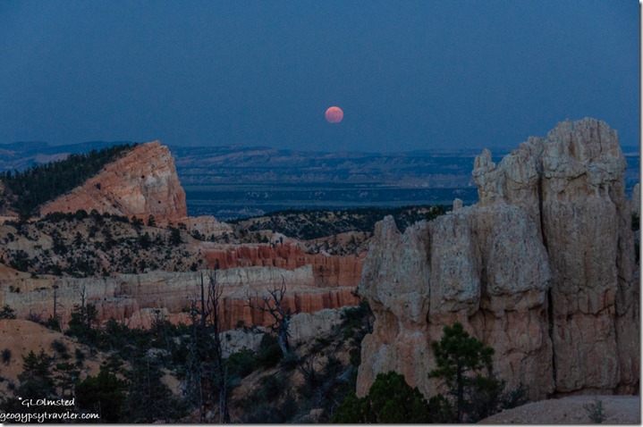
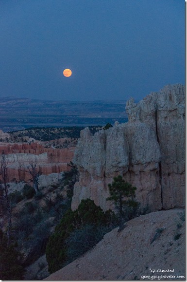
Sinking Ship Hoodoos valley full moon from Fairyland Loop Trail Bryce Canyon National Park UtahA young woman and her “Sherpa” coming up the trail with “$1000s in camera gear” hadn’t even seen the full moon.  She joined me setting up her tripod.  Hope she got some better shots than I did as darkness deepened.

full moon hoodoos Fairyland Loop Trail Bryce Canyon National Park UtahI like to walk a trail under full moon light, to see the shadows, and wished for my tripod to take more photos.

Hoodoos full moon rise sunset Navajo Loop Trail Bryce Canyon National Park UtahProcessing these shots took a lot of time, going from silhouette to pulled shadows for a little more color.  I most time preferred the dark silhouette.  How about you?

Hoodoos full moon reverse sunset Navajo Loop Trail Bryce Canyon National Park UtahThis experience gave me the idea for a Shooting the light full moon walk about balance in nature, photography, and life.  Possibly in September.

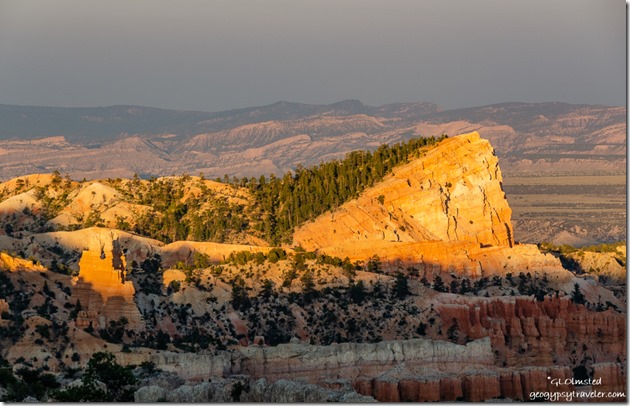
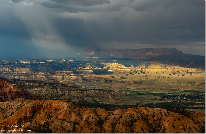
red hills Tropic valley Blue Cliffs Aquarius Plateau sunrays rainbow storm clouds from Bryce Pt Bryce Canyon National Park UtahBut now that monsoon has finally arrived it’s rather hit or miss for clear skies to full clouds.  Yet I’m still working on a plan for August Bryce Canyon full moon hoodoos.  I’m off work the 14th for an 8:17 moon rise five minutes before sunset.  My work schedule on the 15th has me closing the visitor center at 8pm so I’ll probably miss the 8:20 sunset but should be able to make the 8:51 moon rise somewhere behind the hoodoos.

Push my buttons!

  • Click to share on Facebook (Opens in new window) Facebook
  • Click to share on X (Opens in new window) X
  • Click to share on LinkedIn (Opens in new window) LinkedIn

Like this:

Like Loading...
Bryce Canyon National Park, full moon, Utah Bryce Canyon NP, full moon, hoodoos, trails, Utah 33 Comments
30 July 2019

Shopping road trip Bryce Canyon to Cedar City, and back

In early July there was still construction on SR12 to the west so also a slight delay for my morning road trip from Bryce Canyon to Cedar City for a long day of shopping.  Only the first of several incidents for the day.

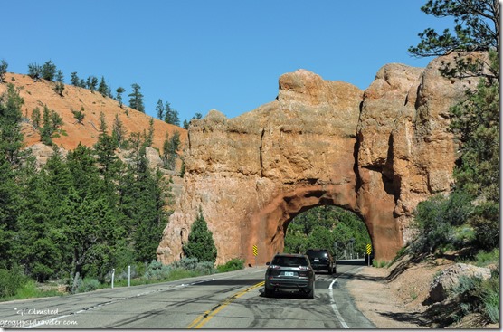
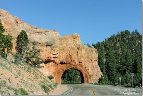
cars arch SR12 West Red Canyon Dixie National Forest UtahYet it’s always pretty driving through Red Canyon and their blasted-tunnel arches.  Not a bad place to be stuck in construction traffic.

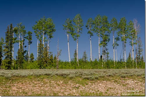
aspen SR14 Dixie National Forest Utah

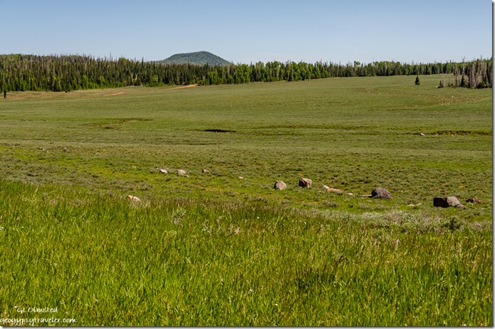
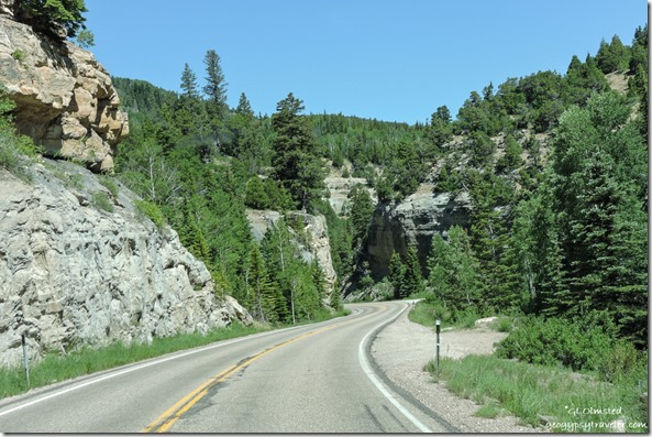
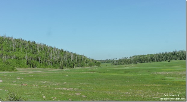
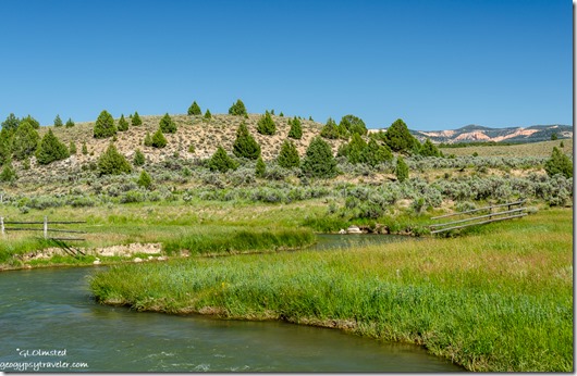
meadow trees mountain SR14 Dixie National Forest UtahPlus the rest of the drive is scenic and I do like the curvy State Route 14 through a lava field, past the aspen (making note for fall color), and meadows with some flowers.

Past the Cedar Breaks National Monument turnoff, a literally cool location at almost 10,000 feet, and a tempting side trip for another time.

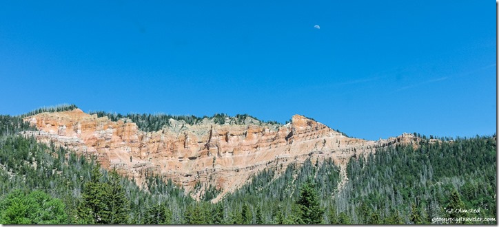
red cliffs trees moon SR14 Dixie National Forest UtahThen descending with a quick peak back at some hoodoos.

cliffs trees SR14 Dixie National Forest Utah

cliffs trees SR14 Dixie National Forest Utah

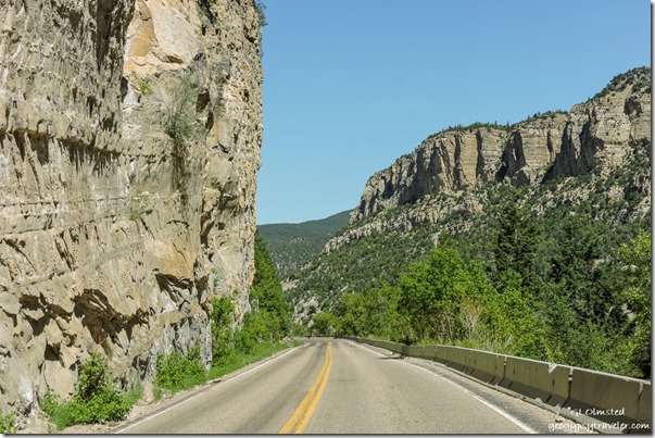
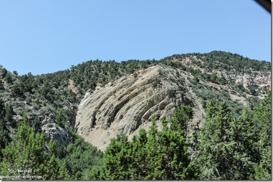
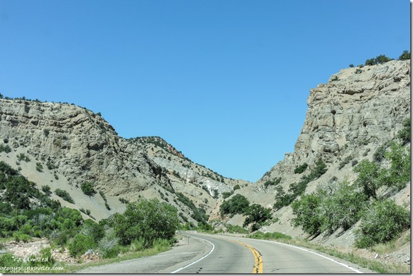
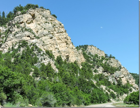
cliffs trees SR14 Dixie National Forest UtahThrough more curves surrounded by towering cliffs and some interesting looking geology.

cliffs trees SR14 Dixie National Forest UtahUntil many curves later and 5,000 feet lower Cedar City came into sight.

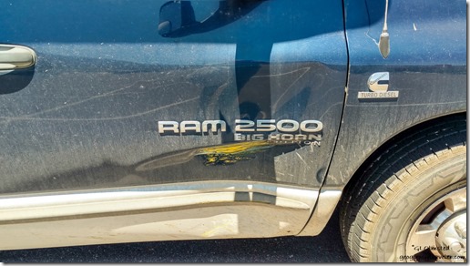
crunch on truck Cedar City UtahNow I’m not keen on shopping in big towns but sometimes the list gets long, so once a month I bite the bullet and then have several stops to make.  Pulling into a parking lot with a huge dip knocked off part of the sewer attachment, no leakage, and I was able to retrieve the piece. Second time this has happened but this time not as serious. Then, I creamed the passenger door on a short yellow cement post and left a crease.  The first mark I’ve put in this ole gal. Door still opens.

chicken Tom Yum soup Pad Thai & Satay at Sweet Basil Cedar City UtahThings got better after that with a delicious Thai lunch at Sweet Basil.  The best part about going to town is eating out.  Oh, and fresh produce.

cliffs trees moon SR14 Dixie National Forest UtahFinally after too many hours shopping I headed back on the pretty scenic drive with a waxing moon hanging over the landscape of Cedar Canyon.

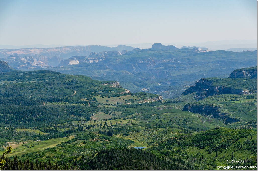
Grand Staircase view South SR14 Dixie National Forest UtahMade a stop at the Grand Staircase viewpoint.  Sadly a bit hazy (could be smoke) to see the entire 80 miles south to the Kaibab Plateau.  However this is an interesting perspective of Zion’s white cliffs about 55 miles away.

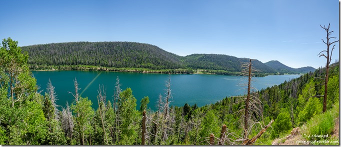
Navajo Lake mountain Dixie National Forest UtahAlso stopped at the Navajo Lake overlook showing the lake fuller than I’ve ever seen with even the dike underwater.  Appeared to be quite a few campers along the far shore.

flowers meadow trees SR14 Dixie National Forest UtahBack past the lava flow which I’d like to spend more time exploring.  But as it was getting late enough I whizzed on by.   Thought about a side trip into Cedar Breaks for wildflowers but just didn’t seem like enough blooms yet.  I’ve heard they are in full bloom now so may return.

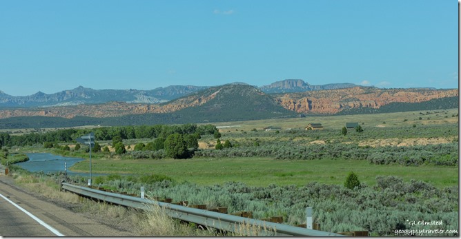
Sevier River meadows Paunsaungunt Plateau SR89 UtahI did explore a side road, maybe a piece of old SR89, I’ve been eyeballing for a while.

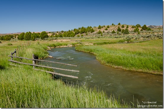
fence meadow Sevier River UtahRuns along the Sevier River as it winds like a serpent across meadows and through fenced grazing lands with views east of the Paunsaugunt Plateau where I live, work, and play.

fence meadow Sevier River UtahI always enjoy the rarity of seeing water in the Southwest.

arch red rock trees SR12 East Red Canyon Dixie National Forest Utah

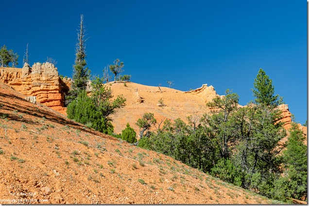
hoodoos trees SR12 stopped for construction Red Canyon Dixie National Forest UtahThen back through Red Canyon, the arches, and the construction wait which gave me time to take a few photos out the truck window.

Sierra cat bag of thrift store clothesIt was a long day driving two hours each direction from Bryce Canyon to Cedar City plus way too much time shopping.  But Sierra seemed to approve of my thrift store purchases.

Push my buttons!

  • Click to share on Facebook (Opens in new window) Facebook
  • Click to share on X (Opens in new window) X
  • Click to share on LinkedIn (Opens in new window) LinkedIn

Like this:

Like Loading...
Bryce Canyon National Park, Cedar City, Utah road trip, shopping, SR14 20 Comments
← Older posts
Newer posts →

Hi, I’m Gaelyn, the Geogypsy

I retired after 29 summer seasons as a Park Ranger, traveling solo for 40+ years. My passions include travel, connecting to nature, photography, and sharing stories.

I started exploring US National Parks in 1977 and 20 years later became a seasonal Park Ranger.  I’ve lived full-time in a RV for 30 years working summers and playing winters.  I’m still trying to figure out what I want to be when I grow old, other than grow up.

Let’s share our stories.  Here’s more of mine…

My wheeleastate

I am currently…

…boondocking somewhere in southern Arizona.  In the area, give a shout.

Geogypsytraveler on YouTube

Follow my journey on YouTube. Just click the pic. Hope you’ll like, share, and subscribe.

Click image for 7 minute documentary (Password “geogypsy” lowercase)

Making the Gypsy documentary is a story of its own.  Click below for the rest of the story.

Living nomadically & connecting to nature documentary

Subscribe to Blog via Email

Enter your email address to subscribe to this blog and receive notifications of new posts by email.

Photos available for sale include prints, greeting cards, coffee mugs, tote bags, phone cases and more

Reflected Wave 24X16 metal print under $100

Custom Coffee Mugs

Many items to choose from including prints

The Last Blast 24 x 16″ metal print under $100

Need a signal boost? When I boondock on public lands sometimes signal is weak or intermittent and a booster helps. Click the pic to visit WeBoost.

Connecting to nature and the rest of the world too.

Please contact me for photo purchases not seen at GLOlmsted Photography

Order fulfillment is by Fine Art America. If you’re not happy with your purchase, for any reason, simply return it within 30 days, and you’ll receive a full refund of the purchase price.

Why read Geogypsy?

The gypsy life spring-summer 1998 - "You were a real pioneer. RV'ing before it was cool." ...Yogi

How do you process photos? - “Your photographs create an Emotional feeling in the viewer...that they become One with You.” …Cindy

Life’s transitions between travel and work play - "I know you love your job as much as you love travel -- it shines through all your posts." ...Sallie

Lions at Kruger National Park - “Wonderful post, thank you. I was hooked start to finish!” … Peter B

11 lessons looking back 2013 - “A great post -- made me think, made me smile, made me want to cry." ...Sallie

Wildlife video Kruger National Park - “Gorgeous, this makes me want to go straight to South Africa now.” … Ayngelina

Living nomadically & connecting to nature documentary - “What an experience you had and gave to the "crew." Sometimes I think you don't realize how unique and inspiring you are.” …Alan

Search

Popular Posts

1. Prioritize the well-being of nature over photography. 2. Educate yourself about the places you photograph. 3. Reflect on the possible impact of your actions. 4. Use discretion if sharing locations. 5. Know and follow rules and regulations. 6. Always follow Leave No Trace principles and strive to leave places better than you found them. 7. Actively promote and educate others about these principles
Categories

Archives

Sites I follow, read & recommend

  • A Full-time Life
  • A Yankee in Belgrade
  • Bob's Eyes
  • Box Canyon Blog
  • Camels and Chocolate
  • Dawns bloggy blog
  • In the Direction of Our Dreams
  • Jane in her infinite wisdom
  • Janie and Steve, Utah Trails
  • Kathie's Birds
  • Las Adventuras
  • Memorable Meanders
  • Oh, The Places They Go
  • On the Road Abode
  • Port Elizabeth Daily Photo
  • Stillhowlyntravels
  • Take to the Highway
  • Technomadia
  • the good luck Duck
  • Travel with the Bayfield Bunch
  • Wandering Earl
  • Wheeling It
  • Yogi's Den

Caught in a Slot 9×12 canvas print under $50

If you don’t like what’s going on in your government, contact your Congress

Directory of Senators

Directory of Representatives

Lijit

© Copyright 2008-2024. Geogypsytraveler.com
%d