• Home
  • About Geogypsy
    • Herstory
    • Parks where I’ve worked
  • Places I’ve been
    • United States
      • Arizona
        • Antelope Slot Canyon
        • Casa Grande Ruins National Monument
        • Colossal Cave Mountain Park
        • Flagstaff
        • Glen Canyon National Recreation Area
        • Grand Canyon National Park
          • Grand Canyon National Park North Rim
          • Grand Canyon National Park South Rim
          • Toroweap
        • Havasu Canyon
        • Horseshoe Bend
        • Jerome
        • Kaibab National Forest
        • Lee’s Ferry
        • Meteor Crater
        • Navajo Bridge
        • Oak Creek Canyon
        • Painted Desert
        • Pipe Springs National Monument
        • Prescott
        • Quartzsite
        • Saguaro National Park
        • Sedona
        • Sunset Crater Volcano National Monument
        • Vermilion Cliffs
        • Walnut Canyon National Monument
        • Wupatki National Monument
        • Yarnell
      • California
        • Anzaberrego
        • Bakersfield
        • Death Valley National Park
        • Joshua Tree National Park
        • Redwoods NP
        • Salton Sea
        • Yucca Valley
      • Colorado
        • Mesa Verde National Park
      • Florida
      • Illinois
        • IL River
        • Morton Arboretum
        • Starved Rock State Park
      • Michigan
      • Nevada
      • New Mexico
      • Oregon
        • Crater Lake NP
        • Mt Hood
        • Oregon Caves National Monument
      • Texas
        • Alpine Texas
        • Padre Island
        • Port Isabel
        • Rio Grande Valley
      • Utah
        • Brian’s Head
        • Bryce Canyon National Park
        • Buckskin Gulch
        • Cedar Breaks National Monument
        • Cedar City
        • Coral Pink Sand Dunes State Park
        • Dixie National Forest
        • Grand Staircase Escalante National Monument
        • Johnson Canyon
        • Kanab
    • World Travels
      • Germany
      • Mexico
      • South Africa
  • Tours
  • Photography
  • Work with Me
    • Sponsors
  • Contact
Geogypsy
Menu
  • Home
  • About Geogypsy
    • Herstory
    • Parks where I’ve worked
  • Places I’ve been
    • United States
      • Arizona
        • Antelope Slot Canyon
        • Casa Grande Ruins National Monument
        • Colossal Cave Mountain Park
        • Flagstaff
        • Glen Canyon National Recreation Area
        • Grand Canyon National Park
          • Grand Canyon National Park North Rim
          • Grand Canyon National Park South Rim
          • Toroweap
        • Havasu Canyon
        • Horseshoe Bend
        • Jerome
        • Kaibab National Forest
        • Lee’s Ferry
        • Meteor Crater
        • Navajo Bridge
        • Oak Creek Canyon
        • Painted Desert
        • Pipe Springs National Monument
        • Prescott
        • Quartzsite
        • Saguaro National Park
        • Sedona
        • Sunset Crater Volcano National Monument
        • Vermilion Cliffs
        • Walnut Canyon National Monument
        • Wupatki National Monument
        • Yarnell
      • California
        • Anzaberrego
        • Bakersfield
        • Death Valley National Park
        • Joshua Tree National Park
        • Redwoods NP
        • Salton Sea
        • Yucca Valley
      • Colorado
        • Mesa Verde National Park
      • Florida
      • Illinois
        • IL River
        • Morton Arboretum
        • Starved Rock State Park
      • Michigan
      • Nevada
      • New Mexico
      • Oregon
        • Crater Lake NP
        • Mt Hood
        • Oregon Caves National Monument
      • Texas
        • Alpine Texas
        • Padre Island
        • Port Isabel
        • Rio Grande Valley
      • Utah
        • Brian’s Head
        • Bryce Canyon National Park
        • Buckskin Gulch
        • Cedar Breaks National Monument
        • Cedar City
        • Coral Pink Sand Dunes State Park
        • Dixie National Forest
        • Grand Staircase Escalante National Monument
        • Johnson Canyon
        • Kanab
    • World Travels
      • Germany
      • Mexico
      • South Africa
  • Tours
  • Photography
  • Work with Me
    • Sponsors
  • Contact

Category: Mojave National Preserve

15 November 2017

Camping at Kelso Dunes Mojave National Preserve

November 9 & 10, 2017
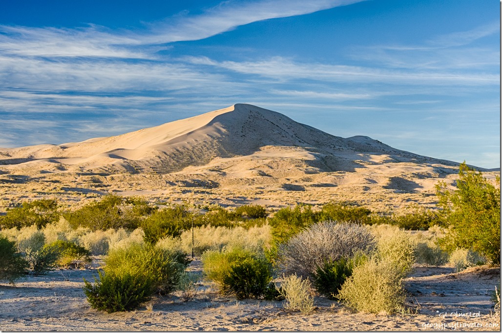
late light Kelso Dunes Mojave National Preserve CaliforniaThursday afternoon I pulled into a quiet Kelso Dunes camp area about 10 miles off I40 in Mojave National Preserve.  One SUV parked under the “big” (read only) trees taller than 8-10 feet, two people hanging out in the shade.  They took photos at sunset and were gone.  A family walked out a little ways on the sand laughing and playing and then left.
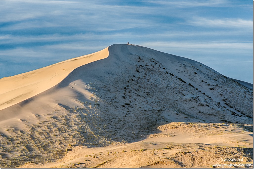
late light Kelso Dunes Mojave National Preserve CaliforniaTime change upon entering California, something we don’t do in Arizona.  Sunset before 5pm.  Did seem weird to go to bed at 8pm the first night (Thursday) but I’ve changed the clocks and watch and will adjust.
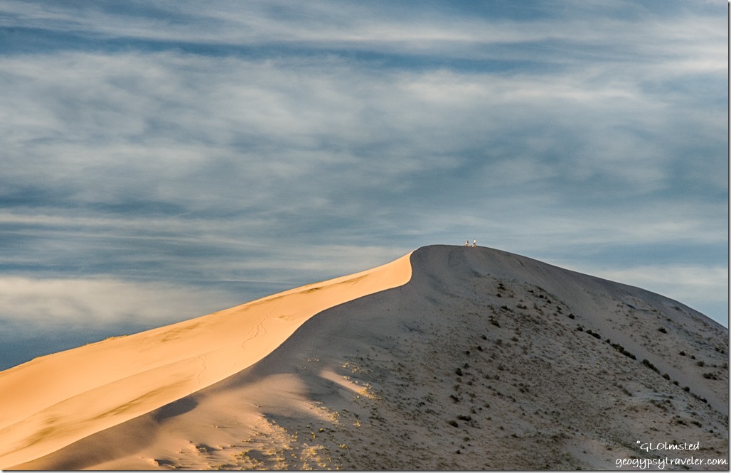
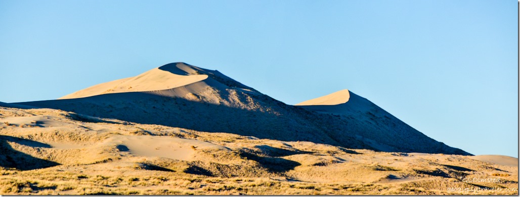
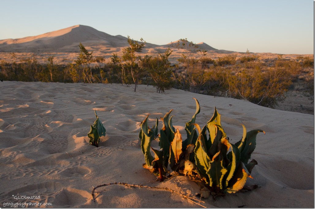
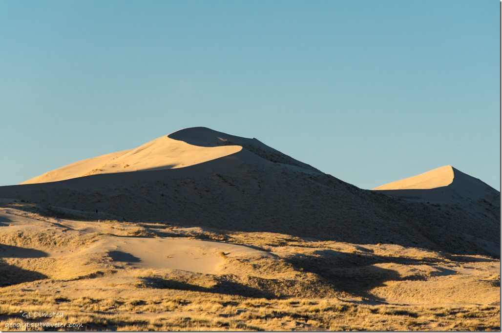
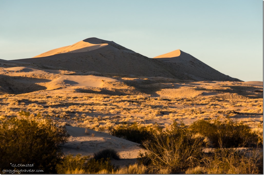
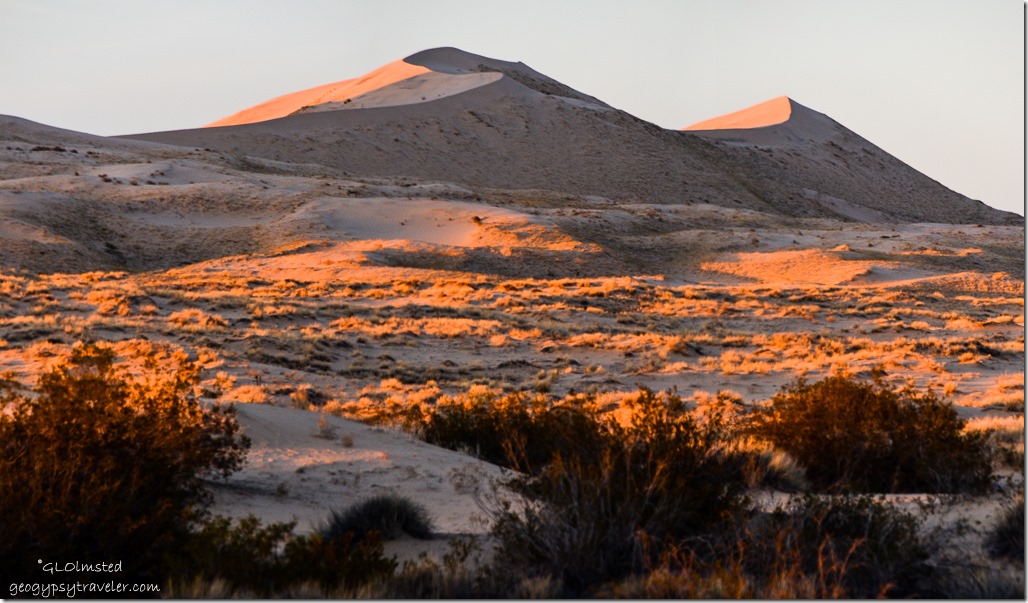
late light Kelso Dunes Mojave National Preserve CaliforniaLast light made the dunes look like folded satin.
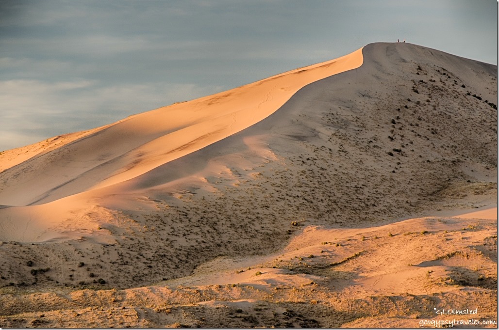
late light Kelso Dunes Mojave National Preserve CaliforniaI had the night to myself with the distant call of coyotes but I didn’t hear the dunes sing.  I’ve heard if you slide down them under the right conditions they do “sing”.
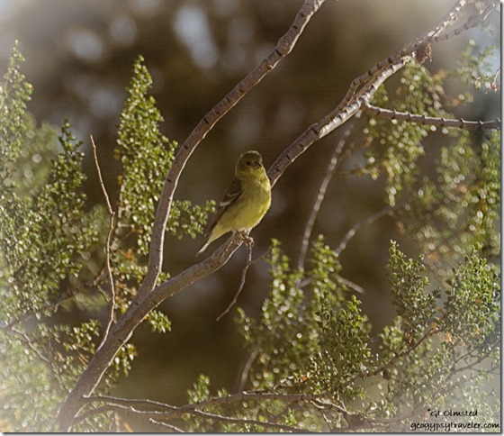
unidentified bird creosote bush Kelso Dunes Mojave National Preserve CaliforniaYet bird song was prevalent at first light flitting in and out of the creosote bush near my window.  All the photos I took are terrible through a dirty window.

Cell signal was rather in and out.  I tried to share the day’s Foto Friday Fun post on Facebook without luck.

Two vehicles and a pair of walkers rushed in briefly for sunrise light.  Which frankly I wasn’t all that impressed with in a cloudless sky.  Slowly the temperature rose and the sun’s warmth felt divine in an almost soundless desert.  The brilliant blue light gave the dunes an almost flat look.

I don’t walk into the dunes.  I prefer to look at them from afar.  Besides not liking sand in my shoes it’s too much work slogging through the soft terrain.  I sat outside in the warm sunshine reading.

Day trippers who had overshot the parking along the Kelso Dunes Road came in, some more cautiously than others on the possibly soft sand.  They don’t stay long.

But it’s Friday on a three-day holiday weekend.  Around noon the peace is broken when three huge 5th-wheels parked in a circle around the big shade trees.  And ran a generator all day.  Oh Joy!  Plus played really excessively loud music for over an hour.  Why can’t they leave the noise behind?  Hang on for a noisy weekend.
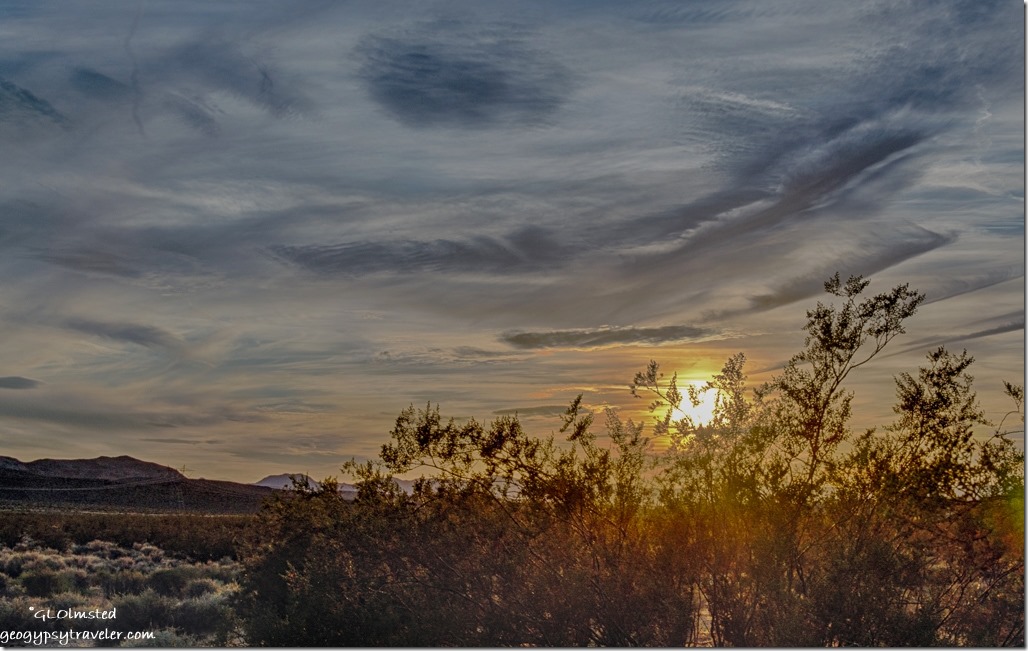
sunset Kelso Dunes Mojave National Preserve CaliforniaThe cloudy sunset reminded me of a Van Gogh painting.  Yet provided no light on the dunes.
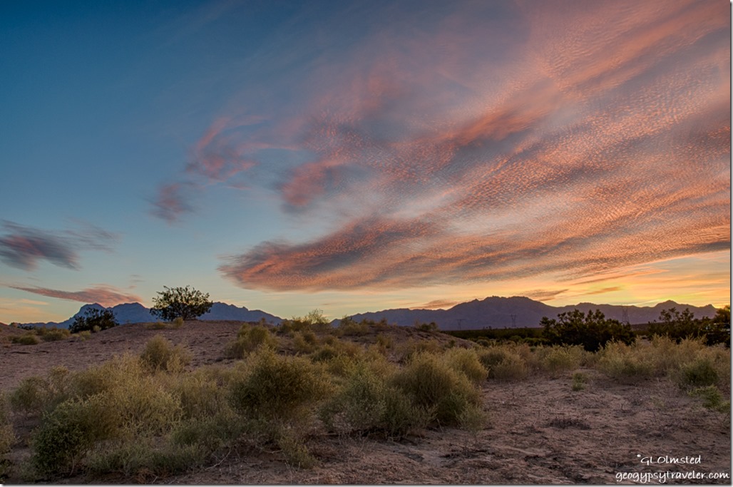
sunrise Kelso Dunes Mojave National Preserve CaliforniaUp in time for a flash of colorful sunrise.
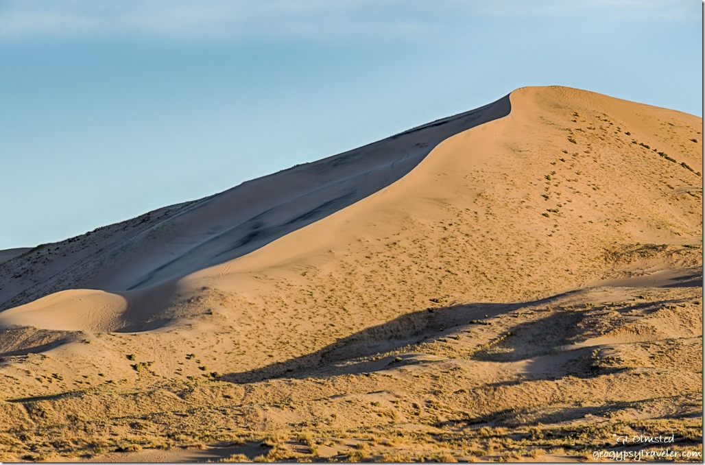
morning light Kelso Dunes Mojave National Preserve CaliforniaAnd morning light gave the dunes a different pattern of shadows.

Then time to roll as I made my way towards Lone Pine to meet a friend with a one night stop along the way at Fossil Falls.

Push my buttons!

  • Facebook
  • Twitter
  • LinkedIn

Like this:

Like Loading...
California, Mojave National Preserve, National Parks and Monuments, Places I've been, United States camping, public lands, sand dunes, sunrise, sunset 8 Comments
16 March 2016

Hole-in-the-Wall Rings Loop Trail Mojave National Preserve

February 21 & 22, 2016

Which hole, I kept asking Bill, is this place named for?


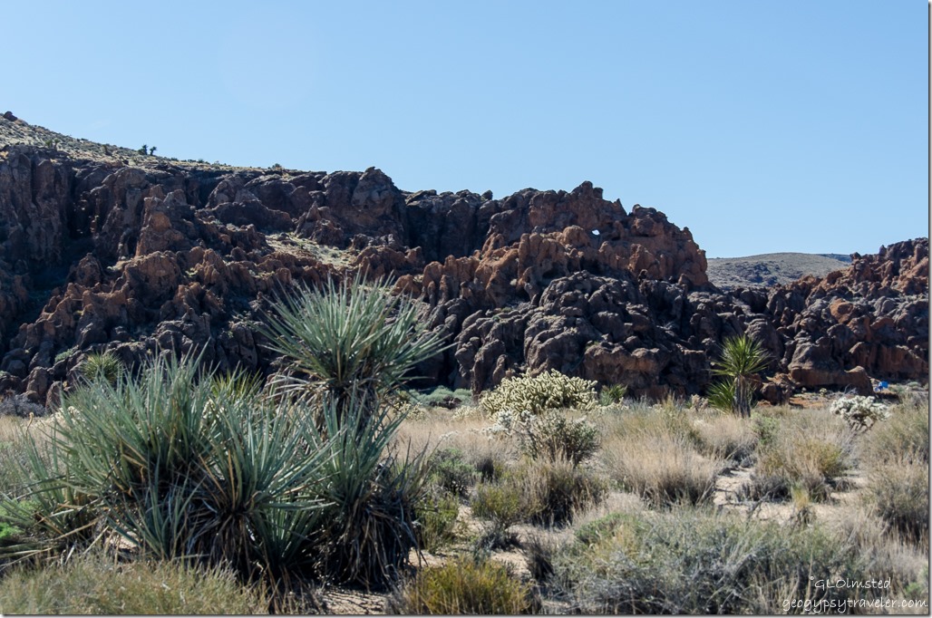
Rock face Banshee Canyon Rings Loop Trail Hole in the Wall Mojave National Preserve CaliforniaMany places in the west are called “Hole-in-the-Wall” but I’m not sure any except Mojave National Preserve offer a Rings Loop Trail with metal rings set in the rock to make a climb through the narrows of Banshee Canyon.  Listen for the howl as the desert wind blasts through multiple holes in the canyon walls like the keening of a Gaelic hag continuously carving and sculpting this volcanic landscape.  No wind brought the howl of banshees but there were plenty of places for them to hide.


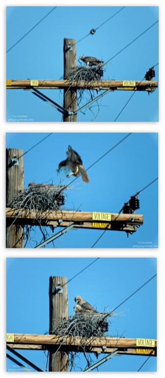
Red tail hawks nest building Mojave National Preserve California


After a delightfully quiet night camping by Kelso Dunes we headed for Hole-in-the-Wall campground with a stop at the visitor center at Kelso Depot.  Along the way I saw a hawk, no two hawks.  I seem to be drawn to their presence.  One landed on this nest.  Then another flew in seemingly with some twigs to add to their cozy new home.  Unfortunately, the camera didn’t focus well through the windshield.  But I’m pretty sure they were a red-tail pair.  I mentioned the sighting to the same Rangers we’d seen the day before and one of them said he’d look for the nest on his way to the dunes later that day.


Kelso Cima Road Mojave National Preserve California

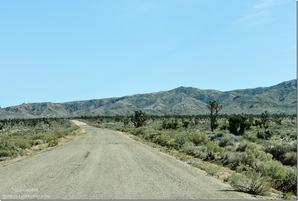
We left Kelso about noon and paralleled the tracks through a Joshua Tree forest on the Kelso Cima Road for 14 miles (22 km) then right turn across the tracks onto Mojave Road toward the Mid Hills.  About half the 6 miles (10 km) was paved before the road turned to gravel, a bit rough but doable under dry conditions.  Then another right onto Black Canyon Road, still gravel, for 10 miles (16 km) to Hole-in-the-Wall Campground.  The 20 miles (32 km) of roads coming from the south off I 40 are paved.

2005 Hackberry Fire Black Canyon Road Mojave National Preserve California

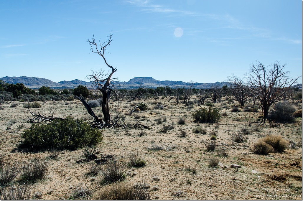
The landscape changed as we saw the burnt skeletons of twisted juniper.  The plentiful winter rains in 2005 produced abundant plant growth with a wildflower display that competed with the same show in Death Valley.  Yet as a dry summer advanced all that vegetation died creating a huge fuel source.  On June 22, 2005, lightning strikes ignited seven fires that burned 70,736 acres over the next four days.

Windmill Black Canyon Road Mojave National Preserve California

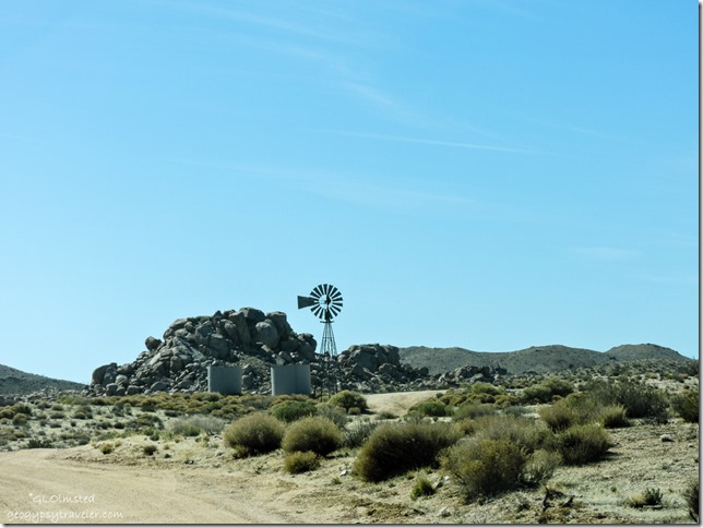
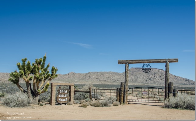
Surprisingly we saw fencing along the road, then ranch entrances, and even one for sale.  Of course long before this was a National Preserve rugged ranchers ran cattle in the Mojave.  Yet times were lean during drought through the late 1920s and 30s.  Then with passage of the Taylor Grazing Act in 1934 requiring individual ranchers to clearly delineate and fence their ranges, and pay grazing fees to the government for forage consumed by each animal on public lands many moved on.  Only a few remained by 1994 when Congress passed the California Desert Protection Act, which created Mojave National Preserve.

Gold Valley Ranch Black Canyon Road Mojave National Preserve California

In 2005 three major ranching families sold their properties to the National Park Foundation and moved out of the area, retiring their grazing allotments.  Because the government cannot directly acquire land, the foundation buys it and then donates it to the park service.  The National Park Service recognizes ranching as part of the cultural heritage that made the desert a unique and special place.  In fact the Preserve is in the process of creating the largest Historical Ranching District recorded in the National Register of Historic Places.  The Providence Ranch is the largest remaining privately owned property within the Mojave National Preserve, owned by the same family for 100 years.  Now for sale for $3,400,000.  But there’s no guarantee the public land grazing rights go with that.

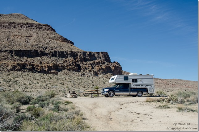
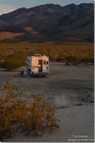
Truck camper Hole in the Wall campground Mojave National Preserve California

I’ll settle with this, and the Hole-in-the-Wall campground has large sites with lots of open space in between.  It did take a few blocks to get level near the provided picnic table and fire pit.  Plenty of toilets and water pumps scattered around but I’m not sure if the water was working in the campground although was available at the nearby Information Center.  A good deal for $12/night dry camp, half with the Senior Pass, and didn’t cost millions to enjoy the views.

Rings Loop Trail Hole in the Wall Mojave National Preserve California

Is that The Hole-in-the-Wall?

Once set up we took off on the 1 mile (1.6 km) Rings Loop Trail knowing that we’d not climb the boulders using the rings with Sasha along but turn around instead.  Very easy walk up to that point towards the end of the loop.  Well signed but pay attention.

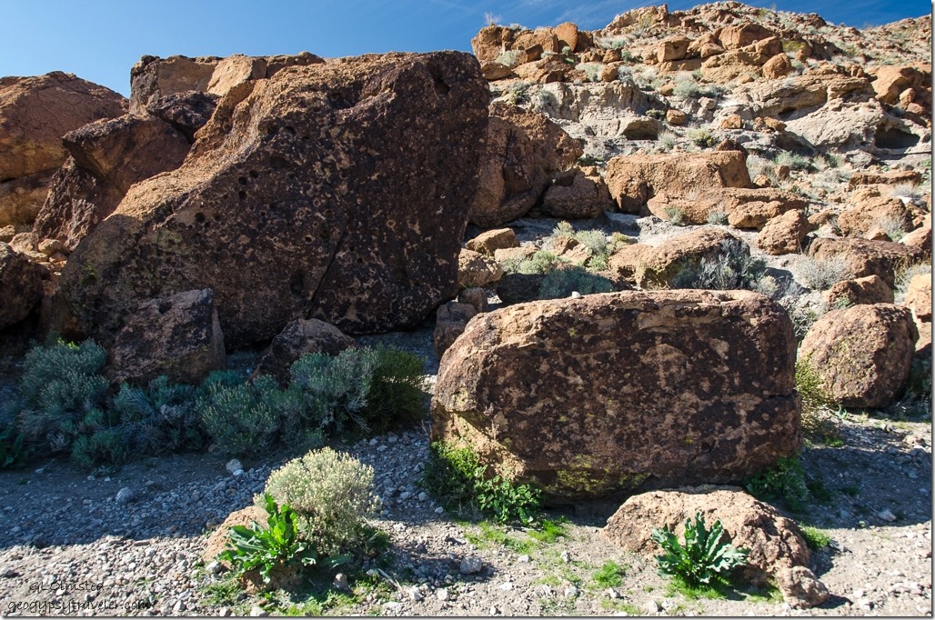
Petroglyphs Rings Loop Trail Hole in the Wall Mojave National Preserve California

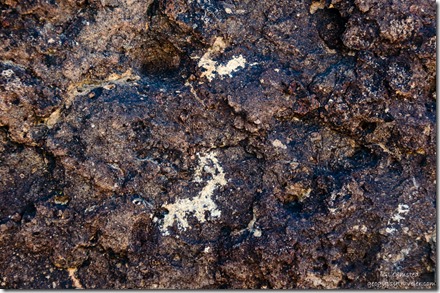
About 1/4 mile (.4 km) along the trail we saw petroglyphs on a few well varnished boulders.  I later learned of more petroglyphs in Mojave National Preserve at Cow Cove located on the northeast fringes of the Aiken Cinder Cone field and off an unmarked road between Baker and Keslo where we drove in.  I couldn’t find any authoritative information about the people who made these marks.  Yet the name “Mojave/Mohave” has been used as the name of an Indian tribe who lived – and whose survivors still live – along the Colorado River.  And they claim that their true Indian name always was, and is, Aha macave (pronounced aha makav, all a’s sounded as the a in “father,” the c as in “cool,” the e silent) which translates as “people who live along the water (river).”


Petroglyphs Rings Loop Trail Hole in the Wall Mojave National Preserve California


Desert Bighorn Sheep still live in the Preserve but we weren’t lucky enough to see any.


Wild Horse Canyon Road Rings Loop Trail Hole in the Wall Mojave National Preserve California

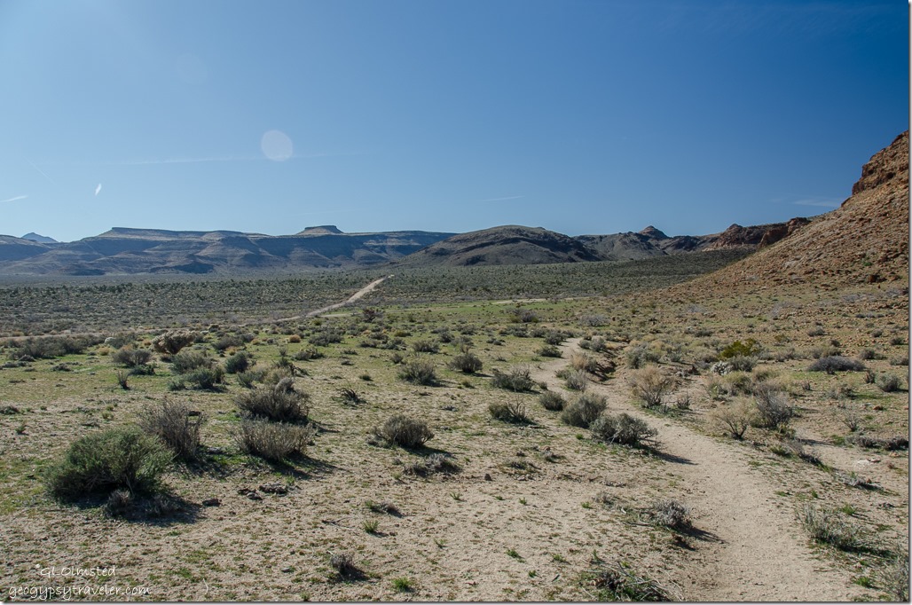
The trail loops around a rock outcrop with wide open spaces and we could see where Wild Horse Canyon Road loops back north to the Mid Hills campground.

Banshee Canyon Rings Loop Trail Hole in the Wall Mojave National Preserve California

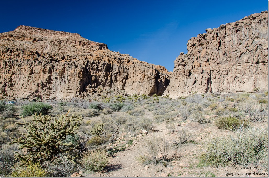
Then we saw a dark shadow that would lead us into Banshee Canyon.  There is actually a parking lot off this road that brings you closer to the actual canyon mouth but then you’d miss the petroglyphs.

Looking out of Banshee Canyon Rings Loop Trail Hole in the Wall Mojave National Preserve California

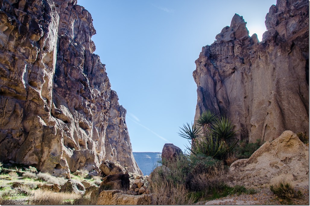
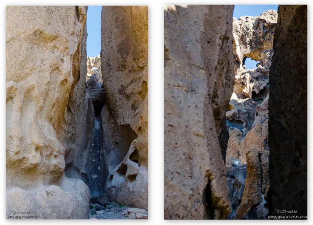
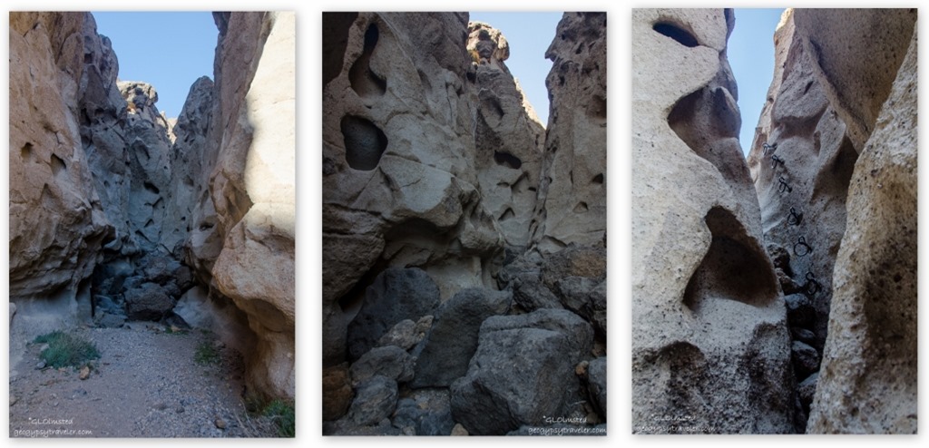
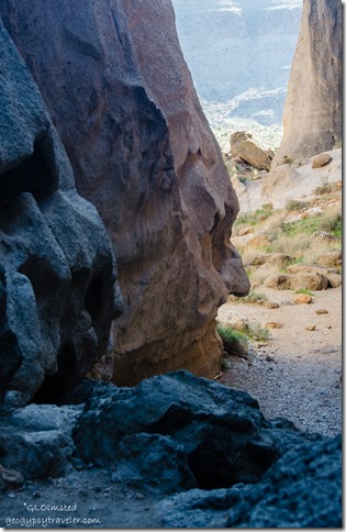
A slip through this crack in the rock brought us to a wonderland with rock walls like Swiss cheese and many faces.  A small alcove supported grasses and trees.

Banshee Canyon Rings Loop Trail Hole in the Wall Mojave National Preserve California

Is that The Hole-in-the-Wall?

Other cracks beckoned into usually short dead ends.  Could somebody have been climbing a stairway to heaven?  Appears to be hand and toe holes on this rock face, but I don’t think they are ancient.  Is this the hole this place was named for?


Rock face Banshee Canyon Rings Loop Trail Hole in the Wall Mojave National Preserve California


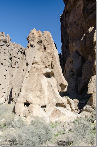
Actually, these holes have been enlarged by the power of that banshee wind erosion and are examples of tafoni, a rock weathering pattern.  Turns out this rock, or tuff beds, were created millions of years ago when a nearby volcano erupted, covering the area with a mixture of gas and ash.  As the ash cooled the gas dissipated leaving behind the holes in the walls.


Banshee Canyon Rings Loop Trail Hole in the Wall Mojave National Preserve California

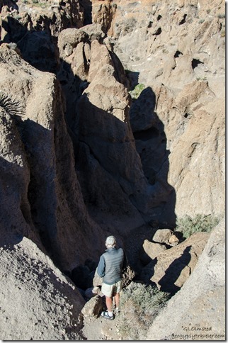
Even the trail route appears to be a dead end, or one heck of a climb.  To make it “safe for hikers to continue,” there are two sets of rock-mounted ringbolts, which you can use as hand holds and steps through two dry falls of 100 feet (30 m).  Which of course we didn’t do because of Sasha.


Bill Banshee Canyon Rings Loop Trail Hole in the Wall Mojave National Preserve California


But we did return to the other end of the loop the next morning and still didn’t climb it.  I’m sure I could, but didn’t need to prove it.  We saw two women start down to the out-of-site ‘rings’ and spoke to them after their quick return.  They said it was a bear and decided to tackle it from the lower end where we’d been the day before.  I think climbing up would be easier than down.


Trails near Hole in the Wall Mojave National Preserve California

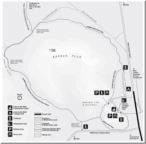
Several other trails, without the need for rings, are accessible from Hole-in-the-Wall campground.  A 1/4 mile (.4 km) nature trail leads to the Information Center where we met a very informative volunteer.  The 6 mile (9.6 km) Barber Peak Loop Trail connects to the 8 mile (12.8 km) one-way route to Mid Hills campground.

Hearing not the banshee, but the call to home, we left Mojave National Preserve with a desire to return, to see and learn more about this hugely diverse landscape.

Mojave National Preserve California

From there we left the Preserve and headed towards Lake Mead in Nevada.  My question still unanswered.  Which hole is this place named for?

How many rock faces did you see?

Note: March 28 – April 28, 2016 Kelbaker Road closure from Baker to Kelso for planned road work.  Can enter 39 miles east on I 15 on the Cima Road instead.  2/22/16 – 3/3/16 the water system at Kelso will be shut down to replace waste system infrastructure.  Portable toilets are available; bottled water is available for purchase when the visitor center is open.  Check Mojave National Preserve website for current information.


Push my buttons!

  • Facebook
  • Twitter
  • LinkedIn

Like this:

Like Loading...
California, Mojave National Preserve, National Parks and Monuments campground, Hole in the Wall, Rings Loop trail 26 Comments
14 March 2016

Camping by Kelso Dunes Mojave National Preserve

February 20 & 21, 2016

Truck camper Kelso Dunes Mojave National Preserve California


We thoroughly appreciated the uncrowded, free camping by Kelso Dunes in the quiet of Mojave National Preserve.  With just under 600,000 visitors last year this little known jewel should be visited before it starts to get crowded.


Kelso Dunes Mojave National Preserve CaliforniaBill and I enjoyed a brief time with late light and shadows on the Mesquite sand dunes in Death Valley.  We had also seen, or not seen, how blowing wind obscures the dunes, and just about everything else around.  So we were really looking forward to some time with the dunes but didn’t realize we could camp there.

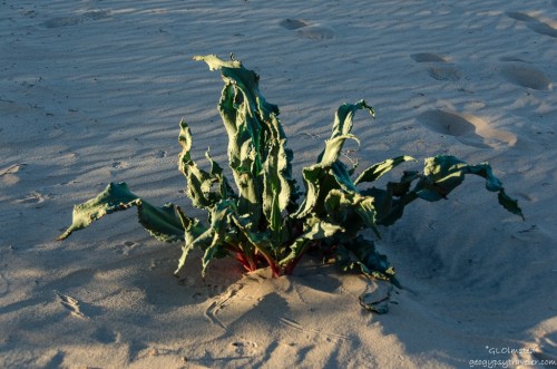
Unidentified plant Kelso Dunes Mojave National Preserve CaliforniaAlways ask the Ranger.  Which I forgot to do regarding this plant.
As soon as we walked into the visitor center a Ranger at a table with tortoise information asked immediately if we’d seen a tortoise.  No, and didn’t for the entire visit.  I wanted to see at least one, but not in the road, so can live with that.  Two more Rangers behind the desk were helpful, one seemed more seasoned, the other at his first park started in winter and was eagerly learning the newest blooms.  They gave us the skinny on free camping at the dunes where you’re suppose to park by a fire ring.

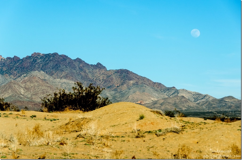
Moon over Providence Mountains Kelso Dunes Mojave National Preserve CaliforniaSo off we went.  Seven miles (11 km) south of Kelso Depot on the Kelbaker Road, then 3 miles (4.8 km) west on a graded dirt road, off to the right we saw the one big tree we’d been told to look for.


Says Phoebe Kelso Dunes Mojave National Preserve California


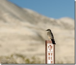
This Says Phoebe welcomed us to camp and perched on this sign in between bug catches.  One of the IDs I got the next day back at the visitor center.


Kelso Dunes from camp Mojave National Preserve California

Truck camper Kelso Dunes Mojave National Preserve CaliforniaPerfect camp view of the dunes.  And Mojave is dog friendly on leash.


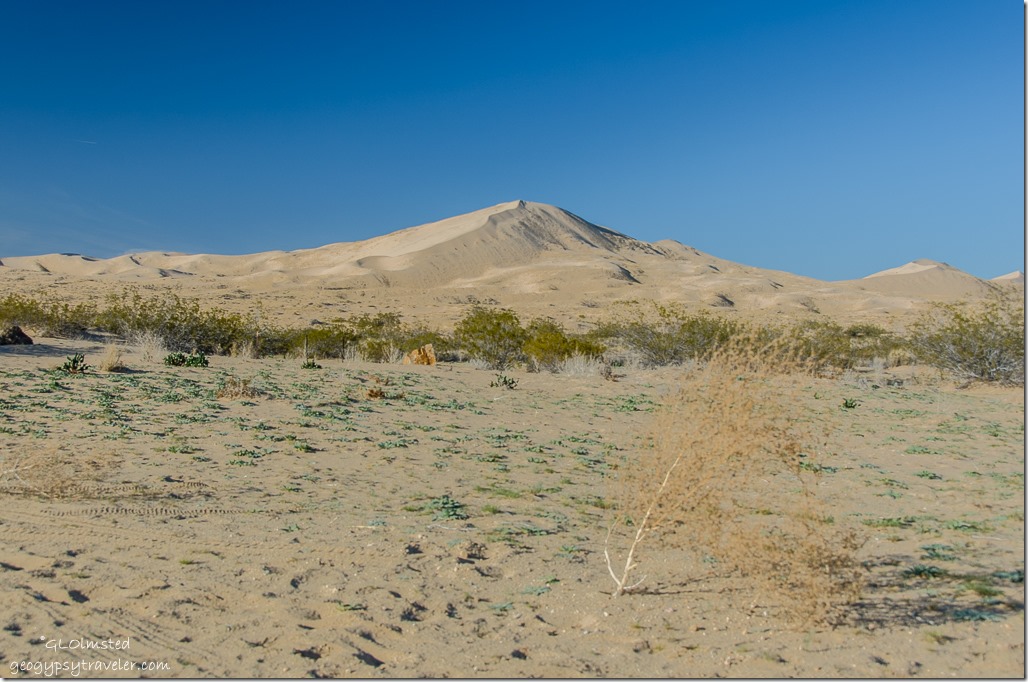
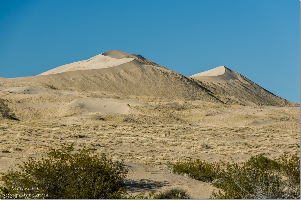
Kelso Dunes Mojave National Preserve CaliforniaNearly 700 feet high and covering a 45-square-mile area, the Kelso Dunes are among the tallest and most extensive dune fields in the United States.

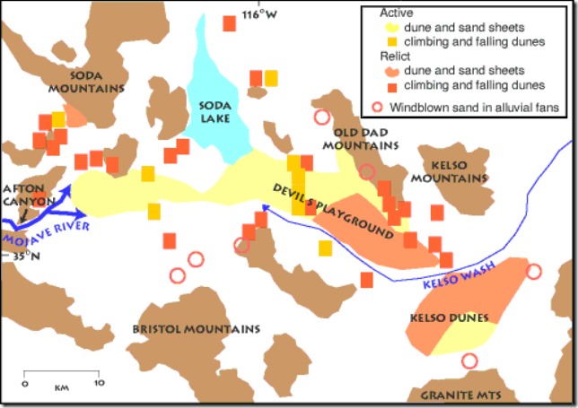
geo map MOJA & Kelso dunes

Huge amounts of sand were needed to build Kelso’s delicate wind-created sculptures, but geologists studying the Preserve discovered that no new sand is moving in to replenish the dunes.  By studying the mineral composition and shapes of sand grains they discovered that most of the sand has traveled all the way from the Mojave River sink east of Afton Canyon at least 30 miles (48 km) away.  Wind blowing from the northwest gradually carried the sand southeastward to the base of the Providence and Granite Mountains.  Where the sand piles up researchers found that the dunes are actually made up of several sets of dunes, stacked one on top of another. Each set formed in response to some past climate change during the last 25,000 years.

Kelso Dunes Mojave National Preserve CaliforniaOver the past few thousand years plants have progressively covered and stabilized areas once covered by drifting sand.  Yet a slightly drier climate may kill some of the vegetation holding the sand in place. Once the grasp of the plant roots is loosened, the sand is on the move again.

Kelso Dunes Mojave National Preserve CaliforniaAnd all it takes is a bit of breeze (10 miles/hour or 16 kilometers/hour) to put fine sand in motion.  The finest grains may be suspended in the air and carried along.  Heavier grains tend to bounce along as they are lifted into the air, fall back to the ground, then bounce back up again.  Once sand begins to pile up, ripples and dunes can form. Wind continues to move sand up to the top of the pile until the pile is so steep that it collapses under its own weight. The collapsing sand comes to rest when it reaches just the right steepness to keep the dune stable. This angle, usually about 30-34 °, is called the angle of repose.

Kelso Dunes Mojave National Preserve CaliforniaWe didn’t walk out into them but simply enjoyed watching the change in shadows as the sun sank lower towards the horizon.  Of course that means we didn’t hear them sing.  When quantities of the sands move, they sometimes produce a “booming” or “singing” sound when sand with the right moisture content slides down the steep slopes.

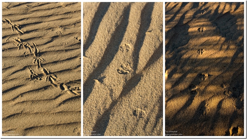
Tracks in sand Kelso Dunes Mojave National Preserve CaliforniaOK, I did walk a little ways to see the patterns in the sand and discovered some unknown tracks from those who’d gone before me.

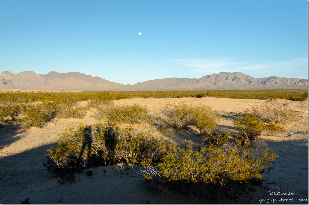
Moon over Providence Mountains Kelso Dunes Mojave National Preserve CaliforniaBonus was the rising moon over the Providence Mountains.  And I managed a shadow selfie of Bill, Sasha and myself.  Can you see us against the bushes?

Kelso Dunes Mojave National Preserve California

Sunset Kelso Dunes Mojave National Preserve California


Plus the color of the sand changed as the sun set.  Unfortunately my camera wasn’t auto focusing and my manual focus skills are lacking so many shots are very fuzzy.


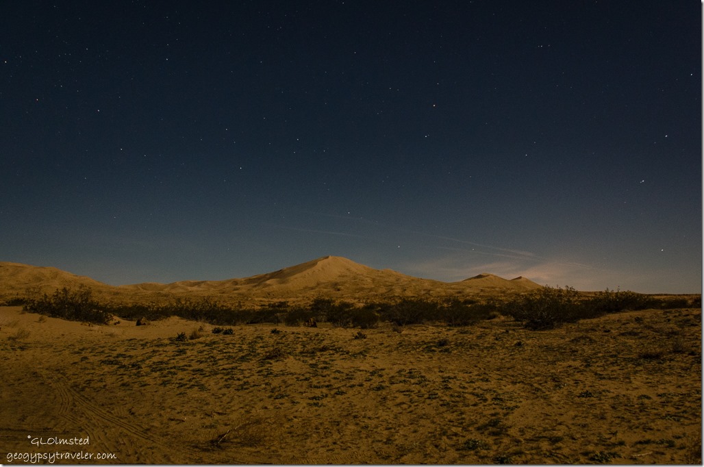
Stars Kelso Dunes Mojave National Preserve CaliforniaBut I was really happy with the night sky shots, maybe because I got the tripod out, with the moon highlighting the dunes.  Will have to try more of that when the temps stay up after dark.

Holes in rock Rings Loop Trail Hole in the Wall Mojave National Preserve California


There are several camping options in Mojave including the dunes, roadside boondocking and two developed campgrounds.  We decided to check out one of the later at Hole-in-the-Wall for our next night in the preserve.


Note: March 28 – April 28, 2016 Kelbaker Road closure from Baker to Kelso for planned road work.  Can enter 39 miles east on I 15 on the Cima Road instead.  2/22/16 – 3/3/16 the water system at Kelso will be shut down to replace waste system infrastructure.  Portable toilets are available; bottled water is available for purchase when the visitor center is open.  Check Mojave National Preserve website for current information.

Push my buttons!

  • Facebook
  • Twitter
  • LinkedIn

Like this:

Like Loading...
California, Mojave National Preserve, National Parks and Monuments camping, Kelso Dunes, sand dunes 22 Comments
← Older posts

Hi, I’m Gaelyn, the Geogypsy

I retired after 29 summer seasons as a Park Ranger, traveling solo for 40+ years. My passions include travel, connecting to nature, photography, and sharing stories.

I started exploring US National Parks in 1977 and 20 years later became a seasonal Park Ranger.  I’ve lived full-time in a RV for 30 years working summers and playing winters.  I’m still trying to figure out what I want to be when I grow old, other than grow up.

Let’s share our stories.  Here’s more of mine…

My wheeleastate

I am currently…

…boondocking somewhere in southern Arizona.  In the area, give a shout.

Geogypsytraveler on YouTube

Follow my journey on YouTube. Just click the pic. Hope you’ll like, share, and subscribe.

Click image for 7 minute documentary (Password “geogypsy” lowercase)

Making the Gypsy documentary is a story of its own.  Click below for the rest of the story.

Living nomadically & connecting to nature documentary

Subscribe to Blog via Email

Enter your email address to subscribe to this blog and receive notifications of new posts by email.

Photos available for sale include prints, greeting cards, coffee mugs, tote bags, phone cases and more

Reflected Wave 24X16 metal print under $100

Custom Coffee Mugs

Many items to choose from including prints

The Last Blast 24 x 16″ metal print under $100

Need a signal boost? When I boondock on public lands sometimes signal is weak or intermittent and a booster helps. Click the pic to visit WeBoost.

Connecting to nature and the rest of the world too.

Please contact me for photo purchases not seen at GLOlmsted Photography

Order fulfillment is by Fine Art America. If you’re not happy with your purchase, for any reason, simply return it within 30 days, and you’ll receive a full refund of the purchase price.

Why read Geogypsy?

The gypsy life spring-summer 1998 - "You were a real pioneer. RV'ing before it was cool." ...Yogi

How do you process photos? - “Your photographs create an Emotional feeling in the viewer...that they become One with You.” …Cindy

Life’s transitions between travel and work play - "I know you love your job as much as you love travel -- it shines through all your posts." ...Sallie

Lions at Kruger National Park - “Wonderful post, thank you. I was hooked start to finish!” … Peter B

11 lessons looking back 2013 - “A great post -- made me think, made me smile, made me want to cry." ...Sallie

Wildlife video Kruger National Park - “Gorgeous, this makes me want to go straight to South Africa now.” … Ayngelina

Living nomadically & connecting to nature documentary - “What an experience you had and gave to the "crew." Sometimes I think you don't realize how unique and inspiring you are.” …Alan

Search

Popular Posts

1. Prioritize the well-being of nature over photography. 2. Educate yourself about the places you photograph. 3. Reflect on the possible impact of your actions. 4. Use discretion if sharing locations. 5. Know and follow rules and regulations. 6. Always follow Leave No Trace principles and strive to leave places better than you found them. 7. Actively promote and educate others about these principles

Categories

Archives

Sites I follow, read & recommend

  • A Full-time Life
  • A Yankee in Belgrade
  • Bob's Eyes
  • Box Canyon Blog
  • Camels and Chocolate
  • Dawns bloggy blog
  • In the Direction of Our Dreams
  • Jane in her infinite wisdom
  • Janie and Steve, Utah Trails
  • Kathie's Birds
  • Las Adventuras
  • Memorable Meanders
  • Oh, The Places They Go
  • On the Road Abode
  • Port Elizabeth Daily Photo
  • Stillhowlyntravels
  • Take to the Highway
  • Technomadia
  • the good luck Duck
  • Travel with the Bayfield Bunch
  • Wandering Earl
  • Wheeling It
  • Yogi's Den

Caught in a Slot 9×12 canvas print under $50

If you don’t like what’s going on in your government, contact your Congress

Directory of Senators

Directory of Representatives

Lijit

© Copyright 2008-2024. Geogypsytraveler.com
%d