• Home
  • About Geogypsy
    • Herstory
    • Parks where I’ve worked
  • Places I’ve been
    • United States
      • Arizona
        • Antelope Slot Canyon
        • Casa Grande Ruins National Monument
        • Colossal Cave Mountain Park
        • Flagstaff
        • Glen Canyon National Recreation Area
        • Grand Canyon National Park
          • Grand Canyon National Park North Rim
          • Grand Canyon National Park South Rim
          • Toroweap
        • Havasu Canyon
        • Horseshoe Bend
        • Jerome
        • Kaibab National Forest
        • Lee’s Ferry
        • Meteor Crater
        • Navajo Bridge
        • Oak Creek Canyon
        • Painted Desert
        • Pipe Springs National Monument
        • Prescott
        • Quartzsite
        • Saguaro National Park
        • Sedona
        • Sunset Crater Volcano National Monument
        • Vermilion Cliffs
        • Walnut Canyon National Monument
        • Wupatki National Monument
        • Yarnell
      • California
        • Anzaberrego
        • Bakersfield
        • Death Valley National Park
        • Joshua Tree National Park
        • Redwoods NP
        • Salton Sea
        • Yucca Valley
      • Colorado
        • Mesa Verde National Park
      • Florida
      • Illinois
        • IL River
        • Morton Arboretum
        • Starved Rock State Park
      • Michigan
      • Nevada
      • New Mexico
      • Oregon
        • Crater Lake NP
        • Mt Hood
        • Oregon Caves National Monument
      • Texas
        • Alpine Texas
        • Padre Island
        • Port Isabel
        • Rio Grande Valley
      • Utah
        • Brian’s Head
        • Bryce Canyon National Park
        • Buckskin Gulch
        • Cedar Breaks National Monument
        • Cedar City
        • Coral Pink Sand Dunes State Park
        • Dixie National Forest
        • Grand Staircase Escalante National Monument
        • Johnson Canyon
        • Kanab
    • World Travels
      • Germany
      • Mexico
      • South Africa
  • Tours
  • Photography
  • Work with Me
    • Sponsors
  • Contact
Geogypsy
Menu
  • Home
  • About Geogypsy
    • Herstory
    • Parks where I’ve worked
  • Places I’ve been
    • United States
      • Arizona
        • Antelope Slot Canyon
        • Casa Grande Ruins National Monument
        • Colossal Cave Mountain Park
        • Flagstaff
        • Glen Canyon National Recreation Area
        • Grand Canyon National Park
          • Grand Canyon National Park North Rim
          • Grand Canyon National Park South Rim
          • Toroweap
        • Havasu Canyon
        • Horseshoe Bend
        • Jerome
        • Kaibab National Forest
        • Lee’s Ferry
        • Meteor Crater
        • Navajo Bridge
        • Oak Creek Canyon
        • Painted Desert
        • Pipe Springs National Monument
        • Prescott
        • Quartzsite
        • Saguaro National Park
        • Sedona
        • Sunset Crater Volcano National Monument
        • Vermilion Cliffs
        • Walnut Canyon National Monument
        • Wupatki National Monument
        • Yarnell
      • California
        • Anzaberrego
        • Bakersfield
        • Death Valley National Park
        • Joshua Tree National Park
        • Redwoods NP
        • Salton Sea
        • Yucca Valley
      • Colorado
        • Mesa Verde National Park
      • Florida
      • Illinois
        • IL River
        • Morton Arboretum
        • Starved Rock State Park
      • Michigan
      • Nevada
      • New Mexico
      • Oregon
        • Crater Lake NP
        • Mt Hood
        • Oregon Caves National Monument
      • Texas
        • Alpine Texas
        • Padre Island
        • Port Isabel
        • Rio Grande Valley
      • Utah
        • Brian’s Head
        • Bryce Canyon National Park
        • Buckskin Gulch
        • Cedar Breaks National Monument
        • Cedar City
        • Coral Pink Sand Dunes State Park
        • Dixie National Forest
        • Grand Staircase Escalante National Monument
        • Johnson Canyon
        • Kanab
    • World Travels
      • Germany
      • Mexico
      • South Africa
  • Tours
  • Photography
  • Work with Me
    • Sponsors
  • Contact

Category: Death Valley National Park

06 December 2017

A brief and windy visit to Death Valley National Park

November 16-18, 2017

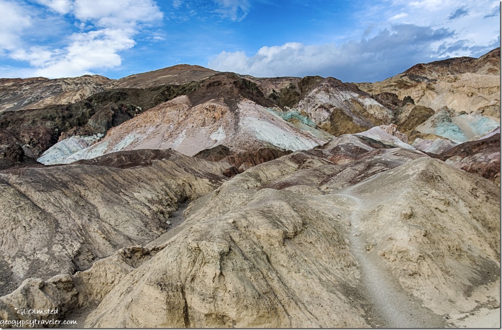
Artists Palette Death Valley National Park CaliforniaArtists Drive Death Valley National Park

As the weather deteriorated at Alabama Hills, in other words snow on the Sierras, it was time to get to warmer climate like Death Valley at or below sea level.  But their is that matter of CA190 east climbing not one but two mountain ranges to get there.
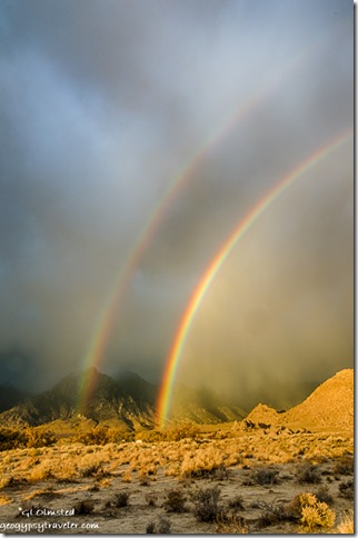
double rainbow low clouds Alabama Hills BLM Lone Pine CaliforniaThe clouds hung low obscuring the Eastern Sierras from view but right before leaving I was gifted with a double rainbow.
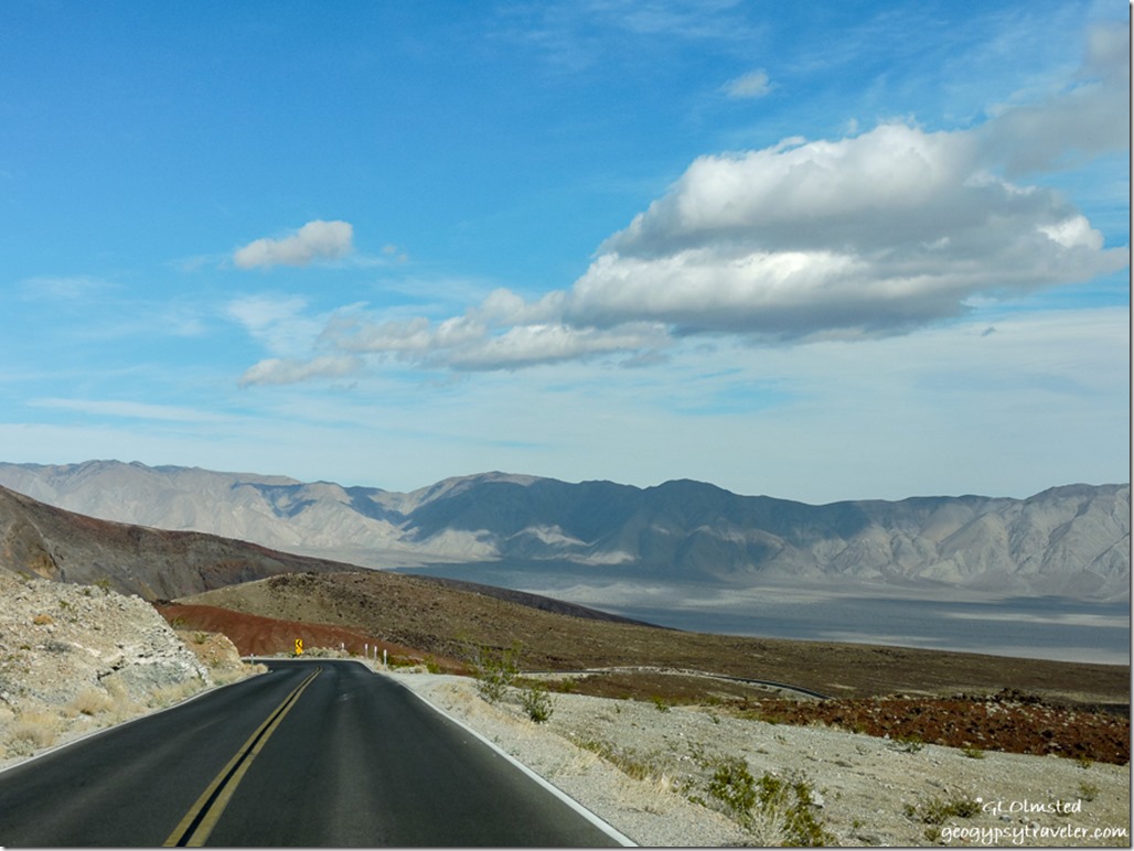
CA190 East CaliforniaFollowed by a desert wind on the nose with sandy salts flowing across the road from Lake Owens.  The first pass over the Inyo Mountains helped reduce the wind.  Sure glad I didn’t need fuel in Panamint Springs at $4.99/gal for diesel.
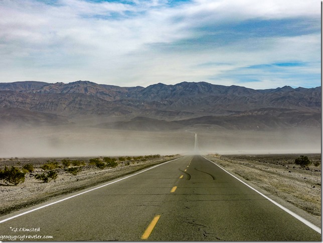
wind blown sand Panamint Valley CaliforniaThen a wicked south wind in Panamint Valley nearly knocked me off the road with a sand blasting strong enough to obliterate much of the view.  Remember this is blowing on the side of the camper like a billboard going down the road and on the fridge side so the pilot blew out.
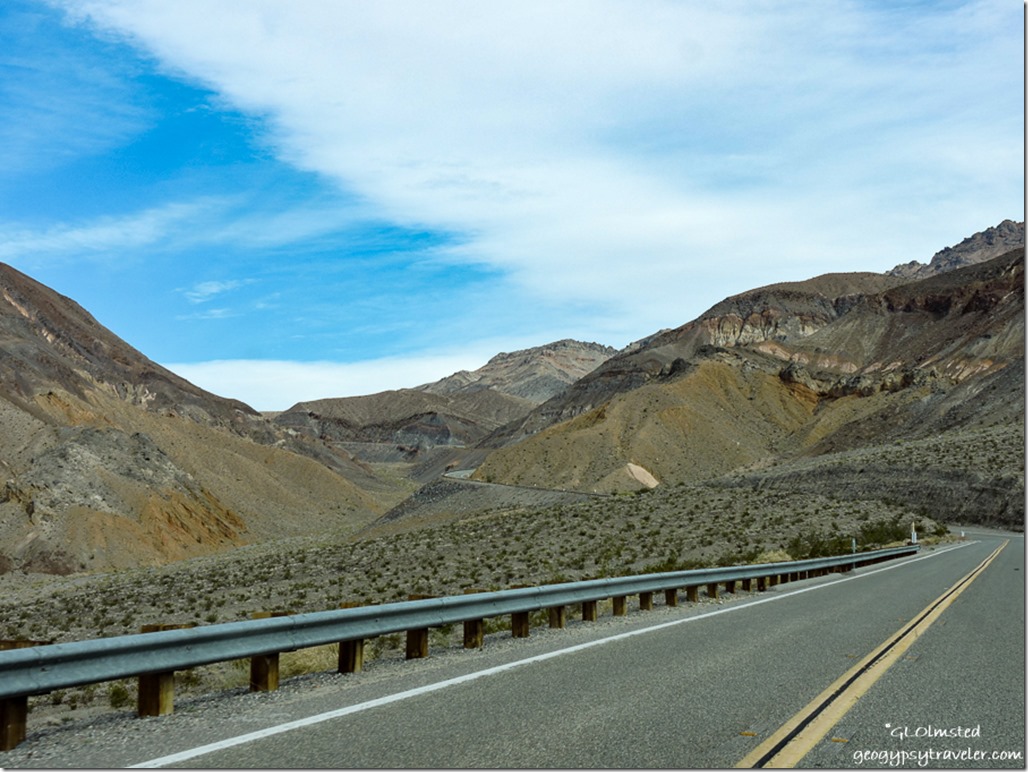
Panamint Mountains CA190 East Death Valley National Park CaliforniaThis followed by another climb into clearer air in the Panamint Range and back down into Death Valley with a little less wind.
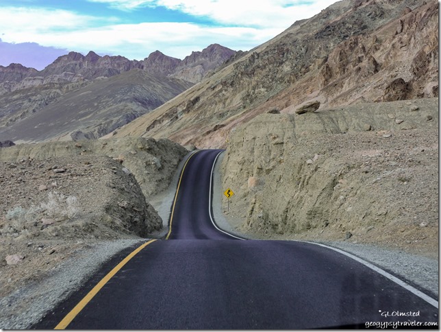
Artists Drive Death Valley National Park California

Artists Drive Death Valley National Park CaliforniaStayed the first night at Texas Springs, my favorite of all the parking lot campgrounds in the park.  After snagging my campsite I took the Artists Drive which was closed last winter and is now newly paved with maybe some more parking areas along the one way road.
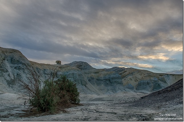
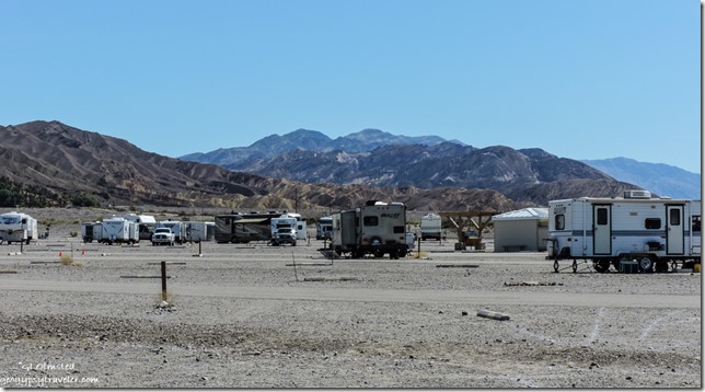
sunrise Texas Spring campground Death Valley National Park CaliforniaAfter sunrise I moved to the Stovepipe Wells campground where I would meet friend and fellow Ranger Jeremy late in the afternoon.

motorbikes tents sand storm mountains Stovepipe Wells campground Death Valley National Park CaliforniaThe tent area was filling fast along the northern edge of this parking lot camp.  Because I’m considered a RV I can’t park along that side but can be nearby along a curb.  So I paid for a tent site, hung the receipt and hunkered in watching the dust and sand fly up the valley to the east.  It appeared to be moving north away from me but then turned and headed towards camp.  I closed the door and windows and hung on tight.  Even inside the camper felt like a sand storm.  People were grabbing and abandoning tents for their cars.  Like a haboob I guess.  Not a great day to take photos.

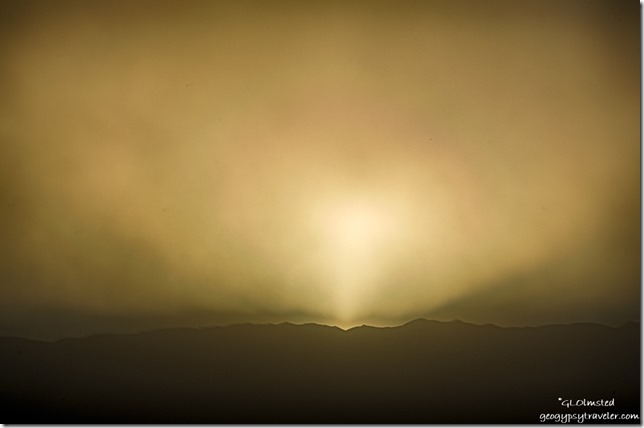
sandstorm sunset Stovepipe Wells campground Death Valley National Park CaliforniaDusty sunset

Jeremy got in after dark, took me to dinner, stayed up most of the night watching meteors—saw 11 of them—and in the morning slept in his car instead of fighting the wind to set up his tent.
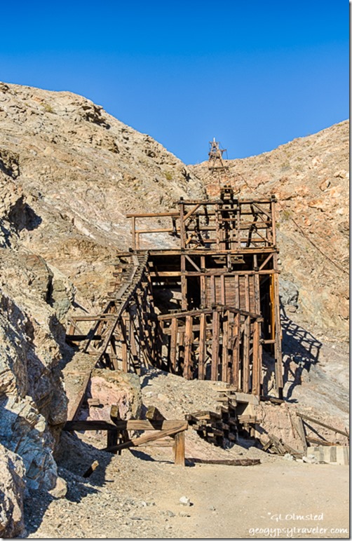
Keane Wonder Mine Death Valley National Park California

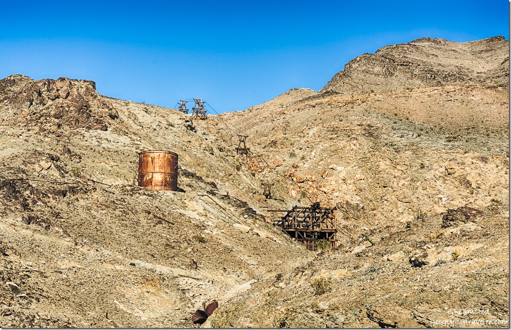
aerial tramway Keane Wonder Mine Death Valley National Park CaliforniaThe next day we visited the recently reopened Keane Wonder Mine with it’s unique mile-long aerial tramway.      https://www.nps.gov/deva/learn/historyculture/keane-wonder-mine.htm
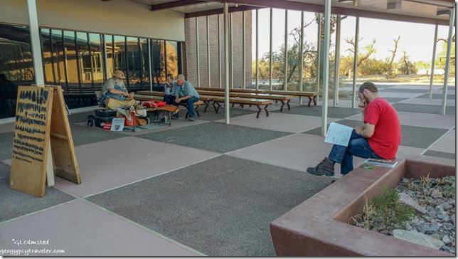
Jeremy Visitor Center Death Valley National Park CaliforniaWhile Jeremy worked on his Junior Ranger book I watched a volunteer demonstrate flint knapping in the visitor center courtyard.  I earned my Death Valley Junior Ranger badge a few years ago.
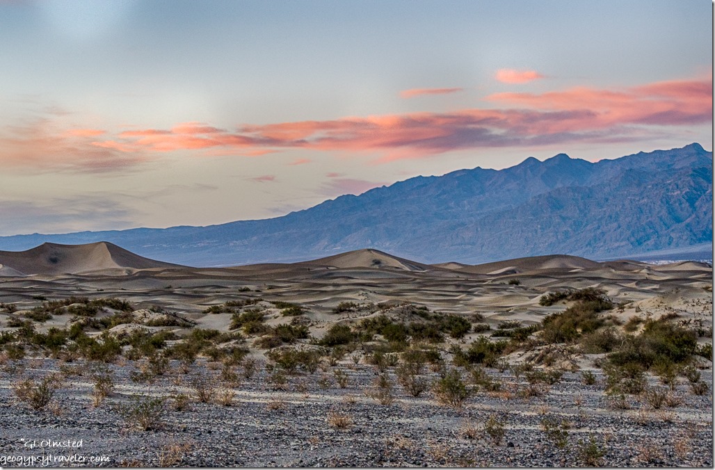
Mesquite dunes sunset mountains Death Valley National Park CaliforniaMade a quick stop by the Mesquite Sand Dunes but it was getting late and Jeremy planned to BBQ dinner, which he is very good at, so we returned to camp.
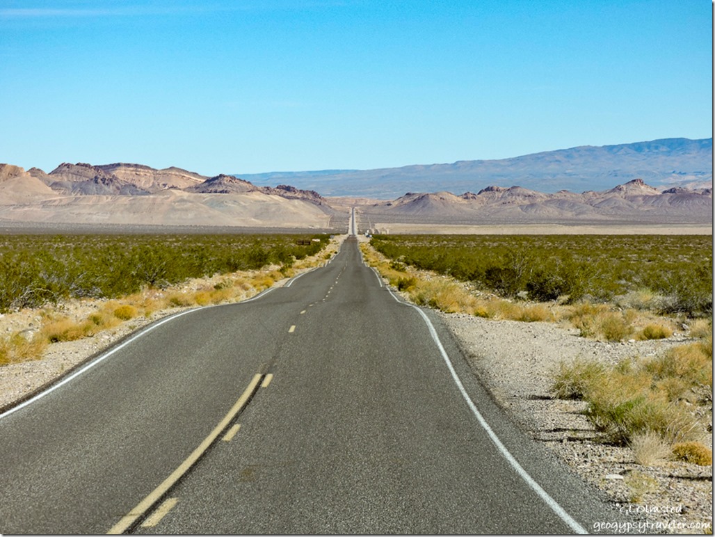
Daylight Pass Road CA NV borderAnd in the morning we both took off our separate ways, me to drive up Mud Canyon on the Daylight Pass Road to explore the ghost town of Rhyolite, Nevada.

Push my buttons!

  • Facebook
  • Twitter
  • LinkedIn

Like this:

Like Loading...
California, Death Valley National Park, Places I've been, United States badlands, campgrounds, camping, dust, gold mine, rainbow, sand storm, sunrise, sunset 14 Comments
20 March 2017

Death Valley – a geologic wonder

  March 8-9, 2017

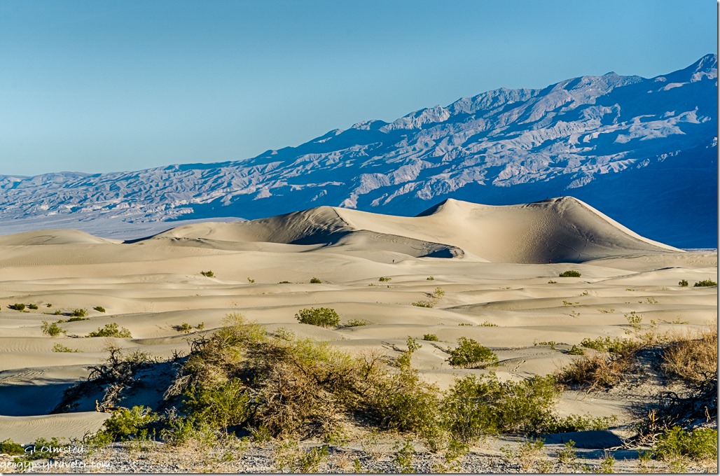
Mesquite Flat sand dunes Death Valley National Park CaliforniaSecond day at Death Valley started early—for me—to catch morning light, not sunrise, on the Mesquite Flat sand dunes.  The real photographers were already parked in a good location on the shoulder.

Mesquite Flat sand dunes Death Valley National Park California

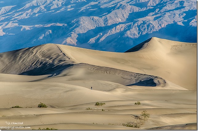
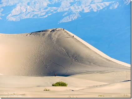
Mesquite Flat sand dunes Death Valley National Park CaliforniaI actually set up the tripod and tried the longer 300mm lens for a little more zoom.  Plus used the smaller Nikon for presumably even more zoom.  People were already out on the dunes, which puts these 100 foot sand piles in perspective.


Gaelyn's shadow Mesquite Flat Sand Dunes Death Valley National Park CaliforniaMesquite Flat sand dunes Death Valley National Park California

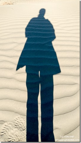
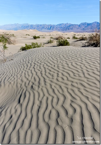
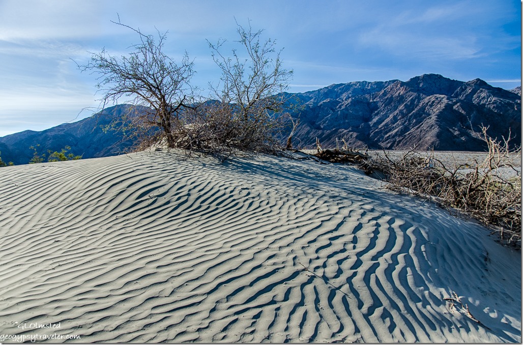
I took a short walk into the dunes not wishing to hike one mile to the tallest and climb the slippery slopes, especially with a camera.  The wind patterns in the sand are fascinating enough.  This dune field includes crescent, linear, and star shaped dunes.  Quite the pallet for Mom nature’s wind.
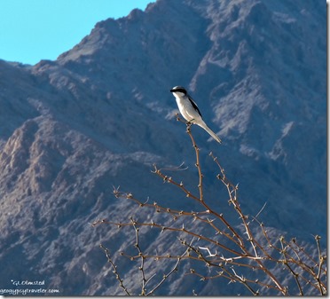
Loggerhead shrike Mesquite Flat sand dunes Death Valley National Park CaliforniaThe trilling song of a Loggerhead shrike, lifer for me, caught my attention and surprisingly sat still long enough for a few photos before taking off in its undulating flight.


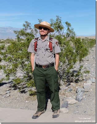
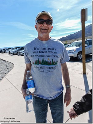
Ranger Mike Mesquite Flat sand dunes Death Valley National Park CaliforniaGreat t-shirt saying Mesquite Flat sand dunes Death Valley National Park California

Ranger Mike                                                                       Couldn’t resist

While waiting for the 10am Ranger walk I hung around in the parking lot when I discovered a strong signal.  No surprise that I love Ranger programs when I get to learn something about the environment I’m visiting.

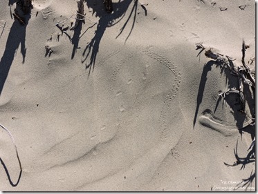
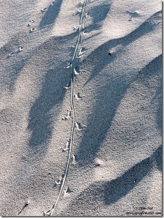
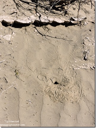
Beetle tracks Mesquite Flat sand dunes Death Valley National Park CaliforniaAfter dark is the best time to spot wildlife in the park.  However, the hardcore survivors at Death Valley leave evidence that tell a story.  So we went for a short walk on the dunes looking for clues.  The Death Valley beetle is a species of concern because it is only known to occur in the drainage basin of the Amargosa River in the southwestern United States.  Also known as a scarab beetle, it scurries across the sand trying to avoid being eaten and thus the stink.

Kangaroo rat & lizard tracks Mesquite Flat sand dunes Death Valley National Park CaliforniaLizard tracks & burrow Mesquite Flat sand dunes Death Valley National Park California

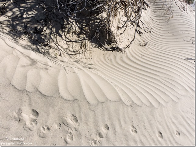
Other than human, lizard tracks are the most commonly seen and other than size are difficult to know which of the many species live here.  If out during the day they will often flatten themselves out on the sand leaving a body print along their trail.  Otherwise, like many animals surviving in the heat, they dig burrows.  Kangaroo rats also dig burrows and can survive their entire lives drinking no water.  Instead they get all their moisture from the vegetation eaten and seeds that gather moisture when left in their underground pantry.     [*Whose tracks are these?]

Canine tracks sand patterns Mesquite Flat sand dunes Death Valley National Park CaliforniaCanine tracks could be a sign of coyote, kit fox, or an illegal dog.  This walk sure was a fun way to learn about life in the dunes.

Mesquite Flat sand dunes Death Valley National Park CaliforniaSo why dunes here and not everywhere?  There are actually five dune fields in Death Valley including Eureka, Saline Valley, Panamint, Ibex, and Mesquite Flat which sprawls 14 miles across the widest part of Death Valley.  For dunes to exist there must be a source of sand, prevailing winds to move the sand, and a place for the sand to collect. The eroded canyons and washes provide plenty of sand, the wind seems to always blow (especially in the springtime), but there are only a few areas in the park where the sand is “trapped” by geographic features such as mountains.

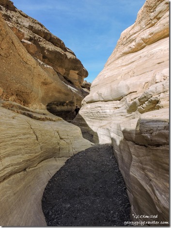
Mosaic Canyon Death Valley National Park California

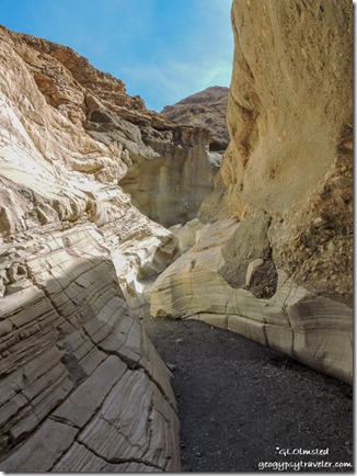
Mosaic Canyon Death Valley National Park California

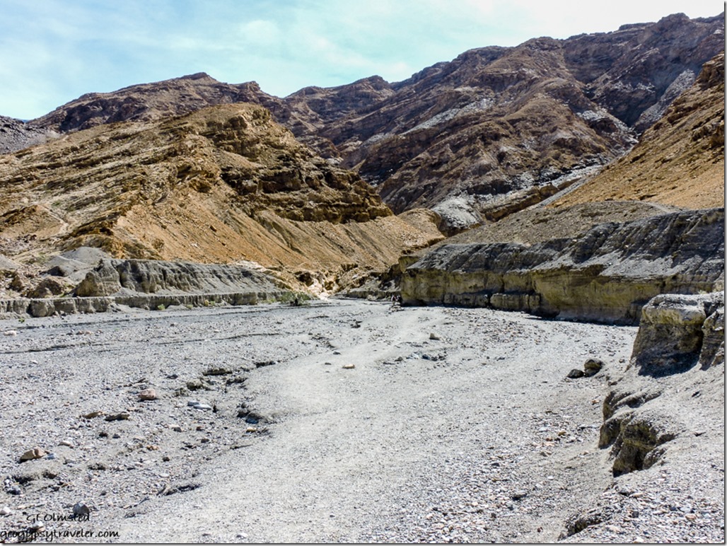
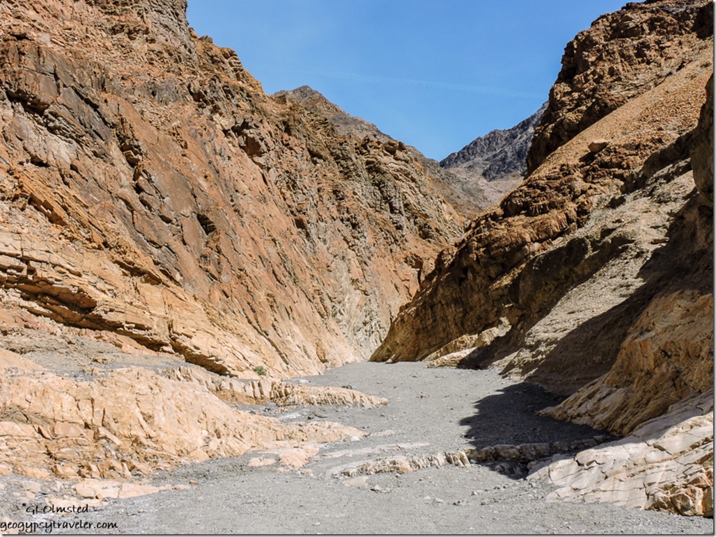
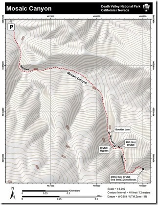
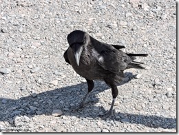
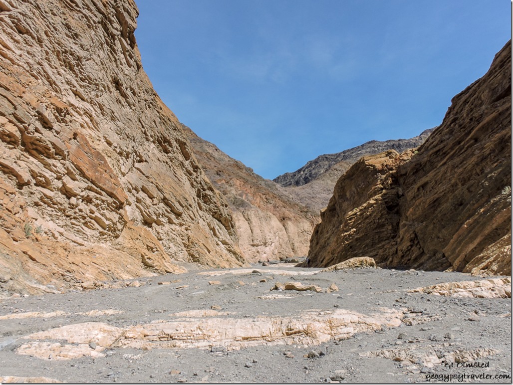
map Mosaic Canyon trail Death Valley National Park CaliforniaRaven Mosaic Canyon trailhead Death Valley National Park CaliforniaOnly a few miles down the road from the dunes and just past the developed Stovepipe Wells (store, lodge, gravel parking lot camping, and expensive fuel) I drove the bumpy but doable 2.3 miles uphill to walk in Mosaic Canyon.  The entire 4 m round trip trail starts out wide in a rocky wash, gets narrow, and then opens again.       [Raven welcomes visitors at trailhead, not cropped]

Mosaic Canyon Death Valley National Park California

Mosaic Canyon Death Valley National Park CaliforniaAdventurous hikers can crawl between the boulder jam about 1.3 miles into the canyon, bypass a 20 foot slanted dryfall, and continue to a third set of narrows to a 25 foot vertical dryfall where the trail ends.

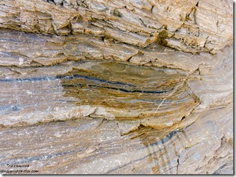
Marble graphite Mosaic Canyon Death Valley National Park California


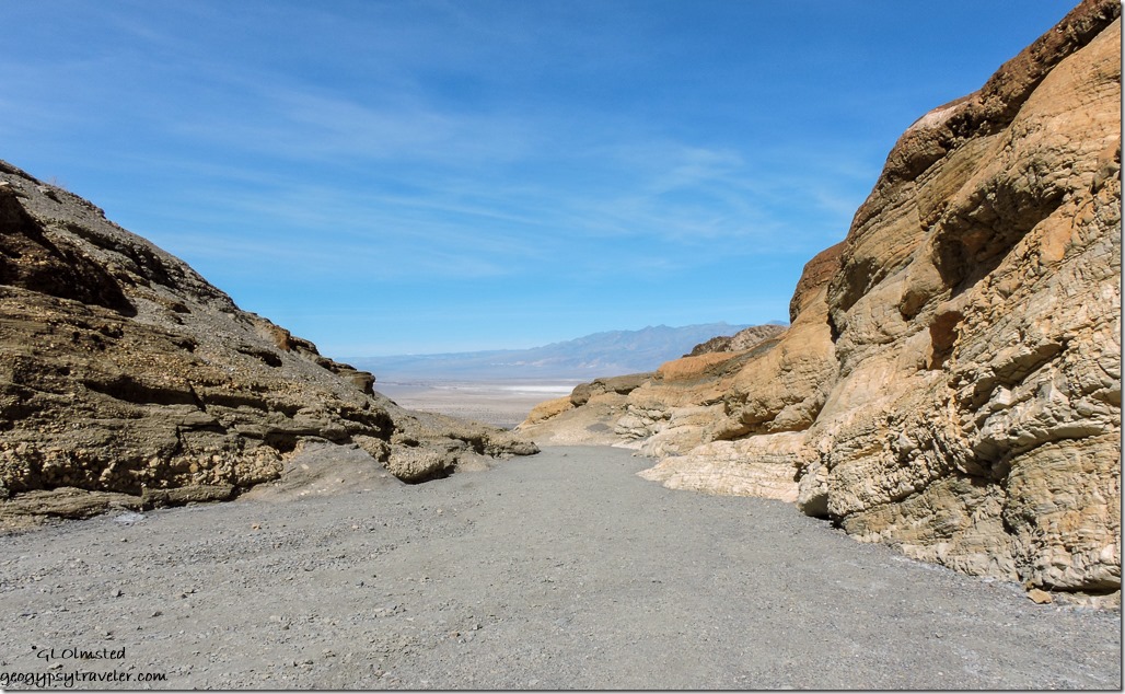
Marble walls Mosaic Canyon Death Valley National Park CaliforniaI only went a bit past the first narrows—not much further than the last time hiked—because it’s the shinny, water polished marble (metamorphosed limestone) contrasting with breccia (sediments with upstream rocks cemented together) that fascinates me.        [Note the dark graphite where I poured water on the marble]

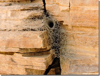
spiderweb Mosaic Canyon Death Valley National Park California

Mosaic Canyon Death Valley National Park California

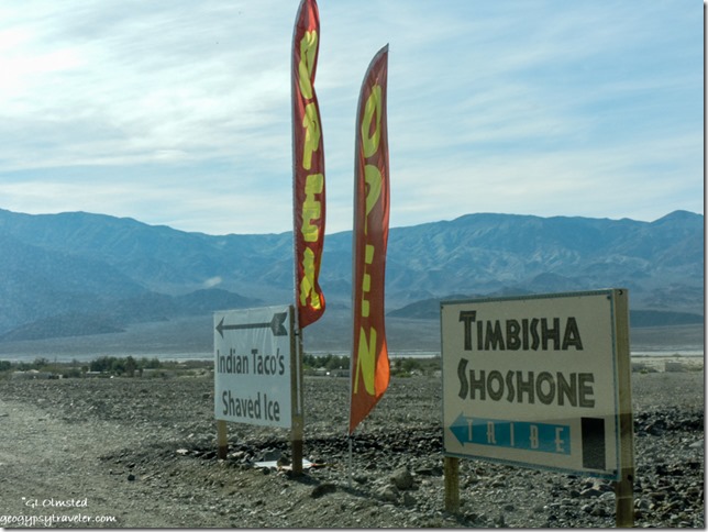
Timbisha Shoshone Village signs Death Valley National Park CaliforniaAfter my meander I was hungry and feeling too lazy to make lunch so decided to check out the Indian Tacos sold on the reservation village near Furnace Creek.  The Timbisha Shoshone Tribe were formerly known as the Panamint Shoshone Indians of Death Valley and were best known for their fine basket making skills.  Over a thousand years ago they would move from the valley floor into the mountains during the summer months, ten return for the winter.  The Timbisha Indian Village was created in 1936 yet it wasn’t until Death Valley National Monument was expanded in 1994 and became a national park that the tribe asked for a reservation that was signed into law in 2001 covering 7000 acres of land both in and out of the park.  The Tribe consists of close to 300 members, 20 of whom reside in the Village.  I sat at a large table enjoying my taco with a couple from Idaho chatting about the park and what’s going on in the world.

Badlands Zabriskie Point Death Valley National Park California

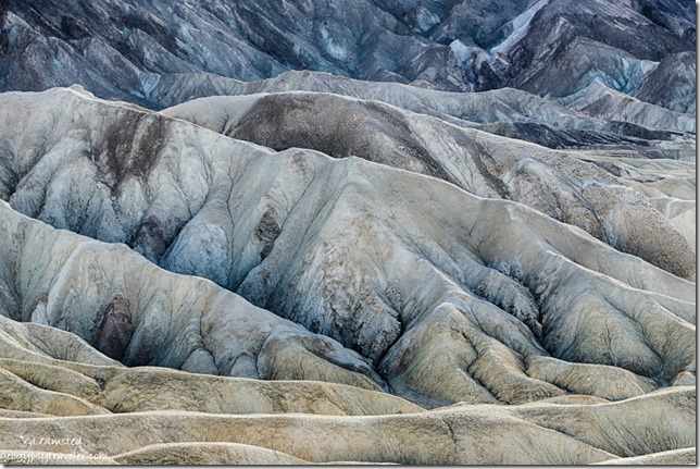
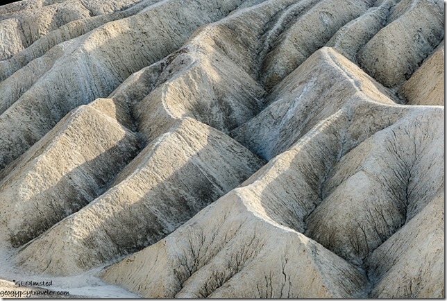
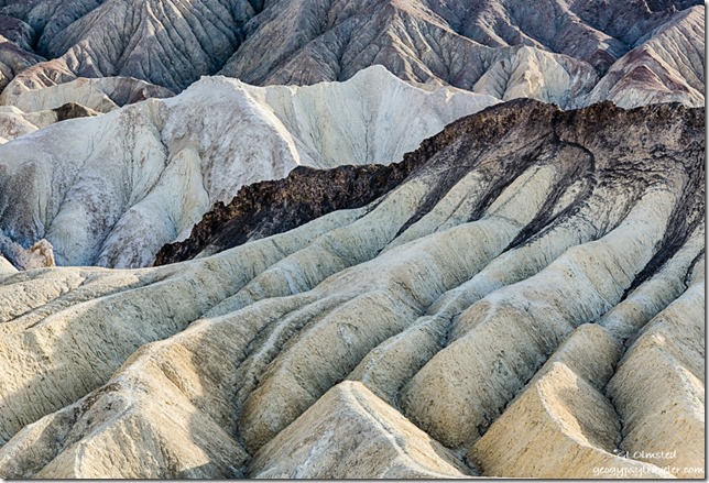
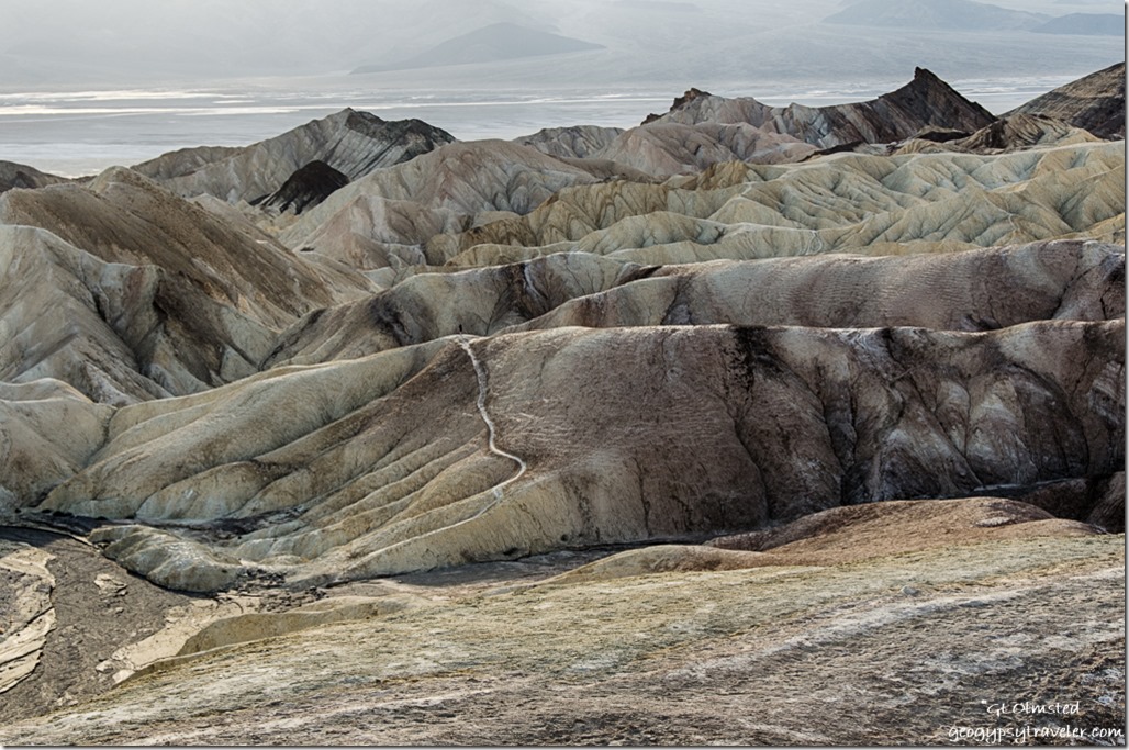
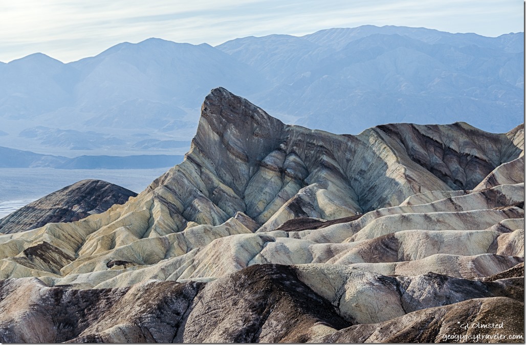
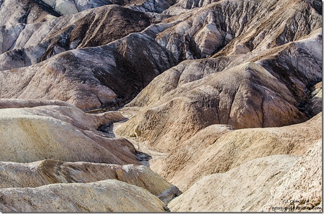
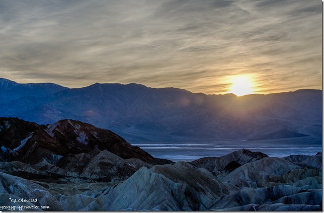
Badlands Zabriskie Point Death Valley National Park CaliforniaThen I visited Zabriskie Point for the afternoon and that turned into sunset.   The late afternoon light and shadows superbly set off the badland formations.

Zabriskie Point Death Valley National Park California

Badlands Zabriskie Point Death Valley National Park CaliforniaThe light color rock is the Furnace Creek formation made up of nine million year old lake sediments, gravel from nearby mountains, and ashfalls from the then active Black Mountain volcanic field.  The dark-colored material capping the badland ridges is lava from eruptions that occurred three to five million years ago.  And then there’s minerals to give everything color.

Badlands Zabriskie Point Death Valley National Park California

Badlands Zabriskie Point Death Valley National Park California

Badlands Zabriskie Point Death Valley National Park CaliforniaIt wasn’t easy to shoot towards the late afternoon sun, but I was focused more on the detail than the big view.

Zabriskie Point Death Valley National Park California

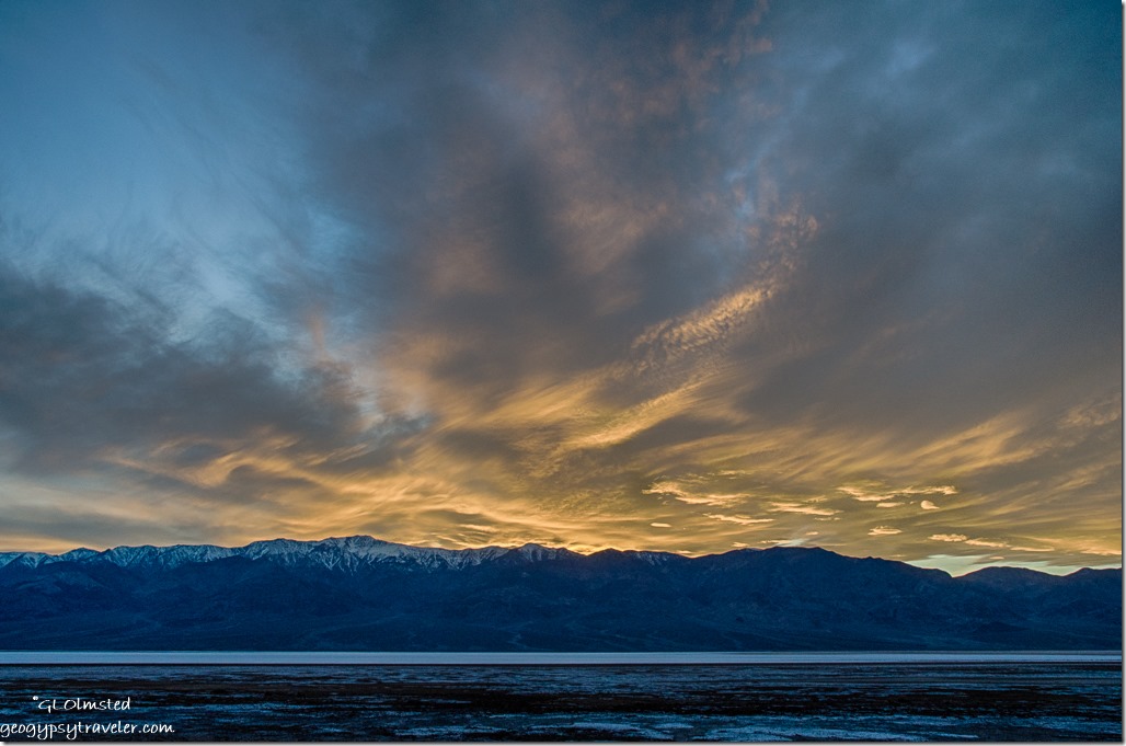
sunset Death Valley National Park California Although sunset wasn’t quite as exciting as the night before at Badwater I was rewarded with a soft sunset on the way back to camp for my last night in Death Valley.

The next morning I dumped the camper tanks and was on the road by 11am with a quick stop for signal at the sand dunes before heading to Owens Valley and the Alabama Hills outside Lone Pine, California.

* Kangaroo rat upper left, and lizard

Save

Save

Save

Save

Save

Push my buttons!

  • Facebook
  • Twitter
  • LinkedIn

Like this:

Like Loading...
California, Death Valley National Park, National Parks and Monuments, Places I've been, United States Mesquite Flat sand dunes, Mosaic Canyon, Timbisha Shoshone Tribe, Zabriskie Point 17 Comments
15 March 2017

Death Valley National Park – Chasing the gold

March 7, 2017

At Death Valley National Park it’s easy to discover gold, even if it’s not a precious metal.  I found it hiking Golden Canyon and chasing the sunset.

Sunset Panamint Range Badwater Basin Death Valley National Park CaliforniaDeath Valley is often described as the hottest, driest, lowest, highest, and wildest of national parks.  Summer temperatures can exceed 115°F, average annual precipitation about 2.5 inches, Badwater Basin at –282 feet (below sea level), Telescope Peak at 11,040 feet, and 92% of the 3.1 million acres is designated wilderness.

After avoiding abduction in Area 51 I felt ready for the extremes of Death Valley National Park.  You know I love the desert, but this section of NV373 is pretty flat and boring with only a few scattered buildings in various states of disrepair.  Somebody’s dream that didn’t make it in the middle of nowhere.  A sign for the Knights of Columbus.  Is that like the Templers from days of old?  Can’t understand why any aliens would want to land here except maybe for the whores at the cathouse.

Sunset campground Death Valley National Park CaliforniaAcross the border, CA190 dips in washes but with good pavement is adequate for any rig.  I noted a boondocking area south of the highway and not far from the park entrance.  Yet I continued on and grabbed a site at Sunset campground, not because it’s pretty, but the view’s not bad and it’s centrally located near Furnace Creek visitor center and other services that I thankfully didn’t need at the inflated prices of anything.  (Diesel was almost $5/gal.)  But at $14/night—a twofer with the senior pass—this huge level gravel parking lot with painted lines does have intermittent internet signal, and allows generators.  I took it just for sleeping in the park two nights.

Next stop, visitor center for information, maps, papers, and Ranger advice.  Scotty’s Castle could be closed until 2018.  Several roads were closed because of snow or repairs.  Always a good idea to check on current conditions.  I’m always watching for wildlife along roads.  Because the National Park Service tends to focus visitors to “features” the speed limit between viewpoints and overlooks often fluctuates between 25-65 mph.  The later seems way too fast to me considering there’s so much to see along the way.  I spent the afternoon slowly exploring south on the Badwater Road headed for the Ranger recommended sunset at Mormon Point.

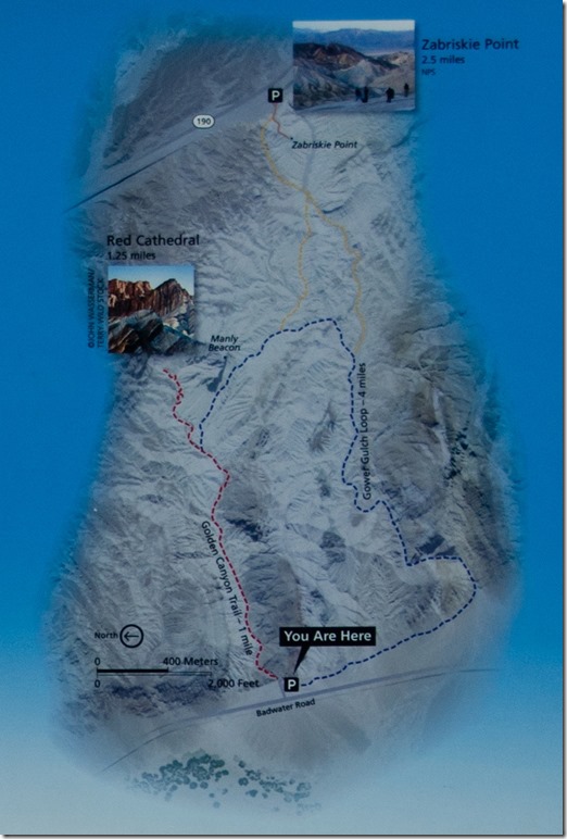
Golden Canyon trail map Death Valley National Park CaliforniaFirst stop, Golden Canyon, considered the most popular hike in the park.  A moderate 3 mile round trip trail with some easy rock scrambling ending at a canyon headwall.  Or make the hike longer on the Gower Gulch Loop or head to Zabriskie Point.
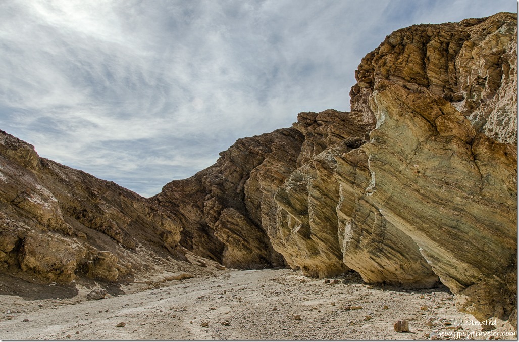
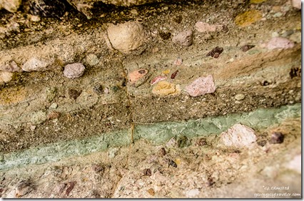
Golden Canyon Death Valley National Park California

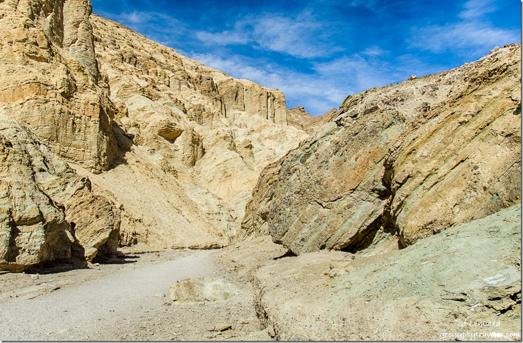
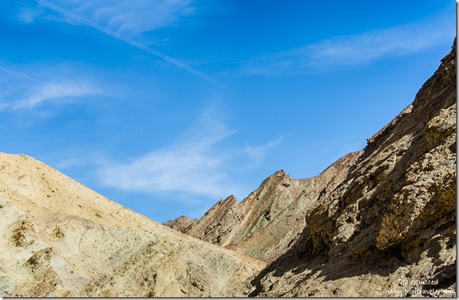
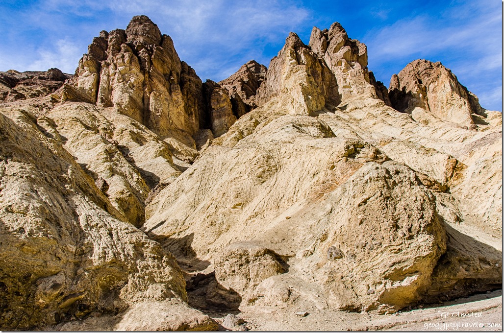
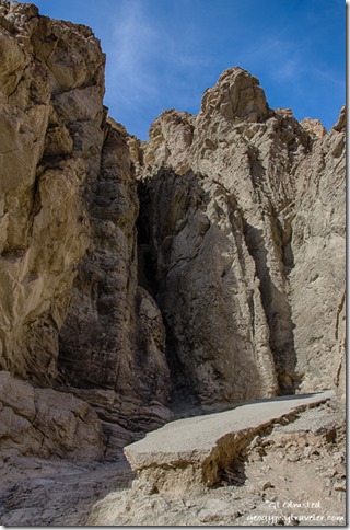
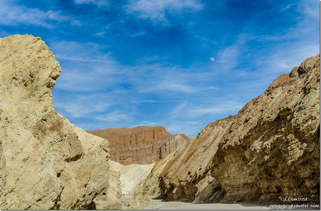
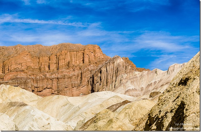
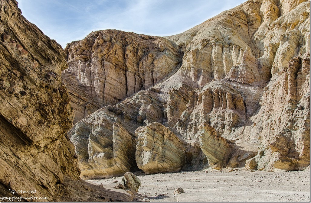
Breccia layered sediments Golden Canyon Death Valley National Park CaliforniaNeedless to say, I didn’t make it that far being constantly distracted by the carved rock walls of sediments deposited over time,  tilted and not, filled with salt-grain to jeep-size rock washed down from the Amargosa Range.


Golden Canyon Death Valley National Park California

Amargosa Range Golden Canyon Death Valley National Park CaliforniaShapes, textures and colors demanded my time and inspection.  Ancient exposed muds provided a pallet for some idiots to carve their mark.  It may take a decade for nature to dissolve this vandalism.

Golden Canyon Death Valley National Park CaliforniaThe beginnings of side canyons formed by water speaks loudly for the power of water.

Road remains Golden Canyon Death Valley National Park CaliforniaOnce a road traveled up the canyon but now only remnants of asphalt remain looking rather out of place like a sidewalk across the Sahara.


Moon Red Cathedral Golden Canyon Death Valley National Park California

Red Cathedral Golden Canyon Death Valley National Park CaliforniaI strolled about an hour up canyon, Red Cathedral within sight but not my destination.

Golden Canyon Death Valley National Park CaliforniaThen back in half the time yet seeing different forms and light.  With Artists Drive closed for repairs, I parked on the shoulder for a while to enjoy the calico colors at the base of the Amargosa Range.  Hard to believe the rocky fans below these magnificent mountains weren’t blanketed in yellow like last year for at super bloom.

Devils Golf Course Death Valley National Park California

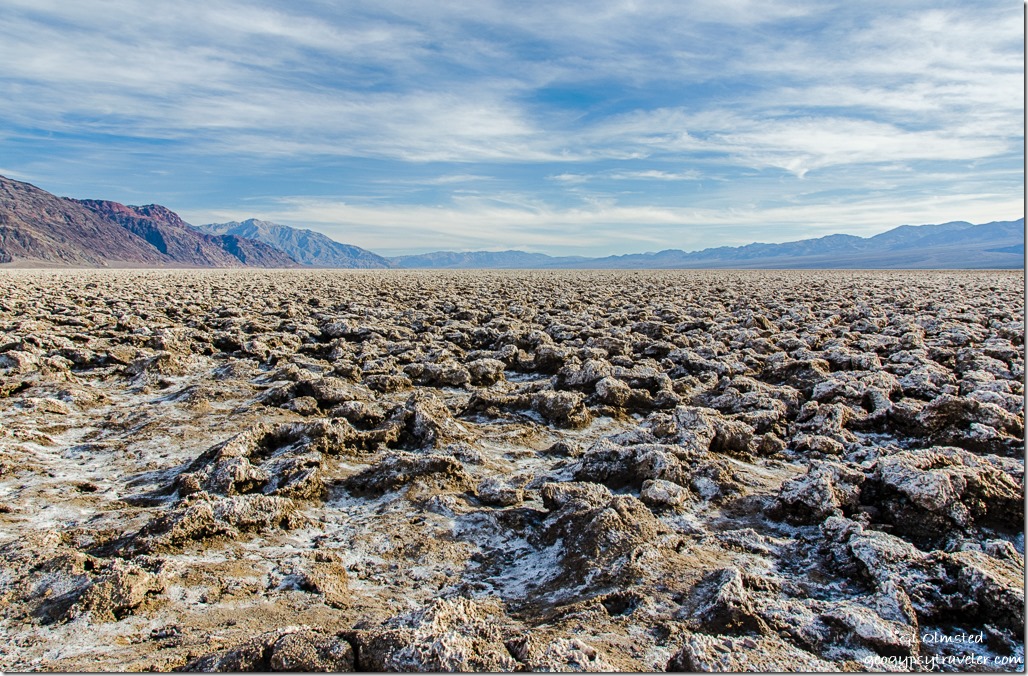
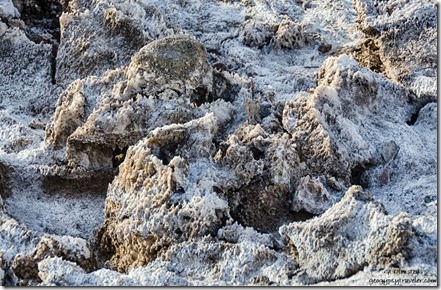
Salt pinnacles Devils Golf Course Death Valley National Park CaliforniaNext stop, Devils Golf Course, note all the deathy names.  Deposited by ancient salt lakes and shaped by wind and rain, jagged crystallized salts constantly change by the forces of nature.  And also sadly by ignorant visitors who walk onto the fragile landscape.  The Death Valley salt-pan is one of the largest protected salt-pans in North America.  It is said that on a warm quiet day you may hear a metallic clicking sound as the salt pinnacles expand and contract.  All I heard was people talking.

Snowy Panamint Range Death Valley National Park CaliforniaHigh above this harsh dry environment towers the Panamint Range buried in snow that come spring melt will, hopefully, bring life giving waters to the valley floor.

Last light Amargosa Range Badwater Basin Death Valley National Park CaliforniaI continued following the twisty road past the crowded official Badwater parking to Mormon Point.  But it is way too far away from the campground for a dark return drive.

Sunset snowy Panamint Range Badwater Basin Death Valley National Park California

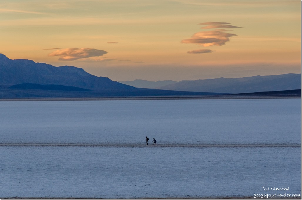
Sunset snowy Panamint Range Badwater Basin Death Valley National Park CaliforniaSo I returned to the Badwater area where the shoulder was full of telltale photographers and found an open piece of shoulder to see what unfolded.

Sunset Badwater Basin Death Valley National Park California

Sunset people Badwater Basin Death Valley National Park CaliforniaI still didn’t stay for the entire show. Yet some folks did.

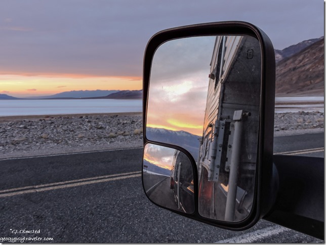
Side mirror sunset Death Valley National Park California

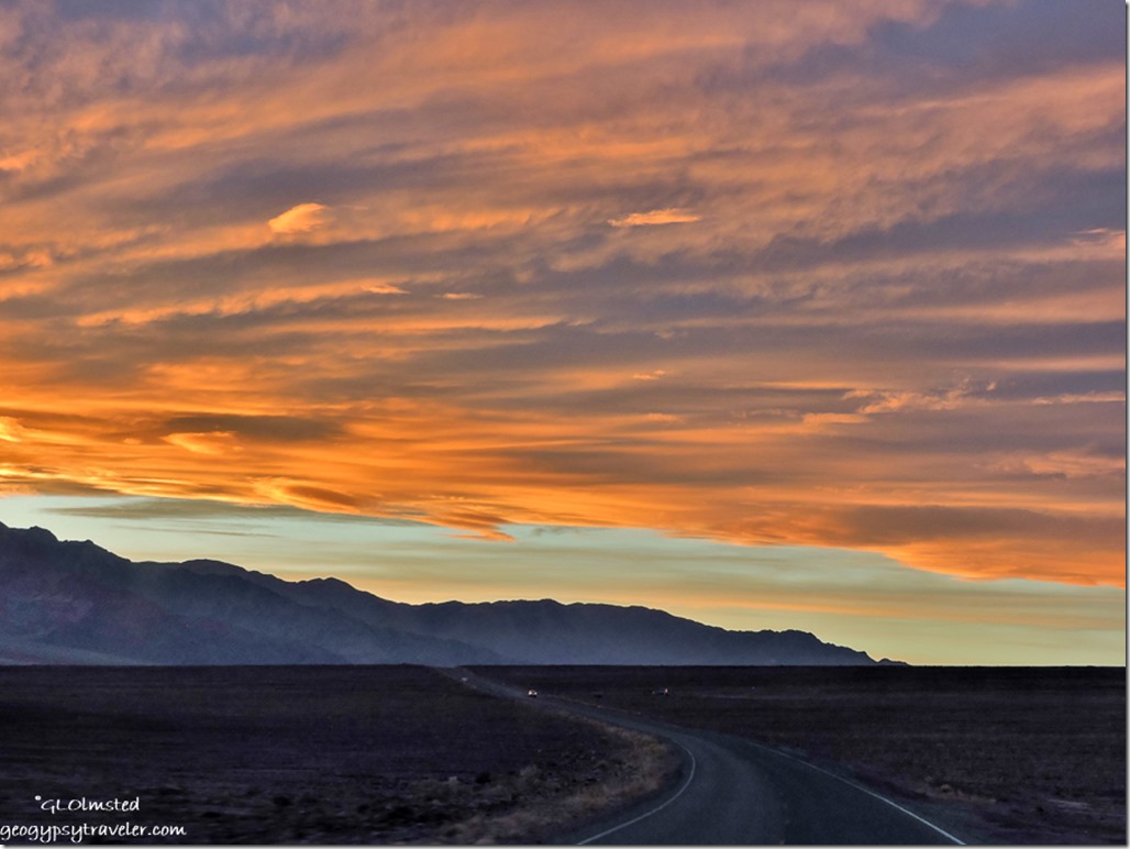
Sunset Panamint Range Badwater Basin Road Death Valley National Park CaliforniaBut did take pics while driving back to camp.

Because I don’t particularly like to drive after dark, get out of bed before daylight, or stay up all night for stars, I place limitations on myself and the photography.  Yet the next morning I forced myself up early to get to the Mesquite Flat Sand Dunes.

Save

Save

Save

Save

Push my buttons!

  • Facebook
  • Twitter
  • LinkedIn

Like this:

Like Loading...
California, Death Valley National Park Badwater Basin, Devils Golf Course, Golden Canyon, sunset, Sunset campground 13 Comments
← Older posts

Hi, I’m Gaelyn, the Geogypsy

I retired after 29 summer seasons as a Park Ranger, traveling solo for 40+ years. My passions include travel, connecting to nature, photography, and sharing stories.

I started exploring US National Parks in 1977 and 20 years later became a seasonal Park Ranger.  I’ve lived full-time in a RV for 30 years working summers and playing winters.  I’m still trying to figure out what I want to be when I grow old, other than grow up.

Let’s share our stories.  Here’s more of mine…

My wheeleastate

I am currently…

…boondocking somewhere in southern Arizona.  In the area, give a shout.

Geogypsytraveler on YouTube

Follow my journey on YouTube. Just click the pic. Hope you’ll like, share, and subscribe.

Click image for 7 minute documentary (Password “geogypsy” lowercase)

Making the Gypsy documentary is a story of its own.  Click below for the rest of the story.

Living nomadically & connecting to nature documentary

Subscribe to Blog via Email

Enter your email address to subscribe to this blog and receive notifications of new posts by email.

Photos available for sale include prints, greeting cards, coffee mugs, tote bags, phone cases and more

Reflected Wave 24X16 metal print under $100

Custom Coffee Mugs

Many items to choose from including prints

The Last Blast 24 x 16″ metal print under $100

Need a signal boost? When I boondock on public lands sometimes signal is weak or intermittent and a booster helps. Click the pic to visit WeBoost.

Connecting to nature and the rest of the world too.

Please contact me for photo purchases not seen at GLOlmsted Photography

Order fulfillment is by Fine Art America. If you’re not happy with your purchase, for any reason, simply return it within 30 days, and you’ll receive a full refund of the purchase price.

Why read Geogypsy?

The gypsy life spring-summer 1998 - "You were a real pioneer. RV'ing before it was cool." ...Yogi

How do you process photos? - “Your photographs create an Emotional feeling in the viewer...that they become One with You.” …Cindy

Life’s transitions between travel and work play - "I know you love your job as much as you love travel -- it shines through all your posts." ...Sallie

Lions at Kruger National Park - “Wonderful post, thank you. I was hooked start to finish!” … Peter B

11 lessons looking back 2013 - “A great post -- made me think, made me smile, made me want to cry." ...Sallie

Wildlife video Kruger National Park - “Gorgeous, this makes me want to go straight to South Africa now.” … Ayngelina

Living nomadically & connecting to nature documentary - “What an experience you had and gave to the "crew." Sometimes I think you don't realize how unique and inspiring you are.” …Alan

Search

Popular Posts

1. Prioritize the well-being of nature over photography. 2. Educate yourself about the places you photograph. 3. Reflect on the possible impact of your actions. 4. Use discretion if sharing locations. 5. Know and follow rules and regulations. 6. Always follow Leave No Trace principles and strive to leave places better than you found them. 7. Actively promote and educate others about these principles

Categories

Archives

Sites I follow, read & recommend

  • A Full-time Life
  • A Yankee in Belgrade
  • Bob's Eyes
  • Box Canyon Blog
  • Camels and Chocolate
  • Dawns bloggy blog
  • In the Direction of Our Dreams
  • Jane in her infinite wisdom
  • Janie and Steve, Utah Trails
  • Kathie's Birds
  • Las Adventuras
  • Memorable Meanders
  • Oh, The Places They Go
  • On the Road Abode
  • Port Elizabeth Daily Photo
  • Stillhowlyntravels
  • Take to the Highway
  • Technomadia
  • the good luck Duck
  • Travel with the Bayfield Bunch
  • Wandering Earl
  • Wheeling It
  • Yogi's Den

Caught in a Slot 9×12 canvas print under $50

If you don’t like what’s going on in your government, contact your Congress

Directory of Senators

Directory of Representatives

Lijit

© Copyright 2008-2024. Geogypsytraveler.com
%d