
 I spent 14 days during early May free camping at Indian Bread Rocks and even got up the nerve to climb the boulders. Lots of space for boondocking, adequate signal, friendly four-legged bovine neighbors, and a bonus June full moon.
 Chiricahua National Monument
 After visiting Chiricahua National Monument I drove north to Wilcox where I bought propane and diesel then went east to Bowie and south to Indian Bread Rocks Recreation Area. I kind of went the long way around, but with purpose.
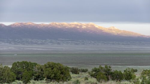
 This BLM managed site looks at the Dos Cabezas Mountains (Spanish for Two Heads) from the opposite side of Chiricahua. And the rocks are a whole lot different.
 After scoping out a couple places to park I chose a large and level space within sight of the gravel road and day-use area with an amazing view and signal too. My nearest neighbor, barely in sight over 100 feet away, ran a noisy generator the first afternoon and thankfully pulled out the next morning. The replacement neighbor was quiet.
 Because I was totally stocked I could stay in this amazing place for a full 14 days. And thus, there will be even more photos than usual.
 Ash-throated Flycatcher
The palpable silence was only broken by delightful bird song from the nearby Mesquite tree.
 Oh, and the startlingly loud lowing, which comes from a word that means to shout, MOO of a cow leading a few others to graze among the boulders every morning, then back to wherever in the late afternoon. Indian Bread Rocks is managed by the Bureau of Land Management (BLM) which allows grazing on public lands. I spent a bit of time sitting outside chasing shade while watching my newest world go by.
 Sierra decided she wanted outside as well and head bumped the screen door open. Took me three days of thinking how to better latch that door and even longer to get to a hardware store for a hook-n-eye latch.
 In the meantime, I put Sierra’s harness on with no fuss, clipped on her leash, carried her outside and she went straight under the shade and safety of the truck. I took a short video that went viral. (She gets better numbers than I do.) Then she immediately backed out of the harness and went wandering straight into the thick leafy duff under the Mesquite. I ended that foray not quite quick enough to keep her extra-long fur from acting like a leaves-magnet before putting her back in the camper. Sierra isn’t keen on being brushed but will let me trim a little so within a few days sported a rather choppy haircut.
 Black hawk, lifer
 No more going outside for her as I get stressed and worry about her becoming prey.

 But she’s figured it out now and continued to bump the door open. If she’d stay close by or come when she’s called it might work. But I worry, so back inside she finally goes. With temperatures in the high 80s I have to keep the outside door open for air flow. I blocked her way with water bottles in front of the door.
 Sitting outside in the Mesquite tree shade I didn’t get much reading done because of constantly snapping photos.


 Loved watching the light and shadows change throughout the day.

 And I watched for the moon in anticipation of seeing it full rising over the boulders of Indian Bread Rocks.


Possibly immature Orioles (feel free to chime in)
The mornings felt cool at 65° before climbing into the low to mid 80s. My signal was good enough to post on the blog and with some patience load videos. The first of May, and I was still sharing stories from March and April.
 Later in the day under clouds it felt like a sultry Spring desert day, warm enough to be dressed for summer. And even though I was in no hurry to leave Indian Bread Rocks, temperatures would rise into the 90s in another week or so. That meant I researched ahead to possible next destinations that included weather and boondocking options. Maybe the Tonto National Forest and Roosevelt Lake. Or Hwy 191, known as the Coronado Trail, north through the White Mountains with 460 curves. Paved all the way through the Apache-Sitgrieves National Forest sounded like my kind of road but possibly too much elevation and cold temperatures.

 Once again the evening light show was worthy of awe.
 On super windy days I stayed inside and worked on videos from Buenos Aires NWR back in April. Still watching the moon.
 I appreciated the wind keeping an 85° day comfortable. After sunset the wind drops and the temperature does too.

 I started seriously watching for the moon in anticipation of May’s full Flower moon.

 Could I catch it coming up over some boulders? According to PhotoPills I could if I was near the Indian Bread Rocks day-use area. Being parked next to that proved convenient, though it was never really busy even with multiple picnic tables, BBQs, and a drop-pit toilet.

 I hoped for no clouds.

 And got real lucky.

 Photo dump!


 Only a few of the too many I took.


White-winged Dove Cactus Wren
The next morning while processing the moon shots I was serenaded and distracted by birds. No complaint. Managed to upload a 360° camp view at Mittry Lake video that took over an hour.
 That afternoon, I decided it was finally time to walk into the boulders of Indian Bread Rocks.


I followed the meandering cow trails while avoiding pies and saw cactus’ colorfully blooming.


I just kept walking along and was surprised at the ease of getting almost to the top.
 Didn’t actually climb boulders but did end up several hundred feet above camp. See the truckcamper?

 And I could have climbed higher.


Large black Carpenter bees swarmed the blooming Ocotillo.

 The view northeast goes forever, even seeing I10 about five miles away, as the Ravens fly. Gone almost two hours and walked just under half mile. Guess Fit doesn’t count elevation.
 After all the photos and videos taken over several days I spent several more days processing and editing. Sure glad for birdy distractions outside my window. Finished Mittry Lake video and it took 4 1/2 hours to upload.
 Strangest sighting occurred at dusk when something large, in flight, landed on the boulders, and I saw the silhouette of a Great Horned Owl.
 I see two bears
 What do you see?
I put off leaving Indian Bread Rocks for a few more days but also started to make a plan for my next stop. A cold front would keep me from going to the 11,000 foot White Mountains. Nice thing about boondocking 1-2 weeks in a place is being part of the landscape unlike a short visit. And even that is often not long enough.

 Actually awake early enough to catch the setting moon.


The rest of the day was birdy. Black hawk was a lifer.


Took a while to identify this Scott’s Oriole as immature birds can be foolers.
 Always nice to see Gamble Quail about though too early in the season for chicks.
 Then, before I knew it, it was time to leave Indian Bread Rocks. Not 100% sure of my next destination and still trying to catch up posting on the blog.

 TeePee Cafe
Made a quick stop in Bowie where everything is closed except the post office.
") Then headed north to Sunshine RV Park in Safford for the night to dump, fill, and take a much appreciated long hot shower, all for $25. Appears lots of working folks live here but a nice quiet place and I had a good view. In the morning I shopped, including that latch for the screen door, and continued on my journey.
Then headed north to Sunshine RV Park in Safford for the night to dump, fill, and take a much appreciated long hot shower, all for $25. Appears lots of working folks live here but a nice quiet place and I had a good view. In the morning I shopped, including that latch for the screen door, and continued on my journey.
Video of Indian Bread Rocks here.
If you’re wondering how I find these places, lots of apps for free/wild/dispersed camping/boondocking. My recent favorite is iOverlander as it’s still free and shows what I need: propane, RV dump & potable water, free camping, campgrounds, and more.


 Once I entered Chiricahua National Monument there was a small cemetery for Erickson family members who settled here in 1888 building the Faraway Ranch, but their home was closed for renovations. They were preceded by the Chiricahua Apaches as the first known people to occupy the area—and visited by the Spanish during the 1500s—before being relocated by the government in 1886.


