• Home
  • About Geogypsy
    • Herstory
    • Parks where I’ve worked
  • Places I’ve been
    • United States
      • Arizona
        • Antelope Slot Canyon
        • Casa Grande Ruins National Monument
        • Colossal Cave Mountain Park
        • Flagstaff
        • Glen Canyon National Recreation Area
        • Grand Canyon National Park
          • Grand Canyon National Park North Rim
          • Grand Canyon National Park South Rim
          • Toroweap
        • Havasu Canyon
        • Horseshoe Bend
        • Jerome
        • Kaibab National Forest
        • Lee’s Ferry
        • Meteor Crater
        • Navajo Bridge
        • Oak Creek Canyon
        • Painted Desert
        • Pipe Springs National Monument
        • Prescott
        • Quartzsite
        • Saguaro National Park
        • Sedona
        • Sunset Crater Volcano National Monument
        • Vermilion Cliffs
        • Walnut Canyon National Monument
        • Wupatki National Monument
        • Yarnell
      • California
        • Anzaberrego
        • Bakersfield
        • Death Valley National Park
        • Joshua Tree National Park
        • Redwoods NP
        • Salton Sea
        • Yucca Valley
      • Colorado
        • Mesa Verde National Park
      • Florida
      • Illinois
        • IL River
        • Morton Arboretum
        • Starved Rock State Park
      • Michigan
      • Nevada
      • New Mexico
      • Oregon
        • Crater Lake NP
        • Mt Hood
        • Oregon Caves National Monument
      • Texas
        • Alpine Texas
        • Padre Island
        • Port Isabel
        • Rio Grande Valley
      • Utah
        • Brian’s Head
        • Bryce Canyon National Park
        • Buckskin Gulch
        • Cedar Breaks National Monument
        • Cedar City
        • Coral Pink Sand Dunes State Park
        • Dixie National Forest
        • Grand Staircase Escalante National Monument
        • Johnson Canyon
        • Kanab
    • World Travels
      • Germany
      • Mexico
      • South Africa
  • Tours
  • Photography
  • Work with Me
    • Sponsors
  • Contact
Geogypsy
Menu
  • Home
  • About Geogypsy
    • Herstory
    • Parks where I’ve worked
  • Places I’ve been
    • United States
      • Arizona
        • Antelope Slot Canyon
        • Casa Grande Ruins National Monument
        • Colossal Cave Mountain Park
        • Flagstaff
        • Glen Canyon National Recreation Area
        • Grand Canyon National Park
          • Grand Canyon National Park North Rim
          • Grand Canyon National Park South Rim
          • Toroweap
        • Havasu Canyon
        • Horseshoe Bend
        • Jerome
        • Kaibab National Forest
        • Lee’s Ferry
        • Meteor Crater
        • Navajo Bridge
        • Oak Creek Canyon
        • Painted Desert
        • Pipe Springs National Monument
        • Prescott
        • Quartzsite
        • Saguaro National Park
        • Sedona
        • Sunset Crater Volcano National Monument
        • Vermilion Cliffs
        • Walnut Canyon National Monument
        • Wupatki National Monument
        • Yarnell
      • California
        • Anzaberrego
        • Bakersfield
        • Death Valley National Park
        • Joshua Tree National Park
        • Redwoods NP
        • Salton Sea
        • Yucca Valley
      • Colorado
        • Mesa Verde National Park
      • Florida
      • Illinois
        • IL River
        • Morton Arboretum
        • Starved Rock State Park
      • Michigan
      • Nevada
      • New Mexico
      • Oregon
        • Crater Lake NP
        • Mt Hood
        • Oregon Caves National Monument
      • Texas
        • Alpine Texas
        • Padre Island
        • Port Isabel
        • Rio Grande Valley
      • Utah
        • Brian’s Head
        • Bryce Canyon National Park
        • Buckskin Gulch
        • Cedar Breaks National Monument
        • Cedar City
        • Coral Pink Sand Dunes State Park
        • Dixie National Forest
        • Grand Staircase Escalante National Monument
        • Johnson Canyon
        • Kanab
    • World Travels
      • Germany
      • Mexico
      • South Africa
  • Tours
  • Photography
  • Work with Me
    • Sponsors
  • Contact

Category: monsoon

26 August 2020

Monsoon rains returning to Bryce Canyon

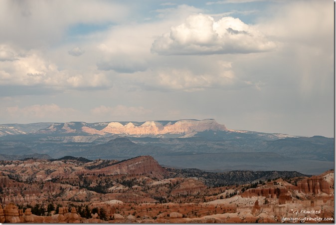
Pink Cliffs Sinking Ship valley light on Table Cliffs storm clouds Bryce Canyon National Park UtahStarting with just a tease of rain clouds and a few sprinkles on my second day off last week I welcome the monsoon rains returning to Bryce Canyon on my first day back to work.

Ok, I’m going to try for another weekly update for the Bryce Canyon COVID summer, but not that much has happened.  Last of three lazy days off work I started thinking about the 2021 calendar.  I don’t have all that many, what I consider spectacular, photos from the last year because of breaking my wrists and not making photos for over four months.

Also thinking about what to do after my summer season ends in mid-October.  Maybe a fall journey into Southeast Utah—Capital Reef, Canyonlands, Arches, etc–then south and westward to Prescott for teeth, eyes, haircut, etc., before further south and possibly southeast depending on weather.
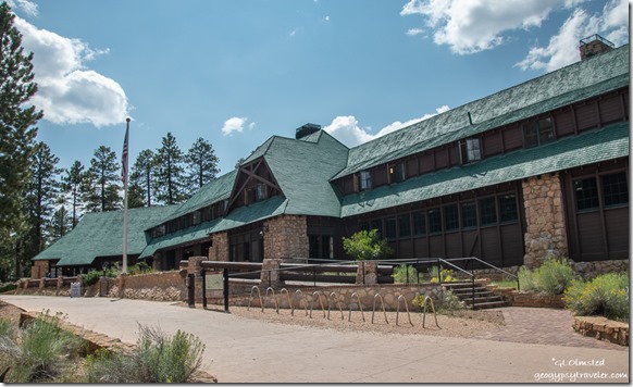
Lodge Bryce Canyon National Park UtahAugust is a good month for national park celebrations:  The 21st marked the Historic Sites Act of 1935 “to preserve for public use historic sites, buildings, and objects of national significance for the inspiration and benefit of the people of the United States.”  Bryce Canyon Lodge was listed on the National Historic Registry ‎May 28, 1987.  Not many of these 1920s rustic lodges left in the Southwest. Which one’s have you seen?
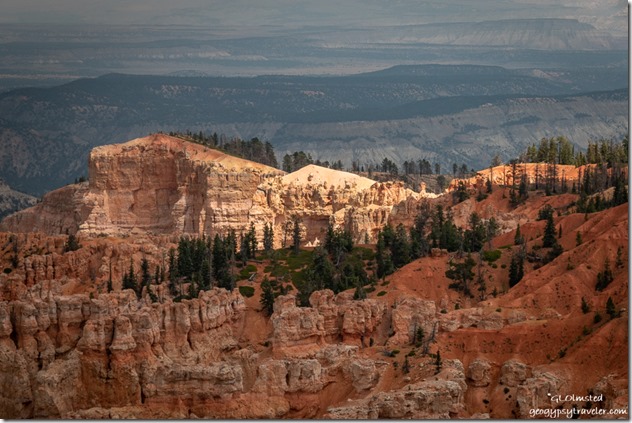
light hoodoos trees Rainbow Point Bryce Canyon National Park UtahBack to work and after opening the information area outside the visitor center and staffing for several hours I drove to the end of the scenic road, Rainbow and Yovimpa Points, for a favorite day away from the busiest areas in the park.

smoke haze from Yovimpa Point Bryce Canyon National Park UtahBecause fire crew could be heard cutting with chainsaws nearby that segued into talking about fire ecology as soon as I walked to the rim.  An appropriate topic with the hazy view south where smoke from California fires reduced visibility to about 40 miles, half the normal view.  Soon after, a few visitors arrived who were interested in the geology so I presented an abbreviated version of the scheduled 20-minute 12:30 Grand Staircase talk twenty minutes early.  Good thing, because dark clouds gathering overhead cancelled the scheduled talk.  As I walked to Rainbow Point for a better view and to remind people about lightning dangers, I was joined by the park’s Superintendent coming off a side trail from Yovimpa Pass.
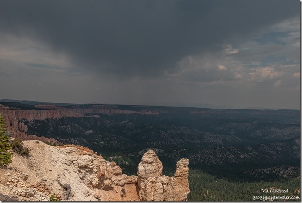
hoodoos trees valley Pink Cliffs storm cloud rain Rainbow Point Bryce Canyon National Park UtahFrom Rainbow Point’s almost 180° view east it looked like the storm was moving northeast and away from the point.  Moments after taking the above photo, I saw lightning and counted it as less than two miles away.  That was almost immediately followed by a reversed cool wind right in the face.  Time to get safely in vehicles.  I tell visitors that and advise against hiding under the roof of a historic structure that isn’t grounded.  Sometimes I point out lightning scared trees.
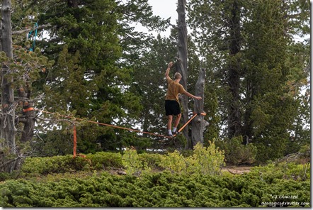
visitor slacklining Yovimpa Point Bryce Canyon National Park UtahAnd speaking of scaring trees…  I am happy to say Bryce Canyon doesn’t allow anything tied to trees—lights, hammocks, clotheslines, slack-lines, etc.—because it is bad for the trees.  Especially the predominant Ponderosa Pine with it’s large chunky bark that is prone to break off.  But really, not dead trees either.  Seems if visitors are planning any unusual activities they should ask a Ranger if it’s OK.
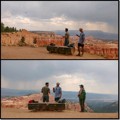
Ranger Paula with drone visitors Bryce Canyon National Park UtahFlying drones is illegal in all national park sites.  I know many things have changed since the National Park Service was established by the 1916 Organic Act, however the mission still includes….

“The service thus established shall promote and regulate the use of the Federal areas known as national parks, monuments, and reservations hereinafter specified by such means and measures as conform to the fundamental purpose of the said parks, monuments, and reservations, which purpose is to conserve the scenery and the natural and historic objects and the wild life therein and to provide for the enjoyment of the same in such manner and by such means as will leave them unimpaired for the enjoyment of future generations.”
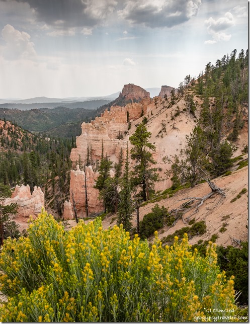
flowering bush trees hoodoos valley clouds Sheep Creek overlook Bryce Canyon National Park UtahBecause of the impending storms I started to drive back to the visitor center, with a stop at Sheep Creek/Swamp Canyon overlook along the way.  I’d been told earlier by visitors at Rainbow Point about being hailed on at the Natural Bridge overlook.  Hail is not uncommon during a high elevation monsoon storm.  But not pleasant while riding a motorcycle like some folks I saw.

Sierra cat waiting for water glass in RV Bryce Canyon National Park UtahRain may have sent the little mouse inside that Sierra caught, but only to play with.  I threw a towel over the poor thing, wrapped it and threw it back outside.  Haven’t seen any more thank goodness.
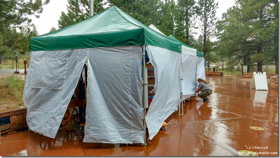
Ranger April sales tents closed raining by visitor center Bryce Canyon National Park UtahMonsoon rains during Sunday had us scrambling a bit to close and cover the outside merchandise and move Rangers indoors to answer questions.  I was outside counting people for our limitation of 50 in the building for safe distancing.  But due to nearby lightning we up the count to 60 and try to get people under the wooden porch cover while they wait to go inside.  Didn’t last too long.  I wondered if my evening program at the outdoor amphitheater would be rained out but it was just cloudy so the show went on.  Two gals hung out afterwards to ask whether I thought it would rain that night as they were tent camping.  I told them that monsoon storms usually stop by 11pm and don’t start until 11am, but that I also don’t predict the weather.  I swear, just after I got home that night, the rain started at 11pm and continued on and off all night.  Oops.
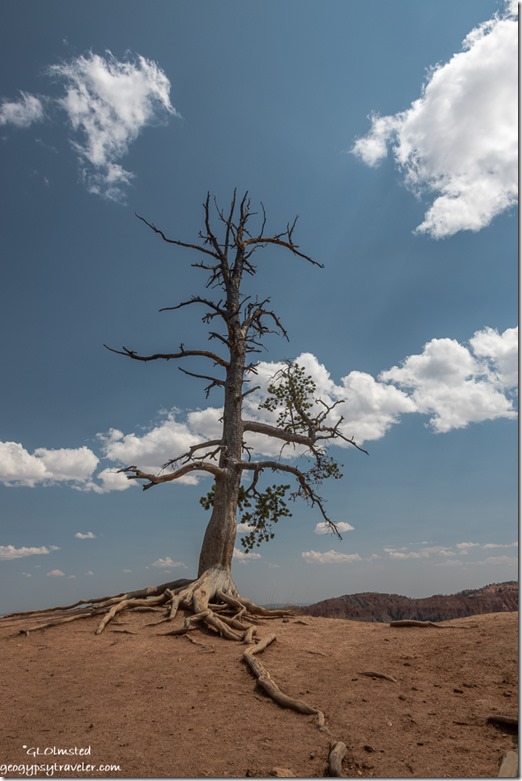
Bristlecone Pine on rim clouds Bryce Canyon National Park UtahYou may think me dead but look closer to see I survive on the edge. The land erodes away beneath my roots. Drought causes me to sacrifice. People climbing on me doesn’t help. Yet I live centuries. ~Bristlecone Pine
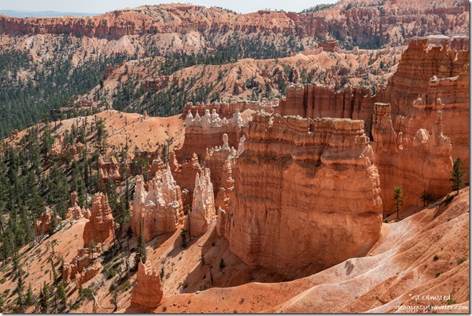
hoodoos from rim Bryce Canyon National Park UtahThe next day predicted a 30% chance of T-storms for afternoon so I wondered if my two hoodoo geology talks would go.  But it turned into a beautiful day with white fluffy clouds and just enough breeze to make the high 86° day hikeable.  And so the 11am and 1pm talks went on.
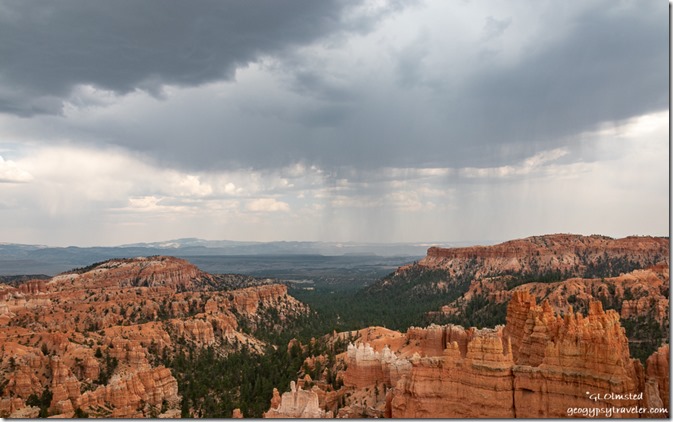
hoodoos valley storm clouds rain Bryce Canyon National Park UtahMy Friday—on Tuesday—started with door counting followed by the information station after lunch. By the time I headed to the rim for the 4pm Rim Walk clouds were building and rumbling but I didn’t see any lightning and only a handful of drops fell.  And so I walked with nine visitors talking about the cultural history of Bryce Canyon and how people have connected to the land over time.  With only two stops along the rim the talk ends after less than a mile and about an hour at the historic lodge.

As I sit inside on my first of two days off writing this post, a light rain falls in the afternoon and thankfully stops the noisy construction going on at the corral below where I live.  I like to listen to the world around me, including the monsoon rains returning to Bryce Canyon, even if it’s just briefly.

Push my buttons!

  • Click to share on Facebook (Opens in new window) Facebook
  • Click to share on X (Opens in new window) X
  • Click to share on LinkedIn (Opens in new window) LinkedIn

Like this:

Like Loading...
Bryce Canyon National Park, COVID-19, monsoon, Park Ranger, Places I've been, United States monsoon, Organic Act, Park Ranger 26 Comments
28 August 2013

Monsoon visits Grand Canyon and What to do when it rains

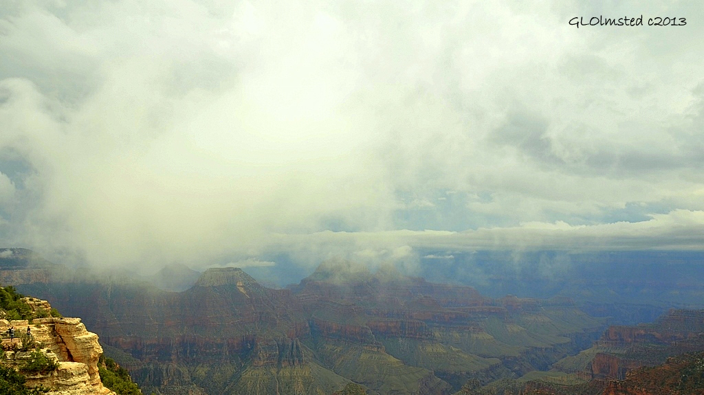
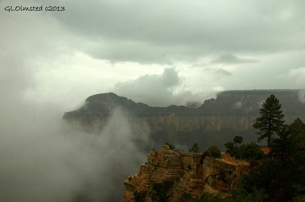
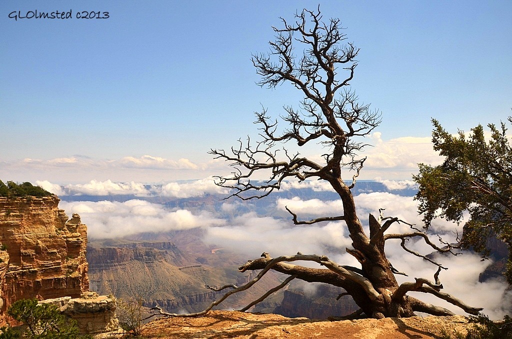
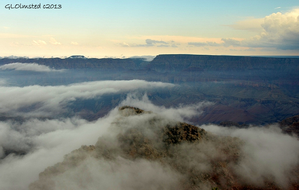
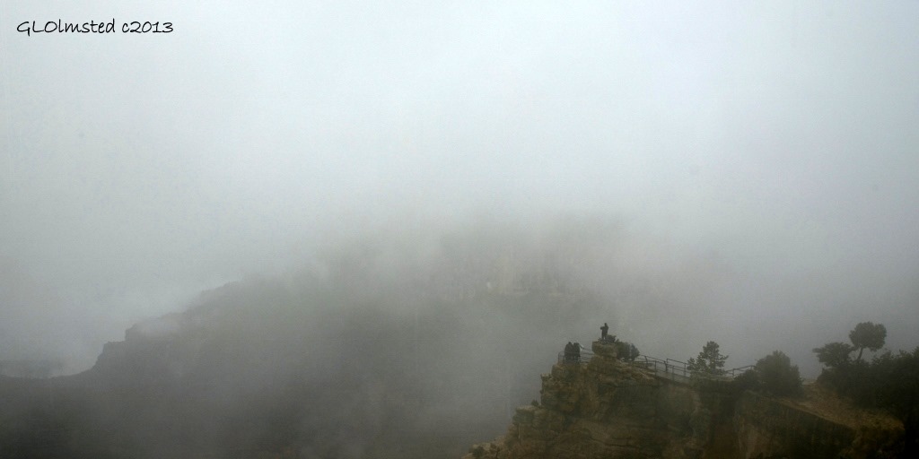
Foggy monsoon view North Rim Grand Canyon National Park Arizona

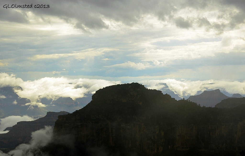
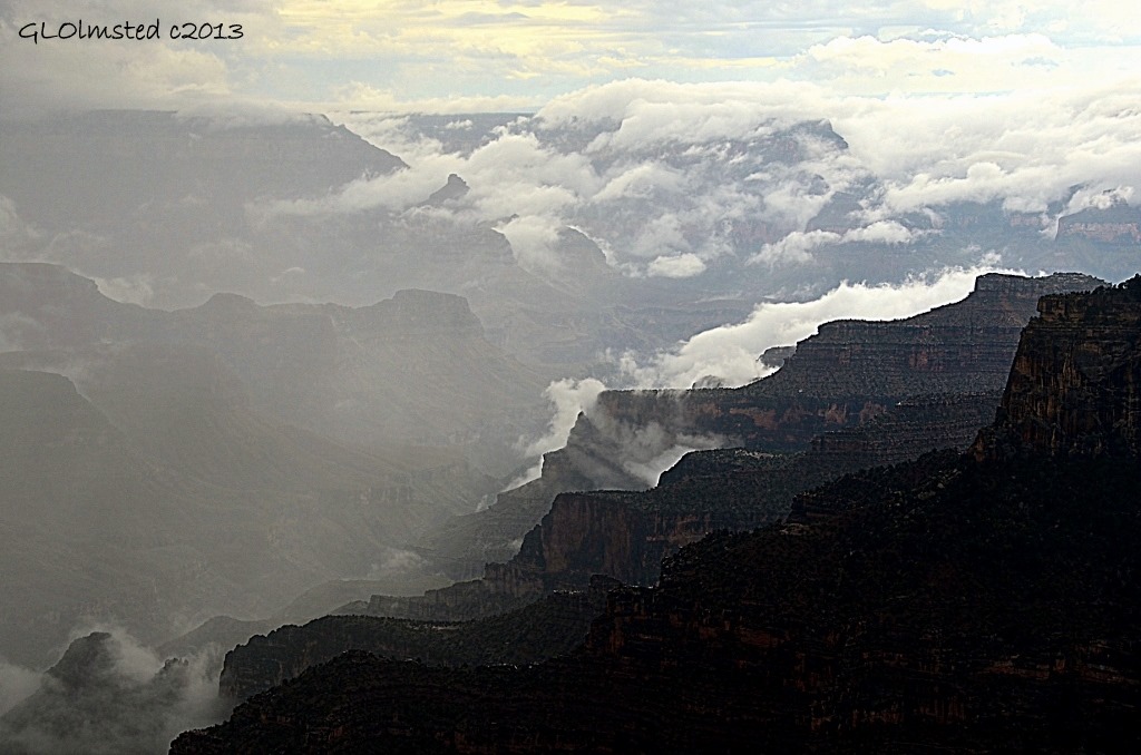
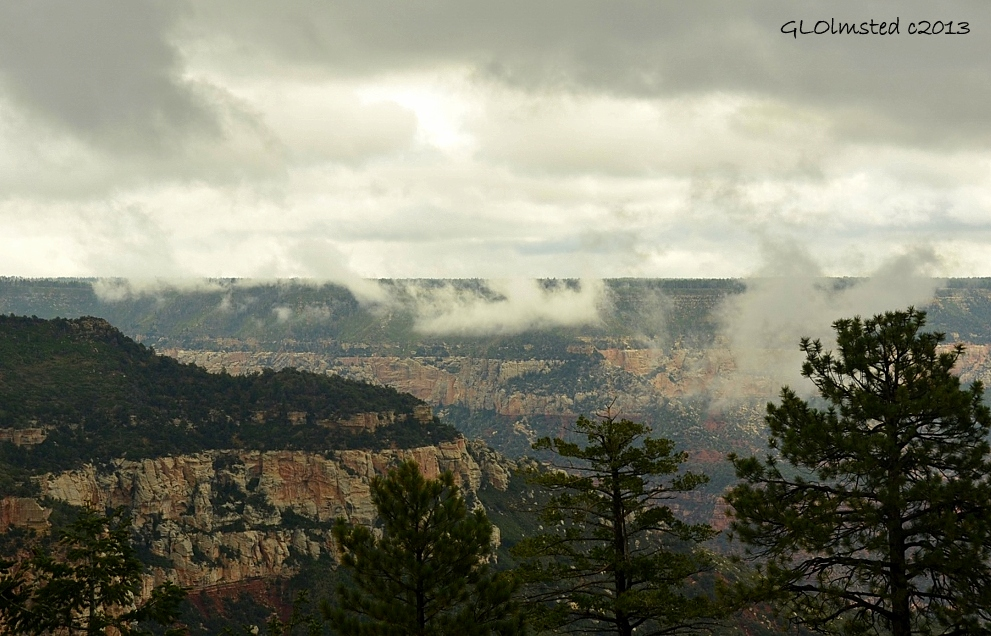
During July and August monsoon season brings much need moisture to the Southwest.  Unfortunately for visiting tourists, who seem to think all of Arizona is a constantly dry desert, rain will most likely happen almost every afternoon.  So the number one question Park Rangers at Grand Canyon hear is, “When will it quit raining?”  We are not weather forecasters, but we can tell you about monsoon, how to be prepared and to have patience for some possibly most amazing views.

Monsoon clouds hanging over the canyon North Rim Grand Canyon National Park Arizona

What is monsoon?

The term monsoon comes from the Arabic mausin, a season of high temperatures, high winds and high moisture.  This seasonal phenomena occurs in other regions of the world including Asia, South America and Africa.  The North America monsoon occurs over northwest Mexico, Arizona, New Mexico and parts of Colorado and Utah.

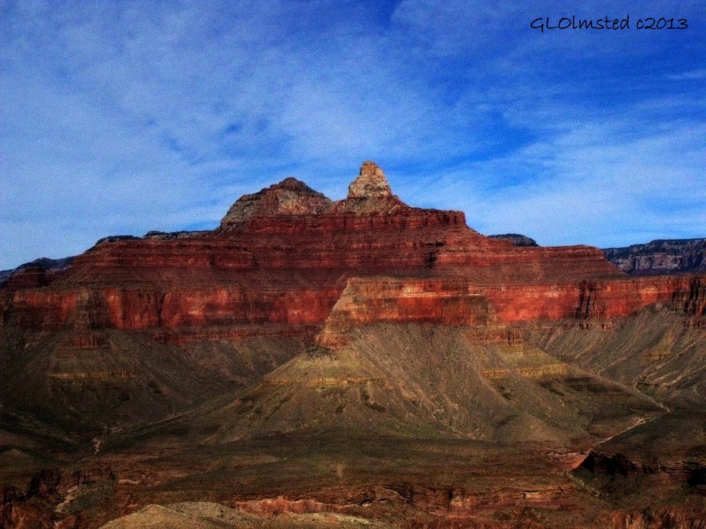
Brahma & Zoroaster temples from South Kaibab trail Grand Canyon National Park Arizona

During winter Arizona’s primary wind flow comes from the west or northwest, across the land and towards the ocean, making the air dry.  That’s one of the reasons the southern desert offers major appeal to northerners, or snowbirds, who spend winter in a delightful summer-like atmosphere.  But they’ve left by spring when early summer temperatures increase to sometimes stupidly high and the remaining hardy desert residents anticipate the moisture laden monsoon to cool things off a bit.

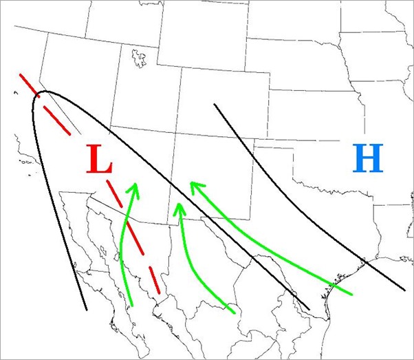
Monsoon wind pattern map

When the wind shifts and comes from the south sometime in July, now ocean to land, moisture held in huge upper air subtropical high pressure cells (read huge fluffy clouds) meet the intense heat rising off the desert causing thunderheads to grow bringing the increased chance of usually afternoon storms.  Downpours, or bursts, are often short in duration followed by breaks.  These storms can be especially strong at elevation and the Colorado Plateau ranges from 7,000 to 10,000 feet (2133 to 3048 m).

Sunset & virga from Lodge North Rim Grand Canyon National Park Arizona

Of course sometimes the rain never touches the ground due to the extreme heat and evaporation.  Called Virga, the effect is stunning when viewed across canyon.

Monsoon clouds in canyon North Rim Grand Canyon National Park Arizona

Monsoon season does not end as abruptly as it begins. While it takes time for the land to heat up, it also takes time for that land to cool in the fall. This makes monsoon season a time of rainfall that diminishes rather than ends.

In 2008 the National Weather Service decided from now on June 15 will be the first day of the monsoon, and September 30 will be the last day.  Of course that doesn’t mean it will rain constantly between those dates.  I think they are just covering their butts.

Tropical wave

Monsoon cloud filled canyon from Lodge North Rim Grand Canyon National Park Arizona

Add to monsoon the possibility of tropical storms, or waves, that equate to an increase of rain, very steady for as long as it hangs out.  In August 2013 this lasted almost three days as low pressure to the east held Tropical Storm Ivo in place on the Kaibab Plateau.  Tropical storms can preclude a hurricane which are exceedingly rare, but not impossible, in Arizona.

Sun & cloud in canyon North Rim Grand Canyon National Park Arizona

What to do in the rain?

The second most common question as a Park Ranger during monsoon season is, “What can we do in the rain?”

Monsoon clouds in canyon North Rim Grand Canyon National Park Arizona

I sympathize that visitors on vacation would all like ideal weather conditions, not too hot, not too cold, not too wet.  Maybe a little pre-planning would help plus being prepared for all kinds of weather.

Sunset over canyon North Rim Grand Canyon National Park Arizona

Typical monsoon—if there’s anything typical about weather—doesn’t usually bring rain until after 11 am so get out to hike and enjoy the canyon views in the morning.  Later in the afternoon the sky often clears.  And sometimes brilliant sunsets flare over the canyon.

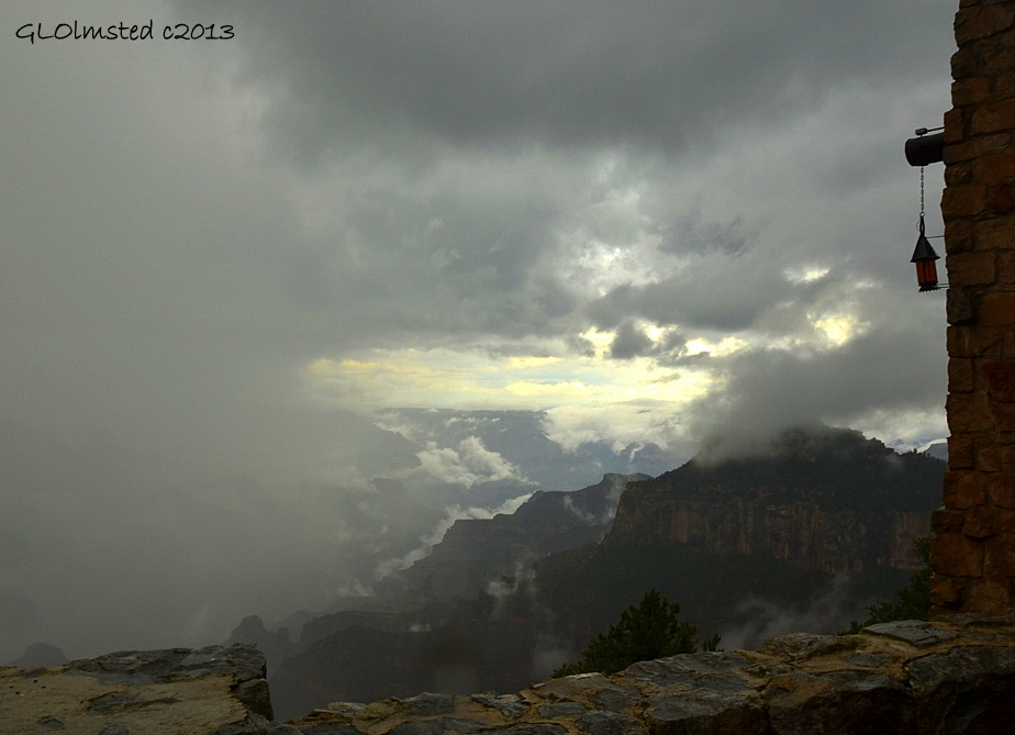
Monsoon clouds in canyon from Lodge North Rim Grand Canyon National Park Arizona

Hang out in the Grand Lodge where either the Sunroom or Auditorium offer panoramic windows and even if there’s a white out, just wait a few minutes and the view will change.

Monsoon clouds around Zoroaster tempe North Rim Grand Canyon National Park Arizona

Safety during monsoon

Monsoon clouds in Roaring Springs Canyon North Rim Grand Canyon National Park Arizona

Always have your eye on the sky and be aware of your surroundings when engaged in outside activities.

Hair standing up is a sign that static charge is nearby.  Don’t be the tallest thing standing at the rim of the canyon.  When a storm is near the safest places to be are in a vehicle or building.  If that’s not possible, move back from the rim and into the forest, just not under the tallest trees.  One in ten of the large Ponderosa Pines at the North Rim have been struck by lightning.  They are fire resistant, we are not.  Look for low, even, bunched vegetation and get small.  Crouch down with your feet together reducing your point of contact to the ground.  Don’t bunch together.  Instead spread out at least 10-12 feet between people.  This may sound extreme and only needs to be advised when lightning is directly overhead.  To estimate the distance between you and a lightning flash count seconds between lightning and thunder with every five seconds equaling about one mile.

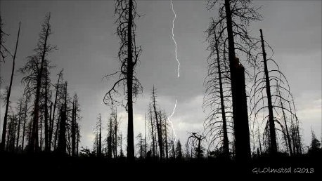
Lightning Walhalla Plateau North Rim Grand Canyon National Park Arizona

That award winning photo of lightning isn’t worth your life.  People die every year in or near Grand Canyon National Park from lightning.  Please don’t become a statistic.  Be lightning smart.

With the rain comes the floods.  Canyon rims are rock so water flows over the rim sometimes creating waterfalls that are rarely seen at any other time.  All this water can create rock slides as well as make a steep trail a slippery mess.  Hiking in the canyon can become quite perilous.

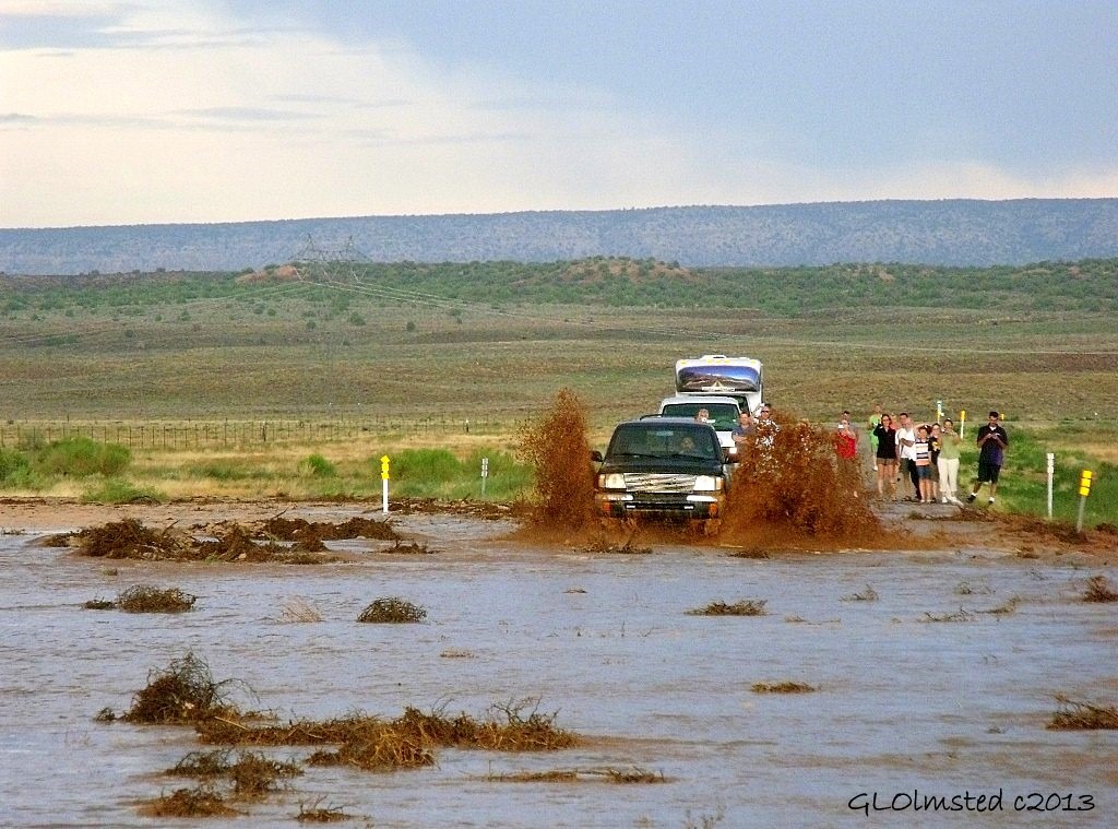
Driving thru flash flood over Hwy 89A near Fredonia Arizona

And when driving off the plateau be aware of the possibility of flash flood.  The hard packed desert soil doesn’t make a good sponge during heavy downpours.  Rain at high elevation sends water down below with the worst areas for flooding being the many washes and small gullies that have drained the land long before roads where built.  Even if the water rushing across the road only looks an inch or two deep it might really be a foot or more.  There may be unseen broken pavement, vehicles can get stuck or stalled, and fast flowing water is capable of moving even high clearance trucks.  The wash on each side of the above road is 30 feet deep.  Arizona has a ‘Stupid Motorist Law’ that allows municipalities and rescue agencies to charge people the cost of being rescued if they fail to observe posted warnings.

Check out David Rankin’s videos of flash floods in the Southwest to see the raw power of water.

What do Park Rangers do when it rains?

Oza Butte from Grand Lodge North Rim Grand Canyon National Park Arizona

I spend many hours trying to lift the spirits of rain depressed tourists.  OK, so I know visitors come to Grand Canyon to see the iconic blue skies over layers of red and gold.  These are the images that everyone has seen.  After many seasons here I only see fog and clouds in the canyon a few times every summer.  This is special magic.

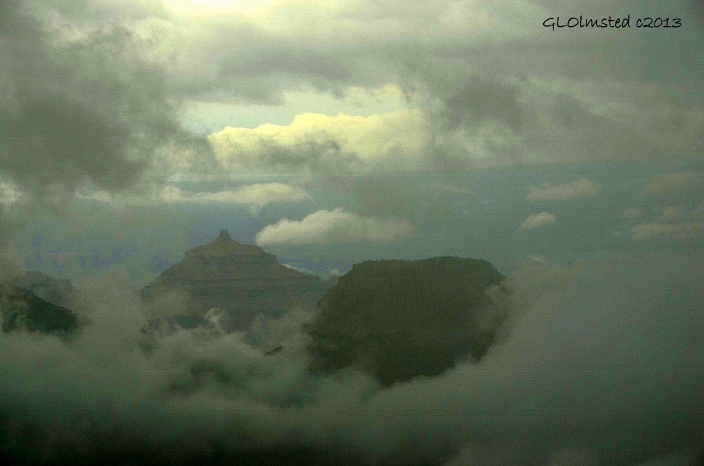
Temple islands in monsoon clouds North Rim Grand Canyon National Park Arizona

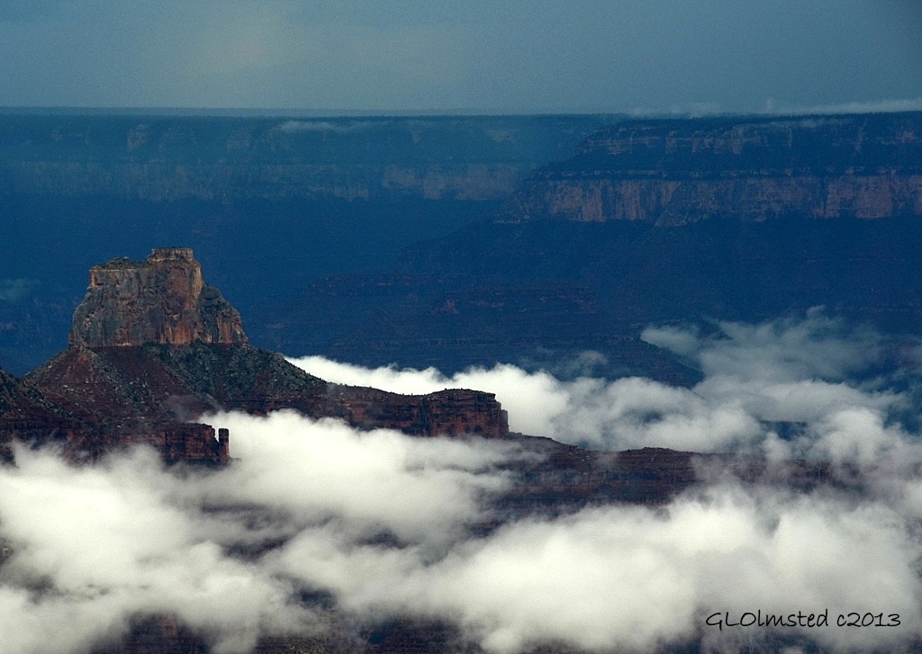
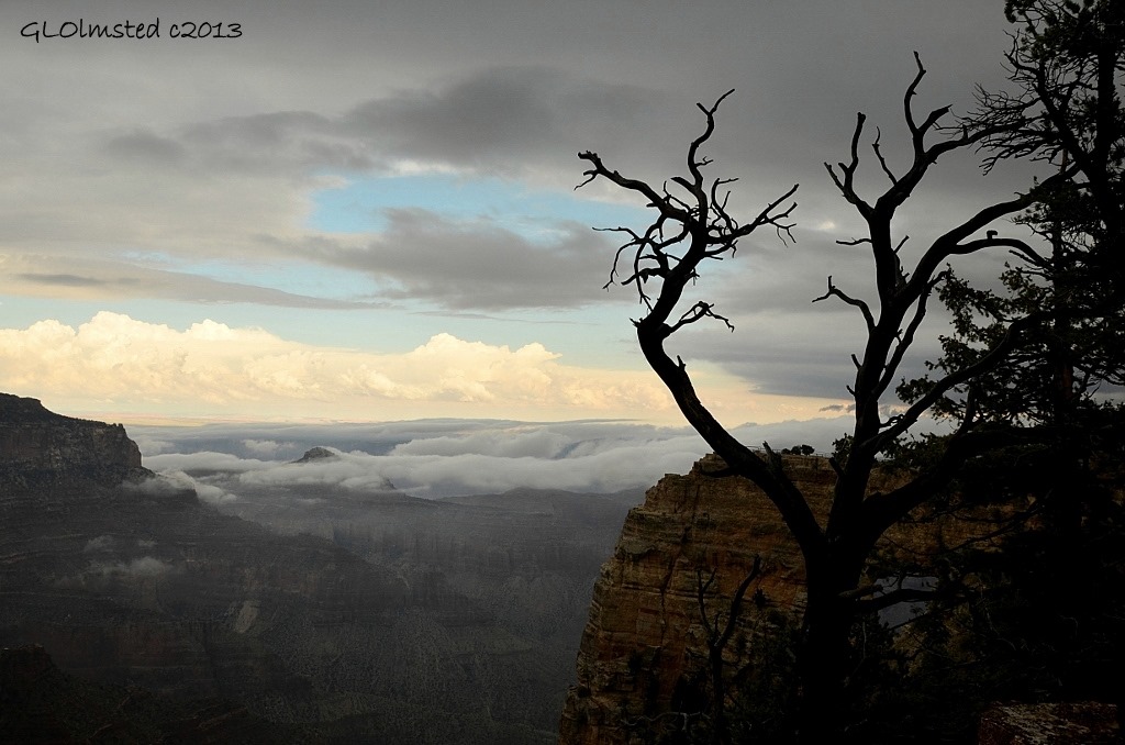
I recommend patience as the view can change from total whiteout to tiny peeks, rock temples floating above the sea of cloud and drifting clouds deep in the canyon with even a surprise burst of sunshine.  Take lots of photos of this amazing phenomenon to share with friends and family who undoubtedly have seen the iconic images of Grand Canyon, but not this special treat.

Monsoon clouds in canyon from Walhalla overlook North Rim Grand Canyon National Park Arizona

One foggy day I went on to the Walhalla Plateau bringing along rain-gear.  Eight visitors enjoyed a break with warming sunshine for my Archeology talk which ended with fog rolling over the rim, and us.

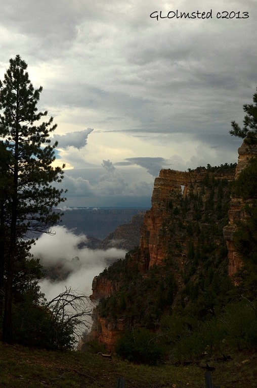
Monsoon clouds & Angels Window North Rim Grand Canyon National Park Arizona

Then I braved through the fog towards the end of the road to Angels Window and Cape Royal knowing the clouds would be playing games of hide-and-seek all over the canyon.

A massive monsoon darkened the sky above the opposite South Rim providing a lightning show.  I was so busy taking video to capture a flash that a visitor startled me when he asked if I’d be giving the 3:00 geology talk.  When I turned around and saw a woman’s hair standing on end like a glow around her head that was enough to shag everybody off the exposed overlook and back to their vehicles. Sure wish I’d taken a photo of that.

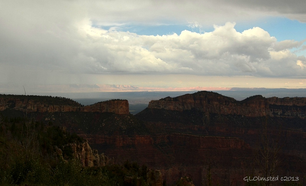
Light on Vermilion Cliffs from Point Imperial North Rim Grand Canyon National Park Arizona

My last stop of that day at Point Imperial revealed sun shining on the distant Vermilion Cliffs.  Just another act in the Greatest Earth on Show.

Monsoon clouds in canyon from Cape Royal trail North Rim Grand Canyon National Park Arizona

Rain brings life and death to America’s Southwest. It’s been a wet summer, and we needed that as there was a very low winter snowpack.

Monsoon clouds enshroud Freya's Castle from Cape Royal North Rim Grand Canyon National Park Arizona

You won’t melt in the rain, so get out there.  Enjoy the magic.  But keep your eye on the sky during monsoon.

Push my buttons!

  • Click to share on Facebook (Opens in new window) Facebook
  • Click to share on X (Opens in new window) X
  • Click to share on LinkedIn (Opens in new window) LinkedIn

Like this:

Like Loading...
Arizona, Grand Canyon National Park North Rim, monsoon monsoon 41 Comments
13 July 2011

Can you overdose on chocolate?

I don’t think so. It’s good for you!

01 Hershey dark chocolate kisses (1024x755)

I treat myself to three kisses every night. That’s dark chocolate for me.

02 Chocolate kisses, fruit & vegies (733x1024)

But it’s not like I don’t eat healthily.

03 Monsoon over canyon from Lodge NR GRCA NP AZ (1024x768)

Skies are suppose to clear and maybe won’t be seeing much of this view at least for a little while. This afternoon it hailed for less than five minutes with window breaking force. None of my windows thank goodness.

Company coming for the next four days so won’t be online much.

Oh BTW, I like all kinds of chocolate!

Push my buttons!

  • Click to share on Facebook (Opens in new window) Facebook
  • Click to share on X (Opens in new window) X
  • Click to share on LinkedIn (Opens in new window) LinkedIn

Like this:

Like Loading...
chocolate, Grand Canyon National Park, monsoon, North Rim 13 Comments
Newer posts →

Hi, I’m Gaelyn, the Geogypsy

I retired after 29 summer seasons as a Park Ranger, traveling solo for 40+ years. My passions include travel, connecting to nature, photography, and sharing stories.

I started exploring US National Parks in 1977 and 20 years later became a seasonal Park Ranger.  I’ve lived full-time in a RV for 30 years working summers and playing winters.  I’m still trying to figure out what I want to be when I grow old, other than grow up.

Let’s share our stories.  Here’s more of mine…

My wheeleastate

I am currently…

…boondocking somewhere in southern Arizona.  In the area, give a shout.

Geogypsytraveler on YouTube

Follow my journey on YouTube. Just click the pic. Hope you’ll like, share, and subscribe.

Click image for 7 minute documentary (Password “geogypsy” lowercase)

Making the Gypsy documentary is a story of its own.  Click below for the rest of the story.

Living nomadically & connecting to nature documentary

Subscribe to Blog via Email

Enter your email address to subscribe to this blog and receive notifications of new posts by email.

Photos available for sale include prints, greeting cards, coffee mugs, tote bags, phone cases and more

Reflected Wave 24X16 metal print under $100

Custom Coffee Mugs

Many items to choose from including prints

The Last Blast 24 x 16″ metal print under $100

Need a signal boost? When I boondock on public lands sometimes signal is weak or intermittent and a booster helps. Click the pic to visit WeBoost.

Connecting to nature and the rest of the world too.

Please contact me for photo purchases not seen at GLOlmsted Photography

Order fulfillment is by Fine Art America. If you’re not happy with your purchase, for any reason, simply return it within 30 days, and you’ll receive a full refund of the purchase price.

Why read Geogypsy?

The gypsy life spring-summer 1998 - "You were a real pioneer. RV'ing before it was cool." ...Yogi

How do you process photos? - “Your photographs create an Emotional feeling in the viewer...that they become One with You.” …Cindy

Life’s transitions between travel and work play - "I know you love your job as much as you love travel -- it shines through all your posts." ...Sallie

Lions at Kruger National Park - “Wonderful post, thank you. I was hooked start to finish!” … Peter B

11 lessons looking back 2013 - “A great post -- made me think, made me smile, made me want to cry." ...Sallie

Wildlife video Kruger National Park - “Gorgeous, this makes me want to go straight to South Africa now.” … Ayngelina

Living nomadically & connecting to nature documentary - “What an experience you had and gave to the "crew." Sometimes I think you don't realize how unique and inspiring you are.” …Alan

Search

Popular Posts

1. Prioritize the well-being of nature over photography. 2. Educate yourself about the places you photograph. 3. Reflect on the possible impact of your actions. 4. Use discretion if sharing locations. 5. Know and follow rules and regulations. 6. Always follow Leave No Trace principles and strive to leave places better than you found them. 7. Actively promote and educate others about these principles

Categories

Archives

Sites I follow, read & recommend

  • A Full-time Life
  • A Yankee in Belgrade
  • Bob's Eyes
  • Box Canyon Blog
  • Camels and Chocolate
  • Dawns bloggy blog
  • In the Direction of Our Dreams
  • Jane in her infinite wisdom
  • Janie and Steve, Utah Trails
  • Kathie's Birds
  • Las Adventuras
  • Memorable Meanders
  • Oh, The Places They Go
  • On the Road Abode
  • Port Elizabeth Daily Photo
  • Stillhowlyntravels
  • Take to the Highway
  • Technomadia
  • the good luck Duck
  • Travel with the Bayfield Bunch
  • Wandering Earl
  • Wheeling It
  • Yogi's Den

Caught in a Slot 9×12 canvas print under $50

If you don’t like what’s going on in your government, contact your Congress

Directory of Senators

Directory of Representatives

Lijit

© Copyright 2008-2024. Geogypsytraveler.com
%d