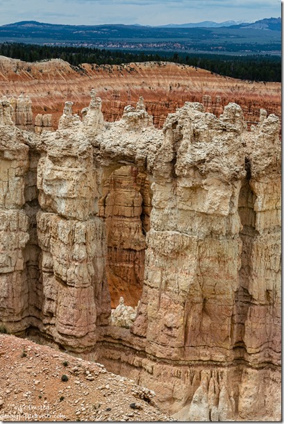
 As a Park Ranger at Bryce Canyon National Park I prepared and present a 20-minute Hoodoo geology talk several times a week. Those crazy looking hoodoos is why people visit Bryce.
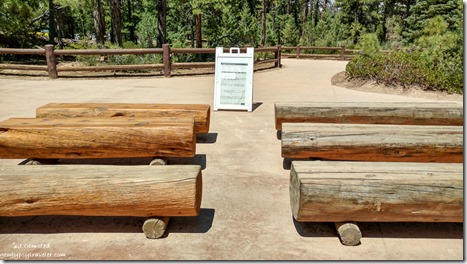
The audience area is located about 40 feet from Sunset Point and the Navajo Loop trailhead. Seating is three double rows of wooden benches. Depending on the time of day many visitors either hang out there to sit in shade, not attend a Ranger program, or hover nearby along a fence under a shade tree. It’s awkward.
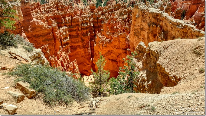 Look closely for people on the Wall Street trail (phone shot)
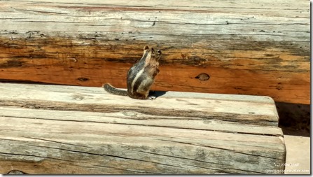 Golden Mantled Ground Squirrel attending program (phone shot)
Plus, the fenced area along the amphitheater’s rim looks down on the popular Wall Street side of the Navajo Loop trail. In addition, the Sunset parking lot is where tour buses disgorge their hordes of mostly international visitors so the overlook fills quickly and frequently. Have I mentioned that 65% of Bryce’s visitors are international. Some people speak English better than others, some not at all. Always interesting to explain things like not feeding, or putting your fingers near, wildlife like chipmunks and ground squirrels who having been fed are way too friendly with people. Part of my job is to haze the critters away from people, basically stomp my feet and act intimidating. Doesn’t work well or for long. But I digress…
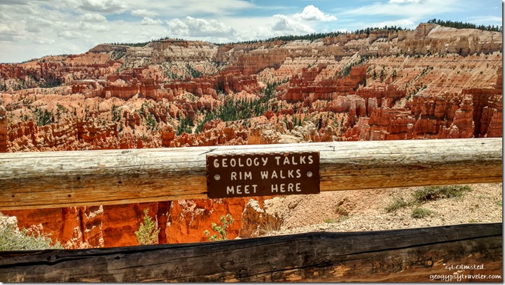 View above Wall Street (phone shot)
I get to my presentation area about 15 minutes before start time, right now advertised at 11am or 2pm. Sometimes it’s difficult to tell if anybody is there for a Ranger program. So I chat with folks asking where they are from, and take it from there. Knowing where visitors live in regards to elevation usually tells me I need to make altitude sickness and dehydration my safety talk before getting down to hoodoo geology.
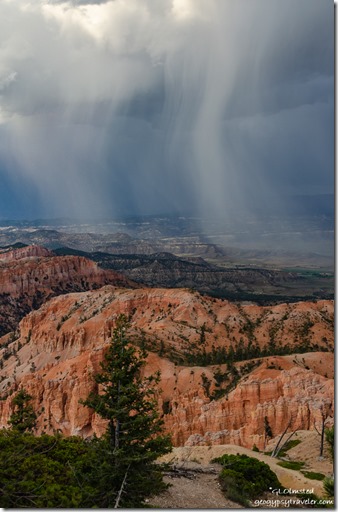
Depending on the season and weather I often add a reminder to stay away from the rim during a nearby lightning storm recommending a vehicle or building as the safest place to be. When thunder roars, go indoors. When you see the flash of a lightning bolt, you can start counting seconds, “One-Mississippi, two-Mississippi, three-Mississippi…” Sound travels 1 mile in roughly 5 seconds and you should be at least 10 miles away from lightning. Finally with small talk and safety message done, usually more people have joined because there’s a Ranger talking.
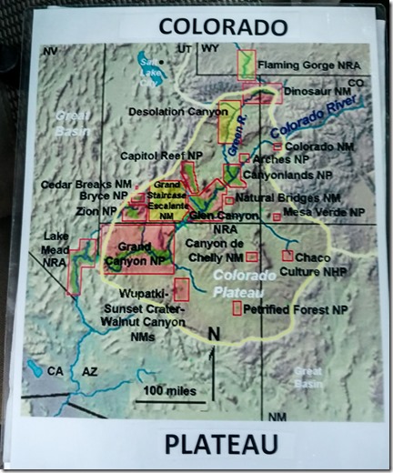 Image shared with audience
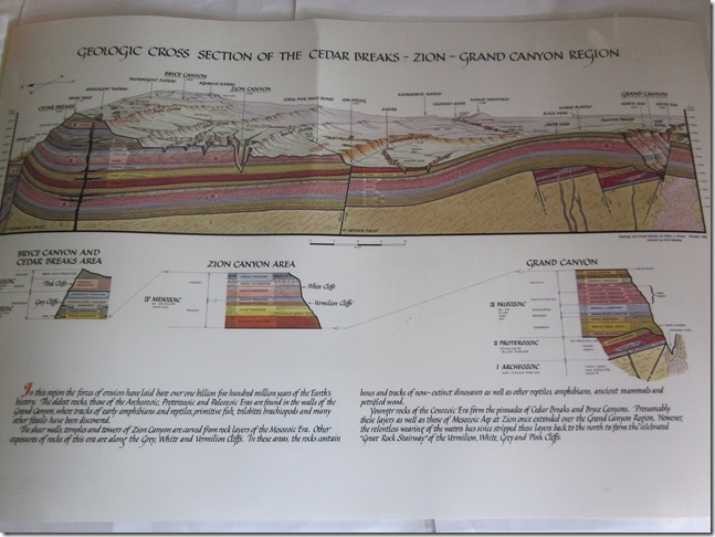 (borrowed from the internet, although I own the poster and use it in another geology talk)
I’m going to talk about how these crazy looking rocks called hoodoos were both created and destroyed by water. But first let’s put Bryce Canyon National Park in perspective on the Colorado Plateau. Going back about 85-60 mya (million years ago) the continent was smaller, no California, and closer to the equator. The floor of the Pacific Ocean, on a separate tectonic plate than the continent, bumped into the continent and subducted below the continental crust. It’s hot down there so that rock melted, became buoyant, and lifted a land mass of 240,000 square miles that straddles some of Utah, Arizona, New Mexico, and Colorado at The Four Corners. The slow uplift went from sea level up 7,000 to 10,000 feet with almost a mile of sedimentary rock deposits from oceans, lakes, dunes, estuaries and rivers.
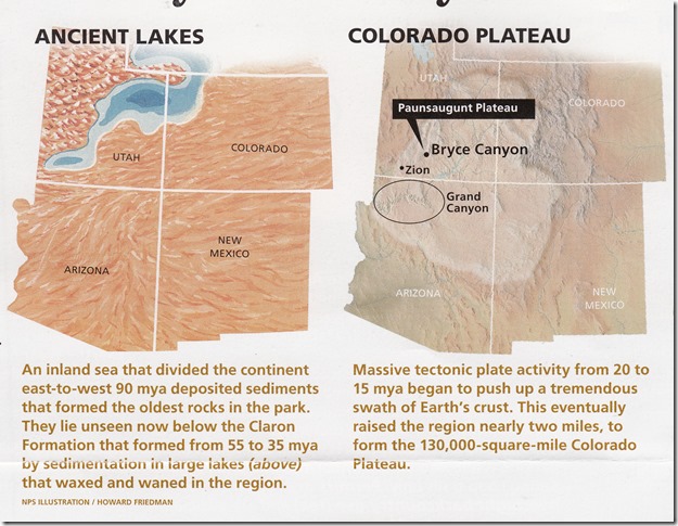 (NPS illustration)
About 60 mya in this location, a dip in the land allowed for a lake to fill. When the tiny creatures living in the lake died their bones and shells fell to the lake bottom, built up, and were compressed into limestone. Rivers and streams flowed into the lake sometimes bringing mud, or sand which was also lithified, or turned into rock, mudstone or shale, sandstone, and then more limestone. Over millions of years the deposits built up to at least 2000 feet thick.
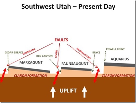 (borrowed from the internet, I use my fists to demonstrate normal faulting)
Then, about 16-6 mya, three blocks of land with faults between broke apart leaving the Aquarius Plateau in the east, a valley where the Paria River flows, the Paunsaungunt Plateau where Bryce is, the Sevier River Valley, and the Markagunt Plateau to the west. The Paunsaungunt is about 1000 to 2000 feet lower than the other two plateaus. Yet the lake deposits are the same so hoodoos can also be seen at Cedar Breaks National Monument, just in smaller concentration than Bryce. Imagine all the shaking of the earth during this faulting.
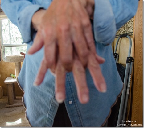 I most often use my hands to demonstrate (lousy hand selfie)
OK, now on to the formation of hoodoos. Bryce receives about 16 inches of precipitation a year. Water flows off the plateau following the line of least resistance and finds cracks and fractures. The water erodes the land backwards, called headward erosion, and leaves walls of rock. The rate of erosion is about one foot every 50 years. That’s fast. In some areas of the park old rim trails are closed and new railings are parallel to the old because of that fast rate of erosion. Think about it, 50 years compared to the 85 million years where I started this story.
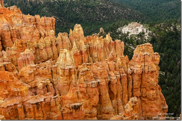
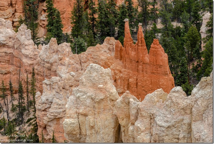 Note the skinny hoodoos still have some gray dolomite cap rock
 I use my hands for this demonstration also (borrowed from internet)
Now, there are walls of fractured, soft, sedimentary rock – mostly limestone with intermittent layers of sandstone and mudstone – and they are capped by dolomite, a harder layer of limestone which protects the softer layers below, for a while anyway. Sort of like me wearing a hat that keeps my glasses dry in the rain. The narrowest area is the softest mudstone. At 8000 feet in elevation, Bryce receives about 200 nights below freezing. When the water in the vertical cracks in the walls freezes it expands forcing the rocks apart, called frost wedging. Over time the wall can become a window. Eventually the cap rock falls and leaves pillars of rock standing side by side. Then erosion from wind, rain and snow softens the shapes into hoodoos. But they don’t stand forever, slowly shrinking into a rounded pile of dirt. The average life of a hoodoo is 2000 years.
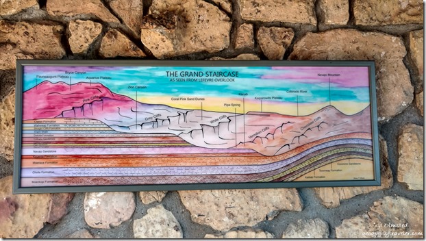 Grand Staircase painting at Le Fevre overlook Kaibab NF AZ
But what about the color? In the early 1870s, geologist Clarence Dutton named these rocks at the top of the Grand Staircase the Pink Cliffs, also known as the Claron Formation. I struggle with pink, seeing mostly shades of orange. Maybe Clarence saw them in a different light, or maybe he was colorblind. Iron is present in the sediments and oxidation makes for the colors.
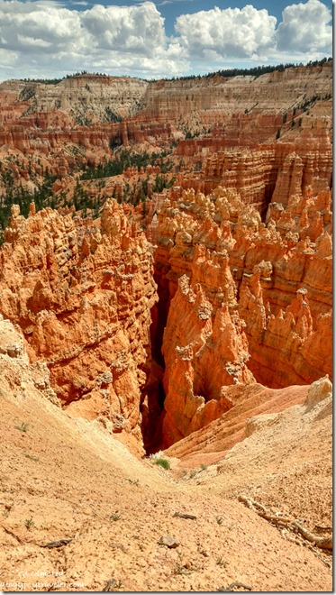 Walls of hoodoos in the Silent City (phone shot)
The word Hoodoos is fun to say, go ahead ‘who-do’. I have discovered different origins for hoodoo. Coming from the southeastern US where 1800s African slaves practiced a folk magic called hoodoo. One band of native Paiute tell a story of the rocks being bad people turned to stone by the trickster coyote. Yet when recently talking to a group of Paiute youth with elders I was told the word is ‘oodoo’ – no “h” – and means neither bad nor good.
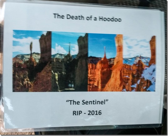 The once famous Sentinel hoodoo over ten years time was struck by lightning
So, hoodoos come and hoodoos go, all created by and destroyed by water. Headward erosion will continue to create walls until there is no plateau left. Of course, not in our lifetimes. Changing climate may also change the rate of frost wedging. Will there be a Bryce Canyon National Park someday in the geologic future?
 The above is one out 1100 photos of the inside of my back pocket from my phone the day I took many of the above photos and presented my talk about Hoodoo geology. Oops. Kind of a fun pattern though.

Well done Gaelyn, I wish I gad of know all this before we went to Bryce, but reading it after maybe in fact more interesting having previously seen them. Interesting post. Keep well Diane
Thanks. Always good to learn.
Speaking of lighting, I was giving my big truck its once a year bath Saturday and watching the sky as it had begin to look ominous. There was the rolling sound of thunder down the valley and I called up to the guys roofing the house next door that they might consider it a day and head for their trucks when a sharp crack and a flash of light caused a pause. The utility pole just over 10 feet away started smoking and the transformer flashed green fire. The guys were off that roof as though swatted off and into their trucks in a flash of pumping arms and legs not even bothering to roll up the tools for the day.
Lightning had jumped to the fence below the pole and it ignited in flame, so hose in hand I put that out and briefly considered putting out the pole and transformer but opted instead to call the power company.
The power was out and I figured it would be a while before it was fixed so moved some jugs of ice into the refrigerator and fired up the Barbie. SW style roasted corn and barbecued chicken and Baked Beans chased by a Corona followed and I finished the day while sitting under the porch with a book(The Origin of Others) by Toni Morrison and watching the fireworks with Buddy at my feet looking unperturbed. The rains refreshed the air offering a rare respite from the usually hot SW Oregon weather this time of year.
The power company came about and hour after the electrifying event and inspected the situation,. A new pole and transformer were ordered to the site. In 3-1/2 hours the power was on but not for long as the extremely rare summer storm built ferociously with 60-MPH winds and a pounding deluge that lasted until daylight the following day. Never have I seen anything like it this time of year in this area. With my LED tent light I finished the evening reading the artful, often profound words and phrasing artlessly presented by Toni Morrison.
Of note: A few years ago on a high plateau in NE Oregon, a dear friend was struck by lighting killing him and his horse. Lightning is serious business and in desert regions and on the high plateaus and mountainous areas of the west, the number of Apache Tears one can find attests to the frequency of lightning ground strikes. As Gaelyn advises ‘When thunder roars, go indoors’. Or at least onto the porch to enjoy the spectacle.
Well, that was exciting. Sure glad nobody was hurt and you were prepared for the lack of electricity. I do love the energy of a good storm, but from a safe place.
This just in. Between the 4th of August and the 12th of August there were 14,000 lightning strikes detected in (7) counties in southern Oregon. And this was only a fraction of the total number of strikes.
This ability to detect strikes is by an airborne aircraft with special new detection equipment to see strikes and detect small fires. A new valuable tool in catching fires early. This new ability is limited by available flight time due to flight conditions and available crew but is a major step forward in early fire detection.
What should be noted by those of us who enjoy the outdoors is just how often lightning strikes the ground.
WOW ! fantastic Geology lecture Gaelyn thank you so much and for the wonderful photo’s I began a geology course myself many years ago but changed my mind and went for archaeology instead. I still have all my geology course work here though and occasionally refer to it.
Thanks. I thought about returning to school for at least a certificate in archaeology but am still paying for the first degree. I am not a geologist but am fascinated by the Earth’s processes.
Thanks for the refresher course. Been to Bryce a couple times, read the signs, listened to a ranger talk, and still have a hard time remembering all that geology. What a fascinating landscape!
You’re welcome. It’s a lot to take in. It is an amazing landscape.
Excellent presentation, good explanation and more great photos
Thanks.
Pretty awesone. Very informative.
Thanks.
Great talk, Gaelyn. Hopefully people will listen and remember. I have a few gorgeous posters of the stratigraphy of the Plateau. My favorite is Capitol Reef. The opposite of Claron formation, hard Wingate sandstone is my favorite. I remember the crumbly trails at Bryce. You write and talk about this so well.
Thanks. If all they remember is my theme, “water creates and destroys hoodoos” I’m doing good. And usually that’s what the Junior Rangers write in their books so it’s working. I do love those strat posters. Really need to further explore Capitol Reef.
Hi, Gaelyn – I like your presentation.
Speaking of faults … I’m at the Oregon Coast now, where they talk about the faults can cause a Tsunami. Question – Is Yellowstone part of the Colorado Plateau?
Thanks. You are along the Cascadia Subduction Zone and I suppose that dipping fault could cause Tsunamis. Yellowstone is not on the Colorado Plateau.
The Cascadia Subduction feature has historically caused major tsunami about every 300-years on a somewhat regular basis. The last one was in 1700. So by some estimates we are overdue for one, but it could also be years away. But there is no argument among scientists and geologists, that one will occur again.
And here is the big takeaway that nearly no one talks about. When the quake occurs, the coastal lands will subside about 4 to 8 feet and the ocean will rush in immediately. The tsunami will follow 12_15-minutes later, but by then most in the low lands along the coast will have died. The politics of business and development keep this info out of the general public view.
I don’t visit the coast often these days, and never sleep or stay long in the coastal lowlands especially at night. I can only be relaxed on the headlands, and always carry emergency supplies and Metzger maps for the area as the roads and highways to the interior valleys/Portland etc will likely be destroyed. It could take days to get back I-5.
The state is now providing an emergency kit for earthquake /tsunami and wildfire fire situations that include maps for trails and back/forest roads to the interior.
Very interesting, you know your stuff. I am also impressed about how you deal with the awkwardness before the talks and determining your audience. You are a really really experienced Ranger. But you already know that.
Thanks. Good to break the ice and help visitors to connect.
Thank you for the geology lesson and for sharing your photos, Gaelyn. You are in one of my favorite areas of the country!
Thank you for reading and commenting. I do love the SW. Hope you visit this area.
You give some of the best presentations, saw you twice at the North Rim, and hope to hear your talk at Bryce some day.
Thank you, always nice hear. Let me know when you plan to visit Bryce.
I love Bryce and learned from your explanation, Gaelyn. Seeing the hoodoos brings back good memories of hiking among them. I’ve always visited in the spring when it’s been mighty cold!
The hoodoos are fascinating but right now is anything but cold. Thank goodness we’re at 8000 feet and haven’t gone over 90°. Nights are already cooling down enough to feel like fall.