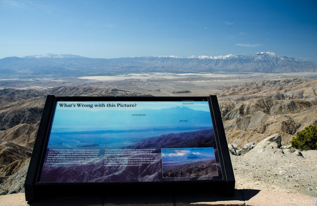
Maybe I should rephrase that to you can sometimes see far from Keys View Joshua Tree National Park. Usually depends on the air quality—how much pollution is blowing in from Los Angeles—the season, and the time of day. Morning or late afternoon being best during the winter.
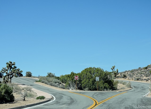 The first time I visited Joshua Tree during spring many years ago, the wind blew so strong I could barely open my truck door and walk less than 1000 feet (304 m) to the overlook. Once there I got a gritty, hazy, barely any view at all. It may be a short walk but is steep, paved and not accessible, for the later parking is just before the end of the viewpoint road.
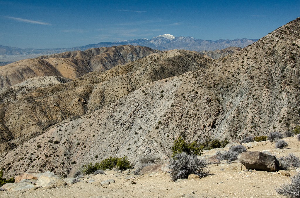
 Being Keys View is at 5185 feet (1581 m) in elevation, the highest point in the park reached by paved road, and perched on the crest of the little San Bernardino Mountains I expected to see forever, or almost anyway. I read that on a really clear day you might be able to see Signal Mountain in Mexico near the border 95 miles (153 km) away. More often you can barely make out the tip of 10,831 foot (3302m) Mount San Jacinto about 50 miles (80 km) away.
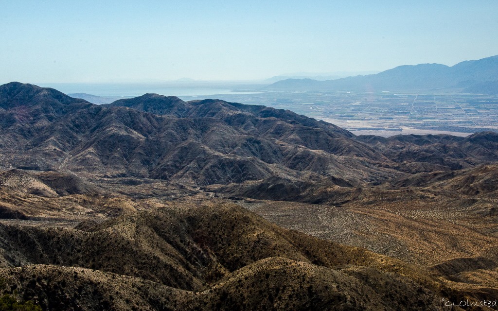 Fortunately after a leisurely drive with stops along the way my 11am Keys View is clear, just not to Mexico. To the left/southwest, just a portion of the Salton Sea glimmers at 230 feet (70 m) below sea level, where I camped and watched birds only a week before.
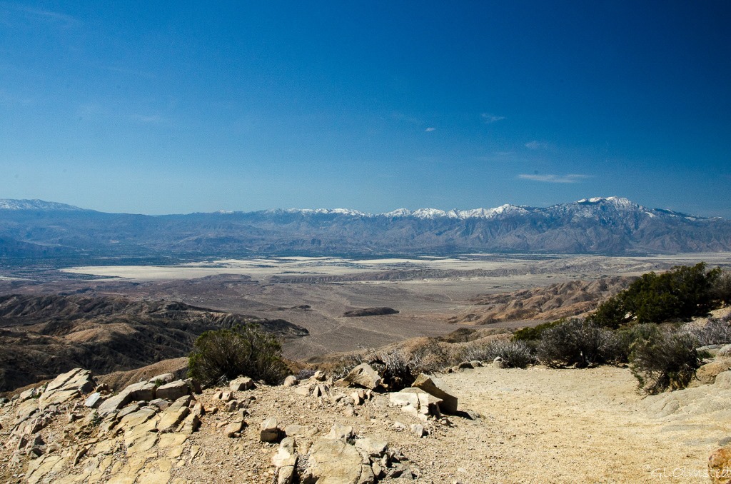 The Coachella Valley stretches 50 miles (80 km) encompassing agricultural lands, small cities like Indio and Palm Springs, and to the base of the San Bernardino Range with 11485 foot (3500 m) snow tipped Mount San Gorgonio to the the right. “Coachella” comes from a Native American name for the conch shells discovered in this ancient seabed.
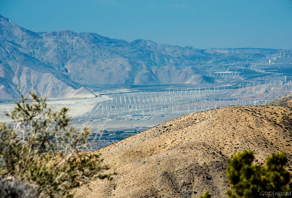 Looking closely into the valley I see miles of white sticks and even from this distance they look out of place. On even closer inspection, which means camera zoom, the San Gorgonio Pass Wind Farm comes into view. It’s the oldest wind farm in the US being in operation since 1982. Currently 2700 turbines produce enough wind energy to power about 300,000 homes. This is considered the windiest place in southern California when cool air blowing in from the Pacific Ocean, 90 miles (144 km) west, is forced between the mountains then meets the rising heat from the desert floor. Wind speeds in the pass have reached 80 mph (128 kph) which is slightly faster than a Category 1 hurricane. Guess that explains all the wind.
 Across Coachella Valley lies the Santa Rosa Mountains seen from the opposite side during my visit to Anza-Borrego Desert State Park. Plus the San Jacinto Mountains and with its snowy Peak.
 No matter the view, I’d rather be in the park enjoying nature than down in that congested valley with the San Andreas Fault running through it. So I continue to explore on this fourth day of visiting Joshua Tree and head to the Barker Dam trail next.

Stunning views. How far is this from LA that the view is so affected by the pollution?
As a resident of the Coachella Valley, I can tell you. First, there are two large mountains on either side of the Banning pass…Mt. San Jacinto, above Palm Springs, and Mt. Gorgonio, which includes Big Bear and the Lake Arrowhead areas. Those two mountains funnel the smog/air pollution (when it is there) down into the valley. We are about 120 miles from Los Angeles. It’s 60 miles to Riverside/San Bernardino from Palm Desert. I used to drive to UC Riverside, so I know that distance well.
Cheryl Ann
Thanks for making this clearer Cheryl Ann. Glad you don’t have to make that long drive any more.
Joshua Tree is about 200 miles from LA. Part of the problem is the wind tunneling between the mountains.
Wow, Gaelyn, Keys View at its highest elevation is almost as high as Kilimanjaro! I love the clear view you share with us here. Thanks! We have a large collection of wind turbines near Port Elizabeth now – at last. And the largest solar panel collection near just before De Aar. Perhaps you saw these two new large sources of energy when you were last in SA. Thanks for always commenting on my posts. (((Hugs))) Jo
I did get lucky with the far view that day. Remember seeing the wind turbines near PE but I prefer the idea of solar because birds fly into the turbines.
A solar-power generating station in central California is killing birds as they catch fire in the reflection of light from its massive array of mirrors, and now there are concerns that initial estimates of bird losses are too low.
Workers at the $2.2 billion Ivanpah solar plant, which opened in December 2013, have a name for the birds unfortunate enough to be caught up in the mirrors’ light: streamers. This is due to the puff of smoke as the birds ignite in mid-air and fall to the ground.
Instead of an estimated one thousand birds dying annually, that number could be as high as 28,000 a year.
You are most likely thinking of photovoltaic solar power when you say “solar” which is far to expensive to replace coal fired or natural gas fired electric generators. But then again if electricity is made too expensive for the unwashed masses to use they will quit using it. Problem solved!
Agreed that those awful grids of many square miles of solar panels are not better. Don’t know why we humans can’t do things in moderation.
Love this! I don’t especially like driving over to LA, but when I come to all of those “wind-mills”, it’s so interesting.
Thanks Roe. I have mixed feelings about the wind turbines as they are a problem for birds. I do support alternative energy and think they’re almost sculptural looking.
Beautiful pictures of the views Gaelyn especially the San Bernardino Range . I’m horrified to hear that the LA smog travels that far and can obscure the views in Joshua Tree. I hope the birds don’t try to use that passageway with all the windmills. I like solar best. I don’t think anyone gets hurt with it.
Thank you Sherry. The saddest part is that LA pollution can also be seen at Grand Canyon. I’m not very happy about the wind turbines because of the problem with birds and also prefer solar.
Cool photos! We totally missed seeing the wind farm. Were you able to see it with the naked eye, or through your zoom.
Thanks Nan & John. I could see it with the naked eye just better with the zoom. There’s another one just outside the south end of Anza-Borrego.
Beautiful views! I hope to make it there this year. Any blooms on the Joshua Trees yet?
The Joshua Trees were beginning to bloom two weeks ago but not much of anything else. Lots of good hiking here.
Wow, you did find a place with great views. California really is amazing with all the different land types they have from deserts to mountains. Below sea level lakes really cause my mind to skip a few cycles.
Wind farms in the wrong places really are ugly. The industry is trying to put them on the tall grass prairie of northeast Oklahoma and many people are fighting them.
I was glad for a view that day but don’t like seeing the landscape covered with wind turbines. Although I support alternative energy those things kill birds and bats. And especially in the SW, solar seems the way to go.
I wish I was in a remote area like this now. I have seen pictures of the smog in CA and it is really terrible.
The smog over LA can be cut with a knife. When you fly in there’s a huge brown turdy cloud.
Great pics of that whole area! There is actually 30% less smog in the L.A. basin than there was in 1971, although it is still awful in the summer 🙁 We used to say we didn’t like to travel out of the area because we didn’t trust air we couldn’t see :-))))) Seems that moderation in solar, wind turbines, and consumption would serve us all better.
I do remember as a teenager going into the Los Padres with my cousins and returning into a brown fog to their LaCanada home. I’m all about moderation.
I agree, the views are stunning. That’s a lot of wind turbines.
I was lucky it was clear that day. Way too many wind turbines.
Oh you were lucky to get a good viewing day. Lovely series.
Thanks Sallie. I put off going for a day due to the wind.